Interested in programmatic, scriptable access to data filtered by time or region of interest? While spatial and temporal data filtering and ordering can be done through applications such as NASA Earthdata Search, you may want to access data in a more programmatic way outside of a web interface. Our Application Programming Interface, or API, enables you to enter spatial and temporal filters into a single data access command, without the need to script against our data directory structure. This may be especially valuable to you if you frequently download data and are interested in incorporating data access commands into your analysis or visualization code. This feature is now available for most data sets at the NASA National Snow and Ice Data Center Distributed Active Archive Center (NSIDC DAAC), including the following collections:
Aquarius: Aquarius radiometer and scatterometer soil moisture and polar-gridded data
ASO: Airborne Snow Observatory spectrometer and lidar derived snow data
High Mountain Asia: Satellite, model, and in situ derived snow, glacier, and permafrost data
IceBridge: Data from Operation IceBridge aircraft missions
MEaSUREs: Cryospheric Earth System Data Records from the NASA MEaSUREs program
Nimbus Data Rescue: Visible and infrared imagery from the 1960s and 1970s
SnowEx: Snow data from airborne multi-sensor and in situ measurements
SMAP: Soil moisture and freeze/thaw data from Soil Moisture Active Passive
MODIS: Snow and ice data from the Moderate Resolution Imaging Spectroradiometer
ICESat/GLAS: Data from the ICESat/Geoscience Laser Altimeter System
VIIRS: Snow and ice data from the Visible Infrared Imaging Radiometer Suite
How does programmatic access work?
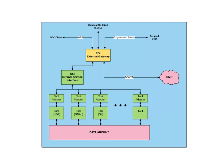
This new functionality utilizes the Common Metadata Repository API, with access provided via an HTTPS URL containing a series of key-value-pairs (KVPs). When utilizing this API in a command line environment, the output is returned as either a single file or multi-file zip downloaded directly to your computer's current working directory.
Want step-by-step instructions?
An overview guide and instructions for programmatically accessing these data can be found in the Help Center. The guide also includes instructions on programmatic access with customization services also available for some NSIDC DAAC data. In addition to spatial and temporal filtering, several NSIDC DAAC data collections can also be programmatically accessed with subsetting, reformatting, and reprojection service options that are currently available through NASA Earthdata Search. The guide walks you through the basic steps needed to construct the API, as well as resources to help you determine the customization options available for your data set(s) of interest.

