All MODIS Version 6.1 data products from 7 July 2023 onward may be subject to more frequent non-recoverable data loss due to the Flight Operation Team (FOT) transition to Lights-Out-Operations (LOOps). Please see our website for further details and updates.

MODIS
Moderate Resolution Imaging Spectroradiometer
Subscribe here to receive email updates of the MODIS data announcements
Overview
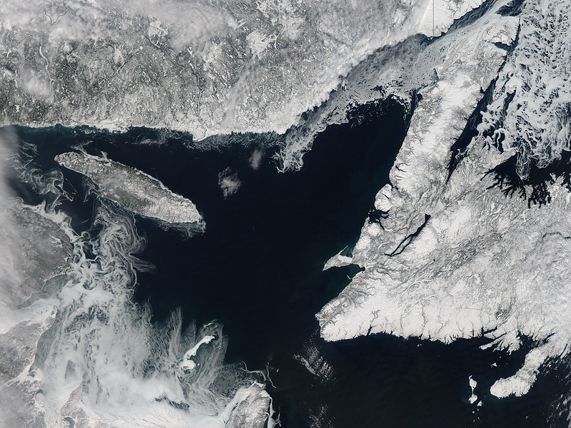
The NSIDC DAAC MODIS data collection includes a suite of snow cover and sea ice data products derived from NASA’s Moderate Resolution Imaging Spectroradiometer (MODIS) instruments aboard both the Terra and Aqua satellites.
MODIS is the first NASA mission to provide daily global coverage at moderate resolution (250 meters). Because MODIS sensors have operated successfully since the Terra and Aqua satellites launched, the MODIS data collection provides a continuous, consistent observation record dating back to the year 2000.
The Terra and Aqua MODIS instruments image the same area on Earth approximately three hours apart. The entire Earth's surface is imaged every one to two days, and the sensors work in tandem to optimize cloud-free surface viewing. Because the Terra and Aqua satellites have polar orbits, the sensors view high latitudes and polar regions multiple times each day.
In multiple ways, MODIS data archived at NSIDC facilitate a better understanding of how the cryosphere has influenced our planet over time:
- These sensors provide opportunities to investigate processes occurring on sub-daily time scales.
- The uninterrupted MODIS record captures the seasonal evolution of snow and ice cover year after year. This record enables comparisons between years over a period of rapid environmental change (since 2000).
- Snow and ice reflect most of the sunlight reaching them back into space, so MODIS snow and sea ice can be used to study Earth’s energy balance.
- MODIS data can feed global and polar climate models.
MODIS data available from NSIDC have been used to study a wide range of topics, including glacier surface elevation, Tibetan lake ice extent, Alaskan permafrost change, and even Iberian wolf pack size.
Terra versus Aqua MODIS products
Because MODIS sensors fly on both the Terra and Aqua satellites, NSIDC offers parallel products derived from each satellite. Terra and Aqua products are very similar with only a few key differences:
- Terra launched two years before Aqua, so the Terra record starts earlier, with observations beginning in 2000.
- Due to a Band 6 detector failures on Aqua shortly after launch, early versions (Version 5 and before) of the MODIS Aqua snow products were produced differently than their Terra counterparts. This made comparing the output from the two collections harder. In 2012, researchers resolved this problem by developing a post-processing technique to restore Aqua Band 6 data to scientific quality. This technique was incorporated into NSIDC products starting in 2015, with the publication of Version 6. Detailed information is available from the MODIS Version History.
- Terra crosses the equator from north to south at roughly 10:30 a.m. local time. Aqua crosses the equator from south to north at roughly 1:30 p.m. local time.
More detail on data capture is provided in MODIS technical references and in user guides for each product.
Ongoing changes in Terra and Aqua orbits
The Terra flight operations team conducted Terra’s last inclination adjust maneuver to maintain Terra’s orbit in February 2020. The inclination adjust maneuvers were used to control the platform’s 10:30 AM Mean Local Time (MLT) equator crossing. Terra reached a 10:15 AM MLT in October 2022, at which time the flight operations team had Terra exit the Earth Sciences Constellation and lowered Terra to a 694 km orbit altitude. MLT will continue to drift, reaching 9:00 AM around December 2025.
Similarly, the Aqua flight operations team completed the final mission manuevers related to maintaining a 1:30 PM MLT equator crossing and 705 km orbit altitude on March 18, 2021. In July 2021, Aqua began drifting to a later MLT. In January 2022, Aqua began its constellation exit; it exceeded a 1:45 PM MLT crossing in February 2023. MLT will continue to drift, reaching 3:50 PM around August 2026.
Earlier (later) crossing times for a morning (afternoon) platform like Terra (Aqua) mean lower solar elevations leading to more prevalent shadows. This decrease in orbit altitude alters the spatial coverage of the sensor including possible gaps in spatial sampling, decreased spatial coverage, and higher spatial resolution. Products are mostly expected to be science quality except for reduced grid size (from lower altitude) and without a strict 16-day repeat of observations (from drift and changing orbit).
Details on the impact of the Constellation Exit on the quality of the product are being compiled and will be posted when available.
MODIS Near Real-Time Data
While the NSIDC DAAC archives the standard science quality MODIS data sets, near-real-time versions of many of these products are available from the MODIS Adaptive Processing System (MODAPS). These products are part of NASA’s Land, Atmosphere Near-real-time Capability for EOS (LANCE) program. The MODIS LANCE data have a shorter latency period than the standard products, are generally produced within three hours of satellite observation, and are only archived for seven days. They are designed to meet the needs of time-sensitive applications, such as numerical weather and climate prediction, forecasting and monitoring natural hazards, agriculture, air quality, and disaster relief. Users may notice some differences between the standard and near-real-time version of products. If latency is not a primary concern, users are encouraged to use the standard science products archived at the NSIDC DAAC, which are created using the best available ancillary, calibration, and ephemeris information.
All MODIS near-real-time data sets can be viewed and downloaded from the MODAPS MODIS website.
Parameters
Snow cover, snow extent, albedo, sea ice extent, sea ice temperature
Geographic coverage
Global
Sensor(s) and satellite(s)
MODIS is a 36-channel visible to thermal-infrared sensor that provides global coverage on polar-orbiting satellites. MODIS flies on the Terra satellite (launched 18 December 1999) and the Aqua satellite (launched 4 May 2002)
Related collection(s)
