News & Stories

Across the globe, snow and ice play a vital role in regulating Earth’s climate and providing freshwater resources to people, plants, and animals.

As Earth’s frozen regions change rapidly, NSIDC is committed to growing its research and open access data to better understand these changes. Read about NSIDC research and its contribution to science and policy making. Check out spotlights on how to use NSIDC data, tools, and resources. Learn about how we steward data and collaborate with scientists and organizations across the world to understand how the frozen parts of Earth affect the rest of the planet and impact society.

News and stories

Filter by:
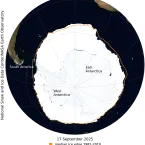
This NASA Blue Marble image shows Antarctic sea ice on September 19, 2024, when sea ice reached its maximum extent for the year. Sea ice extent for September 19 averaged 17.16 million square kilometers (6.63 million square miles), the second lowest in the satellite record.
News Release
Antarctic sea ice has likely reached its maximum extent for the year, at 17.16 million square kilometers (6.63 million square miles) on September 19, according to scientists at the National Snow and Ice Data Center (NSIDC) at the University of Colorado Boulder (CU Boulder). The 2024 maximum is the second lowest in the 46-year satellite record.
Wrangel Island on September 21, 2024
Analysis - Sea Ice Today
Since 2007, the Arctic sea ice minimum has dropped below 5 million square kilometers (1.93 million square miles) every year, except in 2009, 2013, and 2014, when extent barely crossed the 5 million square kilometer mark. Such low extents would have been hard to imagine in the 1990s, when extent averaged 6.46 million square kilometers (2.49 million square miles). Arctic climate warming continues to lead an unfortunate path of change for the planet. Here, NSIDC researchers summarize this year’s events in the Arctic, and touch upon Antarctica sea ice extent at the end of its austral winter.
Photo of Julia Collins at ski resort
Spotlight
Software engineer and metadata architect Julia Collins discusses how she came to NSIDC, and how she came to appreciate the crucial value of data about data.
Arctic sea ice
Analysis - Sea Ice Today
On September 11, Arctic sea ice likely reached its annual minimum extent of 4.28 million square kilometers (1.65 million square miles). The 2024 minimum is the seventh lowest in the nearly 46-year satellite record. The last 18 years, from 2007 to 2024, are the lowest 18 sea ice extents in the satellite record.
This NASA Blue Marble image shows Arctic sea ice on September 11, 2024, when sea ice reached its minimum extent for the year. Sea ice extent for September 11 averaged 4.28 million square kilometers (1.65 million square miles)—ranked seventh lowest in the satellite record.
News Release
Arctic sea ice has likely reached its minimum extent for the year, at 4.28 million square kilometers (1.65 million square miles) on September 11, 2024, according to scientists at the National Snow and Ice Data Center (NSIDC) at the University of Colorado Boulder. The 2024 minimum is ranked seventh lowest in the 46-year satellite record.