NASA SnowEx
Overview
The NSIDC DAAC SnowEx collection includes data products from the NASA SnowEx mission. SnowEx data are collected from a series of airborne and ground campaigns in the western United States. Temporal coverage begins in 2016 with SnowEx 2017 and includes subsequent campaigns. Data products are diverse, ranging from snow depth measurements to radar reflectivity.
Worldwide, more than a billion people rely on seasonal snowpack and glaciers for their water supply, and snow also plays a crucial ecosystem role for vegetation and wildlife. Snow cover is one of the most reflective natural surfaces on Earth, sending much of the Sun’s energy back into space and cooling the planet. With snow cover anticipated to decrease over the course of the 21st century, accurate measurements of snow cover, its water content, and its reflectivity are important to scientists, decision makers and citizens. But accurately measuring and monitoring snow characteristics is complicated by the diverse nature of snowpack and the environments where it exists. Satellite data can provide continuous, global observations of snow cover but require continual improvement through validation.
NASA’s Terrestrial Hydrology Program initiated SnowEx campaigns to fill knowledge gaps related to remote sensing of snow. SnowEx has endeavored to more accurately measure snow characteristics in a variety of terrains and vegetation canopies, check airborne measurements against ground-truth fieldwork, and compare remote-sensing technologies. All of these efforts are intended to inform future snow satellite mission design.
About SnowEx 2017
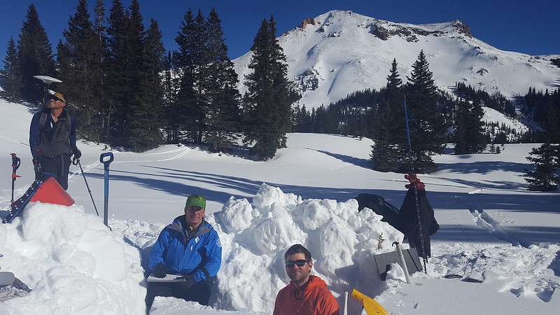
SnowEx 2017 took place primarily in Grand Mesa and Senator Beck Basin, Colorado. The field campaign was designed to evaluate the sensitivity of different snow remote sensing techniques through a gradient of forest densities across Grand Mesa, a large mesa in western Colorado, United States. Observations were collected between September 2016 and July 2017, with the Intense Observation Period (IOP) occurring between February 6-25th, 2017, and included measurements from cloud-absorption radar, ground-penetrating radar, synthetic aperture radar, lidar, airborne video, base station and rover measurements, and snow pit measurements. Snow pit measurements were also collected at Senator Beck Basin, a nearby site in western Colorado.
SnowEx 2017 campaign resources
In addition to SnowEX17 data, the NSIDC DAAC distributes additional campaign resources from SnowEx2017.
Note: Some newer web browsers default to preventing access to FTP directly from a webpage. Depending on the browser, you may be able to change your browser settings, or you can use an FTP client to download the files. (FTP, or File Transfer Protocol, software packages can be downloaded freely from the Internet.)
- FTP accessible Shapefiles: Shapefiles of the campaign study areas including transects, Terrestrial Laser Scan (TLS) areas, met towers, and raster data imagery with some tree classification/density layers. Also including flight-line boxes.
- FTP accessible Photographs: Photographs taken with SnowEx cameras during the Fall 2016 campaign. Photos depict terrain and environment for the upcoming February 2017 campaign.
About SnowEx 2020
SnowEx 2020 had both a single Intensive Observation Period (IOP) and a Time Series (TS) campaign. The IOP took place in Grand Mesa, Colorado, while the TS occurred weekly at a number of other previously established long-term monitoring sites throughout the Mountain West. Observations for the IOP occurred during the fall of 2019 and January 27 to February 12th, 2020. Baseline TS measurements began in December 2019, with weekly measurements occurring from January - March 2020, with two sites extending into the melt season and ending in early May 2020. NOTE: the Covid-19 pandemic affected the TS campaign and caused measurements to conclude earlier than planned. SnowEx 2020 included measurements from ground-penetrating radar, multi-polarization ground-penetrating radar, rover and stationary soil moisture probes, SnowMicroPen measurements, terrestrial laser scanner, and snow pit measurements.
Concurrent with ground-based operations, precision flight lines enabled aircraft instruments to collect data from specific locations. Although observations came from myriad instruments, SnowEx 2020 relied primarily on three systems:
- Compact Airborne System for Imaging the Environment (CASIE), developed at the University of Washington, gathers observations of snow surface temperatures.
- Snow Water Equivalent Synthetic Aperture Radar and Radiometer (SWESARR), developed at NASA Goddard Space Flight Center, employs both active and passive microwave instruments to calculate snow water equivalent.
- Uninhabited Aerial Vehicle Synthetic Aperture Radar (UAVSAR), developed at NASA Jet Propulsion Laboratory, observes various ice and hydrology parameters.
The experiment also leveraged concurrent satellite observations, including data from NASA’s ICESat-2 and Terra missions and the European Space Agency Sentinel-1 mission.
About SnowEx 2021
SnowEx 2021 was a continuation of the Time Series (TS) campaign from SnowEx 2020 and included measurements at a subset of the sites from the 2020 campaign in Idaho, Utah, and Colorado, as well as an additional prairie site in central Montana. Baseline measurements began in December of 2020 and extended into April 2021 for most sites, providing observations of seasonal melt in some cases.
SnowEx 2021 snow pit measurements were central to the ground sampling strategy and matched the experiment design from the 2020 campaign. However, the interval board sampling, or weekly measurements of new snowfall and Snow Water Equivalent (SWE), expanded at most locations. In 2020 most interval boards were co-located with a snow pit, while for 2021 most sites distributed an array of 5-8 boards to sample a range of elevations and aspects. Interval boards are an important ground validation observation to pair with the airborne UAVSAR data. Unused flight hours from SnowEx 2020 (due to the Covid-19 pandemic) were applied to weekly observations of 2021 TS sites. The SnowEx 2021 TS campaign also included albedo measurements taken in Colorado using AVIRIS-NG, a visible/infrared imaging spectrometer.
About SnowEx 2023
SnowEx 2023 took place between October 2022 and October 2023 at three long-term study sites around Fairbanks, AK (Bonanza Creek Experimental Forest, Caribou Poker Creek watershed, and Farmer’s Loop/Creamer’s Field) and two on the North Slope of AK (Arctic Coastal Plain and Upper Kuparuk Toolik). The campaign includes five intensive observation periods (IOPs) during which field measurements were made alongside coincident airborne measurements. The five IOPs were in: March 2022 (Mar 22 IOP), October 2022 (Oct 22 IOP), March 2023 (Mar 23 IOP), April 2023 (Apr 23 IOP), and October 2023 (Oct 23 IOP).
SnowEx 2023 prioritized collecting snow measurements in boreal forests and tundra environments, particularly Snow Water Equivalent (SWE), snow depth, and albedo. Airborne sensors deployed during this campaign included active/passive microwave (SWESARR), lidar and stereoimagery, and hyperspectral (AVIRIS-NG). Additional details about this campaign, including specific field locations and deployed instruments, will be published as they become available. All SnowEx 2023 data will be archived at NSIDC alongside previous SnowEx campaigns.
Parameters
Snow water equivalent (SWE), snow depth, snow stratigraphy, snow density, snow grain size, snow/ice temperature, surface temperature, air temperature, reflectivity, seasonally frozen ground, brightness temperature, two-way travel time, radar reflectivity, lidar, radar cross-section
Geographic coverage
Western United States
Explore images from SnowEx