Climate change is affecting the polar regions more than any other place on Earth. The Arctic is warming two to four times as fast as the rest of the globe, with one consequence being a long-term declining trend in Arctic sea ice. Antarctic sea ice has also exhibited significant changes since 2012. The years 2013 and 2014 had unusually high extents; 2016 and later showed persistently low extents, with ups and downs of Antarctic sea ice far exceeding norms. As scientists have studied sea ice changes, they have also closely watched changes in the globe’s two ice sheets—enormous masses of glacial ice—on Greenland and Antarctica.
NSIDC’s analysis sites Sea Ice Today and Ice Sheets Today offer daily images and statistics, and regular analysis posts by scientists at NSIDC and elsewhere. With these sites, NSIDC aims to keep you up to date on these fast-changing facets of Earth’s cryosphere.
Why sea ice changes matter
Sea ice is ocean water that freezes and floats on the ocean surface in the polar regions. Sea ice experiences dramatic cycles of growth and melt every year. Beyond seasonal cycles, however, sea ice may exhibit long-term changes, and scientists have observed concerning losses.
Sea ice loss impacts both polar ecosystems and Earth as a whole. Because sea ice is light in color and highly reflective, most of the sun’s energy that hits the sea ice is returned to space. This limits the amount of heat that is absorbed by the polar ocean, and helps keep the region cold. In the Arctic, where sea ice cover is the principal source of light-reflecting ice throughout the year, sea ice loss has likely become a self-reinforcing cycle. As a result, sea ice has shown some of the most dramatic changes observed in the Arctic environment since the start of the satellite record in November 1978.
NASA has collected passive microwave data via instruments on satellites continuously since 1978, and these data are publicly available through the NASA NSIDC Distributed Active Archive Center (DAAC). Instruments continue to circle Earth today, providing near-real-time data for scientists studying the cryosphere and climate. The project scientists interpret these data, making the information that they hold about sea ice more accessible to other researchers and the general public.
NSIDC’s analyses focus primarily on sea ice extent, which is a measurement of the area of ocean with at least 15 percent sea ice concentration. In the Arctic, the annual minimum sea ice extent occurs in September and the annual sea ice maximum extent occurs in March. In the Antarctic, the minimum extent occurs in February or March and the maximum occurs in September or October. When compared with previous years and decadal averages, these periods when the annual extremes occur are particularly important indicators of how much ice is being lost over time.
Why ice sheet changes matter
Ice sheet changes not only shed light on climate change but also directly impact sea level rise. Despite their significant impacts on the planet and on human activity, ice sheets pose challenges to scientists monitoring them. Their sheer size means that the loss of even a small fraction of their total ice can significantly raise ocean level. From 2002 to 2017, for example, ice sheet losses accounted for roughly a third of mean sea level rise. So, scientists have employed a variety of methods to gauge ice sheet changes: comparing accumulation through precipitation to loss through melt and iceberg calving, detecting changes in ice sheets’ gravitational pull, and detecting changes in ice surface elevations.
NASA satellites have supported long-term ice sheet monitoring through missions such as the Gravity Recovery and Climate Experiment (GRACE) and Gravity Recovery and Climate Experiment Follow-On (GRACE-FO) missions to detect changes in Earth’s gravity field, effectively weighing the ice sheets to detect their changes. NASA has also monitored changes in ice surface elevation through multiple missions, all of which have data sets archived at the NSIDC DAAC: Ice, Cloud, and land Elevation / Geoscience Laser Altimeter System (ICESat/GLAS), Ice, Cloud, and land Elevation Satellite-2 (ICESat-2), and Operation IceBridge Aircraft Missions, both of which use detailed measurements of surface elevation to detect thickening or thinning of the ice sheet.
Another means of determining if the ice sheets are growing or shrinking uses a measure of the ice’s flow speed and an estimate of the ice’s thickness in the glacier outlets. NSIDC provides data access to Inter-mission Land Ice Velocity and and Elevation (ITS_LIVE) data sets. This project has mapped ice flow over the world’s glaciers as well as Greenland and Antarctica, with data spanning the early 1980s to early 2024.
Ice Sheets Today analyzes surface melt during the melt season for both Greenland and Antarctica. Greenland statistics and analyses appear during the Northern Hemisphere summer, and Antarctic statistics and analyses appear during the Southern Hemisphere summer.
Sea Ice Today: Making sea ice science accessible
NSIDC’s Sea Ice Today website, funded by NASA, provides near-real-time data and monthly insights and analyses on how sea ice is changing and what climate and ocean conditions may be playing a role in ice behavior.
Originally called Arctic Sea Ice News & Analysis (ASINA), this website began in 2006, using monthly reports written for the public as a way to make sea ice science and analysis more timely, relevant, and accessible. In combination, NASA data and NSIDC expertise provide easy-to-use descriptions, resources, and tools to increase our understanding of climate change in the Arctic. Sea Ice Today has been a go-to source for blog-like insights, analyses, and data visualization tools that communicate how sea ice has been changing from year to year. Sea Ice Today receives over two million page visits a year and is used by national and international journalists, the public, academics, policymakers, and scientists.
Sea Ice Today consists of multiple components, all of which are available to the public free of charge. These include:
Daily and monthly images and data for both Arctic and Antarctic sea ice, which illustrate sea ice extent and concentration and how these are changing
Data for this project come from passive microwave instruments on US Department of Defense satellites. The raw data from these satellite-borne instruments are converted into sea ice concentration fields using algorithms developed by scientists at NASA Goddard Space Flight Center. The raw data and the sea ice concentration fields are managed by the NSIDC DAAC. The National Oceanic and Atmospheric Organization (NOAA) Sea Ice Index provides the images and estimates of sea ice extent that we use to track sea ice based on that data.
A monthly analysis written by NSIDC scientists about current sea ice conditions
Within these analyses, they discuss the implications of disappearing sea ice and why it matters, and also highlight new scientific research from the Arctic science community. These analyses are written twice per month during the summer melt season and sometimes feature guest scientists. Discussion topics include air temperature, pressure, precipitation patterns, circulation patterns, ocean temperatures, unusual events or trends, and more, all of which help us to interpret and understand what is happening with the sea ice cover.
Online tools to allow people to interactively look at the data and compare different regions and time periods
For example, our Charctic interactive sea ice graph allows users to view sea ice extent in millions of square kilometers throughout the year and compare these numbers with past years, the median and average 1981 to 2010 extents, and quartile, decile, and standard deviation ranges.
Spreadsheet data
Easy-to-use spreadsheets of Arctic and Antarctic sea ice data that can be used for an independent sea ice analysis for interested users.
The Sea Ice Today project also contributes directly to the Sea Ice Outlook (SIO) and the Sea Ice Prediction Network (SIPN) from the Arctic Research Consortium of the United States. SIO produces monthly summer reports about Arctic sea ice conditions, modeling, and local observations, and SIPN works to improve Arctic sea ice forecasts by facilitating collaborations among groups using a variety of prediction methods. In addition, the scientists contribute to the annual NOAA Arctic Report Card and the Arctic chapter of the American Meteorological Society’s State of the Climate, both of which have provided peer-reviewed updates on the state of the Arctic environmental system relative to historical records.
Ice Sheets Today: Focused on the melt
NSIDC’s Ice Sheets Today is also funded by NASA. This website launched in 2012, and it was originally known as Greenland Today. In 2021, the analysis site expanded to include Antarctica. The project combines near-real-time imagery and scientific analysis to track current melt conditions on the Greenland Ice Sheet and Antarctic Ice Sheet during their respective melt seasons.
Ice Sheets Today offers users the following tools:
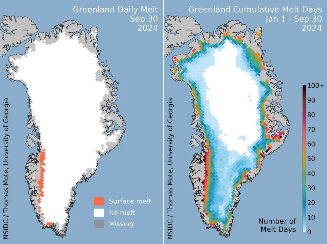
- Daily maps of melt conditions for the ice sheet currently experiencing its melt season based on the freely available data set Near-Real-Time DMSP SSM/I-SSMIS Daily Polar Gridded Brightness Temperatures
- Graph of melt extent showing the percentage of the ice sheet undergoing melt, also based on the freely available data set Near-Real-Time DMSP SSM/I-SSMIS Daily Polar Gridded Brightness Temperatures
- An interactive graph of Greenland melt conditions enabling the user to compare different years and easy-to-use Greenland melt spreadsheets
- Bimonthly melt analyses
Products of collaboration
Sea Ice Today was conceived and built by a team of sea ice research scientists at NSIDC, and senior research scientist Walt Meier is the project’s principal investigator. NSIDC staff from a variety of disciplines contribute to the project, including research scientists, science writers, user support specialists, software developers, and data operations specialists.
Ice Sheets Today was established by Ted Scambos, an alumni NSIDC scientist at the Cooperative Institute for Research in Environmental Sciences (CIRES). The science team consists of collaborators from multiple national and international universities and organizations.
What makes these projects so impactful is that they are on the cutting edge of near-real-time science. Traditionally, scientists collect data, do analysis, write and submit a paper, wait for it to be peer-reviewed, and then the paper is published as much as a year or two later. By summarizing the main trends and causes within days to weeks of various events, both the Sea Ice Today and the Ice Sheets Today websites present the important changes in a far more timely fashion. The projects transform complex data sets into near-real-time monitoring of sea ice and ice sheet conditions and long-term data and analysis. This open science model enables science to be more accessible and usable by a broader range of people.
Both projects are funded by the NASA Cryospheric Sciences Program, which supports studies based on satellite and aircraft remote sensing observations to understand the factors controlling changes in the ice and its interaction with the ocean, atmosphere, solid earth, and solar radiation. The source data for the project, the near-real-time gridded sea ice concentrations, come from the NSIDC Distributed Active Archive Center, which provides data and information on the frozen parts of the world in support of research. The NOAA Sea Ice Index provides the sea ice extent images and summary data and statistics used to track sea ice based on that data.
NSIDC also publishes Snow Today, which focuses on snow cover in the western United States. Snow Today is supported by the NASA Hydrospheric Science Program.

