Sea Ice Today
Data Tools
Charctic Interactive Sea Ice Graph
Sea ice analysis data spreadsheets
These Excel workbooks organize Arctic and Antarctic sea ice data in spreadsheets for ease of analysis. See the “Documentation” tab in each workbook for more description, and links to more information about the workbooks. View more detailed documentation.
1. All daily (single day and five-day trailing average) extent values in one file, updated daily
2. Monthly sea ice average extent and area, and rankings
3. Sea ice extent and area organized by year
4. Minimum and maximum extent values and dates for each month and year, with rankings
5. Sea ice extent rates of change
6. Daily sea ice extent, by region
- N_Sea_Ice_Index_Regional_Daily_Data_G02135_v4.0.xlsx
- S_Sea_Ice_Index_Regional_Daily_Data_G02135_v4.0.xlsx
7. Monthly sea ice extent, by region
- N_Sea_Ice_Index_Regional_Monthly_Data_G02135_v4.0.xlsx
- S_Sea_Ice_Index_Regional_Monthly_Data_G02135_v4.0.xlsx
8. Daily sea ice extent 1981-2010 climatology
You can also access the standard Sea Ice Index data files on the Sea Ice Index Data and Image Archive page.
Sea ice animations for the Arctic and Antarctica
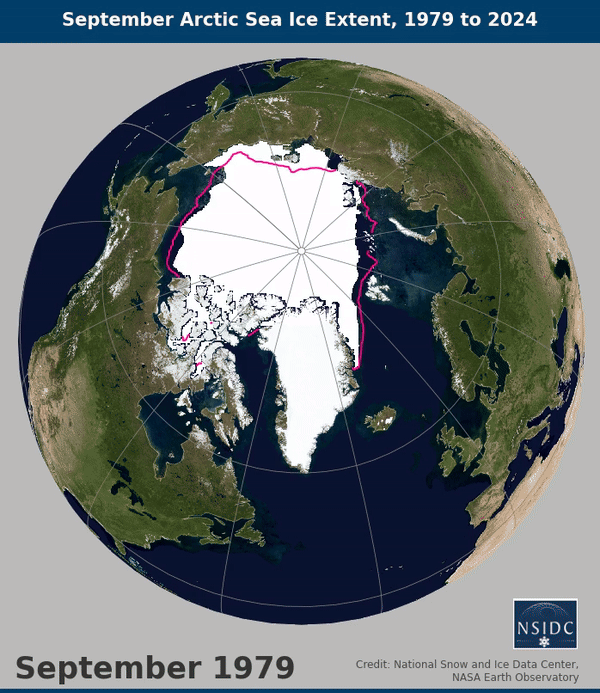
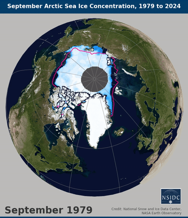
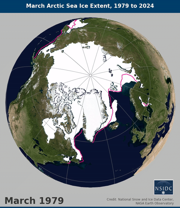
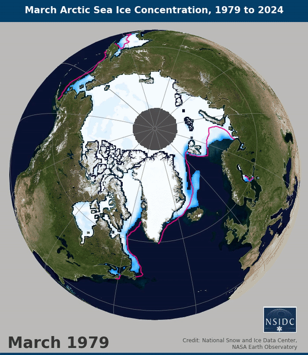
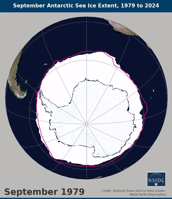
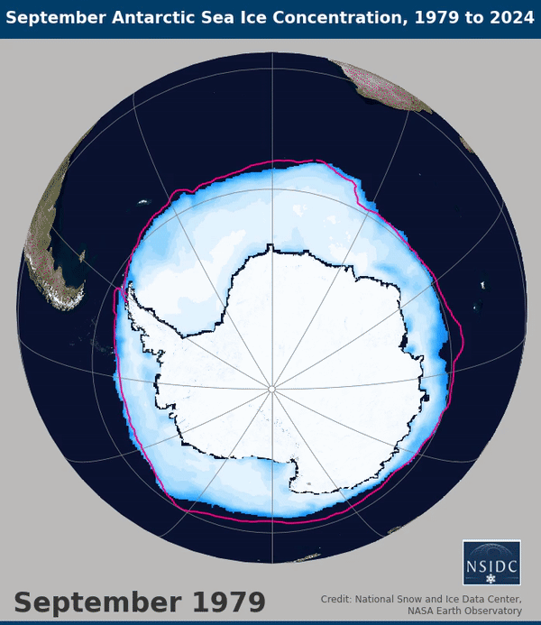
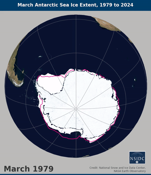
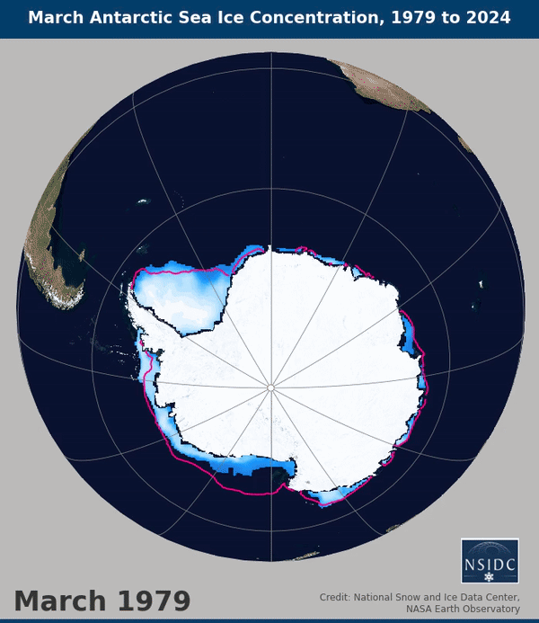
Animated time-series of sea ice extent or concentration averaged for a particular month. The magenta line shows the median ice edge for 1981 to 2010.
Arctic sea ice animations, 1979 to 2024
- September Arctic sea ice extent time-series
- September Arctic sea ice concentration time-series
- March Arctic sea ice extent time-series
- March Arctic sea ice concentration time-series
Antarctica sea ice animations, 1979 to 2024
- September Antarctic sea ice extent time-series
- September Antarctic sea ice concentration time-series
- March Antarctic sea ice extent time-series
- March Antarctic sea ice concentration time-series
Last updated: October 31, 2024
Sea Ice Volume
The below graph shows a time-series plot of the latest sea ice volume from the CryoSat-2 Level-4 Sea Ice Elevation, Freeboard, and Thickness data set. This graph is updated from October through March/mid-April.