By Michon Scott
In May 2024, our planet experienced one of the strongest solar storms in decades. The most visible (and fun) consequence of the solar storm was a proliferation of auroras. These curtains of color are usually confined to northernmost or southernmost latitudes, but in early to mid-May 2024, auroras painted the night sky over places that rarely see such phenomena. Even those as far south as Florida were able to enjoy the show.
Not all consequences of the solar storm were fun, though. Solar storms pose risks to satellites, including NASA’s Ice, Cloud and land Elevation Satellite-2 (ICESat-2) which saw its normal operations interrupted during the storm. But the satellite has since resumed collecting data, and the National Snow and Ice Data Center NASA Distributed Active Archive Center (NSIDC DAAC) has resumed archiving new observations.
Recipe for a geomagnetic storm
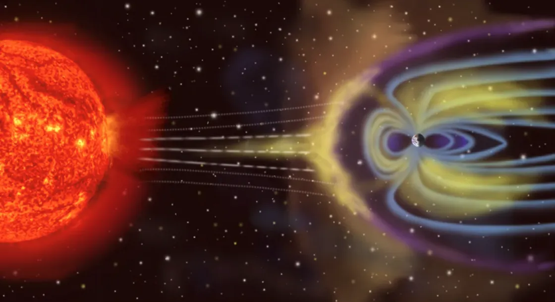
The May 2024 solar storm involved a combination of powerful solar flares (intense bursts of X-rays and other energy) and coronal mass ejections (clouds of particles from the Sun hurled into space). Solar flares reach Earth in minutes, while coronal mass ejections (CMEs) can take a few days. Strong flares started on May 7 and CMEs reached our planet beginning on May 10.
More precisely, the solar storm reached our planet’s magnetosphere.
Earth’s magnetosphere is a massive, elongated magnetic-field bubble. Molten, charged iron far below Earth’s surface charges the magnetosphere, which interacts with conditions caused by the Sun and outer space. The magnetosphere protects against cosmic rays and keeps our atmosphere from being stripped away from the planet’s surface by powerful solar winds. Instead, solar winds collide with oxygen and nitrogen atoms in Earth’s upper atmosphere, resulting in beautiful displays of light.
The confluence of flares and CMEs in May 2024 caused one of the strongest geomagnetic storms on record. Scientists categorized it as the highest level of a geomagnetic storm: G5. It was the strongest geomagnetic storm since October 2003. Another comparable geomagnetic storm struck in 1958. NASA scientists tentatively suggested that the May 2024 geomagnetic storm might have counted among the most severe in centuries but confirming that statement would require much more research and data. Improving observational technologies over time might skew assessments to overemphasize recent events.
ICESat-2: Not a fan of geomagnetic drama
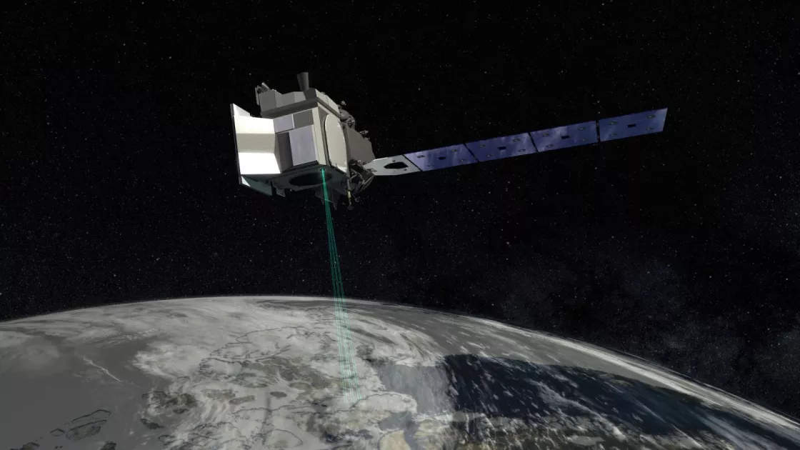
NASA’s Ice, Cloud and land Elevation Satellite-2 (ICESat-2) carries the Advanced Topographic Laser Altimeter System (ATLAS) instrument, which measures heights across the planet’s surface such as land, water, vegetation, and human-built structures in urban areas. ICESat-2 also measures elevations of land ice and sea ice. The instrument gauges height by measuring the amount of time required for the sensor’s laser pulses to echo back to the receiver. The laser emits 10,000 laser pulses every second, thereby taking precise, detailed measurements. By making repeat observations over the same surfaces, ICESat-2 measures how land ice and sea ice change over time. ICESat-2 is the third in a series of NASA missions aimed at measuring elevation changes, following Operation IceBridge and ICESat/GLAS.
Normally, ICESat-2 orbits our planet at 25,200 kilometers (15,660 miles) per hour, 500 kilometers (310 miles) above the planet’s surface. The satellite was designed to operate at this altitude and under the atmospheric conditions typically prevailing there. When the Sun acted up in May 2024, however, it interfered with ICESat-2's orbit by affecting atmospheric density.
Earth’s gravitational pull is at its greatest closest to the planet’s surface, where air molecules are the most densely packed. Higher in the atmosphere, the gravitational pull is fainter, and air molecules are more dispersed. Intense solar activity upsets this arrangement. Solar winds slamming into Earth’s magnetosphere inject extra energy into Earth’s atmosphere. While only a fraction of the size of the magnetosphere, and much closer to our planet’s surface, Earth’s atmosphere is still strongly influenced by what happens to the magnetosphere. The collision with the magnetosphere can raise both the temperature and density of the atmospheric layer heavily trafficked by Earth-orbiting satellites. As the newly energized air rises, warmer, denser air below takes its place. The denser air pulled from below exerts a drag on Earth-orbiting satellites, the same way a strong headwind slows a jogger's progress.
Atmospheric drag tends to pull the satellite toward Earth—nowhere near enough to plunge it into the planet’s surface, but enough to rotate it. (Imagine jogging against a fierce wind with a big windsock on your head.) After the solar flares and CMEs reached Earth’s magnetosphere in May 2024, the drag within the thickened atmospheric layer was enough to change the orientation and altitude of ICESat-2. The satellite went into a safe hold mode and stopped collecting data—a response it was designed to take under such circumstances to preserve the safety and power use of the instruments.
Back to normal
After analyzing it in safe mode, NASA scientists and engineers confirmed the ICESat-2 satellite and instrumentation did not experience any lasting damage. Thruster burns raised the satellite’s altitude and the ICESat-2 team allowed the satellite to drift back to its normal orbit elevation by early June. The Advanced Topographic Laser Altimeter System (ATLAS) instrument resumed collecting data in mid-June 2024.
However, recovering from the Sun's mid-May outburst caused a several-week-long interruption to ICESat-2 data processing, from May 10 to June 21. The data processing has since restarted, and the NSIDC DAAC resumed data distribution in mid-July, but there remains a small gap in the NSIDC DAAC data archive.
For assistance with data analysis, including explanations for other apparent gaps in data collection and advice on where to acquire data for certain time periods, you can contact NSIDC User Services at nsidc@nsidc.org.
Access data through the NSIDC DAAC
NASA’s NSIDC DAAC manages, distributes, and supports a variety of cryospheric and climate-related datasets as one of the discipline-specific Earth Science Data and Information System (ESDIS) data centers within NASA’s Earth Science Data Systems (ESDS) Program. User Resources include data documentation, help articles, data tools, training, and on-demand user support. Learn more about NSIDC DAAC services.
References
NASA. June 11, 2024. After solar storms, ICESat-2 expected to resume operations in mid-June.
NASA. May 16, 2024. How NASA Tracked the most intense solar storm in decades.
NASA. 2018. ICESat-2 mission brochure.
NASA. July 2, 2024. It’s Always Sunny in Space (and That’s a Problem for Satellite Teams)
NASA. The impact of flares. Accessed July 18, 2024.
NOAA. Geomagnetic storms. Accessed July 18, 2024.
NOAA. Satellite drag. Accessed July 18, 2024.


