Our Research
As climate changes, how do Earth's frozen areas affect our planet and impact society?
In this section
Related News & Stories
Filter by:

Spotlight
Representatives from NSIDC will be attending the American Geophysical Union (AGU) Annual Meeting 2025, either virtually or in person in New Orleans, to share their expertise in data management and research in the cryospheric sciences, and to conne

Spotlight
The NSIDC DAAC and NOAA@NSIDC archive and distribute data sets relevant to maritime navigation in the polar regions. Although they are not up-to-the-minute products for operational navigation, they provide climatological data for planning, risk assessments, and feasibility studies.

Analysis - Ice Sheets Today
Beginning October 15, 2025, NSIDC’s Ice Sheets Today services will be reduced because of non-renewed funding.

Analysis - Sea Ice Today
Beginning October 15, 2025, NSIDC’s Sea Ice Today services will be reduced because of non-renewed funding.

News Release
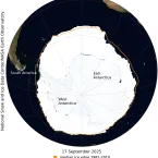
Antarctic sea ice has likely reached its maximum extent for the year, at 17.81 million square kilometers (6.88 million square miles) on September 17, according to scientists at the National Snow and Ice Data Center (NSIDC) at the University of Colorado Boulder (CU Boulder). The 2025 maximum is the third lowest in the 47-year satellite record. The record low maximum occurred in 2023.

Analysis - Sea Ice Today
On September 17, Antarctic sea ice likely reached its annual maximum extent of 17.81 million square kilometers (6.88 million square miles). The 2025 maximum is the third lowest in the 47-year satellite record above 2023 and 2024.