By Michon Scott
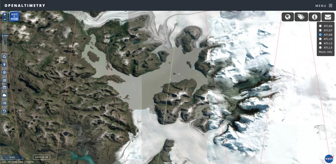
In April 2020, Lake Greve, a glacier-dammed lake in the Southern Patagonian Icefield drained. The lake unleashed one of the world’s largest floods originating from a glacier, otherwise known as an outburst flood.
Outburst floods threaten thousands of lives around the world, so the Lake Greve incident gave scientists a valuable opportunity to study how they unfold. Scientists writing about the event two years later could not identify precisely what triggered Lake Greve to drain, but they could specify the drop in water level, thanks to observations from NASA’s Ice, Cloud, and land Elevation Satellite-2 (ICESat-2) mission.
The ICESat-2 mission provides data sets on land ice and sea ice, and those data sets have been applied to myriad studies of Earth’s frozen regions, but ICESat-2 data offerings do not end there. Researchers can also use ICESat-2 observations to study surface-height changes in land and vegetation, inland water bodies, ocean surfaces, and atmospheric features. NASA’s Distributed Active Archive Center for snow and ice, NSIDC DAAC, archives and distributes a wealth of data sets derived from ICESat-2 observations. The Lake Greve study provides just one example of ICESat-2's value to research.
How it works
The ICESat-2 satellite carries the Advanced Topographic Altimeter System (ATLAS) instrument, which sends photons toward Earth’s surface at 10,000 light pulses per second. Land, water, ice, and clouds reflect photons back to the sensor. Every photon returning to the sensor carries location data with it. Together, the collection of returned photons records three-dimensional surfaces.
ATLAS has three pairs of lasers that register precise elevation data, but the lasers can only take measurements over a narrow track. Consequently, ICESat-2 observes most of the planet every 91 days. Even though observations are often separated by a few months, comparing ICESat-2 data over time shows even small changes in surface heights. Surface-height comparisons occasionally reveal significant changes.
In the case of Lake Greve’s outburst flood and resulting water level drop, ICESat-2 observations of the event were partly down to luck. NSIDC User Services Representative Mikala Beig said, “ICESat-2 data are global, but they’re not spatially continuous. Finding coverage over a feature you need to observe right when you need to observe it is actually pretty exciting.”
Mapping changes and risks
Lake Greve formed from the complex interaction of glaciers in the Southern Patagonian Icefield, so it is both a glacier-fed and a glacier-dammed lake. Such a glacier-dammed lake can have a significant impact on people living downstream, providing valuable water resources for drinking and agriculture, but also posing a risk of deadly flooding. Unfortunately, the lake is not easy to reach in person. Fortunately, ICESat-2 observations, combined with other remote sensing data, enabled scientists to assess the 2020 outburst flood from afar.
ICESat-2 data have helped scientists monitor other water bodies and their potential effects on people. Planning for water resources, floods, and droughts requires reliable ongoing estimates of river discharge. Many of the rivers and streams that significantly impact human populations are narrow, and estimating how much water they carry over time can entail fieldwork and modeling. These efforts are not practical in all locations. A 2023 study highlighted how ICESat-2 fills the data gap. The authors highlighted the geolocated photon data and the inland surface water data. They acknowledged that ATLAS has the disadvantage of not being able to observe water surfaces in all kinds of weather. The reflecting photons that record the surfaces of thick clouds do not simultaneously penetrate those clouds to observe the land, ice, and water surfaces below. Despite this drawback, the authors pointed out the data’s growing importance as changing climate may affect both the frequency and severity of droughts and floods.
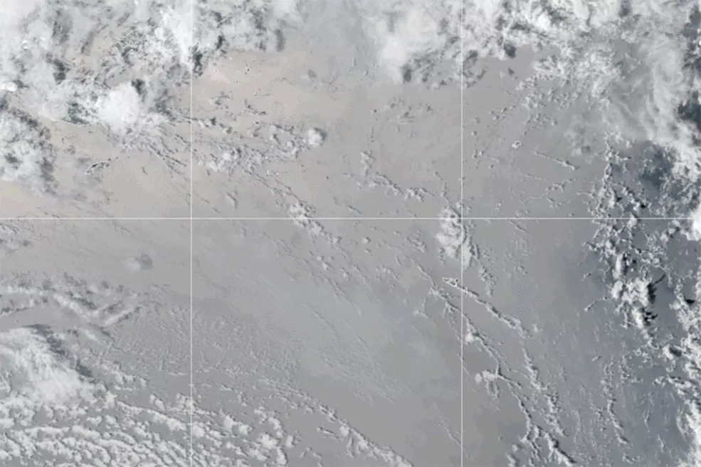
Another area of risk planning where ICESat-2 data provide valuable information involves seismic activity. Volcanoes pose risks, either to local areas or much bigger geographic regions. Seismic activity often changes a volcano’s profile. The changes may be useful in forecasting an approaching eruption, or predicting where the risk of hazards such as pyroclastic flows could threaten nearby populations. ICESat-2 land-height data have revealed the emergence and erosion of the Niijima Fukutoku-Okanoba submarine volcano some 1,300 kilometers (807 miles) south of Tokyo in 2021. Scientists also combined ICESat-2 observations with other data sources to map terrain changes in the wake of the 2022 Hunga-Tonga eruption and resulting tsunami.
ICESat-2/ATLAS observations have not just enabled scientists to broaden their investigations beyond snow and ice. The data have also let scientists probe the cryosphere more completely.
Refining measurements of snow and ice
Sea ice is ocean water that freezes and floats on the ocean surface in the polar regions, but sea ice rarely exists as a simple layer of ice. Snow and meltwater often coexist with sea ice, complicating its responses to sunlight and weather.
Pristine snow is one of the most reflective natural surfaces on Earth, bouncing roughly 90 percent of the sunlight reaching it back into space. Snow can collect on sea ice, bolstering reflectiveness when the sun is above the horizon. Ironically, in the darkness of polar winter, snow provides an insulating layer that slows the rate of sea ice growth. Once the sun reappears, the snow layer quickly melts, sometimes leaving ponds of meltwater that absorb more solar radiation. Given snow’s impact on sea ice growth and melt, understanding how much of the icy mass on the ocean surface consists of snow supports better understanding of sea ice behavior. A 2020 study combining ICESat-2 data with radar observations found that, in the Arctic, roughly half of the sea ice freeboard consisted of snow. Another study released the same year found that, in the Antarctic, about 65 to 70 percent of freeboard consisted of snow.
Identifying the impact of meltwater on sea ice means knowing more than the simple fact that surface meltwater exists. Ideally, scientists can figure out how deep or shallow the melt ponds are. Although standard ICESat-2 sea ice products have proven excellent for tracking Arctic-wide changes in sea ice, researchers had to innovate to measure melt pond depths. A 2023 paper described the development of an automated algorithm to measure melt pond depth based on ICESat-2’s geolocated photon data.
These examples simply scratch the ATLAS/ICESat-2 surface. If you have a research result you want to share, contact NSIDC User Services.
Access data through the NSIDC DAAC
NASA’s NSIDC DAAC manages, distributes, and supports a variety of cryospheric and climate-related datasets as one of the discipline-specific Earth Science Data and Information System (ESDIS) data centers within NASA’s Earth Science Data Systems (ESDS) Program. User Resources include data documentation, help articles, data tools, training, and on-demand user support. Learn more about NSIDC DAAC services.
Selected NASA NSIDC DAAC data highlighted in this article include:
ATLAS/ICESat-2 L2A Global Geolocated Photon Data
ATLAS/ICESat-2 L3A Land Ice Height
ATLAS/ICESat-2 L3A Sea Ice Height
ATLAS/ICESat-2 L3A Land and Vegetation Height
ATLAS/ICESat-2 L3A Calibrated Backscatter Profiles and Atmospheric Layer Characteristics
ATLAS/ICESat-2 L3A Sea Ice Freeboard
ATLAS/ICESat-2 L3A Ocean Surface Height
ATLAS/ICESat-2 L3A Along Track Inland Surface Water Data
References
Coppo Frias, M., S. Liu, X. Mo, K. Nielsen, H. Ranndal, L. Jiang, J. Ma, and P. Bauer-Gottwein. 2023. River hydraulic modeling with ICESat-2 land and water surface elevation. Hydrology and Earth System Sciences 27(5): 1011–1032. https://doi.org/10.5194/hess-27-1011-2023
Hata, S., S. Sugiyama, and K. Heki. 2022. Abrupt drainage of Lago Greve, a large proglacial lake in Chilean Patagonia, observed by satellite in 2020. Communications Earth & Environment 3(1). https://doi.org/10.1038/s43247-022-00531-5
Herzfeld, U.C., T.M. Trantow, H. Han, E. Buckley, S.L. Farrell, and M. Lawson. 2023. Automated detection and depth determination of melt ponds on sea ice in ICESat-2 ATLAS Data—The Density-Dimension Algorithm for Bifurcating Sea-Ice Reflectors (DDA-Bifurcate-Seaice). IEEE Transactions on Geoscience and Remote Sensing 61: 1–22. https://doi.org/10.1109/TGRS.2023.3268073
Kacimi, S., and R. Kwok. 2020. The Antarctic sea ice cover from ICESat-2 and CryoSat-2: freeboard, snow depth, and ice thickness. The Cryosphere 14(12): 4453–4474. https://doi.org/10.5194/tc-14-4453-2020
Kwok, R., S. Kacimi, M.A. Webster, N.T. Kurtz, and A.A. Petty. 2020. Arctic snow depth and sea ice thickness from ICESat‐2 and CryoSat‐2 freeboards: A first examination. Journal of Geophysical Research: Oceans 125(3). https://doi.org/10.1029/2019JC016008
Purkis, S.J., S.N. Ward, N.M. Fitzpatrick, J.B. Garvin, D. Slayback, S.J. Cronin, M. Palaseanu-Lovejoy, and A. Dempsey. 2023. The 2022 Hunga-Tonga megatsunami: Near-field simulation of a once-in-a-century event. Science Advances 9(15). https://doi.org/10.1126/sciadv.adf5493
Simurda, C., L.A. Magruder, J. Markel, J.B. Garvinand D.A. Slayback. 2022. ICESat-2 Applications for investigating emerging volcanoes. Geosciences 12(1): 40. https://doi.org/10.3390/geosciences12010040


