By Michon Scott
The Contribution to High Asia Runoff (CHARIS) project began in 2012 and ended in 2019. The project aimed to distinguish between input from seasonal snow melt and glacier ice melt to High Asia rivers.
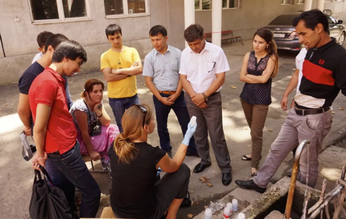
NSIDC partnered with researchers in eight countries in High Asia, at times augmenting field programs, and providing technical training and support. The United States Agency for International Development (USAID) funded the project. Funds provided to NSIDC at the University of Colorado Boulder marked the first USAID funding provided directly to a university. Roughly half of the CHARIS funding went directly to the project’s international partner institutions.
Icy origins of High Asia rivers
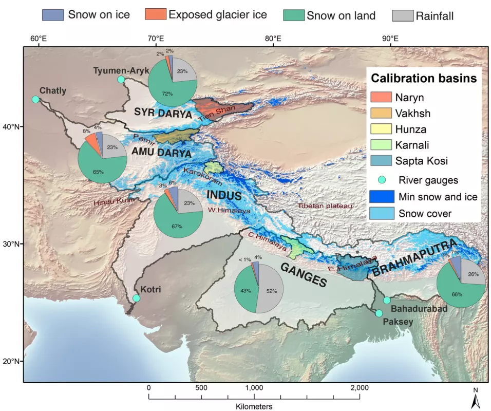
Mountain ranges in High Asia—specifically the Hindu-Kush-Himalaya, Pamir, and Tien Shan Mountain Ranges—are often referred to as Earth’s “Third Pole” because they contain so much snow and ice. These mountain ranges hold the headwaters for several of the world’s great rivers: Brahmaputra, Ganges, Indus, Amu Darya, and Syr Darya. Residents of Bhutan, Nepal, India, Pakistan, Afghanistan, Kyrgyzstan, Uzbekistan, Kazakhstan, and Tajikistan, collectively number more than a billion people who depend on these rivers for drinking water, irrigation, and hydroelectric power generation.
High Asia holds not only headwaters for great rivers but also a diversity of landscapes and local climates, making for significant differences in water resources. Changes in climate and land-use practices may alter the availability of water across High Asia in coming decades. Consequently, CHARIS researchers worked to quantify water sources across the region to inform future planning and development.
CHARIS participation and funding
Before NSIDC scientist Richard Armstrong helped establish CHARIS, he realized that very little science literature could answer basic questions about water availability in High Asia.
High Asia’s roughly 15,000 glaciers and snow-covered areas are often difficult to reach in person. For local insights, Armstrong worked directly with researchers at institutions across High Asia. International partner institutions included Kathmandu University, Nepal; Kabul University, Afghanistan; Department of Hydro-Meteorological Services, Bhutan; Royal University of Bhutan; Sherubtse College, Bhutan; Jawaharlal Nehru University, India; Sharda University, India; Institute of Geography, Kazakhstan; Institute of Water Problems and Hydropower, Kyrgyzstan; Karakorum International University, Pakistan; Water and Power Development Authority, Pakistan; and Institute of Water Problems, Hydropower, and Ecology, Tajikistan.
CHARIS benefited from the expertise of many researchers at the University of Colorado, several of them working at or with NSIDC, including the following:
- Richard Armstrong led the project.
- Andrew Barrett focused on snow cover mapping and assessing reanalysis temperature and precipitation data.
- Mary Jo Brodzik provided research programming support in the areas of satellite data processing, glacier mapping, DEM generation and statistical methods for time-series trend analysis.
- Florence Fetterer coordinated project activities including implementing project partner agreements and arranging workshops.
- Alice Hill expanded run-off contributions of ice and snow to include lower-elevation regions.
- Siri Jodha Singh Khalsa supervised digital elevation model generation and evaluation, and assembled the MODIS snow cover product for use in the snowmelt runoff models and trend analysis.
- Alia Lauren Khan focused on aquatic biogeochemistry in the cryosphere, specifically looking at impurities in snow and ice, such as black carbon.
- Adina Racoviteanu provided expertise in remote sensing and geographic information systems for glacier change detection and mass balance monitoring, with an emphasis on mapping debris covered glaciers.
- Bruce Raup supervised the evaluation and use of existing and new outlines for derivation of glacier hypsometries, and ensured that new glacier outlines are inserted into the NSIDC GLIMS Glacier Database. Bruce has glacier field work experience.
- Karl Rittger provided expertise on how spectral signatures can be applied to map and model snow and ice melt in satellite imagery.
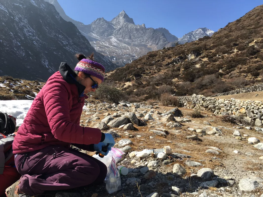
- Alana Wilson collected and analyzed water samples; helped establish sampling protocols with South and Central Asian partners.
CHARIS methodology
Researchers tested two types of melt models: temperature index and energy balance, ultimately finding strong agreement between those model types.
To determine the contribution of glacier ice and seasonal snow to runoff, researchers applied a suite of satellite remote sensing, reanalysis, and ground-based data as input to specific snow and ice melt models.
CHARIS researchers used data from the Moderate Resolution Imaging Spectroradiometer (MODIS) sensor to map glacier-covered areas and seasonal snow cover. Specifically, they used the MODIS Persistent Ice (MODICE) algorithm, derived from the MODIS Snow covered Area and Grain size (MODSCAG) algorithm, as input to a temperature-index melt model. They also evaluated the accuracy of melt model results using innovative isotopic and geochemical tracers to identify and quantify the sources of water flowing into selected rivers.
The CHARIS team relied on satellite-derived digital elevation models (DEMs) for elevation data. For reanalysis, the team used multiple products: the NASA Modern Era Retrospective Analysis for Research and Applications (MERRA), the European Center for Medium Range Weather Forecasts (ECMWF) ERA-Interim, and the National Centers for Environmental Prediction (NCEP) Climate Forecast System Reanalysis (CFSR).
Impact
CHARIS established methods for collecting and evaluating hydrologic data in remote regions, building research capacity and infrastructure in High Asia. Building partnerships across multiple countries and disputed national boundaries, the project overcame initial geopolitical tensions among research institutions. Above all, CHARIS filled gaps in understanding of water sources for hundreds of millions of people. Among the research results was the finding that, across High Asia, snow melt contributes roughly 10 to 20 times as much water as glacier melt to the region’s rivers.
Published research
CHARIS results have been shared in papers, scientific posters, and presentations at international meetings. Listed below are selected papers in science journals.
Armstrong, R., K. Rittger, M. Brodzik, A. Racoviteanu, A. Barrett, S. Khalsa, B. Raup, A. Hill, A. Khan, A. Wilson, R. Kayastha, F. Fetterer, and B. Armstrong. 2018. Runoff from glacier ice and seasonal snow in High Asia: separating melt water sources in river flow. Regional Environmental Change https://doi.org/10.1007/s10113-018-1429-0
Armstrong, R. 2010. The Glaciers of the Hindu Kush-Himalayan Region. International Centre for Integrated Mountain Development (ICIMOD).
Balestrini, R., C. Delconte, E. Sacchi, A. Wilson, M. Williams, P. Cristofanelli, and D. Putero. 2016. Wet deposition at the base of Mt Everest: Seasonal evolution of the chemistry and isotopic composition. Atmospheric Environment 146: 100-112.
Hill, A. F., C. K. Minbaeva, A. M. Wilson, and R. Satylkanov. 2017. Hydrologic controls and water vulnerabilities in the Naryn River Basin, Kyrgyzstan: A Socio-hydro case study of water stressors in Central Asia. Water, 9(5), 325.
Kargel, J. S., G. J. Leonard, D. H. Shugar, U. K. Haritashya, A. Bevington, E. J. Fielding, K. Fujita, M. Geertsema, E. S. Miles, J. Steiner, E. Anderson, S. Bajracharya, G. W. Bawden, D. F. Breashears, A. Byers, B. Collins, M. R. Dhital, A. Donnellan, T. L. Evans, M. L. Geai, M. T. Glasscoe, D. Green, D. R. Gurung, R. Heijenk, A. Hilborn, K. Hudnut, C. Huyck, W. W. Immerzeel, Jiang Liming, R. Jibson, A. Kääb, N. R. Khanal, D. Kirschbaum, P. D. A. Kraaijenbrink, D. Lamsal, L. Shiyin, L. Mingyang, D. McKinney, N. K. Nahirnick, N. Zhuotong, S. Ojha, J. Olsenholler, T. H. Painter, M. Pleasants, K. C. Pratima, Q. I. Yuan, B. H. Raup, D. Regmi, D. R. Rounce, A. Sakai, Shangguan Donghui, J. M. Shea, A. B. Shrestha, A. Shukla, D. Stumm, M. van der Kooij, K. Voss, Wang Xin, B. Weihs, D. Wolfe, Wu Lizong, Yao Xiaojun, M. R. Yoder, and N. Young, 2015. Geomorphic and geologic controls of geohazards induced by Nepal’s 2015 Gorkha earthquake. Science https://doi.org/10.1126/science.aac8353.
Khan, A., S. Wagner, R. Jaffe, P. Xian, M. Williams, R. Armstrong, and D. McKnight. 2017. Dissolved black carbon in the global cryosphere: Concentrations and chemical signatures. Geophysical Research Letters https://doi.org/10.1002/2017GL073485.
Normatov P. I., R. Armstrong, and I. Normatov. 2015. Monitoring of emergency water factors and research of anthropogenic impact of industries on water quality in Zeravshan River Basin. Russian Meteorology and Hydrology 40(5): 347-354. https://doi.org/10.3103/S106837391505009X.
Painter, T. H., M. J. Brodzik, A. Racoviteanu, and R. Armstrong. 2012. Automated mapping of Earth’s annual minimum exposed snow and ice with MODIS. Geophysical Research Letters https://doi.org/10.1029/2012GL053340.
Racoviteanu, A. E., Y. Arnaud, M. W. Williams, and W. F. Manley. 2015. Spatial patterns in glacier characteristics and area changes from 1962 to 2006 in the Kanchenjunga–Sikkim area, eastern Himalaya. The Cryosphere 9: 505-523. https://doi.org/10.5194/tc-9-505-2015.
Racoviteanu, A., Y. Arnaud, M. Williams, and W. F. Manley. 2014. Spatial patterns in glacier area and elevation changes from 1962 to 2006 in the monsoon-influenced eastern Himalaya. The Cryosphere https://doi.org/10.5194/tcd-8-3949-2014.
Racoviteanu, A. E., R. Armstrong, and M. W. Williams. 2013. Evaluation of an ice ablation model to estimate the contribution of melting glacier ice to annual discharge in the Nepal Himalaya. Water Resources Research 49(9): 5117-5133. https://doi.org/10.1002/wrcr.20370.
Racoviteanu, A., and M. W. Williams. 2012. Decision tree and texture analysis for mapping debris-covered glaciers in the Kangchenjunga area, Eastern Himalaya. Remote Sensing 4(10): 3078-3109. http://dx.doi.org/10.3390/rs4103078.
Rasmussen, L.A. 2013. Meteorological controls on glacier mass balance in High Asia, Annals of Glaciology 54(63): 352-359. https://doi.org/10.3189/2013AoG63A353.
Rittger, K., M. S. Raleigh, J. Dozier, A. F. Hill, J. S. Lutz, and T. H. Painter. 2019. Canopy adjustment and improved cloud cover for remotely sensed snow cover mapping. Water Resources Research https://doi.org/10.1029/2019WR024914.
Severskiy, I., E. Vilesov, R. Armstrong, A. Kokarev, L. Kogutenko, Z. Usmanova, V. Morozova, and B. Raup. 2016. Changes in glaciation of the Balkhash–Alakol basin, central Asia, over recent decades. Annals of Glaciology 57(71): 155-168. https://doi.org/10.3189/2016AoG71A067.
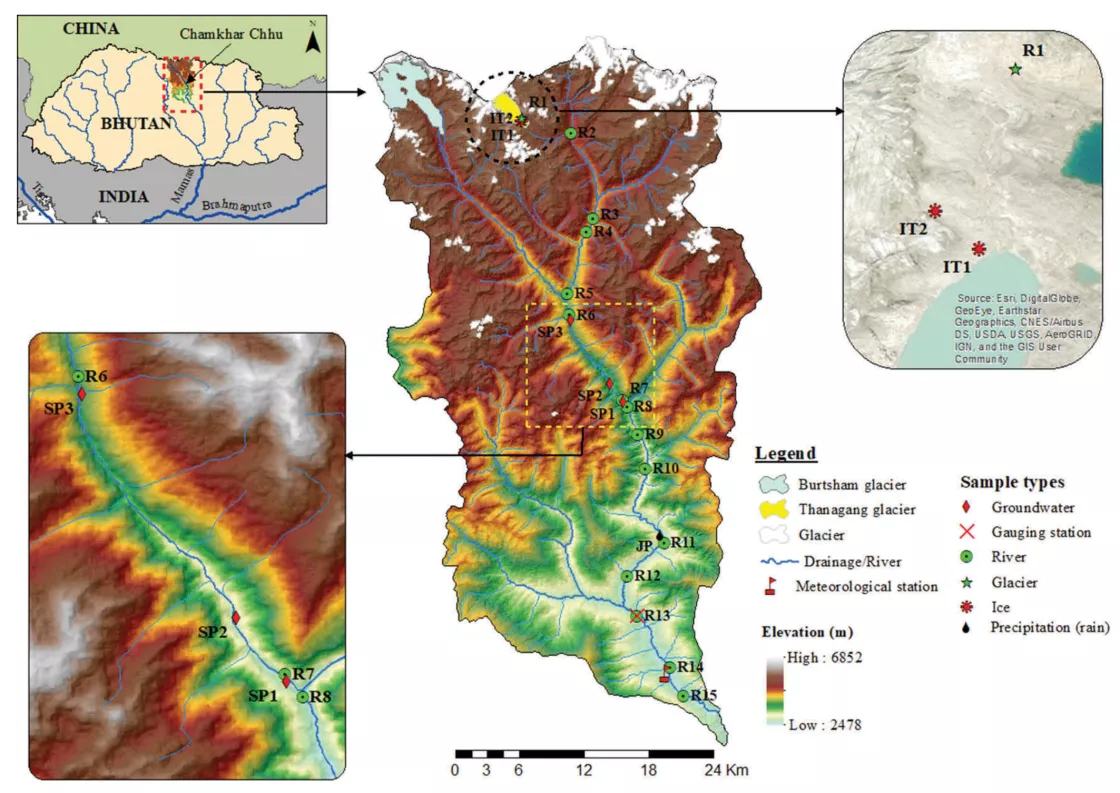
Tshering, D., H. A. Miller, A. F. Hill, and A. M. Wilson. 2020. Seasonal source water and flow path insights from a year of sampling in the Chamkar Chhu Basin of Central Bhutan. Arctic and Alpine Research https://doi.org/10.1080/15230430.2020.1743148.
Vaux, H. J., Jr., D. Balk, E. R. Cook, P. Gleick, W. K.-M. Lau, M. Levy, E. L. Malone, R. McDonald, D. Shindell, L. G. Thompson, J. L. Wescoat, Jr., and M. W. Williams. 2012. Himalayan Glaciers: Climate Change, Water Resources, and Water Security.National Academies Press.
Williams, M. W., A. M. Wilson, D. Tshering, P. Thapa, R. B. Kayastha, and A. Racoviteanu. 2016. Using geochemical and isotopic chemistry to evaluate glacier melt contributions to the Chamkar Chhu (river), Bhutan. Annals of Glaciology https://doi.org/10.3189/2016AoG71A068.
Wilson, A. M., M. W. Williams, R. Armstrong, and A. Racoviteanu. 2017. High Asia: Climate change, water security, and international conflicts. Journal of Asian Studies High Asia: Climate Change, Water Security, and International Conflicts. https://www.jstor.org/stable/44505797.
Wilson, A. M., M. W. Williams, R. B. Kayastha, and A. Racoviteanu. 2016. Use of a hydrologic mixing model to examine the roles of meltwater, monsoon precipitation, and groundwater in the Langtang River Basin, Nepal. Annals of Glaciology 57(71): 155-168 https://doi.org/10.3189/2016AoG71A067.
Ye, Q., J. Zong, L. Tian, J. Graham Cogley, C. Song, and W. Guo. 2017. Glacier changes on the Tibetan Plateau derived from Landsat imagery: mid-1970s – 2000–13. Journal of Glaciology 63(238): 273-287. https://doi.org/10.1017/jog.2016.137.


