News & Stories

Across the globe, snow and ice play a vital role in regulating Earth’s climate and providing freshwater resources to people, plants, and animals.

As Earth’s frozen regions change rapidly, NSIDC is committed to growing its research and open access data to better understand these changes. Read about NSIDC research and its contribution to science and policy making. Check out spotlights on how to use NSIDC data, tools, and resources. Learn about how we steward data and collaborate with scientists and organizations across the world to understand how the frozen parts of Earth affect the rest of the planet and impact society.
News and stories

Filter by:
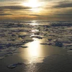
Light reflects off Arctic sea ice.
Spotlight
On December 10, 1972, the world of sea ice data changed forever. For the first time in history, as the Electrically Scanning Microwave Radiometer (ESMR) launched aboard the NASA Nimbus-5 satellite, scientists gained the ability to track changes in sea ice cover over the Polar Regions every day via passive microwave data. Today, they can piece together a half century’s worth of data from several instruments and satellite missions, including ESMR, to better understand how global warming is affecting Arctic and Antarctic sea ice. 
15 lowest minima as of Nov-2022
Ask a Scientist
With satellite observations of sea ice extent stretching back to November 1978, NSIDC scientists can draw from more than 40 years of data to determine when an extent is above or below average or when it reaches a record high or low.
Analysis - Sea Ice Today

November’s rate of sea ice growth in the Arctic was near average. Several of the peripheral seas have open water areas late into the autumn season. Warm air temperatures persist in the northern North Atlantic and northwestern Europe.

Charctic screenshot taken November 2022
Ask a Scientist
NSIDC scientists use the 1981 to 2010 average of sea ice concentration and extent to have a consistent basis for comparison to today’s fluctuating conditions. The 30 years observed in this baseline provide enough data to even out short-term variability.
Sea-Ice-Drilling_Copyright-Martin-Hartley_3
Ask a Scientist
Freshly formed sea ice can be as thin as a few sheets of paper or as thick as a one-story house, depending on how long it has existed. Measuring sea ice thickness is harder than measuring how much sea ice covers the ocean surface but multiple approaches have been used.
Hurricane Fiona heads north
Ask a Scientist
Hurricanes form in the tropics, feeding on very warm ocean waters. As they track northward, they may transform to an extratropical storm with an added punch, sometimes reaching southern Greenland, Alaska, and even Arctic latitudes of the North Atlantic.