• NSIDC's website will undergo planned maintenance on Wednesday, January 15, from 10 a.m. to 12 p.m. (U.S. Mountain Time). During this time, the NSIDC.org website and most NSIDC data access may be briefly unavailable.

Spotlight
  • Glaciers

The St. Patrick Bay ice caps in Canada have completely disappeared

The St. Patrick Bay ice caps on the Hazen Plateau of northeastern Ellesmere Island in Nunavut, Canada, have disappeared, according to NASA satellite imagery. National Snow and Ice Data Center (NSIDC) scientists and colleagues predicted via a 2017 paper in The Cryosphere that the ice caps would melt out completely within the next five years, and recent images from NASA’s Advanced Spaceborne Thermal Emission and Reflection Radiometer (ASTER) have confirmed that this prediction was accurate.

Mark Serreze, director of NSIDC, Distinguished Professor of Geography at the University of Colorado Boulder, and lead author on the paper, first set foot on the St. Patrick Bay ice caps in 1982 as a young graduate student. He visited the ice caps with his advisor, Ray Bradley, of the University of Massachusetts.

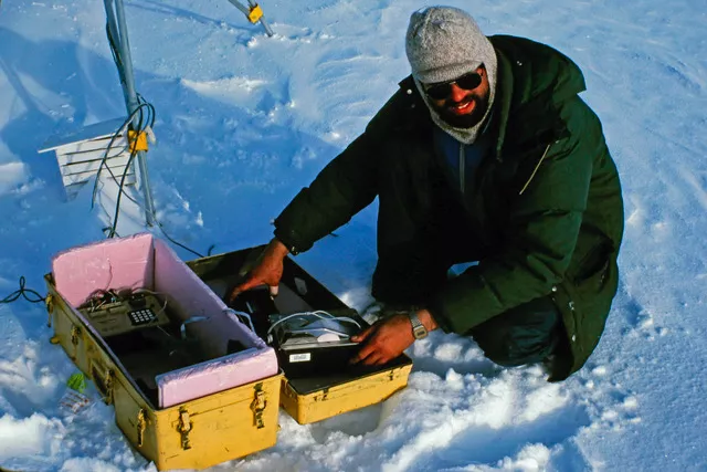
NSIDC director Mark Serreze conducted research on the St. Patrick Bay ice caps as a graduate student at the University of Massachusetts in the early 1980s.
National Snow and Ice Data Center director Mark Serreze conducted research on the St. Patrick Bay ice caps as a graduate student with the University of Massachusetts in 1982. The ice caps have since melted completely and disappeared. — Credit: Ray Bradley

“When I first visited those ice caps, they seemed like such a permanent fixture of the landscape,” said Serreze. “To watch them die in less than 40 years just blows me away.”

In 2017, scientists compared ASTER satellite data from July 2015 to vertical aerial photographs taken in August of 1959. They found that between 1959 and 2015, the ice caps had been reduced to only five percent of their former area, and shrank noticeably between 2014 and 2015 in response to the especially warm summer in 2015. The ice caps are absent from ASTER images taken on July 14, 2020.

The St. Patrick Bay ice caps were one-half of a group of small ice caps on the Hazen Plateau, which formed and likely attained their maximum extents during the Little Ice Age, perhaps several centuries ago. The Murray and Simmons ice caps, which make up the second half of the Hazen Plateau ice caps, are located at a higher elevation and are therefore faring better, though scientists predict that their demise is imminent as well.

“We’ve long known that as climate change takes hold, the effects would be especially pronounced in the Arctic,” said Serreze. “But the death of those two little caps that I once knew so well has made climate change very personal. All that’s left are some photographs and a lot of memories.”
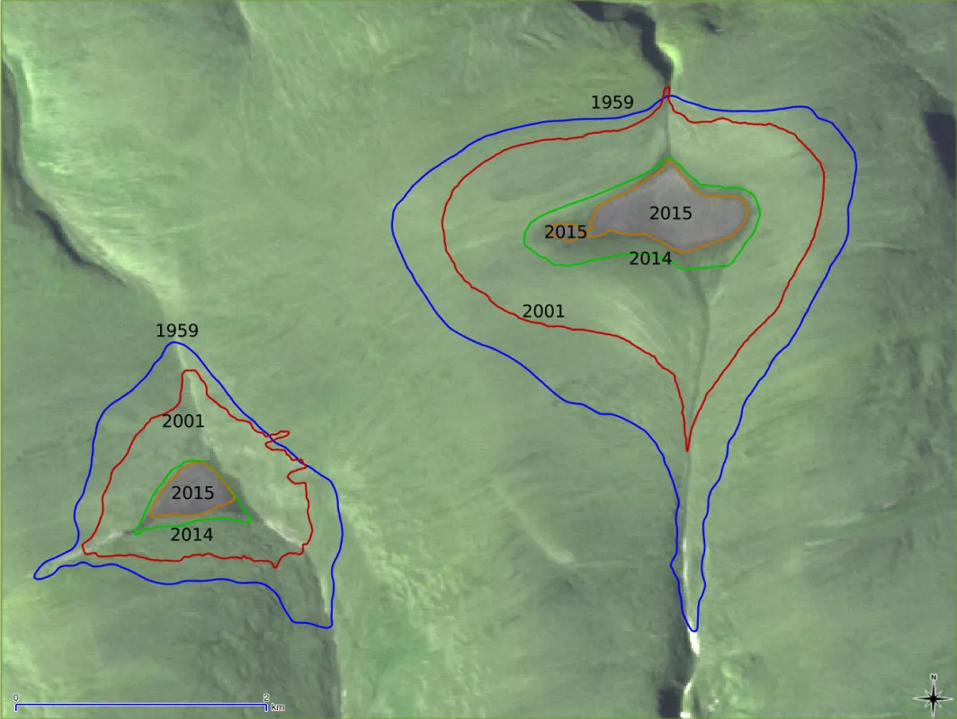
This outline of the St. Patrick Bay ice caps, taken from the 2017 The Cryosphere paper, is based on aerial photography from August 1959, GPS surveys conducted during August 2001, and for August of 2014 and 2015 from NASA’s Advanced Spaceborne Thermal Emission and Reflection Radiometer (ASTER).
This outline of the St. Patrick Bay ice caps, taken from the 2017 The Cryosphere paper, is based on aerialphotography from August 1959, GPS surveys conducted during August 2001, and for August of 2014 and 2015 from NASA’s Advanced Spaceborne Thermal Emission and Reflection Radiometer (ASTER). It shows the area of the St. Patrick Bay ice caps in 1959, 2001, 2014, and 2015. The ice caps were markedly smaller in 2015 than in previous years.
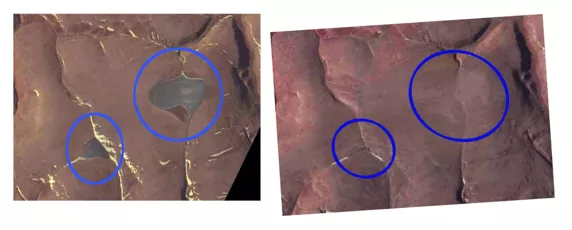
These NASA Advanced Spaceborne Thermal Emission and Reflection Radiometer (ASTER) satellite images show the location where the St. Patrick Bay ice caps used to exist on the Hazen Plateau of northeastern Ellesmere Island in Nunavut, Canada. The ice caps were still intact in the photo on the left, which was taken in August of 2015. As of the photo on the right, which was taken in July of 2020, the ice caps have melted out and no longer exist. — Credit: Bruce Raup, NSIDC
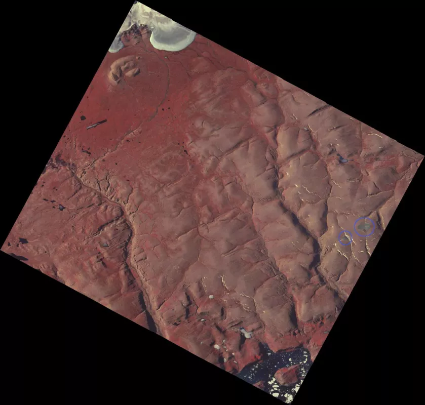
This NASA Advanced Spaceborne Thermal Emission and Reflection Radiometer (ASTER) satellite image from August 4, 2015, shows the location where the St. Patrick Bay ice caps (circled in blue). As of July 2020, satellite images show that these ice caps have disappeared. — Credit: Bruce Raup, NSIDC
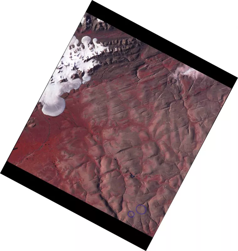
This NASA Advanced Spaceborne Thermal Emission and Reflection Radiometer (ASTER) satellite image from July 14, 2020, shows the location where the St. Patrick Bay ice caps once were (area circled in blue). As of July 2020, satellite images show that these ice caps have disappeared. — Credit: Bruce Raup, NSIDC