By Jane Beitler
How do you map a continent that has no permanent residents, is 99% covered in ice, and dark half the year? Antarctica's remote location and harsh conditions make it extremely difficult to map its thousands of miles of jagged coastline, its remote mountain ranges, and its vast ice sheet.
In the Antarctic summer of 2003 to 2004, NSIDC scientists helped solve that problem. They combined more than 260 satellite images to capture the surface and topography of the continent, producing a map called the Mosaic of Antarctica (MOA). But because some areas of Antarctica have been displaying rapid change, the team hopes that an update of the MOA satellite imagery and comparison of the maps will help reveal the secrets of the Antarctic Ice Sheet.
A map of difference
When it came out in 2006, MOA was the most detailed map of Antarctica ever released. The value of satellite imagery in mapping remote Antarctica had been recognized for decades, but the MOA team was able to solve challenges caused by clouds, blowing snow, and shadows by stacking a number of images for each location, carefully selecting images with clear skies, and matching light conditions in each one. MOA, compiled from images from the NASA Moderate Resolution Imaging Spectroradiometer (MODIS), allowed researchers to see subtle topography in the ice sheet surface, trace the Antarctic coastline, and locate with precision the grounding zone, the location where ice moves from land into the water.
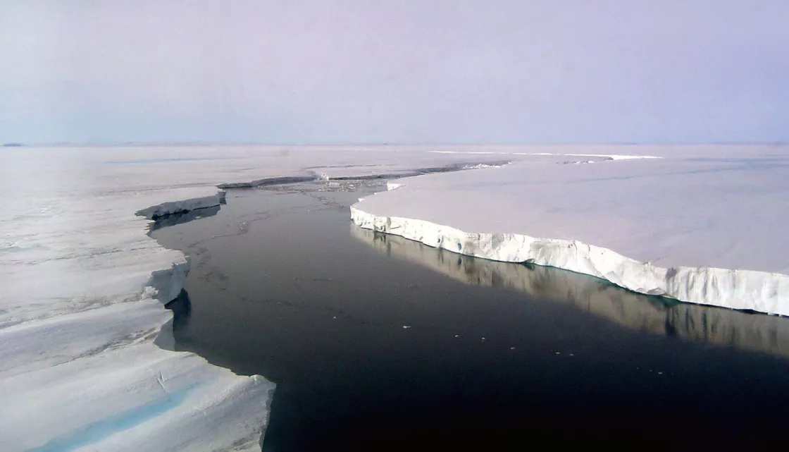
But while the Antarctic Ice Sheet is frozen, it is anything but unchanging. Icebergs calve away, ice shelves collapse into the ocean, glaciers advance and retreat, new fractures and wind-carved dunes appear, and gigantic ice streams wind slowly through frozen peaks and valleys, moving tons of ice from the continent interior towards the coast. So NSIDC researchers decided to update the mosaic based on new data. They carefully selected images from the austral summer of 2008 to 2009 to match the date, time, and light conditions used in MOA 2004, and created a new version of MOA (MOA 2009). This updated map can be compared to MOA 2004 to see changes, large and small, in the ice surface.
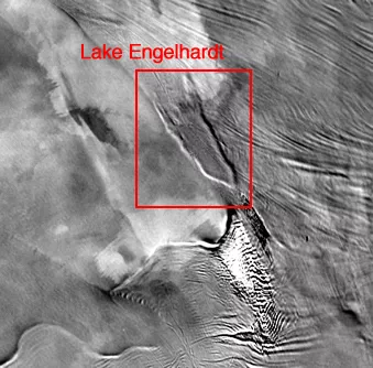
Using the two maps, researchers can now make detailed comparisons of the surface of Antarctica, by comparing the surface of Antarctica in 2009 to the surface in 2004. This method allows them to potentially identify changes in topography and better understand the dynamics of the massive ice sheet. Already, the NSIDC MOA team has used the new product to identify changes in the ice. Using the two maps, they were able to visually confirm changes in Antarctic ice shelf extent since 2004. NSIDC researchers also used a technique called a difference map, essentially subtracting one image from the other, to identify the draining of Lake Engelhardt, a subglacial lake that lies deep beneath the Antarctic Ice Sheet. Sometime between the creation of the two maps, the buried lake drained, and the ice above it sank by nine meters. The two maps also confirm the retreat of several ice shelves along the Antarctic Peninsula, and could help researchers identify other changes in the Antarctic coastline. MOA 2009 is scheduled for release in early 2011.
More information
Antarctic Cryosphere Access Portal (A-CAP) Map server Web site.

