Frozen Ground & Permafrost
Quick Facts
What is frozen ground?
When water turns into ice in soil, it becomes frozen ground. This frozen layer on or under Earth’s surface has a temperature at or below 0°C (32°F). More than half of all the land in the Northern Hemisphere freezes and thaws every year and is called seasonally frozen ground.
Seasonally frozen ground is near-surface soil that freezes for more than 15 days per year. Intermittently frozen ground is near-surface soil that freezes from one to 15 days per year. One-fourth of the land in the Northern Hemisphere has an underground layer that stays frozen all year long, known as permafrost. Permafrost remains frozen for at least two years. In many cases, permafrost has been frozen for thousands of years.
How is frozen ground different from permafrost?
When water freezes or when the temperature of soil drops to or below 0°C (32°F) it is known as frozen ground.
Permafrost, or permanently frozen ground, is soil, sand, sediment, or rock that remains at or below 0°C (32°F) for at least two years. It occurs both on land and beneath offshore Arctic continental shelves. It ranges in thickness from less than 1 meter (3.3 feet) to greater than 1,500 meters (4,900 feet).
Permafrost is not defined by ice content, overlying snow cover, or location; it is defined solely by temperature. Any rock or soil remaining at or below 0°C (32°F) for two or more years is permafrost.
How much does frozen ground cover Earth?
Approximately 50 percent of the Northern Hemisphere's land surface is covered by seasonally frozen ground, which can last for a few weeks in the middle and lower latitudes, and for several months at high latitudes and high elevations.
How much does permafrost cover Earth?
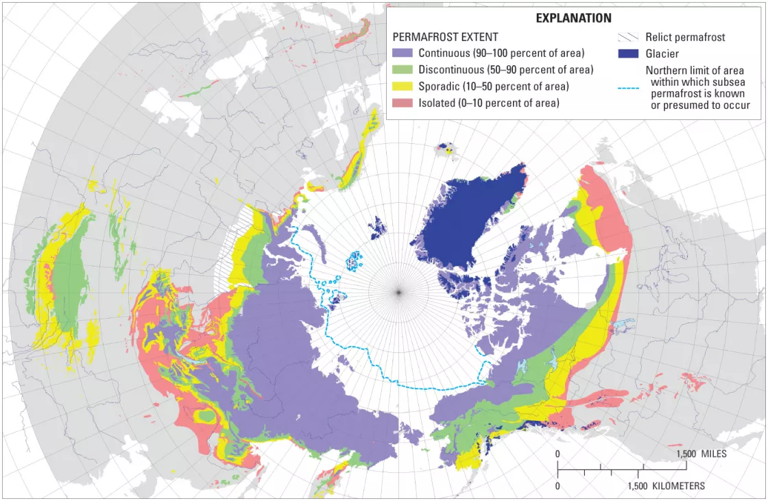
Scientists have mapped permafrost since the mid-twentieth century. In 1990, the International Permafrost Association (IPA) recognized the need for a single, unified map to summarize the distribution and properties of permafrost in the Northern Hemisphere. The IPA map shows the distribution of continuous, discontinuous, sporadic, and subsea permafrost, along with isolated patches.
In total, permafrost underlies approximately 23 million square kilometers (9 million square miles) or about 25 percent of the exposed land surface in the Northern Hemisphere, with approximately 65 percent in Eurasia and the other 35 percent in North America and Greenland.
Why does permafrost hold so much carbon and methane?
Carbon enters permafrost through a process that takes thousands of years. During the past ice age, great ice sheets covered large expanses of land in the Northern Hemisphere. As they spread out and then shrunk back, the ice sheets ground up the rock underneath them into a very fine dust called loess or glacial flour. The ice sheets produced a huge amount of this powdered rock, and wind and rain deposited it onto the soil.
As the ice sheets added loess (silty or loamy material) to the soil, the soil got thicker. As the soil built up, the active layer on top stayed the same thickness. The active layer froze and thawed each year, and plants could grow in it. But underneath the active layer, roots and other organic matter were frozen into the permafrost, where they could not decay.
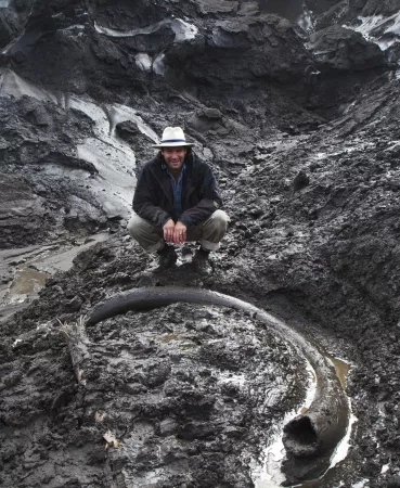
In permafrost today, most of the organic matter consists of partially decayed roots, whole roots, and other plant material, i.e., peat. However, there are also animals and animal material frozen in the ground—sometimes people find entire mastodons or other animals frozen in the permafrost. Significant deposits of carbon-rich permafrost, or yedoma, have been found in Russia.
How do plants find water when the ground is frozen?
Plants have adapted to the extremely cold environment by surviving with little water. In the winter, they push their roots deep down under the frozen topsoil to find liquid groundwater.
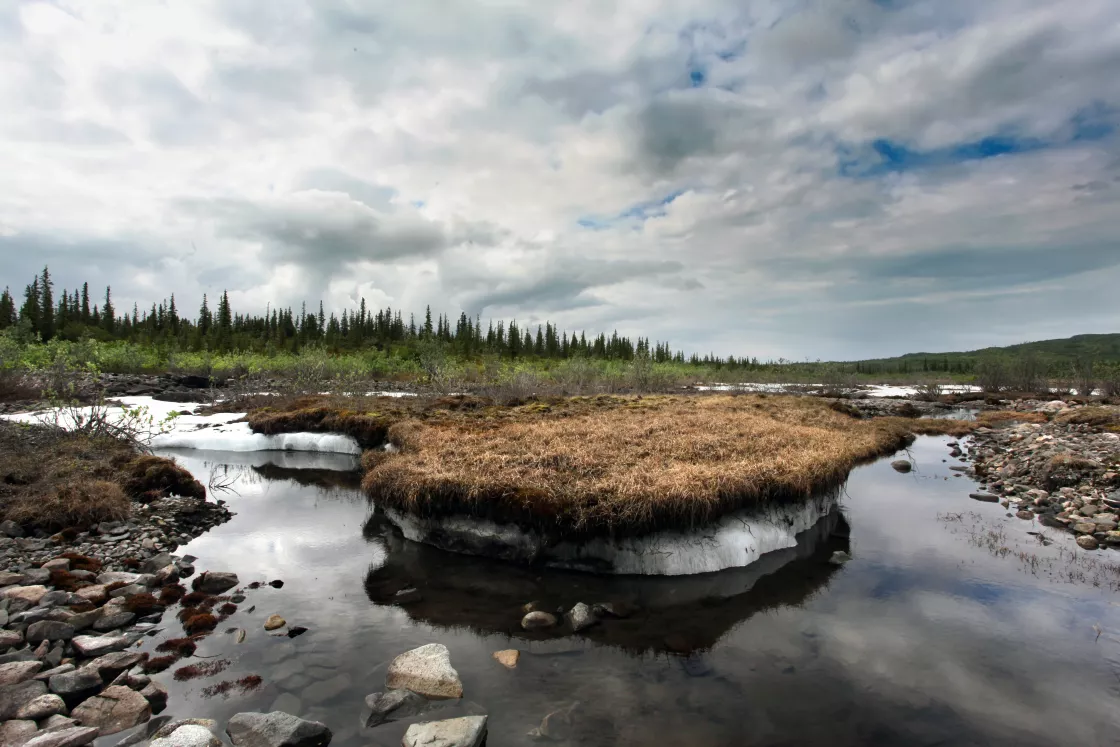
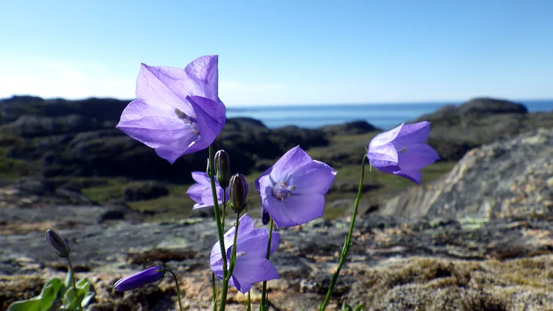
When the ground is frozen for more than two years in a row, forming permafrost, it is harder for plants to survive. These regions, known as tundra, are treeless, but covered with a carpet of shrubs, lichen, and moss that use water when it is available. Tundra is sometimes referred to as a cold desert because of how little moisture it receives. However, when snow and ice melt and the thin topsoil layer thaws come spring and summer, a boggy marsh appears. Because beneath the topsoil is a permanent barrier of permafrost, melted ice and rain pool on the surface. With plenty of water and long summer days, the plants grow rapidly while they have the chance.
Not all permafrost, however, is in tundra areas. Boreal forests, also known as taiga, can exist in areas where patches of permafrost are mixed with seasonally frozen ground. Coniferous forests of pines, spruces, and larches cover 17 million square kilometers (6.6 million square miles) or 11.5 percent of Earth's land area, mostly in Russia and Canada.
How do animals find water when the ground is frozen?
Animals adapt their behavior to survive environments with frozen ground by hibernating or migrating to warmer climates. Animals also have physiological adaptations that help them live in environments where water is frozen. Though snow turns to water when it melts, it takes lots of energy in terms of metabolism to get the liquid water out when eating snow.
What is methane?
Methane is a gas made up of one carbon atom and four hydrogen atoms. Like carbon dioxide, methane is a greenhouse house with heat-trapping properties. Methane lingers in the air about a decade on average, which is much less time than carbon dioxide, but it traps much more energy too. According to the United States Environmental Protection Agency, methane is between 28 to 36 times more efficient at trapping heat than carbon dioxide over a 100-year period—the time period used for comparing different gases and their global warming potential. To put it simply, methane is much more powerful than carbon dioxide at warming the climate but breaks down faster.
Human activities are responsible for about 60 percent of methane emissions. Methane seeps out during the production, processing, storage, transport, and use of coal, natural gas, and oil. It is the primary component of natural gas, used to heat many homes. Methane also enters the atmosphere through agriculture (including fermentation, manure management, and rice production), landfills, and wastewater treatment.
What is methane’s connection to permafrost?
There are two potential sources of methane in the Arctic. The first source of methane is called methyl clathrate. Methyl clathrates are methane molecules that are frozen into ice crystals. They can form deep in the earth or underwater, but it takes very special conditions, with high-pressure and low temperature, to make them. If the temperature or pressure changes, the ice that locks in the methane will break apart, and the methane will escape. Scientists are not sure how much methane is trapped in methyl clathrates, or how much is in danger of escaping.
The other major source comes from thawing dead plants and animals that have been trapped in the frozen permafrost for thousands of years. As long as this organic matter remains frozen, methane will not escape. However, when permafrost thaws, the organic matter decays, releasing carbon dioxide and/or methane into the atmosphere.
How will methane released from permafrost affect global warming?
There are several opposing processes at work, which make this a hard question to answer. Higher temperatures mean that permafrost can thaw and release methane to the atmosphere. But warming also means that the growing seasons in Arctic latitudes will last longer. When the growing season is longer, plants have more time to suck up carbon from the atmosphere. Since carbon in the air is what plants use to grow, it can also act as a sort of fertilizer under certain conditions. Then plants grow faster and take up even more carbon. If the Arctic takes up more carbon than it releases, this means that plants take up carbon during the growing season, but do not release as much carbon through decay. In this case, we say that the Arctic acts as a carbon sink.
But if Earth continues to warm, and a lot of permafrost thaws out, the Arctic could become an overall source of carbon to the atmosphere, instead of a sink. This is what scientists refer to as a “tipping point.” If the Arctic permafrost releases more carbon than it absorbs, it would start a cycle where the extra carbon in the atmosphere leads to increased warming. The increased warming means more permafrost thawing and methane release.
How do scientists study permafrost from space?
Permafrost is hard to see. It covers about 25 percent of the Northern Hemisphere, often in extreme and remote places. Relying on field observations alone is difficult. Satellites provide daily data spanning the globe.
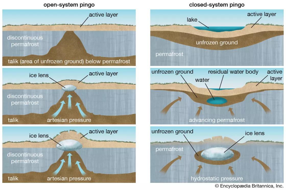
However, satellite technology is complicated, and current satellite sensors cannot probe deeply into the ground. Instead, scientists study the landforms that are consistent with frozen ground areas. Permafrost landscapes form recognizable patterns, such as palsas and pingos. Palsas are permafrost peat mounds. Pingos are hills with ice cores, ranging in height from 3 to 70 meters (10 to 230 feet) and 30 to 1,000 meters (100 to 3,300 ft) in diameter. They are typically cone-shaped, appearing sometimes with a depression on top, like a volcano. Pingos only form in permafrost, so a collapsed pingo suggests a former permafrost environment.
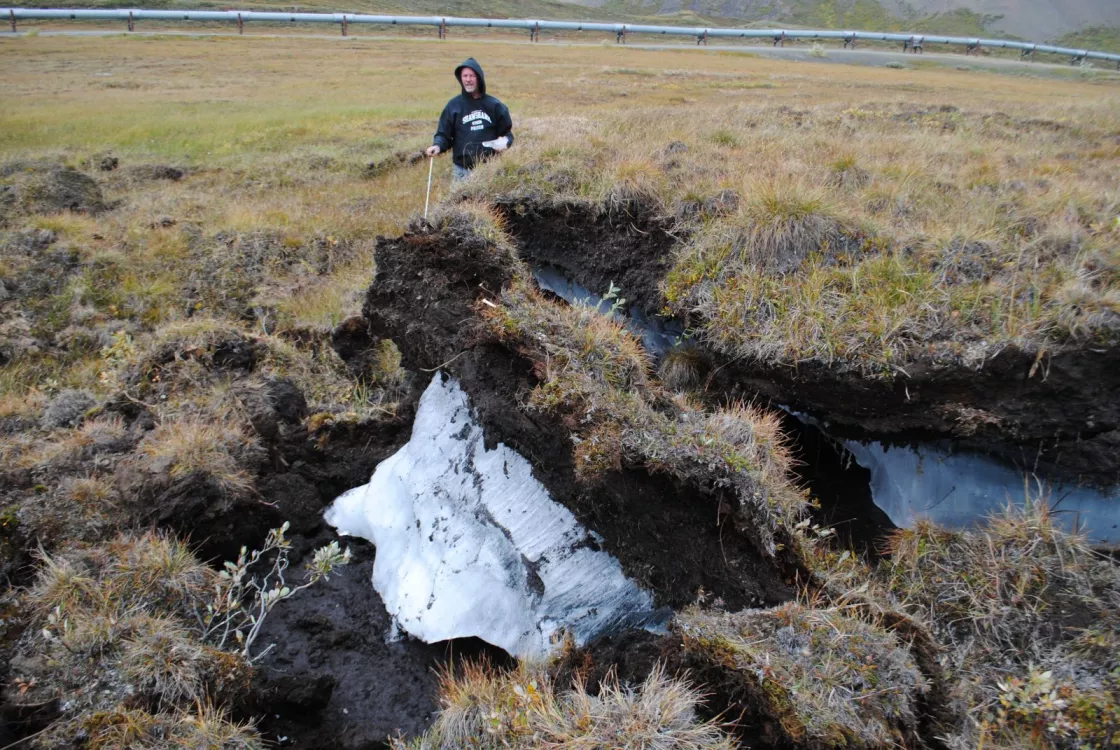
These landscapes, therefore, can also be a sign of warming. Specifically, scientists look for active-layer detachments, retrogressive thaw slumps, degraded ice-wedge polygons, and thermokarst lakes as symptoms of permafrost thaw.
- Active-layer detachments are small landslides that occur in the summer or on thawing permafrost.
- Retrogressive thaw slumps occur when a slope fails because ice-rich permafrost advances into undisturbed ground as material thaws.
- Ice wedge polygons are cracked permafrost shaped into polygons. Formed by contraction of frozen ground in the winter, the water in the ground freezes and expands to form cracks in the surface.
- Thawing ground ice can gradually cave in, a process known as thermokarst that results in irregular surfaces of marshy bowls.
- In areas where permafrost is thawing, trees lose their footing and tilt at odd angles. These areas are known as “drunken forests.”
Satellites can also tell scientists the surface temperature on the ground and whether water near the surface is frozen. Scientists verify the satellite information by comparing it to what they have learned in the field. The NASA Soil Moisture Active Passive (SMAP) satellite orbits Earth measuring the amount of water in the top 5 centimeters (2 inches) of soil. SMAP can decipher whether the soil is frozen or thawed. Scientists also use the NASA gravity-detecting GRACE satellites to trace changes in groundwater reservoirs that may indicate thawing permafrost.
What do scientists study about permafrost and methane?
The big questions scientists ask include: How much carbon is currently frozen in permafrost? How much will thaw out in the future, and when will it be released into the atmosphere? Scientists also want to know how much carbon could be released as methane, and how much could be released as carbon dioxide. That is related to how much of the land is wetlands, since ponds and lakes and swamps are the main places that will produce methane.
If governments around the world knew how much methane could be released from permafrost, it could help them decide what to do about it. For example, they would know how much we need to reduce fossil fuel emissions from human activities. They would also need to know how much carbon Earth is emitting on its own. And finally, communities would need to know how to adapt.
The good news is that we have not yet reached the tipping point. Though permafrost carbon has started to decay in some areas, measurements of carbon dioxide in the air show the Arctic is still a carbon sink. Scientists are studying permafrost to understand more about how it acts, trying to measure how much carbon there is and where it is located. Then scientists can use that information in computer programs to better plan for the future.
