Arctic Weather and Climate
Science
Factors affecting Arctic weather and climate
Just like other areas on Earth, weather and climate in the Arctic depend on a lot of variables, including latitude that affects how much energy is received from the sun, and the distribution of land and water. Arctic climates are highly varied. Individually the factors that affect Arctic climate are important. However, they also interact with each other to produce weather patterns and climate feedbacks, which have effects both within the Arctic region and far beyond the Arctic.
One way of thinking about Arctic climate is to consider the Arctic energy budget, or the balance of energy that flows into and out of the Arctic region. Over the course of the year, the atmosphere and ocean move energy northward into the Arctic. Energy escapes by moving through the atmosphere and then to outer space in a process known as radiative cooling. But energy can be added to the atmosphere from the ocean and land or can flow into the ocean and land. These energy flows vary throughout the year.
Latitude and sunlight
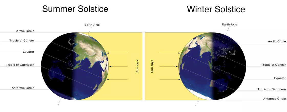
If the axis of Earth's rotation were perfectly perpendicular to the plane of Earth's orbit around the sun, known as the ecliptic, the duration of daylight in every 24-hour period would be uniform across the globe: 12 hours of daylight and 12 hours of darkness. Earth's axis is tilted, however, and depending on where Earth is on its annual trip around the sun, the Northern Hemisphere is either tilted towards the sun (summer), or tilted away from the sun (winter). Whatever the season in the Northern Hemisphere, the Southern Hemisphere is in the opposite season.
The Earth's tilt creates differences in the length of daylight and nighttime. Seasons are least pronounced near the Equator, and most pronounced at high latitudes, where daylight and nighttime can last months. Depending on latitude, the seasonal difference in the duration of light and dark is greater closer to the pole or smaller closer to the Equator.
At the North Pole, the sun sets on the autumnal equinox (around September 21) and stays below the horizon until the following vernal equinox (around March 21). The sun rises to its maximum height at the summer solstice, usually around June 21, but depending on the year can also occur on June 20 or 22. Because the sun stays above the horizon around the clock in summer, the Arctic is sometimes called the “land of the midnight sun.”
How much of the sun's energy reaches the ground in a particular region depends on the angle and duration of sunlight, affected by Earth's tilt, as well as factors such as cloud cover and elevation.
Pressure
Meteorologists look at spatial variations and changes in air pressure to figure out how air masses are moving and predict how weather will change.
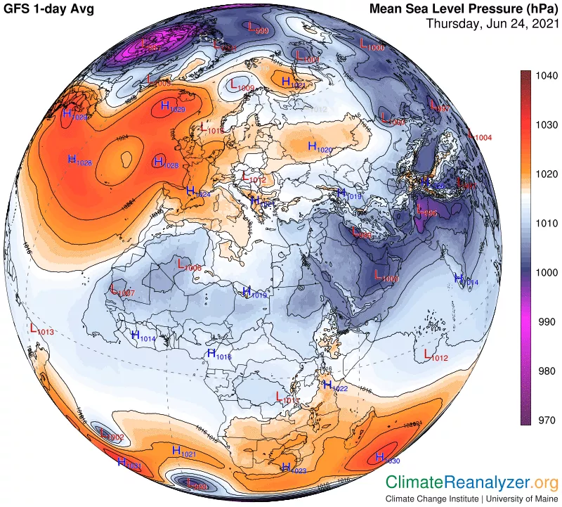
Surface air pressure, or atmospheric pressure, represents the weight of a column of air directly above a point on Earth. At high elevations such as the top of mountains, there is less air above Earth's surface than at lower elevations such as sea level, so atmospheric pressure is lower at the top of a mountain than at sea level. Most weather maps show sea level pressure, which is the atmospheric pressure corrected to sea level. Weather maps show atmospheric pressure using lines called isobars, which are similar to contours on a topographic map. Just as topographic contours show hills, basins, ridges, and valleys, isobars show areas of high pressure (called anticyclones) and low pressure (called cyclones).
Changes in atmospheric pressure can indicate what the weather will be like. A decrease in pressure can indicate an approaching low-pressure system (cyclone), which tends to be associated with cloudy and wet conditions. An increase in pressure indicates an approaching high-pressure system (anticyclone), which tends to be associated with clear and dry conditions. Over longer periods of time, weather maps show patterns where high pressure and low pressure features are common. The names of these patterns often reflect their location. In the Arctic, the common features are the Aleutian Low, Siberian High, Icelandic Low, and Beaufort Sea High. Scientists look at the strength of these patterns to study changes in atmospheric circulation, and how these changes are related to changes in temperature, precipitation, and winds.
Temperature
Temperature is often the first thing read in a weather report, and can help decide what clothes to wear, what activities to plan, and what gear to bring when heading outside.
Air temperature is a measure of the amount of energy held in the air. Warm air has more internal energy than cooler air. Temperature can be reported using several different scales. In the United States, the Fahrenheit scale is the most common. Internationally and in science, people use the Celsius scale or the Kelvin scale.
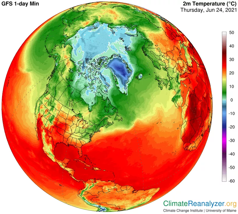
Just like other regions of Earth, temperatures in the Arctic tend to rise during the day, when sunlight warms the ground, and fall at night. Arctic temperatures are higher in summer, when there is more sunlight, and lower in winter, when the region is dark.
Scientists also use temperature for monitoring changes in climate. Long-term measurements of air temperatures over many years are important for scientists to track climate change. Temperature data show that the Arctic has warmed strongly over the past several decades.
Geography
Much of the Arctic region stays warmer than one would expect based solely on latitude. That warmth comes from both the poleward transport of energy by the atmosphere and the poleward transport of energy by the ocean. The ocean effect is most pronounced in the North Atlantic and Scandinavia. Water has a high heat capacity, meaning that it takes a lot of energy to change its temperature. This is one reason that coastal areas tend to have mild climates: the ocean keeps them cool during the summer and warm during the winter. Land, in contrast, has a lower heat capacity, so it heats up quickly during the day and cools down as soon as the sun goes down.
Ocean currents bring heat from warmer regions into the Arctic Ocean. In the Atlantic Ocean, a current commonly called the Gulf Stream brings warm water up along the coast of North America. The Gulf Stream current then transitions to the North Atlantic Drift and crosses the North Atlantic Ocean towards northern Europe. This ocean current keeps places like Norway and the island of Svalbard much warmer than other places at similar latitudes in the Arctic.
But the sea ice covering the Arctic Ocean acts like a lid, preventing heat from the ocean from escaping to warm the atmosphere. That means that the air above the ice can get bitterly cold—deep below freezing—while the water underneath remains much warmer—never getting colder than the freezing point.
Wind
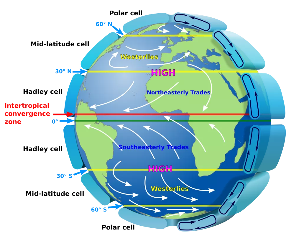
Wind is simply the movement of air. The larger the difference between high and low pressure (closely spaced isobars on weather maps indicate big air-pressure differences), the faster the wind. Wind speed and direction is influenced by other factors, including the Coriolis force, surface friction, and the effects of gravity. The Coriolis force, caused by the rotation of Earth, changes the direction of the wind. In the northern hemisphere, the Coriolis force deflects the wind to the right, so that winds circulate in a clockwise direction around high-pressure regions, and counterclockwise around low-pressure regions. The opposite occurs in the southern hemisphere. Surface friction is caused by the movement of air across land and ocean surfaces. Friction slows the wind.
Winds in the Arctic can vary greatly in strength. Winds tend to be stronger in the Russian Arctic, where there are more storms, than in the Canadian Arctic. Winds can be strong in the Atlantic sector of the Arctic where there are many storms. Strong temperature inversions form in winter, which slow winds near the ground. Temperature inversions are where air at the surface is cooler than the air above. These inversions disconnect the surface air from the air above. Katabatic winds flowing off the Greenland ice sheet, driven by gravity, can be very strong.
Although Arctic winds are often light, strong gales can form and last can several days. In the winter, these strong winds scour the snow from exposed areas and form large snow drifts in sheltered areas. Strong winds increase the wind chill factor. Wind chill refers to the cooling effect of any combination of temperature and wind, expressed as the loss of body heat in watts per square meter of skin surface. The body has a very thin layer of still air immediately adjacent to it called the boundary layer that helps to insulate the body from heat loss. As wind speed increases, the thickness of the boundary layer diminishes, and the rate of heat loss from the body increases.
Humidity
Air is a mixture of gases, and includes mostly nitrogen, oxygen, but also some argon, carbon dioxide, and water vapor (water in its gas form). Humidity refers to the amount of water vapor in air. All air contains at least some water vapor, but the amount of water vapor differs greatly from place to place and from time to time. The amount of water vapor in air can increase when water evaporates from land and water surfaces, and as plants respire. Humidity decreases when water vapor condenses to form very small drops of liquid water, forming clouds or growing to become rain drops. Evaporation and condensation happen all the time. Sometimes more water is evaporating into the atmosphere, sometimes more water is condensing out of the atmosphere, and sometimes evaporation and condensation are in balance. When evaporation is the same as condensation at a particular location in the atmosphere, scientists call the air at this point saturated.
There are several measures of the amount of water vapor in air. Relative humidity is one measure often used by meteorologists and TV weather reporters. Relative humidity is the ratio of water vapor in the air to the saturated water vapor content of the air.
Overall, the amount of water vapor in the Arctic atmosphere is low. Cold air has a lower capacity to hold water vapor than warm air. In some places, Arctic air is as dry as air in the Sahara Desert and very little precipitation can fall. The amount of water vapor tends to be higher over the oceans and in coastal areas and in summer, when water vapor evaporates from the relatively warm ocean surfaces. Humidity is lower over land areas, such as Canada, where it is colder and there is less water to evaporate. In winter, the air holds little water vapor because surface temperatures are very cold. At this time of year, sea ice covers much of the Arctic Ocean, also preventing evaporation from ocean water. However, in areas where there is no sea ice cover, there can be a lot of evaporation and fog can form, making the ocean look as if it is steaming.
Clouds
Clouds are made of tiny water droplets, ice crystals of a combination of the two (called mixed phase clouds) that have condensed onto tiny pieces of sea salt, dust, smoke, or other particles in the air. Clouds have two major effects on weather and climate. Clouds reflect sunlight, which can keep surface temperatures cool. However, they also trap heat close to the Earth's surface, which keeps temperatures warmer. Which one of these processes wins out depends on a number of factors, including cloud type and thickness, the magnitude of the solar radiation, and the reflectivity of the underlying surface.
For the Arctic as a whole, the cloudiest months are in summer, when the sea ice melts away and exposes open water in the Arctic Ocean. That open water adds more moisture to the air, helping to increase cloud cover. Cloud cover is lowest in December and January, when the ice cover is extensive and temperatures are lowest. However, in the Atlantic sector, clouds are common year round.
Precipitation
Precipitation is water that is deposited on Earth's surface from the atmosphere. Although we generally think of precipitation as rain or snow, other forms of precipitation include hail, dew, or hoar frost. Precipitation is part of the hydrological cycle. It supplies water for plants to grow, soaks into the soil, and feeds rivers and lakes, which eventually drain to the ocean. Water from plants, soil, and the oceans evaporates back into the atmosphere. There it forms clouds and returns to the Earth's surface as precipitation.
Over much of the Arctic, precipitation amounts are low. Some areas are called polar deserts and receive as little precipitation as the Sahara Desert. However, the Atlantic sector of the Arctic, between Greenland and Scandinavia is an exception. Storms forming in the Atlantic Ocean bring moisture up into this area, especially in winter.
Almost all precipitation in the central Arctic Ocean and over land falls as snow in winter. However, rain can occur on rare occasions during winter in the central Arctic Ocean when warm air is transported into this region. Snow also falls in summer. More than half of the precipitation events at the North Pole in summer are snowfall. Over the warmer Atlantic sector, snow is rare in summer.
Patterns in Arctic weather and climate
The geography of the Arctic leads to weather patterns that persist in the region year after year. Some weather patterns, such as cyclones or anticyclones, are common outside the Arctic. The Arctic Oscillation is an atmospheric circulation pattern that occurs over the mid-to-high latitudes of the Northern Hemisphere, including the Arctic.
Weather patterns that persist are called semi-permanent highs and lows, because these patterns show up in long-term averages of the regional weather. A good example is the Icelandic Low.
Cyclones and anticyclones
Cyclones, or low-pressure systems, are roughly circular weather patterns that rotate in a counter-clockwise direction. In a cyclone, air moves upwards in the center of the pattern, bringing stormy wet weather. Air also moves upwards along warm fronts and cold fronts. In the Arctic, cyclones occur year round, but they tend to happen more in certain places depending on the time of year. Semi-permanent lows in the Arctic include the Aleutian Low, a low-pressure center located around the Aleutian Islands that experiences many cyclones and storms in the winter, and the Icelandic Low, a low-pressure center located near Iceland.
Anticyclones are the opposite of cyclones, high-pressure systems that rotate in a clockwise direction. An anticyclone known as the Beaufort High recurs year after year, sitting over the Beaufort Sea and Canadian Archipelago in winter and spring. An anticyclone also appears over Siberia during the winter season, known as the Siberian High.
Polar lows
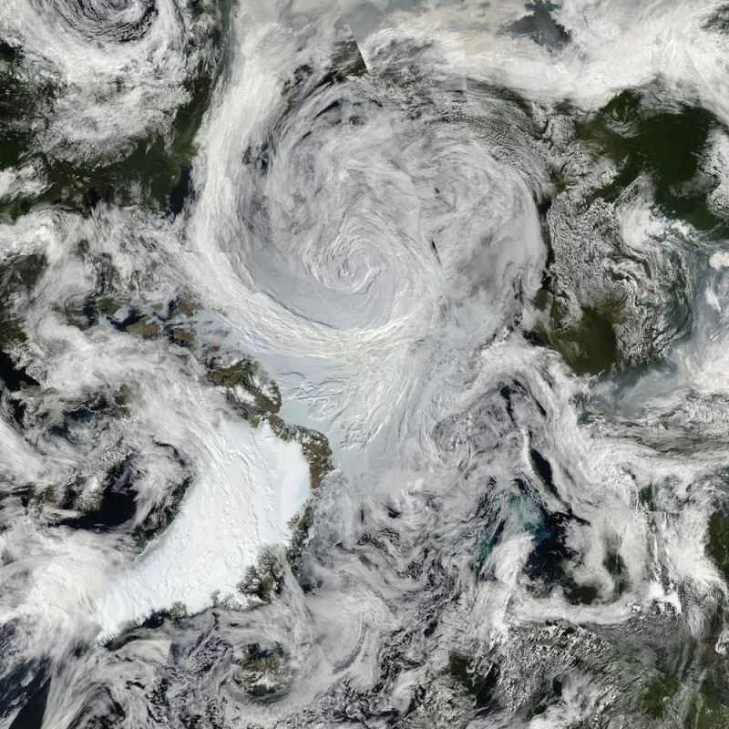
Polar lows are small, intense cyclones that form over the open ocean during the cold season. From satellite imagery, polar lows sometimes look much like a hurricane, with a large spiral of clouds centered around an eye—for this reason they are sometimes called Arctic hurricanes. However, polar lows develop from different processes than tropical hurricanes. Polar lows range in size from around 100 to 500 kilometers (62 to 310 miles) in diameter. Wind speeds average around 80 kilometers (50 miles) per hour, although they can occasionally reach hurricane strength at 103 kilometers (64 miles) per hour.
Polar lows tend to form when cold Arctic air flows over relatively warm open water. The storms can develop rapidly, reaching their maximum strength within 12 to 24 hours of formation, but they dissipate just as quickly, lasting on average only one or two days.
Semi-permanent highs and lows
Weather maps show the circulation and pressure patterns over one or several days. But maps of sea level pressure can also be averaged over several months or years, to show the average circulation patterns in the atmosphere. These averaged maps remove some of the variability caused by day-to-day weather changes, instead showing longer-term patterns that can affect weather and climate both within and outside of the Arctic.
Researchers compare the relative strengths of semi-permanent highs and lows, and report these comparisons in indices such as the North Atlantic Oscillation and the Arctic Oscillation. These indices have been linked to variability in temperatures and to sea ice conditions in the Arctic.
Arctic Oscillation
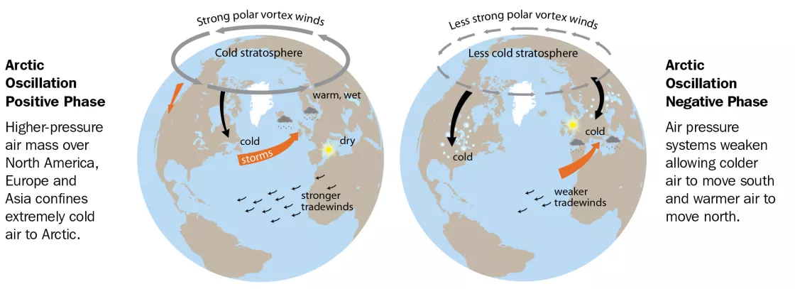
The Arctic Oscillation refers to an opposing pattern of sea level pressure between the Arctic and the northern middle latitudes. Overall, if the atmospheric pressure is high in the Arctic, it tends to be low in the northern middle latitudes, such as northern Europe and North America. If atmospheric pressure is low in the middle latitudes it tends to be high in the Arctic. When pressure is high in the Arctic and low in mid-latitudes, the Arctic Oscillation is in its negative phase. In the positive phase, the pattern is reversed.
Meteorologists and climatologists pay attention to the Arctic Oscillation, because its phase has an important effect on weather in northern locations. The positive phase of the Arctic Oscillation brings ocean storms farther north, tending to make the weather wetter in Alaska, Scotland, and Scandinavia and drier in the western United States and Mediterranean. The positive phase also keeps weather warmer than is typical in the eastern United States, but makes Greenland colder than normal.
In the negative phase of the Arctic Oscillation the patterns are reversed. A strongly negative phase of the Arctic Oscillation tends to bring warm weather to high latitudes, and cold, stormy weather to the more temperate regions where people live. Over most of the past century, the Arctic Oscillation alternated between its positive and negative phase. For a period during the late 1980s to mid-1990s, the Arctic Oscillation tended to stay in its positive phase. However, since then it has again alternated between positive and negative, with a record negative phase.
Explore further: Semi-permanent patterns
The semi-permanent patterns listed below are centers of action in the Arctic atmosphere, influencing weather patterns in the Arctic and around the world.
- Aleutian Low: This semi-permanent low-pressure center is located near the Aleutian Islands. Most intense in winter, the Aleutian Low is characterized by many strong cyclones. Cyclones formed in subpolar latitudes in the North Pacific usually slow down as they traverse northward and reach maximum intensity in the area of the Aleutian Low. Storms also form in this region.
- Icelandic Low: This low-pressure center is located near Iceland, usually between Iceland and southern Greenland. Most intense during winter, it weakens and splits into two centers in summer, one near Davis Strait and the other west of Iceland. Many storms that form to the south end up in the Icelandic Low region and many storms form in the region.
- Azores High: The Azores High is a high-pressure pattern that forms in the subtropical Atlantic Ocean. Although it occurs outside the Arctic Ocean, it is linked to the Icelandic Low through the North Atlantic Oscillation.
- Siberian High: The Siberian High is an intense, cold anticyclone that forms over eastern Siberia in winter, associated with frequent cold air outbreaks over east Asia.
- Beaufort High: The Beaufort High is a high-pressure center over the Beaufort Sea present mainly in winter.
- North American High: The North American High is a relatively weak area of high pressure that covers most of North America during winter. This pressure system tends to be centered over the Yukon, but is not as well defined as its continental counterpart, the Siberian High.
Optical and acoustical phenomena
In the Arctic, people can sometimes see and hear things that they cannot see or hear most other places on Earth. These phenomena are caused by special atmospheric conditions. Microscopic ice crystals are suspended in the air, changing how light and sound travel over distances. Layers of warm and cold air refract, or bend, light rays. Light bounces off the surfaces of clouds, water, and ice to create optical illusions.
People also sometimes report that they can hear noises from much further away in the Arctic. As with optical phenomena, this phenomenon occurs because cold atmospheric conditions bend sound waves differently than the air at lower latitudes. The air near the surface tends to be colder and more dense than air higher up, causing sound waves to tend to reflect down toward the surface rather than up away from Earth as they do in more temperate latitudes where air temperature on average decreases with height. The range at which sound can be heard depends on the temperature of the air, the speed and direction of the wind, and the rate at which sound energy is absorbed by the Earth's surface. For instance, soft snow absorbs sound energy very efficiently, effectively muting the transmission of sound. In contrast, a hard-crusted snow surface absorbs little energy and a smooth ice surface is an almost ideal reflector of sound. Given the right conditions, conversations can sometimes be heard up to 3 kilometers (2 miles) away.
Aurora
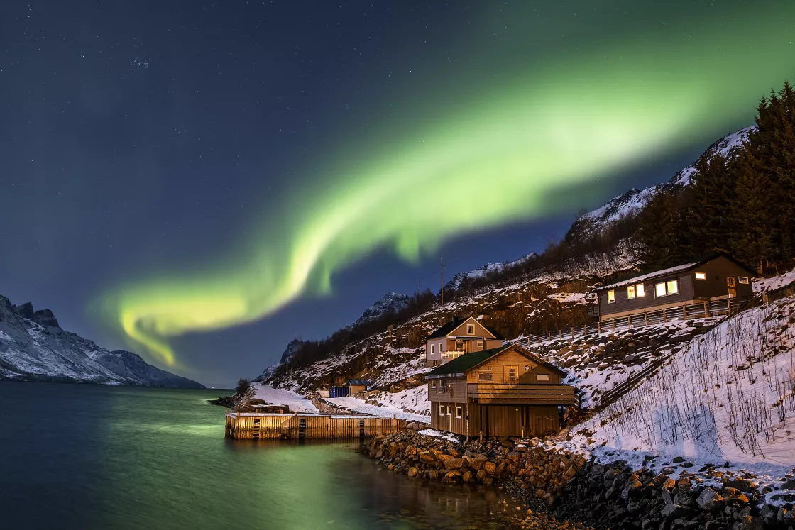
Also called the northern lights, the spectacular color displays of the aurora borealis appear in the sky on clear, dark nights, particularly during periods when solar storms are active. The aurora borealis is centered around the geomagnetic North Pole and is most often seen above the Arctic Circle. However, displays occasionally appear as far south as the northern United States. The same phenomenon occurs in the Southern Hemisphere, known there as the aurora australis or southern lights.
Auroras gleam like rainbows or hang like curtains, sometimes seeming to almost touch the ground. But the actual light is produced high in the sky, 70 to 200 kilometers (43 to 124 miles) above the Earth's surface—far higher than an airplane flies. The amazing color displays and formations are produced by the solar wind, a stream of electrons and protons coming from the sun. The high-energy solar wind collides with oxygen and nitrogen atoms in the upper atmosphere, exciting the gases so that they give off light. Different colors of light result from different gases at different altitudes. Auroras most commonly appear in green, although red, yellow, and blue auroras occasionally appear.
Coronas and anticoronas
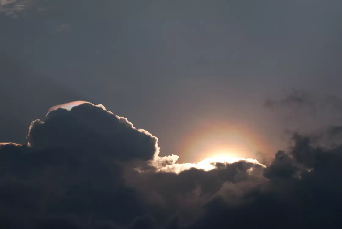
A corona appears as a ring of light that surrounds the sun or the moon, sometimes forming a luminous disk, or even a series of rings with the sun or moon at its center when light is diffracted by water vapor. Coronas often appear blue on the inside and red on the outside. They are often seen when the sun or moon shines through a diffuse mist or thin clouds, as light waves from the sun or moon get slightly deflected around cloud droplets.
A similar phenomenon, the anticorona or glory, consists of one or more colored rings that appear around the shadow cast by an observer on a cloud or in fog. These can sometimes be seen from airplanes.
Water sky and ice blink
Water sky refers to the dark appearance of the underside of a cloud layer when it is over a surface of open water. Ice blink refers to a white glare seen on the underside of low clouds.
An ice blink indicates the presence of light-reflecting ice which may be too far away to see. When other means of reconnaissance are not available, travelers in the polar seas can use water sky and ice blink to get a rough idea of ice conditions at a distance.
Mirages and optical illusions
Mirages and other optical illusions occur in the Arctic because of special atmospheric conditions that bend light. A superior mirage occurs when an image of an object appears above the actual object. Superior mirages sometimes appear in the Arctic because of the weather condition known as a temperature inversion, where cold air lies close to the ground with warmer air above it. Since cold air is denser than warm air, it reflects light towards the eyes of someone standing on the ground, changing how a distant object appears. Superior mirages can produce a few different types of images: Distant objects can appear to float high above their actual position, for example a boat can look like it is floating in the sky, or an object below the horizon can become visible. This is known as a looming type of superior mirage. Superior mirages can also distort images so that the object appears stretched and elevated, called towering.
A Fata Morgana is a complex mirage in which distant objects are distorted as well as elongated vertically. For example, a relatively flat shoreline may appear to have tall cliffs, columns, and pedestals. The phenomenon can also result from temperature inversions.
While mirages may seem like fun, they proved confounding for early explorers. In 1818, British explorer John Ross entered Lancaster Sound while seeking the Northwest Passage. He saw mountains blocking the sound, and decided to sail no further. Ross named the range the Croker Mountains—but a later expedition showed that they did not exist: Ross had likely mistaken a superior mirage for a mountain range. In 1906, American explorer Robert E. Peary viewed a vast land northwest of Ellesmere Island and named it Crocker Land after his patron George Crocker. The next decade, American explorer Donald MacMillan and his men traveled laboriously over the frozen ocean toward what appeared to be the snow-capped peaks, hills, and valleys of Crocker Land. But the landscape ahead seemed to change its form and extent over time, and MacMillan realized that he and the members of his expedition were seeing, as Peary had seen, a superior mirage.
Optical haze
Also called shimmer, optical haze can work like a fog or mist, blurring objects seen at a distance. Optical haze occurs in a layer of air next to the ground where warmer air flows up and colder air descends, creating wind patterns known as convective currents. The difference in how the warm and cold air refract light causes objects seen through the layer to blur. Optical haze occurs quite frequently in the Arctic, often making it difficult to identify details in the landscape.
Halos
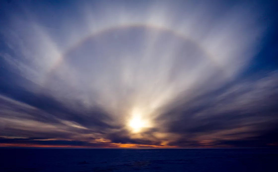
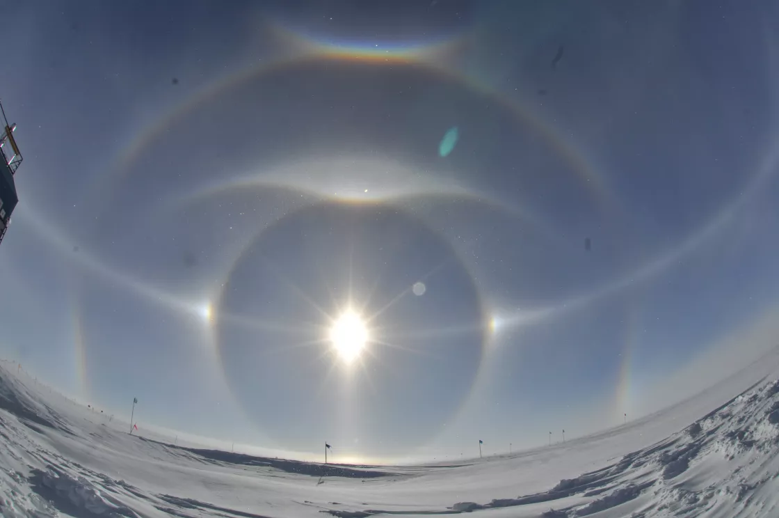
A halo occurs around the sun when light is refracted as it passes through ice crystals and produces a very well-defined ring of light around the sun. This is different from a corona whose ring is created when light is diffracted through small droplets of liquid water in clouds. When a thin uniform cirrostratus cloud deck containing ice crystals covers the sky, the halo may be in the form of a complete circle.
Sun dog
There are many types of halos. One special note is the parhelion or "sun dog." Sun dogs are luminous spots on both sides of the sun that occasionally occur with a halo.
Fogbow
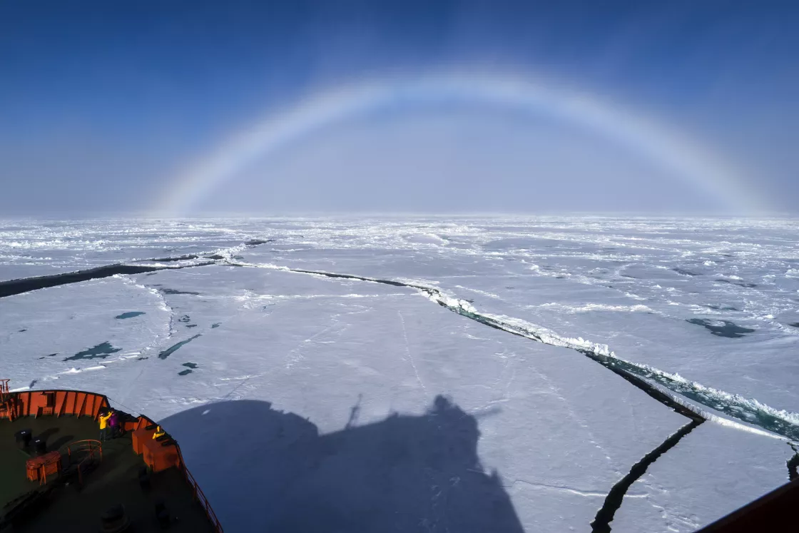
A fogbow is caused by a process similar to that causing rainbows, but because of the very small size of the water droplets, the fog bow has very pale colors.
Whiteout
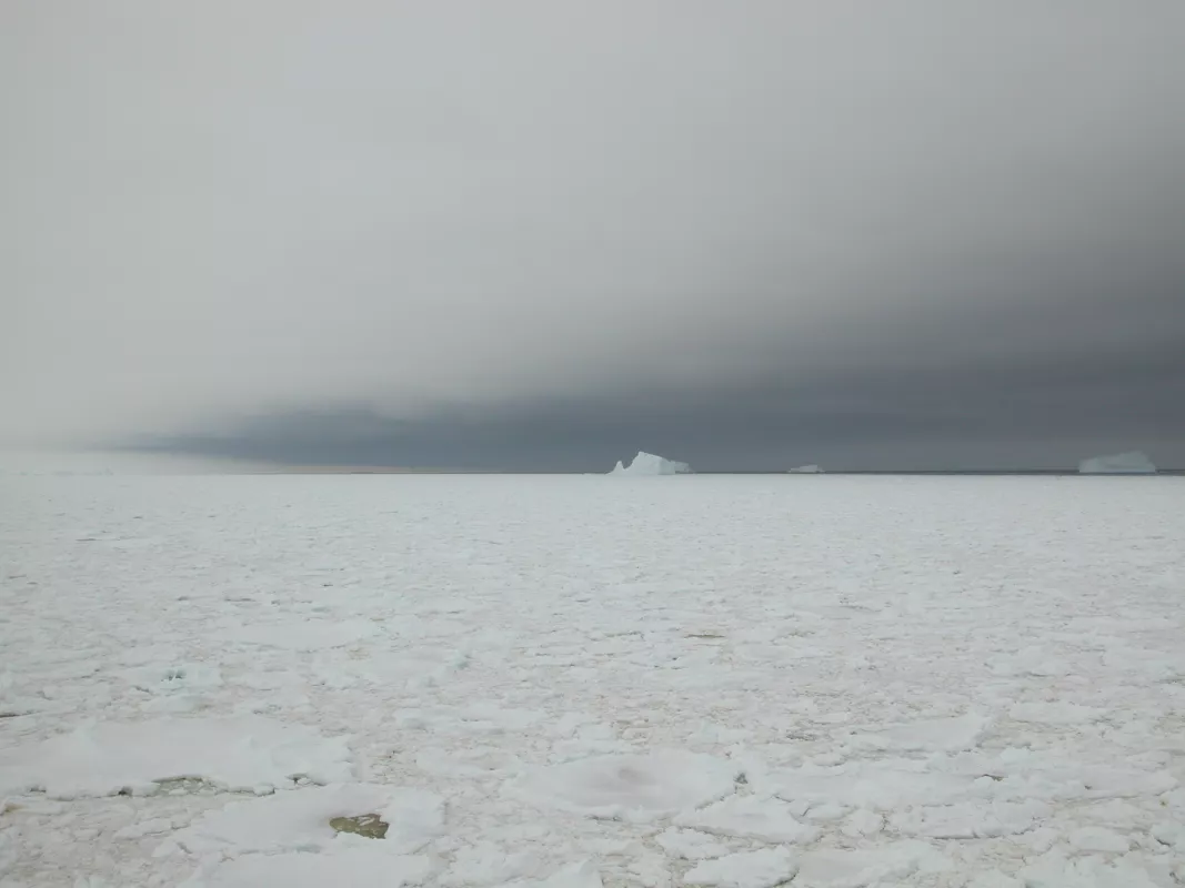
Whiteout occurs when the sky and snow assume a uniform whiteness, making the horizon indistinguishable and eliminating the contrast between visible objects both near and far. The observer loses all sense of perspective, and aircraft and other operations become extremely hazardous. Whiteouts happen most frequently in spring and fall, when the sun is near the horizon. Low clouds or fog and high-albedo surfaces such as snow create whiteout conditions because, under those conditions, light is reflected by multiple surfaces.
Research
Early research
People have lived in the Arctic for thousands of years. Europeans began venturing into the Arctic around a thousand years ago, as Russians and Scandinavians ventured north and west, exploring new lands and searching for shipping routes. Scientific exploration began in earnest in the eighteenth and nineteenth centuries, as people realized that there was much to learn about the Arctic climate.
In 1882 and 1883, 12 countries participated in the first International Polar Year expedition, establishing research stations and conducting extensive studies of oceanography, sea ice, and biology of the polar regions. The expeditions catalogued new islands, animals, and plants.
While many nations have contributed to Arctic research, Russia in particular has a long history of exploration and science in the Arctic. Large parts of Russia lie above the Arctic Circle, and the country is home to the three largest communities in the Arctic. Russians first started exploring the Arctic as early as the eleventh and twelfth centuries, and carried out a number of expeditions starting in the early eighteenth century. In 1937, Russia established drifting stations that floated on sea ice in the Arctic Ocean, which laid the foundation for later studies of sea ice.
For more information on Russian research in the Arctic, see the Environmental Working Group Arctic Meteorology and Climate Atlas.
Research today
Today, scientists study the Arctic to learn more about how climate and weather are changing. They investigate how Arctic climate and weather interact with weather and climate in the middle latitudes, and are working to understand how climate change will affect the Arctic. To study the Arctic, researchers sometimes travel to the field to conduct experiments or make observations. They study the properties of snow and sea ice, digging snow pits to examine the properties of snow, or measuring the thickness of sea ice by hand to determine how the ice cover is changing. Researchers also study the frozen ground and permafrost that covers much of the Arctic lands. Other scientists use data collected by satellites or during aircraft missions while still others conduct experiments with climate models. Biologists research the unique plants and animals that live in the Arctic. In 2007 to 2008, researchers from around the world participated in another International Polar Year, launching international expeditions and collecting vast amounts of data about the Arctic and Antarctic regions.
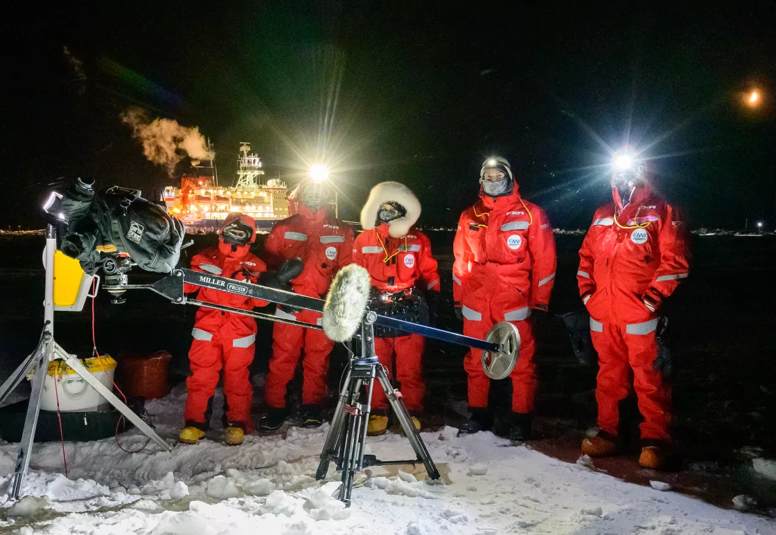
In October 2019, the German Research Vessel Polarstern locked into sea ice for a yearlong expedition, drifting with the currents to study the Arctic climate system. The Multidisciplinary drifting Observatory for the Study of Arctic Climate (MOSAiC) was a 13-month, $155 million expedition focused on the interactions between the ocean, sea ice, and atmosphere. Over 600 experts from 20 countries divided their time on the ship to get a complete picture of the Arctic across all seasons. With MOSAiC having an open sharing data policy, results from this expedition are unlocking the complexities of the Arctic climate system to see what potential impacts may ripple to the rest of the planet.
Researchers are now also collaborating with local communities who know a lot about the weather, plants, and animals that they see and rely upon. For example, Inuit in northern Canada noticed that weather patterns in their region had changed in a way that scientists had not noticed. When researchers listened to the Inuit and collaborated with them, they documented new changes in local weather that they think are related to climate change.
The Arctic is a huge region, and scientists cannot conceivably measure every bit of it in person. Hence researchers also use other tools to study the Arctic from afar. They make observations using satellite and aircraft remote sensing that allow them to measure factors that they cannot see directly, or which are too big to observe in person. Instead, they mount sensors on airplanes or satellites to record data. For example, satellite data provide estimates of the sea ice cover on the Arctic Ocean as well as weather patterns over the Arctic.
Researchers also combine their observations and data with computer models that try to replicate weather and sea ice conditions in the Arctic, and make predictions about the future. Models can help scientists understand what effects higher temperatures will have, for instance, or whether declining sea ice cover on the Arctic Ocean will add to climate change.
