Ask a Scientist

These articles provide answers to frequently asked questions related to Earth's frozen realms. Questions range from general background information and detailed science processes to the data gathered and archived at the National Snow and Ice Data Center (NSIDC) and its data management programs including NOAA@NSIDC, the NASA NSIDC Distributed Active Archive Center (DAAC), and the Exchange for Local Observations and Knowledge of the Arctic (ELOKA). If you have a question that is not answered here, please contact NSIDC User Services.
 

Filter by:
coast-guard-healy_1
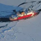
In summer months, icebreaking ships head north into the Arctic Ocean, tearing through the sea ice and leaving trails of open water in their wakes. Readers occasionally write in to ask us whether the trails left by these ships contribute to the
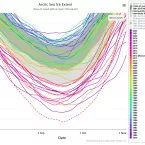
15 lowest minima as of Nov-2022
With satellite observations of sea ice extent stretching back to November 1978, NSIDC scientists can draw from more than 40 years of data to determine when an extent is above or below average or when it reaches a record high or low.
Sea-Ice-Drilling_Copyright-Martin-Hartley_3
Freshly formed sea ice can be as thin as a few sheets of paper or as thick as a one-story house, depending on how long it has existed. Measuring sea ice thickness is harder than measuring how much sea ice covers the ocean surface but multiple approaches have been used.
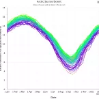
Charctic screenshot taken November 2022
NSIDC scientists use the 1981 to 2010 average of sea ice concentration and extent to have a consistent basis for comparison to today’s fluctuating conditions. The 30 years observed in this baseline provide enough data to even out short-term variability.
Hurricane Fiona heads north
Hurricanes form in the tropics, feeding on very warm ocean waters. As they track northward, they may transform to an extratropical storm with an added punch, sometimes reaching southern Greenland, Alaska, and even Arctic latitudes of the North Atlantic.
Sea ice concentration on globe
NSIDC archives satellite data for polar sea ice dating back to November 1978. The sharpest declines have occurred in the summer and fall, including the time of year when sea ice reaches its annual minimum in September. Although Arctic sea ice extent has not declined as much during winter months, it has still shown a steadily decreasing trend. Arctic sea ice extent now exhibits long-term declines in all months, including the coldest, darkest months of the year.