By Agnieszka Gautier
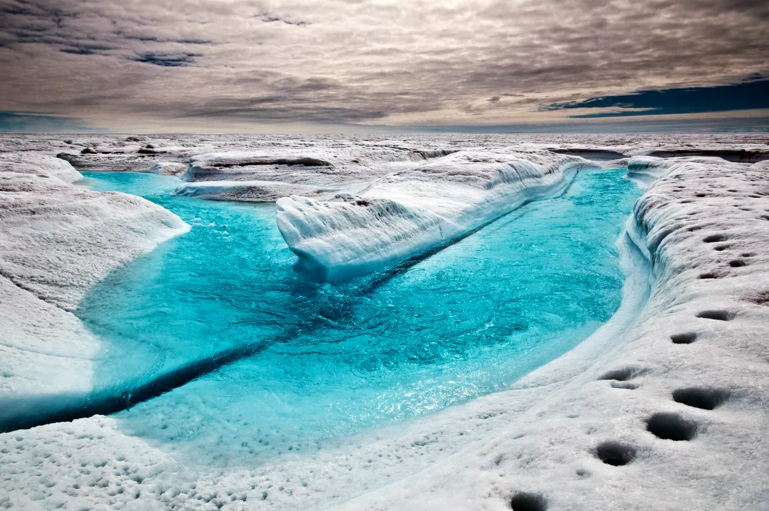
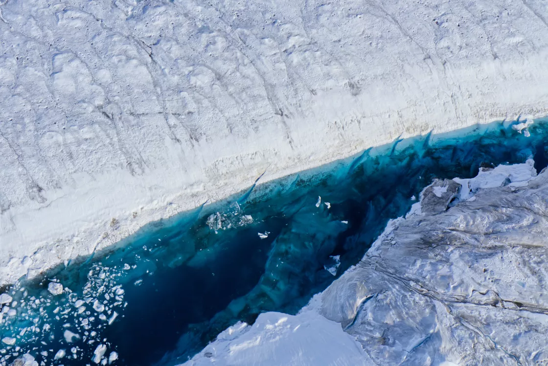
During the height of the summer melt season, as the Arctic sun lingers all day above the horizon, meltwater from the Greenland Ice Sheet flows in small streams called rivulets on the surface, pooling into growing melt ponds. The ice sheet is gridded with thousands of low-lying divots where meltwater collects and further shapes the ice sheet. Small and narrow rivulets feed larger rivers and gullies that carve the ice sheet like wrinkles on a face.
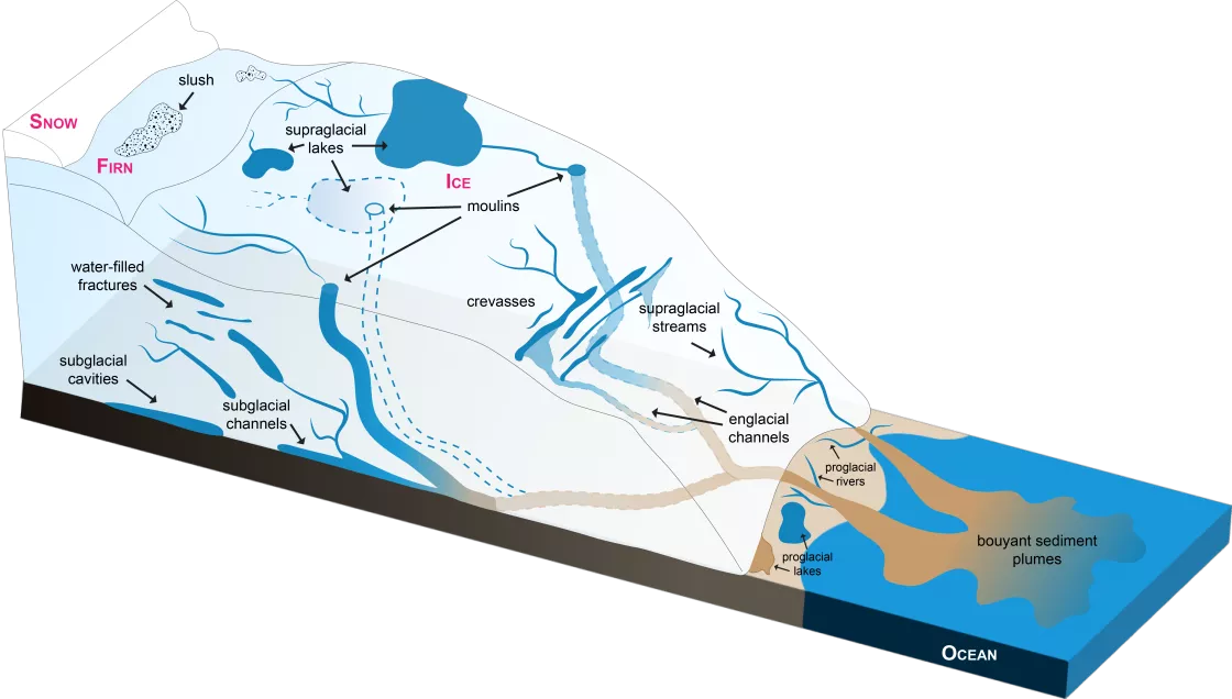
Hydrology, or how water interacts with disparate snow and ice qualities within the ice sheet, is key to studying its movement. Water flows mostly unrestrictedly in fresh snow. But in the firn layer, where more-than-one-year-old granular snow is not yet compressed into ice, water becomes creative, finding cracks between the firn crystals. But water stops when it meets ice lenses, often pooling above them, waiting for an opportunity. There are three main components to hydrology on the Greenland Ice Sheet: supraglacial, on the surface; subglacial, beneath; and englacial, meaning within.
Understanding how this little-known hydrological system functions is key to estimating how much meltwater the Greenland Ice Sheet is losing and how quickly sea levels will rise. The process of water moving off the ice sheet is complex and can take years. Water rarely just flows to the bottom of the ice sheet and out to sea. All this ice is always moving, and features evolve and change. Water always has a journey with its own story to tell.
An ice sheet recipe
The Greenland Ice Sheet builds up from the interior, where it measures up to 3.2 kilometers (2 miles) thick. Layers of ice stack up through an annual process of snow accumulation. Winds, moisture levels, atmospheric conditions, precipitation, and temperature fine tune the characteristics of the ice sheet’s different regions.
The eastern, and especially, south-eastern portions of the Greenland Ice Sheet tend to have the greatest snowfall in winter, developing a wet snowpack in the summer months. Here, not all of the winter snow melts away in the summer and few melt ponds form. By contrast, on the west coast during the summer, a large portion of winter snow melts away, exposing glacial ice, which is darker than fresh snow. The darker surface absorbs more sunlight like dark asphalt, reinforcing further melt. Lake formation and drainage starts at the ice sheet edge. As the summer melt season progresses, the exposed glacial ice corridor expands further inland.
The firn layer is an integral step in making an ice sheet. Firn is snow that has survived more than one melt season with physical properties between those of fresh snow and glacial ice. It is not regionally specific, but because snow needs to linger to form firn, it typically extends closer to the coast in the southeast and doesn’t reach as far from the interior in the west.
On the eastern and south-eastern side of the ice sheet, the firn layer forms a surprising relationship with the heavy, wet snowpack. Though the winter snow does not melt off fully in the summer, surface melt still occurs, so water percolates down into the firn layer, where it thrives in liquid form within a vast snow-insulated well. In 2013, a group of scientists discovered one such “firn aquifer” that measured over 70,000 square kilometers (27,000 square miles), or about the size of Ireland. For more on this, see Can liquid water persist within an ice sheet?
Getting beyond the ice
Thousands of rivulets incise the surface of the ice sheet, slivering until they merge into larger streams, rivers, and gullies. These waterways vary in size and shape from a few centimeters to several meters wide. Some waters mimic the world’s most challenging river rapids. All this surface meltwater eventually spills into the interior of the ice sheet. Flowing down into the cracks and channels within the ice, water can pool into an aquifer, drain down to the underbelly of the ice sheet, or refreeze, forming an impermeable ice slab that forces water to stay above it. Ice slabs commonly occur on the western and northern portions of the ice sheet as these areas tend to have less winter snowfall, without the insulating capability to form firn aquifers.
On the west coast, hundreds of melt ponds form in the glacial ice and firn. Being darker than the surrounding snow and ice, these lakes absorb more solar energy, creating a vicious amplifying loop of further melt. They grow deeper and wider. Eventually, this stagnant water befriends gravity and drills channels, called moulins, deep into the ice sheet, draining water from the surface to underneath and within the ice sheet.
Sometimes water can persist, trapped within the ice sheet. A team of scientists in 2015 tracked the flow of meltwater runoff from the Greenland Ice Sheet surface in southwestern Greenland. Using satellite and drone remote sensing, they obtained 72 hours of continuous field measurements of discharge in a large surface river on the ice sheet. The findings suggested that the porous ice can retain more water than previously thought. Some computer models, for instance, overcompensated runoff by 21 to 58 percent. The data was then used to better calibrate computer models.
How much and how fast?
Water can migrate through the firn aquifer system, connecting to more crevasses and moulins within. It can flow to subglacial streams and lakes, sitting underneath the ice sheet. Eventually, however, water is going to reach the sea, as there is no evidence for increasing water storage under the ice sheet. How much water is added to the ocean and how quickly is key to calculating sea level rise.
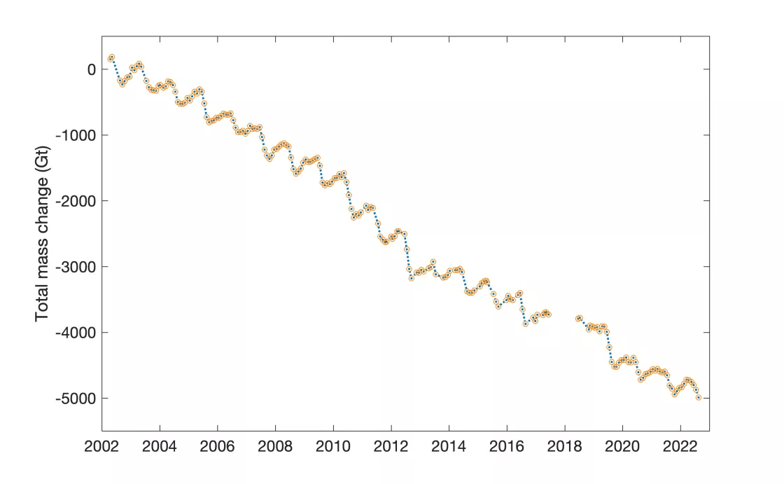
Since 1998, the ice sheet has been losing mass from both surface melting and glacial retreat. Rising air temperatures and a darkening ice surface are tag teaming to speed up the melting of Greenland’s land-terminating glaciers, while warming ocean waters are also chewing away at the bottom of marine-terminating glaciers. In fact, the ice sheet has lost so much ice that the resulting water would cover all Australia at a knee-deep level!
From 2002 to 2022, Greenland has lost 5 trillion tons of mass according to NASA. Using two satellites, Gravity Recovery and Climate Experiment (GRACE) and GRACE Follow-On, which have been observing Greenland since 2002, NASA also found that glaciers are now melting six to seven times faster than 25 years ago.
But this is only a fraction of how much water the ice sheet holds.
The Greenland Ice Sheet contains about 2.9 million cubic kilometers (696,000 cubic miles) of ice. If the entire Greenland Ice Sheet melted, sea level would rise about 7.4 meters (24 feet). For our children and their children, the ice sheet will not melt in its entirety, but even a small fraction of its total melt will transform our coasts, as is already happening around the world. A 2019 special report from the Intergovernmental Panel on Climate Change states that the ocean will rise between 0.29 meters (0.95 feet) and 1.1 meter (3.61) by 2100. So, knowing just how much and when is key for mitigating future consequences and continuing coastal adaptations.
More information
Learn more about the Greenland Ice Sheet and data on ice lenses, mass changes, and future projections via the QGreenland project, which was created by an international team of researchers led by researcher Twila Moon from the National Snow and Ice Data Center (NSIDC). The QGreenland site is a free and open-source mapping tool that can be used to better understand, monitor, and research the changes occurring in Greenland.
References
Chu, V. W. 2014. Greenland ice sheet hydrology: A review. Progress in Physical Geography: Earth and Environment, 38(1), 19–54. doi:10.1177/0309133313507075
Forster, Richard F. et. all. 2013. Extensive liquid meltwater storage in firn within the Greenland ice sheet. Nature Geoscience. doi:10.1038/ngeo2043.
Smith, L. C., K. Yang, L. H. Pitcher, B. T. Overstreet, et al. 2017. Direct measurements of meltwater runoff on the Greenland Ice Sheet surface. Proceedings of the National Academy of Sciences (PNAS). 114 (50) E10622-E10631, doi:10.1073/pnas.1707743114


