How to Import EASE-Grid Sea Ice Age in to ArcGIS
This article describes the actions to perform in order to work with NSIDC-0611 in ArcGIS. At the time of writing, this tutorial is relevant for ArcMap10.5 and earlier. The following steps will show you how to prepare the binary files for import, format conversion, and geolocation/projection.
1. Preparing the binary data for ArcToolbox functions
Gridded binary data require an accompanying header file to aid in describing the binary format to ArcTools. The header file can be created with your favorite text exitor. It must be saved with the same name as the data file you wish to bring into ArcGIS, but needs to have the .hdr extension. (e.g. "iceage.grid.week.1984.01.n.v3.hdr"). The contents of the header file should be:
nrows 722
ncols 722
nbands 1
nbits 8
pixeltype unsignedint
byteorder I
layout bil
ulxmap -4518421.38125
ulymap 4518421.38125
xdim 12533.7625
ydim 12533.7625
Optional:
NODATA 0
Adding the "no data" line will mask out all zeros.
* For more explanation on how the header content is developed, please navigate to the end of this document.
2. Conversion to GeoTIFF
With your new header file placed in the same directory as your datafile, you are ready for conversion. Open the ArcToolbox and navigate: ArcToolbox > Conversion Tools > To Raster > Raster to Other Format (multiple). Select the binary file, and your preferred output workspace.
3. Projection and Geolocation of GeoTIFF
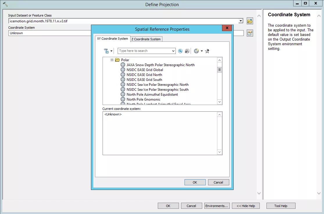
With ArcToolbox still open, navigate: ArcToolbox > Data Management > Projections and Transformations > Define Projection. Select the newly created .tif and "NSIDC EASE Grid North". You can find this projection under Projected Coordinate Systems > Polar.
Selecting 'OK' for both windows will run the function and automatically add the new GeoTIFF to the map and Table of Contents.
Done! On to the next file, or setting up batch processing, if you need to.
*Additional information on the header contents.
Data are stored in 1-byte integer binary format (little endian) and are stored by row. The nominal resolution is 12.5km, and the i by j dimensions are given. This information is enough to begin producing the header:
For the northern hemisphere:
nrows 722 ;given
ncols 722 ;given
nbands 1 ;only one variable to display
nbits 8 ; "1-byte integer" 8 bits per byte
pixeltype unsignedint ;integer which has only positive values
byteorder I ;little endian
layout bil ;"stored by row", BIL stands for Band Interleaved by Line
ulxmap -4518421.38125 ; 722 12,533.7625m resolution pixels -> 9049376.525m across, edge to edge. OR, 9036842.7625m across from furthest grid cell center point. If center of X is 0, then upper left X located at -4518421.38125.
ulymap 4518421.38125 ; 722 12,533.7625m resolution pixels -> 9049376.5255m across, edge to edge. OR, 9036842.7625m across from furthest grid cell center point. If center of Y is 0, then upper left Y located at 4518421.38125.
xdim 12533.7625 ; From the MapX Map Projection Parameters, the EASE North scale is defined as 200.5402 km/pixel. For a nominal 12.5km grid, there are 16 pixels per map unit, such that 200540.2/8 = 12533.7625.
ydim 12533.7625 ; same as above, but read more here: A Guide to EASE Grids
Last Updated January 2018

