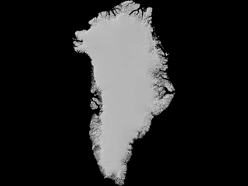
MEaSUREs Greenland Ice Mapping Project (GIMP) Digital Elevation Model, Version 1
Data set id:
NSIDC-0645
DOI: 10.5067/NV34YUIXLP9W
This is the most recent version of these data.
Version Summary
Version Summary
Initial release
Overview
This data set consists of an enhanced resolution digital elevation model (DEM) for the Greenland Ice Sheet. It was constructed by combining ASTER and SPOT 5 DEMs over the ice sheet periphery and margin with AVHRR photoclinometry for the interior and far north, and calibrating the data to approximate mean ICESat/GLAS elevations from 2003 to 2009.
See Greenland Ice Mapping Project (GIMP) for related data.
Parameter(s):
GLACIER ELEVATION/ICE SHEET ELEVATION
Platform(s):
ICESAT
NOAA-14
SPOT-5
TERRA
Sensor(s):
ASTER
AVHRR-2
GLAS
HRS
Data Format(s):
GeoTIFF
Temporal Coverage:
- 20 February 2003 to 11 October 2009
Temporal Resolution:
- 1 year
Spatial Resolution:
- 30 m
- 90 m
- 30 m
- 90m
Spatial Reference System(s):
- WGS 84 / NSIDC Sea Ice Polar Stereographic NorthEPSG:3413
Spatial Coverage:
- N:83S:60E:-14W:-75
Blue outlined yellow areas on the map below indicate the spatial coverage for this data set.
Data Access & Tools
A free NASA Earthdata Login account is required to access these data. Learn More
Sample Data Image
Image

Assembled from ASTER, SPOT, and AVHRR satellite sensors, this digital elevation model encompasses the entire Greenland Ice Sheet and its periphery. Credit: NASA MEaSUREs GrIMP Data: NASA, NOAA, ESA
Documentation
Help Articles
General Questions & FAQs
This article covers frequently asked questions about the NASA NSIDC DAAC's Earthdata cloud migration project and what it means to data users.
How to Articles
This article shows how to download NSIDC DAAC data from NASA Earthdata Cloud to your computer using three tools: wget and curl—popular command-line utilities for downloading files—and Data Downloader, a Python-based command-line tool developed by the Physical Oceanography Distributed Active Archi
Many NSIDC DAAC data sets can be accessed using NSIDC DAAC's Data Access Tool. This tool provides the ability to search and filter data with spatial and temporal constraints using a map-based interface.Users have the option to:
Below the image in this article, you will find sample code in IDL, MATLAB, and Python to read in a GeoTIFF file, extract the metadata, and create an image.
The code has been tested with the following data products:
We recommend using the Geospatial Data Abstraction Library (GDAL) to convert GeoTIFF files into a different format.
We recommend using the Geospatial Data Abstraction Library (GDAL) or a GIS to reproject geoTIFF files.
The NASA Earthdata Cloud is the NASA cloud-based archive of Earth observations. It is hosted by Amazon Web Services (AWS). Learn how to find and access NSIDC DAAC data directly in the cloud.