Antarctic Ice Sheet Velocity and Mapping Project (AIV)
Overview
Antarctic Ice Sheet Velocity and Mapping (AIV) is a NASA Making Earth System Data Records for Use in Research Environments (MEaSUREs) project. Developed by scientists for scientists, MEaSUREs projects facilitate the development of value-added products derived from satellite observations.
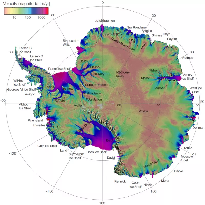
The AIV project was designed to collect multiyear, digital records of Antarctic ice velocity. These data products help document changes in:
- Ice sheet dynamics and boundaries
- Rates of ice mass flow to the ocean and contribution to sea level rise
- Sensitivity of ice dynamics to climate forcing on decadal time scales
AIV products are made through well-proven, extensively documented, peer-reviewed algorithms and numerical tools that have been refined over a period of decades. AIV products use state-of-the-art techniques in mapping ice sheet velocity from space. The results are independent of cloud cover and solar illumination, and offer a uniform, high-resolution sampling of the entire Antarctic continent. AIV temporal coverage ranges from the early 1990s to the present. AIV products are compiled from myriad satellites and sensors:
- Canadian Space Agency's (CSA) RADARSAT-2 and RADARSAT-1
- Japan Aerospace Exploration Agency's (JAXA) Advanced Land Observing Satellite "DAICHI" (ALOS), Advanced Land Observing Satellite-2 "DAICHI-2" (ALOS-2) PALSAR-2, and ALOS PALSAR
- European Space Agency's (ESA) Copernicus Sentinel-1, Envisat Advanced Synthetic Aperture Radar (ASAR), and European Remote Sensing satellites 1 and 2 (ERS-1 and -2)
- U.S. Geological Survey's/NASA's Landsat
Team
The AIV project principal investigators are Eric Rignot of Jet Propulsion Laboratory and the University of California, Irvine; and Bernd Scheuchl of the University of California, Irvine. Jeremie Mouginot of the Institut des Géosciences de l'Environnement also served as a principal investigator.
Funding
Antarctic Ice Sheet Velocity and Mapping (AIV) is a NASA Making Earth System Data Records for Use in Research Environments (MEaSUREs) project. MEaSUREs projects enable Earth science researchers to develop satellite-derived, value-added data products.


