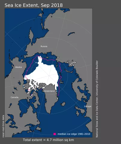
After reaching the sixth lowest minimum on September 19 and 23, Arctic sea ice extent averaged 4.71 million square kilometers (1.82 million square miles) for the month of September, tying with 2008 for the sixth lowest September in the satellite record, according to scientists at the National Snow and Ice Data Center (NSIDC) at the University of Colorado Boulder.
The 2018 melt season—from the sea ice maximum in March, leading up to the sea ice minimum in September—reinforced the importance of summer weather patterns in determining if the September average extent will be above or below the long-term trend line, NSIDC scientists said.
Arctic sea ice extent reached record lows in January and February, and stayed at second lowest from March through May. Despite these record and near-record low monthly extents at the beginning of the melt season, less extreme summer weather led to a September extent that was not near record-low levels and was slightly above the long-term trend line.
Monthly September ice extent remains on a downward trend. The linear rate of decline for September ice extent is now at 12.8 percent per decade or 82,300 square kilometers (31,800 square miles) per year.
Read the full analysis of the 2018 melt season in NSIDC’s Sea Ice Today.
NSIDC is part of the Cooperative Institute for Research in Environmental Sciences (CIRES) at the University of Colorado Boulder. The NSIDC Sea Ice Today is supported in part by NASA.
