NSIDC supports NASA in its quest to ensure continuous study of ice in Earth's polar regions.
Ice at the ends of the Earth
In the Arctic and Antarctic, ice is not what it used to be. There, vast expanses, bitter cold, and months of darkness can thwart ground studies of changing ice shelves, glaciers, and ice sheets, so researchers depend on remote sensing to capture data on the rapid and unprecedented change in these remote regions. Scientists seeking to understand changes in the mass balance of polar ice, and its potential to contribute to global sea level change, have turned to NSIDC for access to data from the Geoscience Laser Altimeter System (GLAS), on board NASA's ICESat (Ice, Cloud, and Land Elevation Satellite). But soon, they will be turning to NSIDC for data on polar ice from a new source: NASA's IceBridge mission. IceBridge addresses the gap between ICESat-I, expected to conclude operations in early 2010, and the next satellite, ICESat-II, planned for launch until 2015. To keep these essential climate data continuous, NASA moved to fill the data gap with aircraft-borne sensors, and selected NSIDC as the bridge between the mission's data and the researchers who depend on it.
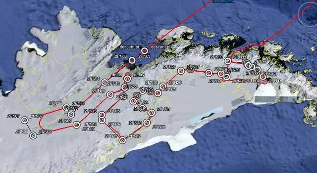
A web of flight tracks and observations
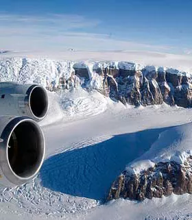
Begun in 2009, Operation IceBridge is a six-year campaign of annual flights over the poles, covering coastal Greenland and Antarctica, the Antarctic Peninsula and interior, glaciers in southeast Alaska, and Antarctic and Arctic sea ice. The IceBridge aircraft carry an array of instruments to study conditions and change in these regions. The IceBridge sensors can map ice surface topography, bedrock topography beneath the ice sheets, and grounding line position. Other instruments measure ice and snow thickness, sea ice distribution, and sea ice freeboard. Data from laser altimeters and radar sounders are paired with gravimeter, magnetometer, mapping camera, and other data to provide dynamic, high-value, repeat measurements of rapidly-changing areas of land and sea ice.
Data coming soon to your fingertips
NSIDC is managing the active archive of both GLAS and IceBridge data, providing needed data access and supporting services to researchers studying the changing polar cryosphere. NSIDC's goal is to simplify data access and usage from this many-faceted mission. NSIDC has begun corralling these data from the various mission groups and creating data access points. Ultimately, NSIDC will be the central access point for all IceBridge data, and will further process and organize these data into products that can be used with much less data manipulation and programming than the raw data from the IceBridge mission. For the latest on NASA IceBridge data at NSIDC, see the IceBridge Data Overview.

