By Jane Beitler
Greenland is home to the largest ice sheet outside of Antarctica, and scientists are discovering that its ice is not immune to temperatures that continue to rise across the Arctic. While scientists do not expect a rapid or sudden thawing, a recent burst of surface melt revealed just how vulnerable Greenland’s ice may be.
During the summer of 2012, nearly 97 percent of the ice sheet’s surface melted, the most extreme melt extent scientists had seen in three decades of satellite records. This stood in contrast to the 40 to 50 percent surface melt that typically occurs during the summer. Although scientists were able to blame the extreme melt on an unusually warm mass of air that parked over Greenland for several weeks, this event occurred as the Arctic sea ice extent was declining to what would become a record low later in the year. Consequently, scientists are paying closer attention to the Greenland Ice Sheet and its potential for melting and contributing to even small amounts of sea level rise.
Watching the ice
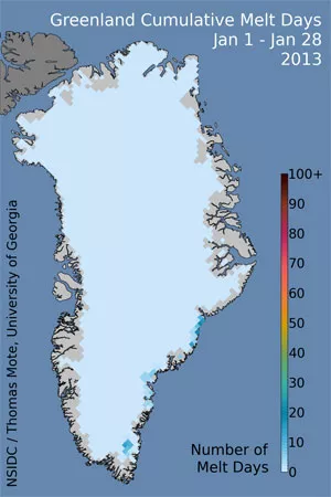
The extreme summer melt of 2012 caught many by surprise, and prompted NSIDC to develop a new Web site to help track Greenland’s ice. This site, Greenland Ice Sheet Today, features daily melt images and images showing cumulative melt days on the ice sheet. Both images are updated daily, with a one-day lag. A daily graph will chart the current melt percentage against the average melt observed in the satellite record.
NSIDC partnered with two experts to help develop the site: Dr. Thomas Mote of University of Georgia and Dr. Marco Tedesco of the City University of New York. They both provide expertise on the Greenland Ice Sheet, and Dr. Mote will supply imagery derived from NSIDC’s passive microwave brightness temperature data. NSIDC will post regular updates describing conditions in Greenland and provide analysis placing them in the larger historical context, as well as in the context of Arctic-wide conditions.
Ice in the balance
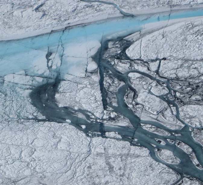
All across the Arctic, warming oceans and declining sea ice are leaving tidewater glaciers vulnerable to melting, and making many of Greenland’s outlet glaciers more likely to retreat. And further inland, higher air temperatures may be thawing interior ice more rapidly. Greenland’s ice has begun to feature more melt ponds, rivers, and other melt water features that drain increasing amounts of water from the ice sheet.
Melting on the Greenland Ice Sheet continue to mirror changes happening in the larger Arctic environment. “If you look at years where we’ve had minimum sea ice extent, like 2007 and 2012 for example, those are often years in which we’ve seen extensive melting over Greenland,” Mote said. “There are certainly similarities between what we’re seeing in Greenland and what we’re seeing in other parts of the Arctic.”
While the changes in Greenland may not yet be as dramatic as those in other regions, scientists are concerned that more melting on the ice sheet could pump massive amounts of freshwater into the oceans. In addition to raising sea levels, a large influx of water could reduce salinity in parts of the ocean and potentially alter ocean currents.
The images and analysis featured in Greenland Ice Sheet Today provide a new way to monitor conditions in and around Greenland. The site complements NSIDC’s Arctic Sea News and Analysis Web site and will help pinpoint changes and emerging patterns around the Arctic in near-real time. Mote said, “I think we’re still trying to get a sense of just how inter-related these different cryospheric measures are across the Arctic.” Greenland Ice Sheet Today will be another tool to help users see how changes across the Northern Hemisphere may be influencing Greenland’s ice.
Reference
Nghiem, S. V., D. K. Hall, T. L. Mote, M. Tedesco, M. R. Albert, K. Keegan, C. A. Shuman, N. E. DiGirolamo, and G. Neumann. 2012. The extreme melt across the Greenland ice sheet in 2012. Geophysical Research Letters, 39(20), doi:10.1029/2012GL053611


