By Michon Scott
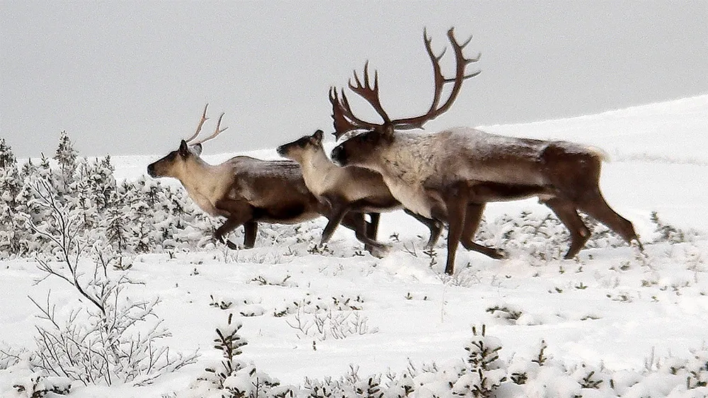
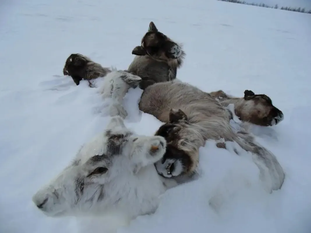
The international Arctic Rain on Snow Study (AROSS), led by NSIDC, focuses on the effects of a growing problem in the Arctic. With increasing frequency, rain falls on snow, refreezes, and forms an icy crust. The consequences range from hazardous travel conditions to animals left unable to forage. The animals often starve by the hundreds or even thousands. The impacts of these events, for instance, on reindeer herds and the communities that depend on them, have been studied in specific locations across the Arctic, ranging from Siberia, Northern Europe, to North America. Over the Arctic Ocean, these events can greatly alter the characteristics of the snow covering sea ice. The events affect sea ice growth and melt, the denning of seals, and the travel of polar bears.
A new study from the AROSS project zooms out for an Arctic-wide perspective on how often precipitation falls as snow or rain, and how snow-to-rain ratios are changing. Although overall trends are apparent, changes vary by location and season.
Obstacles to overcome
Zaria Cast, a graduate student working with NSIDC Director Mark Serreze, led the new study, which has been submitted to The Cryosphere. When Cast studied meteorology at the University of Tennessee, she combined her interests in meteorology and American football to report on game day weather for ESPN+. “Then I did an internship based on research. I got assigned to different projects every summer, but I got introduced to the Arctic, and I just took that and found my niche,” she said.
The new niche is challenging. The Arctic is a complex region of ocean bodies, land ice, sea ice, snow, tundra, forest, and human infrastructure. The region even includes desert, if you count the polar variety. A polar desert has little precipitation and especially low temperatures, Cast explained. “You may think, ‘Okay, it will thaw,’ but no, that's the climate there.”
The Arctic is also one of Earth’s fastest changing regions. The Arctic Report Card: Update for 2024 reports that the Arctic is warming roughly three times as fast as the global average. Precipitation appears to be increasing, notably over the Barents Sea region, but the pattern of change is complex. Still, field observations are relatively rare so far north. Weather stations get built where people with the resources to build weather stations live and work. So, while such stations are common in latitudes of frequent football games, stations remain rare in the Arctic. The Argo float program, which has established a temperature-monitoring network of more than 4,000 floats across the world’s oceans, has deployed relatively few floats in the Arctic Ocean, where sea ice complicates float operations. So, assessing precipitation changes and changes in the partitioning between rain and snow across the Arctic entailed turning to additional data sources.
Multiple lines of evidence
For Cast and her coauthors, undertaking this study meant making use of what weather station reports were available from the Automated Surface Observing System (ASOS). They also turned to a study published in 1996 highlighting observations over the latter half of the twentieth century, based on the Integrated Comprehensive Ocean-Atmosphere Data Set (ICOADS). Finally, they made extensive use of the European Centre for Medium-Range Weather Forecasts (ECMWF) Version 5 Reanalysis, or ERA5.
Reanalyses like ERA5 are essentially weather-prediction models, but instead of forecasting future weather, provide detailed records of past weather and atmospheric conditions spanning decades. To do this, ERA5 draws from a wealth of observations taken from the ground or recorded by weather balloons, aircraft, and satellites. The resulting reanalysis provides consistent records of past events. “ERA5 projects Earth’s surface onto a grid,” Cast said. “So, if you can be specific with the date, time, and location, you can zoom in and get all the information you need.” ERA5 data extend back to 1950; the new study only used data from 1979—the beginning of the satellite record—through 2023. Study authors chose 1979 as the start year because the advent of the satellite record enhanced reliability; it provided regular, daily readings of land and ocean surfaces, and weather systems.
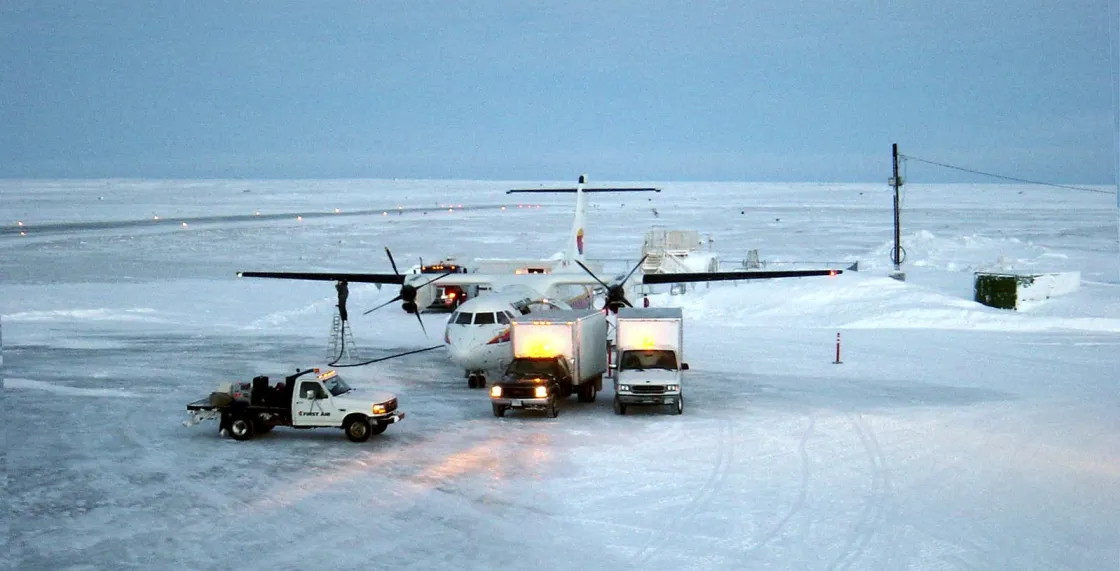
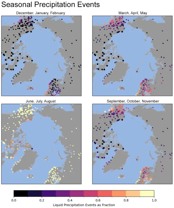
Meanwhile, when assembling data from the ASOS database, study authors examined records carefully to exclude questionable data, such as reports of freezing rain combined with temperature readings too high for water to freeze. They ended up with 765,610 records of rain and 18,174 records of freezing rain. Note that these records were from the finest temporal resolution, so a single weather event could generate multiple records.
The study authors especially wanted to identify whether ERA5 data could provide reliable estimates of precipitation amounts and phase (solid or liquid water). They could not rule out all uncertainty, but this study, like several others, found that ERA5 shows consistency with independent data sets. The finding is welcome, because it provides confidence that fast-changing conditions in the Arctic can be better understood.
Complex places cause complex findings
The Arctic is not a uniform, straightforward place, and neither were the study findings. Instead, the conclusions were nuanced.
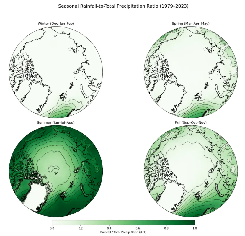
Overall, precipitation has increased across the Arctic. This is consistent with what we expect in a warming Arctic. A warmer atmosphere can hold more moisture, which can subsequently be released as precipitation. Furthermore, precipitation in the form of rain comprises a greater proportion of the total precipitation—but only in some seasons and regions. The greatest seasonal changes occur in summer when rainfall dominates over land. The exception is the Greenland Ice Sheet, which experiences very little rain. A remarkable exception occurred on the ice sheet on August 18, 2021, when rain fell at the summit for several hours, the first such event in weather station records. As summer turns to autumn, the proportion of rainfall drops with temperature, and more precipitation falls as snow. In winter, most precipitation falls as snow, except for the southernmost portion of the Atlantic sector of the Arctic Ocean.
The North Atlantic stands out as a warm, humid, rainy spot in the Arctic. Nearly all summer precipitation falls as rain in this region, and precipitation continues falling as rain throughout much of the year. These warm conditions are due to the North Atlantic Drift current. But in the highest latitudes of this region, in the Barents Sea, precipitation has increased and what was once snow is shifting to rain—a shift that may be partially driven by sea ice loss. Sea ice provides a barrier between ocean water and the atmosphere, limiting the amount of moisture that escapes the water. Less sea ice means more moisture in the air overhead and warmer conditions.
Outside of summer, and outside of the North Atlantic, the climate has not warmed enough to change the snow-to-rain ratio. Perhaps even more surprising, comparison of modern precipitation patterns with those documented in the IOCADS study (from 1950 to 1995) shows little change in the snow-to-rain ratio from those observed from 1950 to 1999, when the Arctic was cooler than now.
Summer has the highest proportion of liquid precipitation, but even in summer, snowfall is the rule over the Greenland Ice Sheet and is still common over parts of the Canadian Archipelago. This is the same region where Arctic sea ice remains thickest and is expected to persist longest in the coming decades.
Implications
This study assesses conditions over the past several decades rather than predicting future states. It does, however, add information that other studies can use to predict what might be on the horizon.
In recent decades, rain-on-snow events have, by inhibiting foraging, led to starvation in tens of thousands of reindeer, caribou, and musk oxen. In October 2003, some 20,000 Banks Island musk oxen starved after a rain on snow event. In the Novembers of 2006 and 2013, an estimated 80,000 reindeer starved across the Arctic due to rain on snow events. Not only do these herbivores die, so do the predators that prey on them. High-latitude herders who rely on these animals face dire threats to their livelihoods. The mass mortality events may sound like someone else’s problem, and the Arctic may seem only remotely relevant to those of us living in the midlatitudes, but the region is part of a unified Earth system. The snow and ice in the polar regions act as the planet’s built-in air conditioning systems. With one of those systems failing, the planet overall might be accumulating more heat.
“We're living in the USA; the Arctic doesn't affect us, so why study it?” Cast imagined people asking. Earth’s current climate, which has shown relative stability for the last 10,000 years, depends on a complex mixture of warmth and cold. The differences between polar and equatorial temperatures drive winds and weather patterns that could change if the temperature gradient declines. Cast continued, “And I always tell people that's where we get our balance. We have the equator, and then we have the Arctic. If we don't have one or another, then we will have either more heat or we will have more water or more cold. And we just need a balance.”
Reference
Cast, Z.I., M.C. Serreze, E. Cassano, and A.P. Barrett. In press. Seasonal characteristics and trends in precipitation partitioning in the Arctic.

