The National Snow and Ice Data Center (NSIDC) is part of the Cooperative Institute for Research in Environmental Sciences at the University of Colorado Boulder. NSIDC scientists provide content for Sea Ice Today with partial support from NASA.
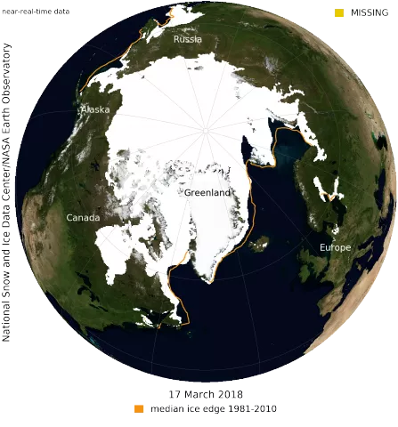
Sea ice over the Arctic Ocean likely reached its maximum extent for the year on March 17 at 14.48 million square kilometers (5.59 million square miles), the second lowest in the 39-year satellite record, falling just behind 2017. This year’s maximum extent is 1.16 million square kilometers (448,000 square miles) below the 1981 to 2010 average maximum of 15.64 million square kilometers (6.04 million square miles).
The four lowest seasonal maxima have all occurred during the last four years. The 2018 maximum is 60,000 square kilometers (23,200 square miles) above the record low maximum that occurred on March 7, 2017; 40,000 square kilometers (15,400 square miles) below the 2015 and 2016 maxima (now tied for third lowest); and 190,000 square kilometers (73,400 square miles) below the 2011 maximum, which is now fourth lowest.
NSIDC will release a full analysis of the winter season in early April.
See the full NSIDC announcement at https://nsidc.org/arcticseaicenews.
See the NASA feature at https://www.nasa.gov/feature/goddard/2018/arctic-wintertime-sea-ice-extent-is-among-lowest-on-record.
