Satellites have continuously monitored sea ice since 1979. To gauge what Arctic sea ice was like before then, scientists use a combination of historical records and proxy measurements such as marine sediment cores. Taken together, these records indicate that the current Arctic sea ice decline is unprecedented in the last several centuries.
Physical evidence sheds light on Earth's past climate
To piece together our planet's past, scientists can examine a variety of data sources. Core samples from the ocean floor allow scientists to study layers of marine sediments laid down hundreds, thousands, even millions of years ago. Scientists have also studied the remains of algae, plants, and animals in the ocean floor or along coastlines. Ice cores pulled from deep within Arctic glaciers contain evidence of past temperatures and periods of cooling and warming. Even the distribution of ancient driftwood can provide clues about where there was open water and where there was ice.
Looking at these lines of evidence, scientists surmise that Arctic sea ice may have melted completely in summertime about 125,000 years ago, during a warm period between glaciations. As recently as 5,500 years ago, summertime Arctic sea ice may have been much less extensive than it is today.
Historical records show a changing Arctic
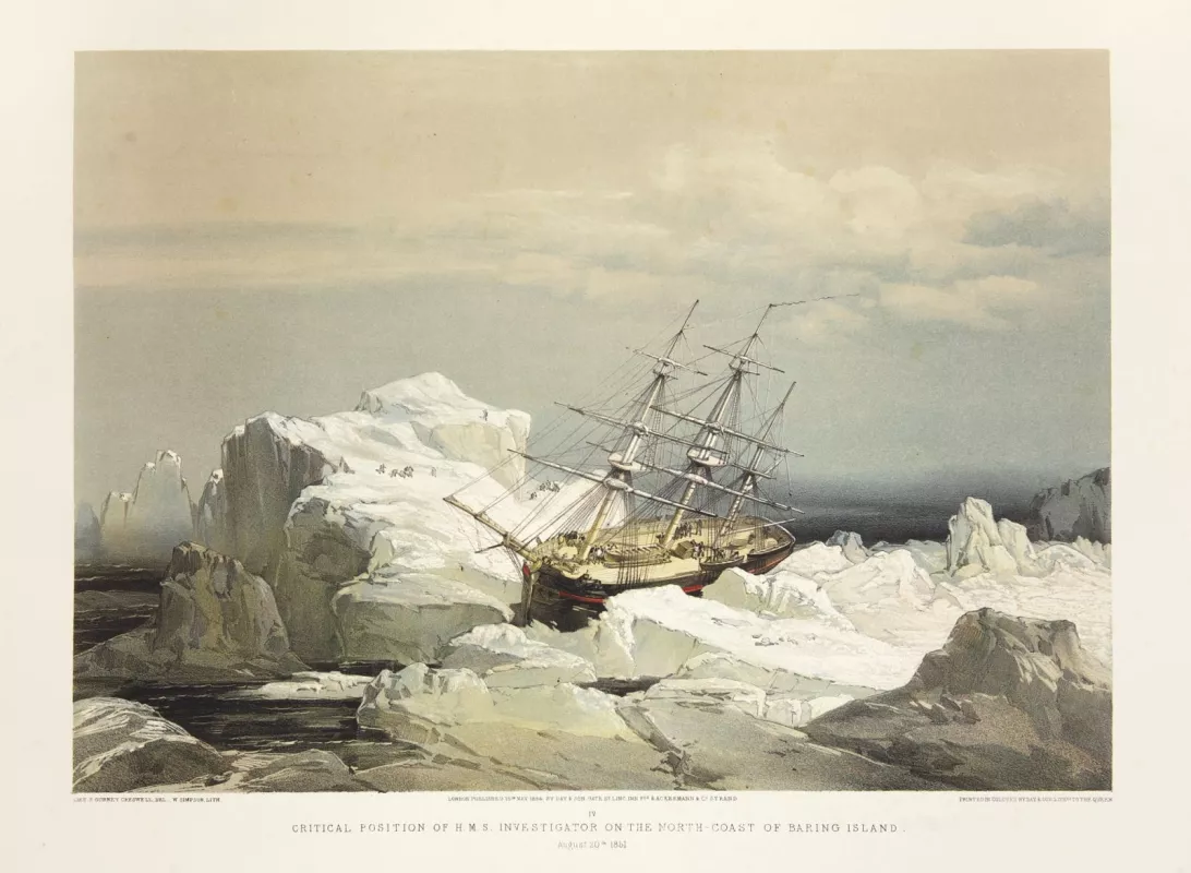
To estimate Arctic sea ice extent over the past millennium, scientists have used historical records. Where there have been people trading goods, chasing natural resources, or complaining about the weather, there have often been written accounts. Those records include ship logs, travel diaries, newspapers, government reports, even sheriffs' letters.
Over time, written records have become more regular and detailed. Inhabitants of Iceland started noting sea ice conditions along the coast around 865 C.E. Government reports became routine in Iceland around 1600. Hudson's Bay Company began keeping regular logbooks of sailing conditions between Hudson Bay and England in 1751. Along the Northern Sea Route, Russian records of sea ice conditions survive from nearly every year since the late 1860s. Although these records do not match the comprehensive coverage of satellites, they have allowed modern scientists to reconstruct regional conditions, sometimes with impressive detail.
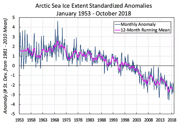
By the 1950s, shipping charts were regular and extensive enough to comprise a robust data set covering the Arctic Ocean. This data set is now available from the United Kingdom Met Office Hadley Centre. Hadley data show that Arctic sea ice has declined since at least the mid-1950s.
NSIDC hosts a data product extending shipping records even further back in time. The Gridded Monthly Sea Ice Extent and Concentration, 1850 Onward data set draws from ship observations, compilations by naval oceanographers, analyses by national ice services, and other sources to document Arctic sea ice conditions to the mid-19th century.
Combined evidence documents decline
Historical records and physical evidence pulled from the planet document multiple instances of natural variability in Arctic sea ice, on annual to multidecadal scales. The records also show that, by the early 20th century, Arctic sea ice was lower than it had been in the preceding centuries. The Hadley Centre data set shows a continued decline in sea ice. In other words, multiple lines of evidence show that Arctic sea ice was in decline well before the start of the continuous satellite record in 1979. Indeed, sea ice is less extensive now than it has been in several centuries.
The historical data also show how closely Arctic sea ice extent is linked to Earth's climate. When Arctic sea ice was lower, Earth's climate was much warmer than it is today, and sea level was higher than it is today. Leonid Polyak, a researcher at the Byrd Polar Research Center, said, "If that's where we are heading, we should be worried."
References
Bobylev L.P., Miles M.W. 2020 Sea Ice in the Arctic Paleoenvironments. In: Johannessen O. et al. (eds) Sea Ice in the Arctic. Springer Polar Sciences. Springer, Cham. doi:10.1007/978-3-030-21301-5_2.
Polyak, L., et. al. 2010. History of sea ice in the Arctic. Quaternary Science Reviews 29: 1,757-1,778. doi:10.1016/j.quascirev.2010.02.010.
Walsh, J. E., W. L. Chapman, F. Fetterer, and S. Stewart. 2019.Gridded Monthly Sea Ice Extent and Concentration, 1850 Onward, Version 2. Boulder, Colorado USA. NSIDC: National Snow and Ice Data Center. doi:10.7265/jj4s-tq79.

