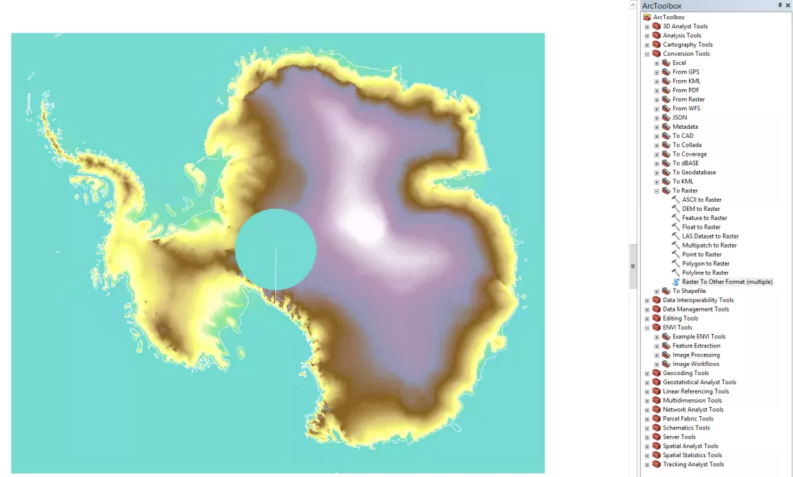
How do I import GLAS/ICESat 500m Laser Altimetry Digital Elevation Model of Antarctica into ArcMap?
The following steps outline the process for visualizing the GLAS/ICESat 500 m Laser Altimetry Digital Elevation Model of Antarctica (NSIDC-0304) data product in ArcGIS. At the time of writing, these instructions are relevant to ArcMap 10.4
- Download both the .gz and .hdr file. The compressed data file contains an ENVI raster, and the header file is needed to convert the data properly with ArcGIS tools. Make sure they are in the same directory when you proceed onto the following steps.
- Unpack the *.gz so that the data file is in *.dat format.
- (optional). Upload your favorite continent / coastline Shapefile so you can test the placement of the raster data.
- Use the Arc Toolbox: Conversion Tools > To Raster > “Raster to Other Format (Multiple)” tool.
- See the graphic below these instructions for the tool tree breakdown
- Fill out the tool pop-up menu, select TIFF as the output raster format and and click 'OK' to let the process run.
- Set the data frame to the WGS84 Geographic Coordinate System.
- Add the new TIFF raster to the ArcMap Data Frame.
- Reproject the data frame to South Polar Stereographic.
