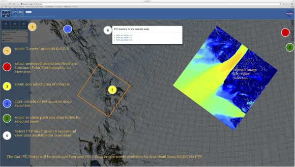
The National Snow and Ice Data Center is pleased to announce the release of a new data set, “Global Land Ice Velocity Extraction from Landsat 8 (GoLIVE)”. GoLIVE is a NASA-funded effort that serves as a processing and staging system for near-real-time global ice velocity data derived from Landsat 8 panchromatic imagery. The GoLIVE product website (https://nsidc.org/data/golive/) provides links to the dataset documentation and data access through the new GoLIVE Map Application.
The map application allows users to spatially search for and download land ice velocities from May 2013 to present. GoLIVE spatial coverage includes all terrestrial permanent ice with an area greater than 5 km2 between 82°S to 82°N latitude. The data are provided in Network Common Data Format (NetCDF; .nc) as geo-located grids of x and y velocity components at a 300m spatial resolution with accompanying error and quality parameters. In addition, data files have a corresponding Geospatial Tagged Image File Format (GeoTIFF; .tif) and Portable Network Graphics (PNG; .png) browse images showing scalar ice flow to assist users with selecting preferred data for their study. For reference, please use the following data citation: Scambos, T., M. Fahnestock, T. Moon, A. Gardner, and M. Klinger. 2016. Global Land Ice Velocity Extraction from Landsat 8 (GoLIVE), Version 1. [Indicate subset used]. Boulder, Colorado USA. NSIDC: National Snow and Ice Data Center. doi: https://dx.doi.org/10.7265/N5ZP442B. [Date Accessed]. The data portal is in its initial release and will benefit from user feedback such as yours. If you have any questions or recommendations for improvement, please contact: NSIDC User Services Office: nsidc@nsidc.org.
