
MEaSUREs Greenland Ice Mapping Project (GIMP) Land Ice and Ocean Classification Mask, Version 1
Data set id:
NSIDC-0714
DOI: 10.5067/B8X58MQBFUPA
This is the most recent version of these data.
Version Summary
Version Summary
Initial release
Overview
This data set, part of the NASA Making Earth System Data Records for Use in Research Environments (MEaSUREs) Program, provides a complete land ice and ocean classification mask for the Greenland ice sheet, using a combination of imagery from the USGS Landsat 7 ETM+ and Landsat 8 OLI instruments and Synthetic Aperture Radar (SAR) from the Canadian Space Agency's RADARSAT-1.
See Greenland Ice Mapping Project (GIMP) for related data.
Parameter(s):
LAND ICE/OCEAN CLASSIFICATION
Platform(s):
LANDSAT-7
LANDSAT-8
RADARSAT-1
Sensor(s):
ETM+
OLI
SAR
Data Format(s):
GeoTIFF
Temporal Coverage:
- 1 July 1999 to 30 September 2002
- 15 January 2013 to 30 September 2015
- 1 July 2020 to 1 October 2020
Temporal Resolution:
- Not applicable
Spatial Resolution:
- 15 m
- 30 m
- 90 m
- 15 m
- 30 m
- 90 m
Spatial Reference System(s):
- WGS 84 / NSIDC Sea Ice Polar Stereographic NorthEPSG:3413
Spatial Coverage:
- Northern latitude82Southern latitude58Eastern longitude7Western longitude-90
Blue outlined yellow areas on the map below indicate the spatial coverage for this data set.
Data Access & Tools
A free NASA Earthdata Login account is required to access these data. Learn More
Sample Data Image
Image
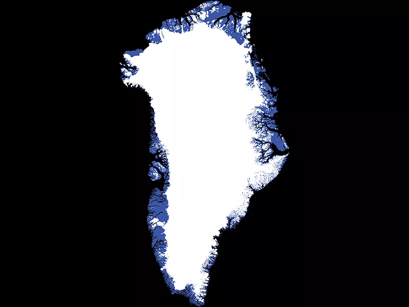
This land ice and ocean classification map of Greenland indicates land-based ice (white), below-sea-level land (blue), and ocean (black). Credit: NASA MEaSUREs GrIMP Data: USGS, CSA