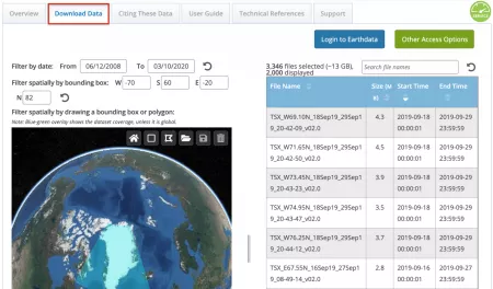
NSIDC DAAC Data Access Tool
The NSIDC DAAC Data Access Tool can be used to search and filter data files for NSIDC DAAC data sets using a map-based interface. Once you've made your selection, there are multiple options for how to access the data you have selected.
How to use the NSIDC DAAC Data Access Tool:
- First, navigate to an NSIDC DAAC data set landing page and the NSIDC DAAC Data Access Tool from the Data Access & Tools section of the page.
- Once the tool launches, use the temporal and spatial selectors on the left side of the page to search and filter your data product by time range and/or geographic area.
- As you make your selections, the table on the righthand side will automatically filter down to the selections you make.
Once you've made your selection, you have three options:
- Download Script: Receive a Python script to access the data.
- Download Files: Complete your order using the Earthdata Download application.
- Order via Earthdata Search: Hand off your selection to Earthdata search where you can apply further customizations to your order.
For more tips on how to use this tool, visit our help article.
