Data Sets for Research
Scientific Data Search
Support for Researchers
Data for Everyone
Sponsored Programs
Looking for facts and information? See About the Cryosphere.
On Thin Ice: Expedition to a Crumbling Ice Shelf
Scientists blog from Antarctica and provide a glimpse of what it's like to do research in the field. Read their blog ...
For the Media
For Data Users
Current Conditions
NSIDC In the News
Events
NSIDC Highlights
Icelights: Answers to your burning questions about ice and climate
What's hot in the news around climate and sea ice and what are scientists talking about now? Read more...
About NSIDC
About the Cryosphere
What is the Cryosphere?
When scientists talk about the cryosphere, they mean the places on Earth where water is in its solid form, frozen into ice or snow. Read more ...
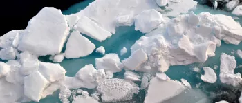
Sea ice north of Greenland. Photo Credit: Courtesy Andy Mahoney, NSIDC (View photo detail.)
Jumpsuit Main Camp October 1972 Image Credit: NSIDC courtesy Tom Marlar/CRREL AIDJEX Web site (View photo detail.)
Pfeister's Island; March April 1974 Image Credit: NSIDC courtesy Pat Martin AIDJEX Web site (View photo detail.)
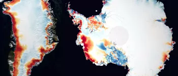
Sea ice concentration from the NSIDC Sea Ice Index. (View photo detail.)
AIDJEX 1972 pilot study. Inside NASA CV990 Image Credit: National Snow & Ice Data Center AIDJEX Web site (View photo detail.)
AIDJEX 1972 pilot study Image Credit: National Snow & Ice Data Center AIDJEX Web site (View photo detail.)
AIDJEX 1972 pilot study. Image Credit: National Snow & Ice Data Center AIDJEX Web site (View photo detail.)
Lead, AIDJEX pilot study. Image Credit: National Snow & Ice Data Center AIDJEX Web site (View photo detail.)
AIDJEX pilot study 1972 Image Credit: NSIDC courtesy Tom Marlar/CRREL AIDJEX Web site (View photo detail.)
Pfeister's Island;March April 1974 Image Credit: NSIDC courtesy Pat Martin AIDJEX Web site (View photo detail.)
AIDJEX 1972 pilot study Image Credit: NSIDC courtesy Tom Marlar/CRREL AIDJEX Web site (View photo detail.)
AIDJEX 1972 pilot study: snowmobile tracks lead to a hole in the ice. Image Credit: NSIDC courtesy Tom Marlar/CRREL AIDJEX Web site (View photo detail.)
Jumpsuit Main Camp Octtober 1972 Image Credit: NSIDC courtesy Tom Marlar/CRREL AIDJEX Web site (View photo detail.)
AIDJEX pilot study 1972. Jumpsuit camp from the air. Image Credit: NSIDC courtesy Tom Marlar/CRREL AIDJEX Web site (View photo detail.)
Midnight Sun: 1972 AIDJEX pilot study Image Credit: National Snow & Ice Data Center AIDJEX Web site (View photo detail.)
AIDJEX pilot study 1972. Twin otter airplane. Image Credit: NSIDC courtesy Tom Marlar/CRREL AIDJEX Web site (View photo detail.)
AIDJEX pilot study 1972. Image Credit: NSIDC courtesy Tom Marlar/CRREL AIDJEX Web site (View photo detail.)
Twin otter loading during evacuation of AIDJEX camp. Oil drums left as radar target; 1971 AIDJEX pilot study. Image Credit: National Snow & Ice Data Center AIDJEX Web site (View photo detail.)
1972 AIDJEX pilot study. Image Credit: NSIDC courtesy Tom Marlar/CRREL AIDJEX Web site (View photo detail.)
Smoke bombs mark CRREL-USGS tellurometer site during NAVOCEANO "Birdseye" overflight 1972 pilot study. Image Credit: National Snow & Ice Data Center AIDJEX Web site (View photo detail.)
1972 AIDJEX pilot study: W.Hibler center right, W.Weeks far right. Image Credit: NSIDC courtesy Tom Marlar/CRREL AIDJEX Web site (View photo detail.)
1972 AIDJEX pilot study: S.Ackley, W.Weeks Image Credit: NSIDC courtesy Tom Marlar/CRREL AIDJEX Web site (View photo detail.)
1972 AIDJEX pilot study: W.campbell center Image Credit: NSIDC courtesy Tom Marlar/CRREL AIDJEX Web site (View photo detail.)
1972 AIDJEX pilot study. Image Credit: National Snow & Ice Data Center AIDJEX Web site (View photo detail.)
Pat Martin, 2 Soviets 1972 AIDJEX pilot study Image Credit: NSIDC courtesy Tom Marlar/CRREL AIDJEX Web site (View photo detail.)
B. Campbell 1972 AIDJEX pilot study Image Credit: NSIDC courtesy Tom Marlar/CRREL AIDJEX Web site (View photo detail.)
The CRREL-USGS group measured mesoscale deformation of sea ice Image Credit: National Snow & Ice Data Center AIDJEX Web site (View photo detail.)
1971 AIDJEX pilot study. The University of Washington boundary-layer studies used divers to assemble current-meter masts under the water and to map under-ice topography Image Credit: National Snow & Ice Data Center AIDJEX Web site (View photo detail.)
Tabata 1972 AIDJEX pilot study. Image Credit: National Snow & Ice Data Center AIDJEX Web site (View photo detail.)
View from beneath of diver descending. (University of Washington boundary-layer studies.) 1971 AIDJEX pilot study Image Credit: National Snow & Ice Data Center AIDJEX Web site (View photo detail.)
AIDJEX 1971 Pilot Study: NASA, NAVOCEANO, and the U.S. coast guard made a series of remote-sensing flight over the AIDJEX strain array. The photo shows a NASA convair 990 making a low-level pass over the area Image Credit: National Snow & Ice Data Center AIDJEX Web site (View photo detail.)
AIDJEX 1972 Pilot Study: Unmanned current-meter holes had to be reopened periodically. Image Credit: National Snow & Ice Data Center AIDJEX Web site (View photo detail.)
AIDJEX 1972 Pilot Study: 1972 pilot: calling for helicopter rescue, W.Campbell, unknown, W.Weeks; Image Credit: NSIDC courtesy Tom Marlar/CRREL AIDJEX Web site (View photo detail.)
1971 AIDJEX pilot study: An emissometer was used by CRREL-USGS-AEROJET to measure microwave emissivity of sea ice (Far right W. Campbell) Image Credit: National Snow & Ice Data Center AIDJEX Web site (View photo detail.)
AIDJEX 1972 Pilot Study: calling for helicopter rescue, W.Weeks. Image Credit: NSIDC courtesy Tom Marlar/CRREL AIDJEX Web site (View photo detail.)
AIDJEX 1972 pilot study: Steve Ackley heads for rescue helicopter and dry clothing Image Credit: NSIDC courtesy Tom Marlar/CRREL AIDJEX Web site (View photo detail.)
Steve Ackley AIDJEX 1972 pilot study Image Credit: National Snow & Ice Data Center AIDJEX Web site (View photo detail.)
AIDJEX 1972 Pilot Study: Steve Ackley after rescue from snowmobile accident. Image Credit: National Snow & Ice Data Center AIDJEX Web site (View photo detail.)
AIDJEX 1972 pilot study. Inside NASA convair 990. W.Campbell at left. Image Credit: NSIDC courtesy Tom Marlar/CRREL AIDJEX Web site (View photo detail.)
AIDJEX 1972 Pilot Study: Steve Ackley waits for helicopter Image Credit: NSIDC courtesy Tom Marlar/CRREL AIDJEX Web site (View photo detail.)
Barry Allen AIDJEX 1972 pilot study Image Credit: National Snow & Ice Data Center AIDJEX Web site (View photo detail.)
AIDJEX 1972 pilot study. Rolf Bjornerd, field manager Image Credit: NSIDC courtesy Tom Marlar/CRREL AIDJEX Web site (View photo detail.)
AIDJEX 1972 pilot study. Inside NASA convair 990, W.Campbell at left. Image Credit: NSIDC courtesy Tom Marlar/CRREL AIDJEX Web site (View photo detail.)
1972 pilot study: "Bam's Hut." Arne Arneberg "the human forklift", at left. Image Credit: NSIDC courtesy Tom Marlar/CRREL AIDJEX Web site (View photo detail.)
AIDJEX 1972 pilot study. Inside NASA Convair 990, W. (Bill) Campbell at left Image Credit: NSIDC courtesy Tom Marlar/CRREL AIDJEX Web site (View photo detail.)
Alan Gill AIDJEX 1972 pilot study. Image Credit: National Snow & Ice Data Center AIDJEX Web site (View photo detail.)
Dr. Wilson Goddard AIDJEX 1972 pilot study. Image Credit: National Snow & Ice Data Center AIDJEX Web site (View photo detail.)
AIDJEX 1972 pilot study. Inside NASA convair 990: Andy Heiberg at right. Image Credit: NSIDC courtesy Tom Marlar/CRREL AIDJEX Web site (View photo detail.)
AIDJEX 1972 pilot study: Dr.Wilson Goddard Image Credit: NSIDC courtesy Tom Marlar/CRREL AIDJEX Web site (View photo detail.)
AIDJEX 1972 pilot study. Inside NASA convair990: Andy Heiberg at right. Image Credit: NSIDC courtesy Tom Marlar/CRREL AIDJEX Web site (View photo detail.)
AIDJEX 1972 pilot study. Pat Martin. Image Credit: NSIDC courtesy Tom Marlar/CRREL AIDJEX Web site (View photo detail.)
1972 pilot study. J.D. Smith Image Credit: NSIDC courtesy Tom Marlar/CRREL AIDJEX Web site (View photo detail.)
AIDJEX 1972 pilot study: seated, Miles McPhee, standing George Bean Image Credit: NSIDC courtesy Tom Marlar/CRREL AIDJEX Web site (View photo detail.)
Miles McPhee AIDJEX 1972 pilot study Image Credit: National Snow & Ice Data Center AIDJEX Web site (View photo detail.)
Ken Hunkins AIDJEX 1972 pilot study. Image Credit: National Snow & Ice Data Center AIDJEX Web site (View photo detail.)
Murray Stateman AIDJEX 1972 pilot study Image Credit: National Snow & Ice Data Center AIDJEX Web site (View photo detail.)
AIDJEX 1972 pilot study. Inside NASA cv990 Murray Stateman at right Image Credit: NSIDC courtesy Tom Marlar/CRREL AIDJEX Web site (View photo detail.)
W. Weeks 1972 AIDJEX pilot study. Image Credit: National Snow & Ice Data Center AIDJEX Web site (View photo detail.)
Scientist performing chemistry analysis of Arctic Ocean water by pouring it into a filtration assembly during SCICEX 98. Photo courtesy of ASL. (View photo detail.)
Jay Ardai (LDEO) launches a Seabird CTD which is suspended in the cage as an ADCP lays on the deck in preparation for deployment as a CTD/ADCP cast from the deck of the USS Hawkbill during SCICEX-98. Photo: Greg Kurras (Edwards and Coakley 2003). (View photo detail.)
USS Hawkbill from its starbord bow while surfaced near the North Pole during SCICEX 98. Photo courtesy of ASL. (View photo detail.)
Scientists and crew members setup a red tent on the bow of the USS Hawkbill used for holding science experiments while surfaced during SCICEX 98. Photo courtesy of ASL. (View photo detail.)
Members of Ice Camp Lyon chip away the sea ice to access the hatch of the USS Hawkbill after it surfaces during SCICEX 99. Photo courtesy of ASL. (View photo detail.)
The USS Hawkbill surfaces at the North Pole during SCICEX 99. Photo courtesy of ASL. (View photo detail.)
Warming tent set up adjacent to the USS Hawkbill during SCICEX 99. Although no surface sampling was performed during SCICEX 99, a film crew from the National Geographic Society, in collaboration with Dr. Tom Lehman (LDEO), lowered cameras through a hole in the ice next to the submarine to photograph its descent. Photo courtesy of ASL. (View photo detail.)
Oceanographer Steve Okkonen (UAF) collecting through-hull water samples in the forward part of the torpedo room during SCICEX 99. Okkonen stands on a grate that drains spilled water to the submarine's bilges. The blue curtains to Okkonen's right cover bunks belonging to two USS Hawkbill sailors. In addition to serving as the science center, the torpedo room provided bunk space for ~ 30 sailors. Photo courtesy of Mark Rognstad. (View photo detail.)
Crewman “Ted” Groustra loads an Expendable Conductivity, Temperature, Density (XCTD) probe for launch during SCICEX 99. These instruments were designed to measure physical and chemical water properties (such as temperature and salinity) under the arctic ice canopy. Photo courtesy of ASL. (View photo detail.)
The station members of NP-30, one of the last Russian North Pole Stations, gather for a photograph during the closing ceremony. Image credit: EWG. (View photo detail.)
Similar to the opening ceremonies, the closing ceremonies also involved firing guns and rifles. This ceremony commemorates the closing of North Pole Station 25. Image credit: EWG. (View photo detail.)
Flag ceremonies at North Pole stations typically marked the establishment of each new team. Image credit: EWG. (View photo detail.)
Part of the opening ceremonies involved the firing of guns and rifles. Image credit: EWG. (View photo detail.)
The station members of NP-25 gather for a final photograph during the closing ceremony. Image credit: EWG. (View photo detail.)
An interior view of the NP-1 tent, which served as both living quarters and work area. Station members lived for nine months on NP-1. Image credit: EWG. (View photo detail.)
An aerial view of NP-6. The small building in the foreground is the diesel power station. The big building to the right is the ward room (marine terminology was used on the North Pole stations). The ward room was a dining room and recreation room, with billiards, ping-pong, movies, and a meeting room. Image credit: EWG. (View photo detail.)
Tents at NP-1 served as both living and working areas. On subsequent stations, however, such as that pictured here, tents were used mainly for supply storage. Plywood was used for buildings that housed people and laboratories. Image credit: EWG. (View photo detail.)
A biplane landing near an iceberg, off the Laptev Sea. Image credit: EWG. (View photo detail.)
Recreation could include climbing the large ridges and hummocks on the ice station floe. These often reached 10 meters in height. During excursions like this, one of the men would typically carry a rifle for protection against polar bears. Image credit: EWG. (View photo detail.)
Cables leading to the meteorology laboratory at NP-21 supply electricity from a diesel generator. Image credit: EWG. (View photo detail.)
Two station members walking through the base camp of the high-latitude Sever expedition at Zhokov Island. Image credit: EWG. (View photo detail.)
As a rule, each North Pole camp served as the base camp for the activity of the high-latitude Sever ("North" in Russian) airborne data collecting expeditions. Image credit: EWG. (View photo detail.)
The main airplane, Ilyushin 14 (IL-14) used for transporting personnel and cargo. Image credit: EWG. (View photo detail.)
Harsh and extreme arctic conditions required special considerations when trying to build any type of structure. Heavy machinery was used to construct and maintain the runways that allowed planes to deliver supplies. When not used for runways, tractors such as this one would be used for other construction around the camp. Image credit: EWG. (View photo detail.)
Generators running on diesel fuel provided enough electricity to keep the camp well lit through the long arctic winter. Image credit: EWG. (View photo detail.)
Sunset at a North Pole station. The large antennae are for studying ionospheric processes. Image credit: EWG. (View photo detail.)
Even if materials didn't need to be housed within a building, storing them outside also posed difficulties. Supplies were stacked on fuel barrels to elevate them above the snow and to protect them from melt water during summer. Image credit: EWG. (View photo detail.)
Around some buildings in the summertime, "pedestaling" occurs because structures shade the ice and snow beneath from the sun's heat. Each subsequent summer adds to the height of the pedestal. This building on NP-22 reached 5 meters in height after seven years. Image credit: EWG. (View photo detail.)
Although summers posed the hazards of melt water, the winters posed problems with deeply drifting snow. In winter, windblown snow had to be cleared from the entrance of this aerological (radiosounding) hut. Image credit: EWG. (View photo detail.)
Most of the time, the only way to deliver supplies to the North Pole stations was by plane. Weather conditions in the sky could be just as harsh and extreme as conditions on the ground. Here, a biplane is grounded after an accident near the Kara Sea in 1981. Image credit: EWG. (View photo detail.)
Due to changes in the ice floe surface, it was not uncommon for camps to relocate to more stable ground. This photograph was taken during the rebuilding of the camp NP-22 in 1980. Aluminum tent poles are at the right, and an overturned boat is at the left. Image credit: EWG. (View photo detail.)
"Pedestaling" occurs in summer because structures shade the ice and snow beneath from the sun's heat. Although this supply bag offers an example on a small scale, pedestaling frequently occurred around buildings and large structures. Image credit: EWG. (View photo detail.)
A small lead (or crack in the ice) has opened in the foreground. New leads, which form under wind stress when the ice diverges, were a constant threat to the camps. Camps often had to be relocated due to the sudden appearance of an ice lead through the middle of the camp (unless the crack appeared during summer and was simply a melt channel). Image credit: EWG. (View photo detail.)
During summer, moving around camp became difficult, as melting snow formed large puddles (melt ponds) and channels everywhere. Image credit: EWG. (View photo detail.)
Here, melt ponds encroach on many of the buildings in the camp. Sometimes, inflatable boats were used for transportation. Image credit: EWG. (View photo detail.)
One of the primary purposes of the drifting stations was to collect all possible meteorological data while on the ice floe. This involved installing, calibrating, and maintaining the instruments. Here, researcher German Maximov conducts a routine calibration of a pyranometer (in the large tube). Image credit: EWG. (View photo detail.)
When a pond melts, a whirlpool forms, emptying the pond in minutes. This photograph of a melt pond whirlpool is from NP-6. Image credit: EWG. (View photo detail.)
During summer, melt ponds posed hazards to the camp. Here, a station member rows an inflatable raft in a melt pond that has formed in the middle of the camp at NP-6. Image credit: EWG. (View photo detail.)
German Maximov collecting the measurement of direct solar radiation. Image credit: EWG. (View photo detail.)
Not all measurements required venturing outside. Aerologists Makurin and Ippolitov recording radio-sounding data at NP-16 in 1968. Image credit: EWG. (View photo detail.)
A lone station member taking snow line (snow survey) measurements. Image credit: EWG. (View photo detail.)
Determining instrument location by theodolite. A theodolite is a high-precision surveying instrument. Because the ice floes rotated and changed in topography as they drifted, undergoing freezing and thawing, station members needed to regularly determine the position of the instruments relative to each other and to North. Image credit: EWG. (View photo detail.)
Two station members traverse the snow survey line measuring snow density by weight. Image credit: EWG. (View photo detail.)
Notice the granular structure of this ice, and how large the grains are. The ruler is marked in centimeters. Image credit: EWG. (View photo detail.)
Dogs provided companionship and entertainment for people living in the station camp, and they also alerted the camp when polar bears were present. Here, dogs are approaching a polar bear as it emerges from a lead (crack) in the ice. Image credit: EWG. (View photo detail.)
A ruler measures the ice freeboard, or the height of the ice above the water. Ice draft, on the other hand, is the depth of the ice below the surface of the water. Notice the elongated crystals. Image credit: EWG. (View photo detail.)
Here the dogs investigate the polar bear as the polar bear retreats. Image credit: EWG. (View photo detail.)
The three dogs try to prevent the polar bear from coming out of the water, but the bear moves quickly and escapes into the icy terrain. Image credit: EWG. (View photo detail.)
Beyond the ridges of ice, dogs chase the polar bear, ensuring that it does not approach the camp. Image credit: EWG. (View photo detail.)
This station member was just climbing around on the ridges and hummocks of the ice floe, but, like all who ventured away from camp, he carried a rifle for protection from polar bears. Image credit: EWG. (View photo detail.)
Station members were responsible for recording measurements from a variety of different instruments. Shown here is an array of meteorological instruments at NP-21. From left are the instrument for solar radiation measurement (pyranometer, albedometer, actinometer and balancemeter), the shelter housing thermometers for air temperature and humidity and the hair hygrometer, the precipitation gauge (Tetrakov type), and the anemometer, which is mounted on a mast at 10 meters. Image credit: EWG. (View photo detail.)
A closer view of the instrument array at NP-21. The camp buildings in the background are just visible through the blowing snow. Image credit: EWG. (View photo detail.)
Not all of the ice phenomena on the ice floes were naturally occurring. Station members sometimes made the most of their surroundings, witnessed in this polar bear made of snow. Image credit: EWG. (View photo detail.)
Instrument masts were insulated using mounds of hay to help keep them upright and prevent the snow from melting out from around them. Image credit: EWG. (View photo detail.)
When the anchors were not insulated, the snow melted out from around the mast bases, causing them to topple. Image credit: EWG. (View photo detail.)
A close-up view of a pyranometer, which measures diffuse solar radiation. Image credit: EWG. (View photo detail.)
A radio-sounding locator antenna. Image credit: EWG. (View photo detail.)
This meteorological instrument box is at the standard height of two meters above the surface. Image credit: EWG (View photo detail.)
An IVO device for measuring the base height of cloud cover. IVO is the Russian abbreviation for this instrument. Image credit: EWG. (View photo detail.)