By Michon Scott
Combined observations from NASA’s Ice, Cloud, and land Elevation / Geoscience Laser Altimeter System (ICESat/GLAS) and Ice, Cloud, and land Elevation Satellite-2 (ICESat-2) missions have mapped Earth’s changing land, ice, water, and cloud surfaces in astonishing detail for years. The sheer volume of elevation data, however, has presented potential users with a steep learning curve.
Enter NASA’s OpenAltimetry tool. OpenAltimetry allows experienced and new users alike to quickly find and download elevation data through a web browser. OpenAltimetry supports users with searching on areas of interest, but without wading through large data repositories. It also spares users the burden of installing costly software or marshaling hefty computational resources.
The downside of data abundance
Sensors such as those on ICESat and ICESat-2 measure heights across Earth’s surface by shooting laser pulses at the planet and measuring the time required for particles of light, or photons, to bounce back to the sensor. By collectively measuring these photons, ICESat and ICESat-2 provide detailed elevation profiles of the land, water, ice, or cloud surfaces below.
The GLAS instrument onboard ICESat collected observations from 2003 to 2010, emitting 40 laser pulses per second. Since 2018, the Advanced Topographic Laser Altimeter System (ATLAS) instrument onboard ICESat-2 has collected similar observations, but with a brain-popping 10,000 laser pulses per second.
The ICESat and ICESat-2 missions have collected enough data to fill libraries, but libraries must be easily searched to be useful. Imagine walking into a vast library stocked with millions of books, planning to search for a particular subject. Then imagine finding the books organized solely by publication date. Novice users of ICESat and ICESat-2 data collections have faced a similar problem.
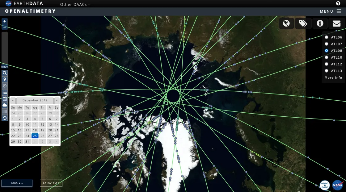
Both ICESat and ICESat-2 are polar-orbiting satellites that have collected observations along narrow tracks, and the data are organized in sequential order along those tracks. Outside of the polar regions, repeat observations might be separated by months. The data-file organization—by time, not location—makes finding repeat observations in some regions a tricky task for non-expert users. New users may get around this problem by turning to data distributors for help, but limited resources often prevent that help from arriving immediately.
Overcoming the challenges users faced in finding data started with developing an experimental interactive tool.
A successful proof of concept
The NASA National Snow and Ice Data Center Distributed Active Archive Center (NSIDC DAAC) has archived and distributed data from both the ICESat and ICESat-2 missions since 2003. Providing users with an interactive web portal for easy data discovery required an effort beyond traditional data archival. OpenAltimetry emerged from additional funds and a collaboration.
Development of the OpenAltimetry platform began with funding from NASA’s Advancing Collaborative Connections for Earth System Science (ACCESS) Program. The project was a partnership between NSIDC, Scripps Institution of Oceanography, San Diego Supercomputer Center at the University of California San Diego, and EarthScope Consortium (formerly UNAVCO).
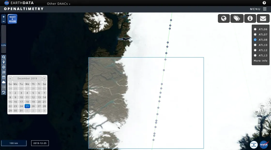
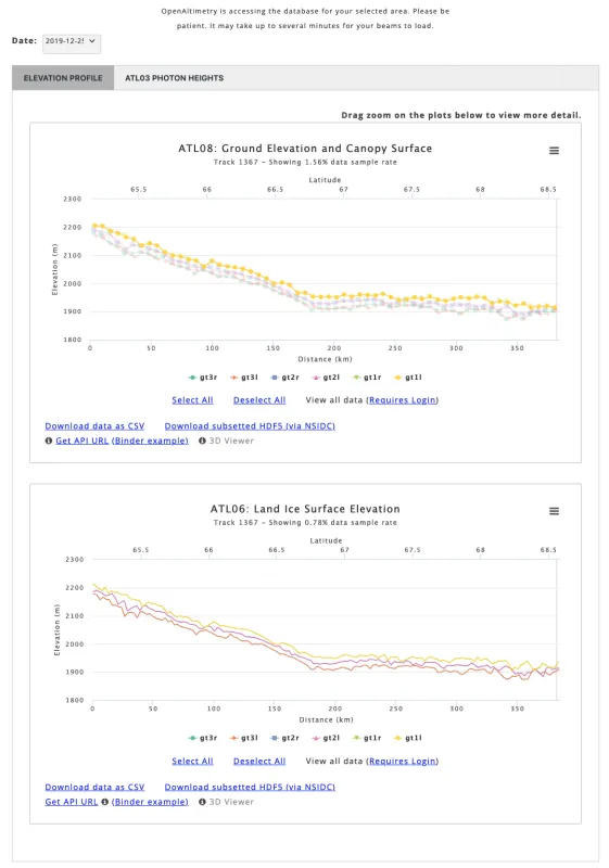
The result of this collaboration, the OpenAltimetry interface, lets any user easily navigate to the desired location, find available observations across a range of dates, generate elevation profiles, examine underlying photon data for those profiles, and download data files. All these functions can be performed through the OpenAltimetry portal accessible through a web browser.
Since it was initially funded through a NASA ACCESS grant, the project was not expected to become a permanent platform. ACCESS is aimed at developing innovative approaches for finding and using NASA Earth observations for research, and the grant provided three years of funding. “The funding was finite. OpenAltimetry was always meant to have an end date,” said NSIDC DAAC project lead Kristin Rowley. The easy-to-use interface, however, was an immediate success. For ICESat-2 data alone, OpenAltimetry enabled these user tasks between January 2019, and September 2023:
- Visualizations of 617,529 elevation plots
- Visualizations of 356,513 photon plots
- Downloads of 136,221 comma-separated values (CSV) files
OpenAltimetry’s remarkable success prompted NASA to provide long-term funding and establish its ongoing maintenance at the NSIDC DAAC. NSIDC took on maintenance of OpenAltimetry in 2023.
Moving up to the cloud
The OpenAltimetry platform now enjoys the benefits that come with being part of the NASA Earthdata Cloud, including enhanced security and improved data-processing efficiency.
In migrating OpenAltimetry to the NASA Earthdata Cloud, the NSIDC DAAC also took on long-term maintenance of the web portal. User support representatives at the NSIDC DAAC now bring their knowledge of ICESat and ICESat-2 products to OpenAltimetry support and collaborate with NSIDC DAAC software developers on future enhancements. “OpenAltimetry now has even more brains behind it,” Rowley said. “We know how the data sets work, so we know how to make OpenAltimetry work for the users.”
Backed by the data expertise at the NSIDC DAAC, OpenAltimetry can put elevation observations from anywhere on Earth into the hands of more people who want to understand how surfaces across our planet change over time.
Access data through the NSIDC DAAC
NASA’s NSIDC DAAC manages, distributes, and supports a variety of cryospheric and climate-related datasets as one of the discipline-specific Earth Science Data and Information System (ESDIS) data centers within NASA’s Earth Science Data Systems (ESDS) Program. User Resources include data documentation, help articles, data tools, training, and on-demand user support. Learn more about NSIDC DAAC services.
Reference
Khalsa, S.J.S., A. Borsa, V. Nandigam, M. Phan, K. Lin, C. Crosby, H. Fricker, C. Baru, and L. Lopez. 2022. OpenAltimetry: Rapid analysis and visualization of spaceborne altimeter data. Earth Science Informatics 15:1471-1480. https://doi.org/10.1007/s12145-020-00520-2.


