Ice Sheets Today
Data images and analyses of polar ice sheet melt conditions
Melt Analyses
Our scientific data analysis articles for the Greenland Ice Sheet melt season are typically published from April 1 to November 1. Antarctic Ice Sheet melt season articles are published from November 1 to April 1. Select an article below to explore ice sheet melt conditions by month and year-to-date.
Filter by:

Greenland
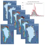
The Greenland Ice Sheet had a far more typical melt extent and intensity in 2013 than in 2012, when summer surface melting set a record, compared to satellite observations since 1978.

Greenland
Greenland's surface ice melt season reached a peak in late July, coinciding with a period of very warm weather. Greenland's melt season this year will be closer to average than was 2012, with far less melting in the northern ice sheet and at high elevations.

Greenland
Surface melting of the snow and ice of the Greenland Ice Sheet had a slightly late start, but quickly spread over a significant area, extending over more than 20% of the ice sheet in early June and reaching above 2,000 meters (6,500 feet) elevation in some areas.

Greenland
The algorithm for the Greenland Ice Sheet Today daily melt extent has been revised to account for unusually warm winter snow layers and residual meltwater deep in the snow. Meltwater from last summer’s intense melt season did not completely re-freeze through at least mid December.

Greenland
Greenland's surface melting in 2012 was intense, far in excess of any earlier year in the satellite record since 1979. In July 2012, a very unusual weather event occurred. For a few days, 97% of the entire ice sheet indicated surface melting.

Greenland
Greenland Ice Sheet Today offers the latest satellite data on surface melting of the Greenland Ice Sheet. Surface melt on the ice sheet results from daily weather conditions that are driven by air temperatures, winds, and feedback effect from