Arctic sea ice
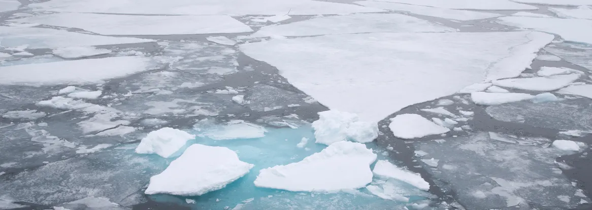
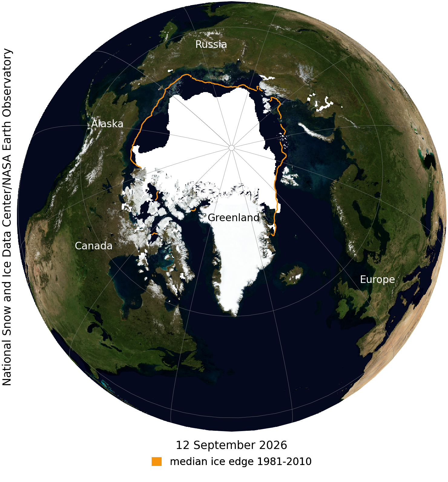
Arctic sea ice likely reached its minimum extent for the year, at 4.60 million square kilometers (1.78 million square miles) on September 12, 2026, according to scientists at the National Snow and Ice Data Center (NSIDC) at the University of Colorado Boulder. The 2026 minimum is ranked tenth lowest in the nearly 48-year satellite record, tied with 2008, 2010, and 2025. The last 20 years are the lowest 20 Arctic sea ice extents in the satellite record.
“This year’s minimum is yet another low extent in a changed Arctic,” said senior scientist Walt Meier. “While this year’s minimum is in line with recent years, it is far lower than anything we saw in the 1980s, 1990s, and early 2000s.”
NSIDC director Mark Serreze said, “It’s been a strange year. It was only tenth lowest in extent, but despite the fairly cool Arctic Ocean summer, there was loose ice all the way to the pole.”
NSIDC scientists stress that the Arctic sea ice extent number is preliminary—compaction from winds could still push the ice extent lower.
Antarctic sea ice
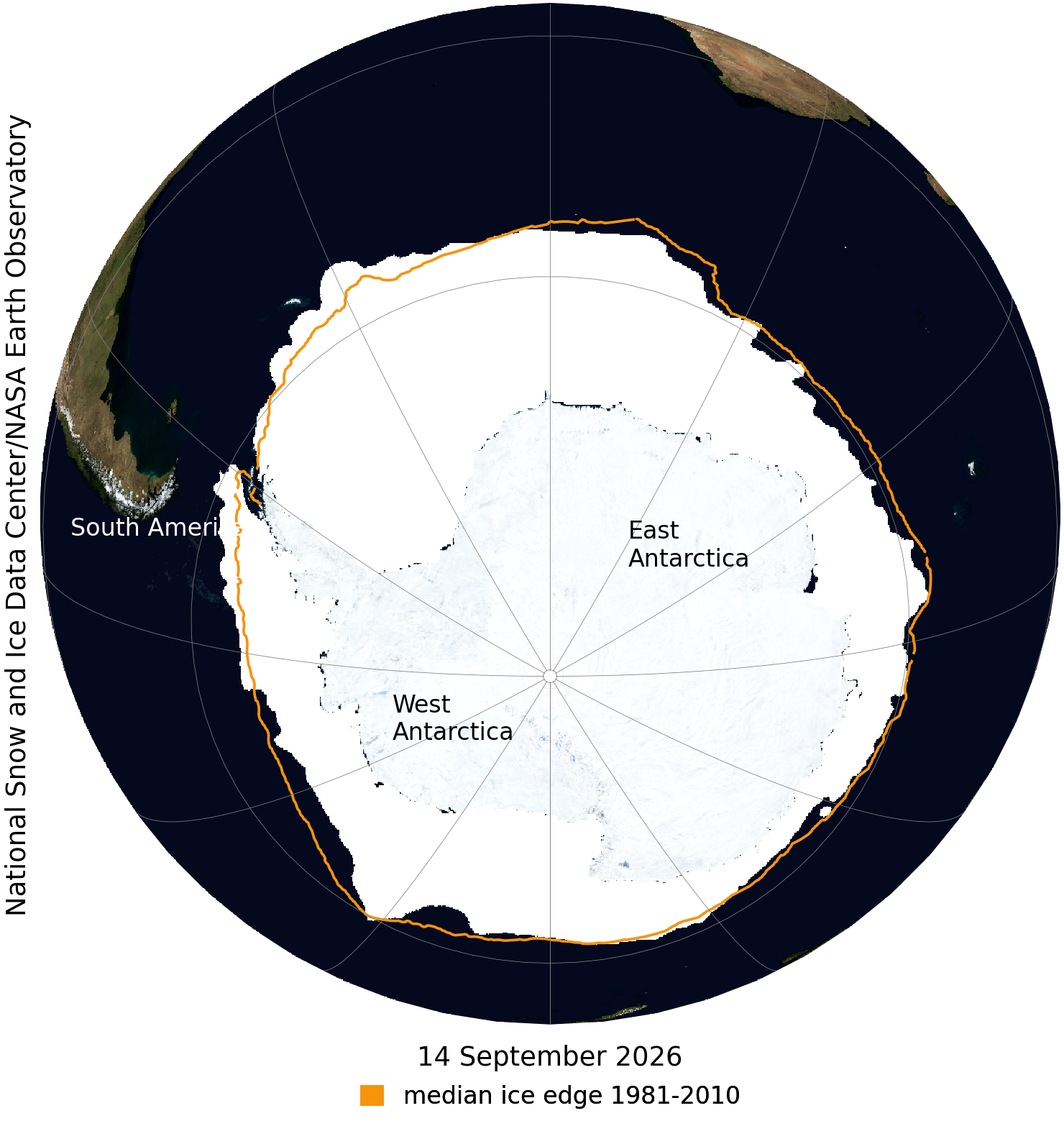
In the Antarctic, sea ice extent has been tracking near record low levels for most of the growth season, most likely reaching its maximum extent on September 14 at 17.59 million square kilometers (6.79 million square miles). If this maximum date holds, this will be the third lowest Antarctic sea ice maximum on record.
“Antarctica’s sea ice during this year's growth season has steadily lagged the long-term average,” said senior scientist Ted Scambos. “This is a continuation of below-average extent across all seasons for most of the past decade.”
It must be noted that large fluctuations in extent are typical of Antarctic sea ice near the seasonal maximum, often leading to some delay in confidently identifying the maximum, which typically occurs in late September or early October but has been reached as early as August 30.
NSIDC will issue a full analysis at the beginning of October addressing the possible causes behind this year’s ice conditions, interesting aspects of the Arctic melt season and Antarctic growth season, and graphics comparing this year to the long-term record.
NSIDC is part of the Cooperative Institute for Research in Environmental Sciences (CIRES) at the University of Colorado Boulder.
Visit NSIDC's Sea Ice Today for more details and images.
View the NASA visualization; read the NASA feature.