By Jane Beitler
“I have often claimed this collection to be more valuable than the moon rocks – after all, we can go back to the moon for more rocks, but we can not go back to take pictures of glaciers 30 years ago.” —Robert Krimmel, United States Geological Survey.
From above, glaciers look like rivers of ice. Like rivers, but much more slowly, they flow downhill, are replenished by precipitation, and diminished by melting. On balance, they ought to stay about the same, but glaciers are sensitive to changes in climate. Telltales of larger climate changes, they shrink in a warming climate or grow in a cooling climate. Only fairly recently have satellites been used to monitor glaciers on a global scale by tracking changes in area, length, elevation, and velocity. Before satellites and still today, scientists with cameras documented the state of a glacier so that they could study whether it is growing or shrinking, advancing or retreating.
A massive problem
Photographing glaciers on foot by hiking to the terminus with a camera could only capture a small number of glaciers, because it is time consuming. With the world’s glaciers uncounted (NSIDC’s World Glacier Inventory contains records of 130,000 glaciers, but scientists think there are many more), Alaska alone may have as many as 50,000 glaciers, but only about 500 of them are named. So before space-based remote sensing became prevalent, glaciologists used aerial photography to study glaciers in their remote, hostile environments.
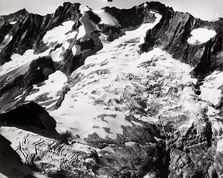
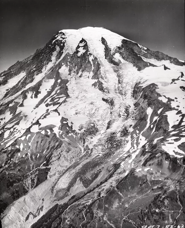
Some visionary glaciologists with airplanes and cameras captured important records of glaciers, starting in the 1930s. As part of a United States Geological Survey (USGS) program for more than 35 years, photographer and glaciologist Austin Post (1922-2012) sometimes lugged his large-format camera weighing more than 60 pounds up mountain trails to photograph glaciers. But more often, he flew in small aircraft over mountain wildernesses, wrangling several cameras as he shot through cutouts in the aircraft floor and sides. Post, who started as a support technician on glacier projects, was passionately interested in glaciers and eventually earned the title of research scientist, despite lacking a college degree. He became an expert observer of glaciers as well as highly skilled in capturing them from vertical and oblique angles. As pioneering glaciologist William O. Field noted, “Not only does Austin know glaciers and appreciate what features should be photographed, and how and to what detail, but also he is a good observer.” Starting in the 1960s Post photographed glaciers in Alaska, Canada, Greenland, and the western U.S., leaving an irreplaceable legacy of documentation regarding glaciers and changes in Earth’s climate.
Captured and on display
The USGS collected these aerial photographs over the years, but at first they were inaccessible to most researchers. Starting in 1978, NSIDC (then called the World Data Center for Glaciology-A) helped create metadata describing the photographs, and created a database of the metadata, as well as copies of the photographs on microfilm. In 2008, these images began to be digitized under the National Oceanic and Atmospheric Administration (NOAA) Climate Database Modernization Project, and added to the NSIDC Glacier Photograph Collection online. NSIDC is currently creating metadata for the digitized images and adding them to the online collection as time and funding permit. Today more than 14,000 images are online, including over 6,400 photographs by Post. Researchers and the public can search for and download images using NSIDC’s Web site. Work continues to make the entire collection accessible online. NSIDC has more than 100,000 Austin Post glacier photographs in its archives, as well as many other photographs waiting to be added. The Austin Post photographs and the NSIDC Glacier Photograph Collection were developed with the support of USGS and NOAA. Today, however, these resources are in need of ongoing stewardship of the physical materials, as well as resources to continue their digitization and metadata to enable online discovery and access. As climate records, their value continues indefinitely as a record of past climate and are used by researchers to compare glaciers then and now, and by educators and communicators to help everyday people see how most of the world’s glaciers are changing. We may not be able to stop many glaciers from disappearing, but we can work to keep these valuable observational records intact and accessible for future research.
More information
Adopt a Glacier NSIDC Archives NSIDC Glacier Photograph Collection Scurlock, John. 2007. Austin Post: Legendary chronicler of glaciers. Northwest Mountaineering Journal 4.

