News & Stories

Across the globe, snow and ice play a vital role in regulating Earth’s climate and providing freshwater resources to people, plants, and animals.

As Earth’s frozen regions change rapidly, NSIDC is committed to growing its research and open access data to better understand these changes. Read about NSIDC research and its contribution to science and policy making. Check out spotlights on how to use NSIDC data, tools, and resources. Learn about how we steward data and collaborate with scientists and organizations across the world to understand how the frozen parts of Earth affect the rest of the planet and impact society.
News and stories

Filter by:
Aerial photo of wildfire smoke
Analysis - Ice Sheets Today
A strong and persistent melt event occurred in southern Greenland in mid-August 2025, preceded by extensive rain in the same area. Snow cover following the rain events covered the lower elevation bare ice areas along the western side, brightening the surface again.
MODIS image of Arctic sea ice
Analysis - Sea Ice Today

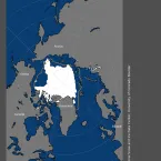
At the end of July 2025, daily sea ice extent in both hemispheres ranked third lowest in the 47-year satellite record. For most of the month, Arctic sea ice extent tracked close to levels recorded for 2012, the record-low-September year.

Seasonal maps of rainfall hours
Spotlight
A new study from the international Arctic Rain on Snow Study (AROSS), led by NSIDC, zooms out for an Arctic-wide perspective on how often precipitation falls as snow or rain, and how snow-to-rain ratios are changing.
Greenland Ice Sheet
Analysis - Ice Sheets Today
A moderately intense melt season for the Greenland Ice Sheet has continued in July, with an extended period of high temperatures and coastal melting in mid-July where nearly half of the ice sheet experienced melt.
ssmis image
Analysis - Sea Ice Today
Arctic sea ice extent tracked at near-record low levels through much of June, hitting daily record low levels from June 20 to 26. Antarctic sea ice averaged third lowest for the month of June. There have been unrecoverable gaps in delivered sea ice data from the Defense Meteorological Satellite Program (DMSP) Special Sensor Microwave Imager/Sounder (SSMI/S). Since the the SSMIS data feed will end July 31, the team will be switching to the Japan Aerospace Exploration Agency (JAXA) Advanced Microwave Scanning Radiometer-2 (AMSR2) passive microwave sensor as the primary data source.