
By Agnieszka Gautier
Alaskan Native Tamura Paul asked a news reporter if she knew what it sounded like to be on a boat during a storm. “It sounded like that,” Paul said, referring to the sound of violent waves battering her home, which had ripped off its foundation and drifted downriver when remnants of Typhoon Halong hit western Alaska on October 12, 2025. Paul was sleeping when the storm hit. She woke up to water pouring into her home. Up to 2 meters (7 feet) of water flooded the town of Kipnuk in just a few hours. “The flood doesn’t usually hit us,” she told the reporter. Paul’s home sat away from the riverbed and had not been prone to flooding. But, this storm was different.
The Yukon-Kuskokwim Delta in Alaska was the hardest hit. One of the world’s largest river deltas, this vast region of flat wetland tundra and meandering rivers drains into the Bering Sea. This remote portion of southwestern Alaska is also one of the state’s most populated rural areas, home to more than 50 Indigenous Yup'ik, Cup'ik, and Deg Xit'an communities. Hurricane-force winds slammed the coastline. The devasting storm surge triggered massive evacuations, displacing over 1,600 residents and permanently altering the towns of Kipnuk and Kwigillingok.
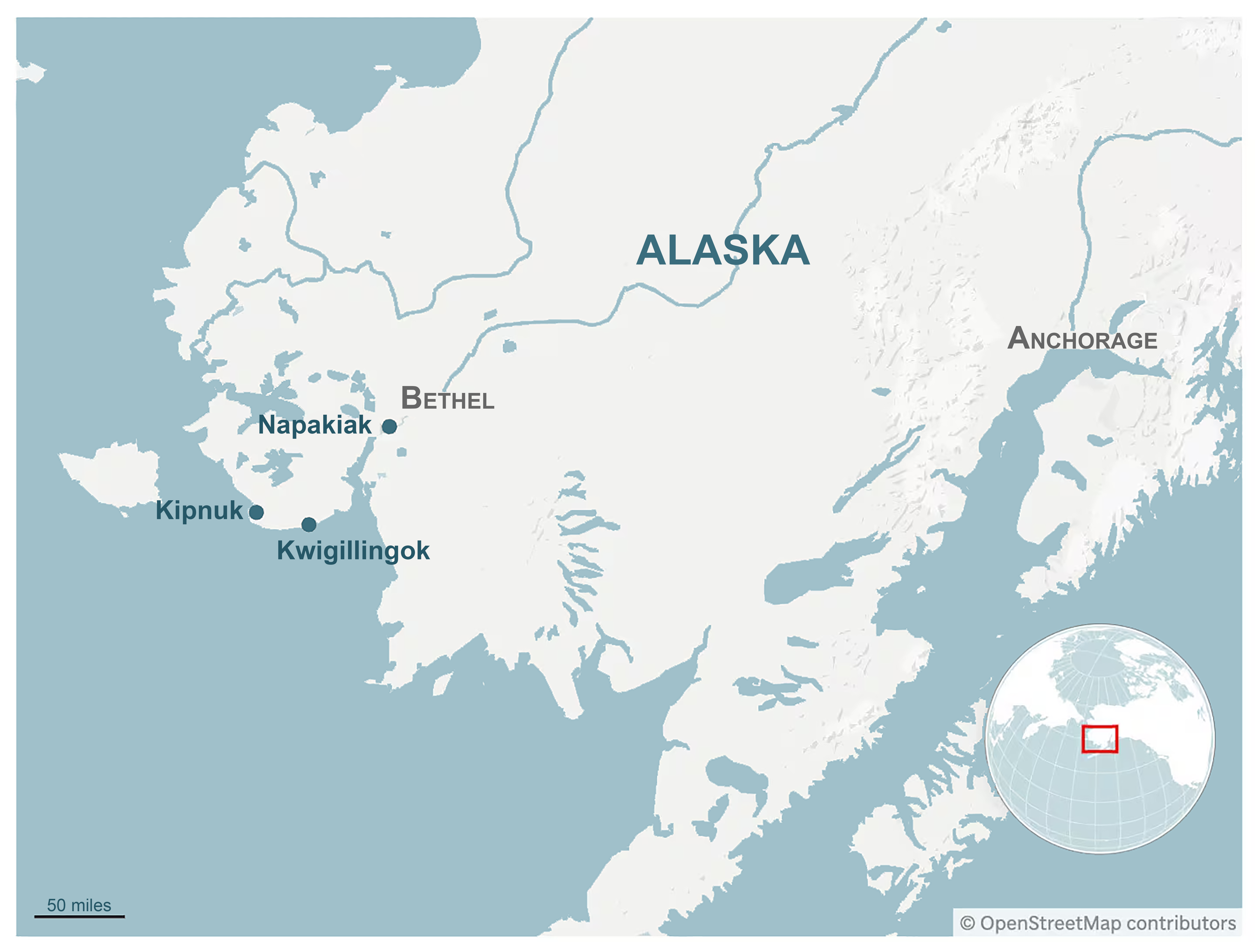
According to the Alaska Climate Research Center, warming oceans help tropical cyclones retain dangerous intensities farther north than in the past. In western Alaska, several long-term environmental changes have amplified its recent storms: warmer ocean waters, declining sea ice, and thawing permafrost. Earth-observing satellites and missions help monitor these environmental changes, offering critical insight as to why this storm was different. The National Snow and Ice Data Center (NSIDC), along with its NASA and National Oceanic and Atmospheric Administration (NOAA) programs, holds pertinent sea ice and soil data that help explain what has changed and what communities may expect in the future.
Data are not simply a means to monitor change, but an objective method to prepare for not only different storms, but as sea levels rise, a different topography. With that in mind, communities and governments around the globe may increasingly need to plan for relocation rather than assume rebuilding in place is viable. But Alaska’s threatened communities demonstrate the challenges of relocation.
Why Halong's impact was so severe
The North Pacific Ocean has warmed faster than any other global ocean basin since 2013. Since then, sea surface temperatures have spiked 0.59°C (1.06°F) above the 1990-to-2020 average, outpacing climate-model predictions. Globally, a warmer ocean is responsible for about 40 percent of sea level rise because of thermal expansion, where water expands as it warms. The other 60 percent comes from melting land ice like glaciers and ice sheets. “We’re dealing with a different ocean than we did in the past, where flooding goes places it didn’t before, causing different kinds of damage and inundation of freshwater that couldn’t be reached before,” said senior NSIDC research scientist Twila Moon. But in the Arctic, flooding and storm surges are not just the result of a higher sea level.
As the Arctic warms at three to four times the global average, sea ice loss in places like the Bering Sea has left the coastline exposed to waves and water surges. Though Arctic sea ice fluctuates from year to year, the long-term downward decline is undeniable. Across the Arctic Ocean as a whole, NSIDC data show that freeze-up is occurring about a week later per decade, meaning it now starts approximately one month later than when satellite observations of sea ice began in 1979. In western Alaska, that delay increasingly overlaps with a typhoon season that lasts well into mid-November.
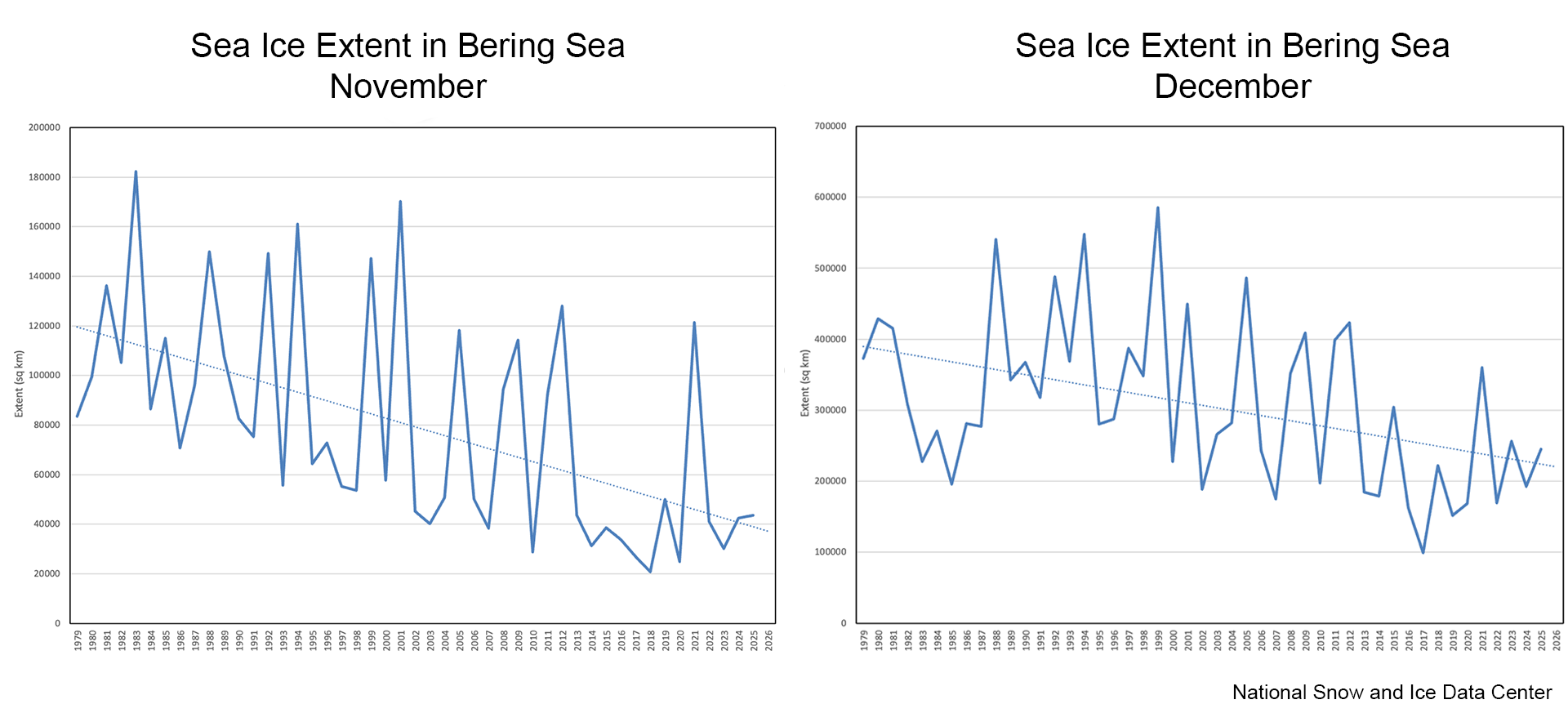
With less sea ice to buffer incoming waves, Alaska’s coastline is increasingly exposed to erosion, particularly where the ground itself is also thawing. Permafrost, or ground that remains frozen for at least two consecutive years, is the glue that holds the coastal sediment in place. As permafrost thaws, the “glue” drains into the sea and the soil’s stability weakens. Then, the ground lacks its structural integrity to uphold building in villages like Kipnuk, rendering coastlines more vulnerable to erosion.
Severe storms compound that vulnerability. In September 2022, for example, remnants of Typhoon Merbok drove unprecedented surge heights and waves exceeding 14 meters (46 feet) into western Alaska. Water surges in the Bering Sea vary by storm, but significant wave heights have increased by 1 meter from 2003 to 2023; storm surge flooding that happened once-a-century now occurs much more frequently and farther inland, as far as 23 miles inland in some locations.
The cost of not knowing
Kipnuk’s root problem, however, began over 100 years ago when the US Bureau of Indian Affairs (BIA) made decisions about a land they did not fully understand. During the late nineteenth and early twentieth centuries, BIA and the federal Office of Education implemented policies to assimilate historically nomadic and semi-nomadic communities by settling them into permanent villages. For thousands of years, Indigenous peoples understood how the delta shifted seasonally. As such, they moved with it. In winter, families moved off the coast, returning in the spring for seal hunting. Alaskan anthropologist and scholar Ann Fienup-Riordan said, “In the past, villages relocated. You can see the same name on maps very close together. That’s because the riverbank changed, so the communities moved a bit here, and a bit more, and in the past when houses were sod houses and there weren’t airports, or schools, it was relatively easy to move—not complicated and hugely expensive like now.”
BIA required that Indigenous children attend school, so it set up 56 sites, not based on where families traditionally spent the winter, but where lumber could be easily transported—close to the coasts. With no trees in the tundra, lumber arrived by barge, favoring sites closer to navigable coastal waters. “That was 100 years ago, and nobody could anticipate this,” said Fienup-Riordan. “The government was responsible for picking these places, maybe they should be responsible for relocating people now. But it’s been a long time and it’s hard to know where we could get the money to relocate communities to keep them safe.”
Before Halong hit, Kwigillingok was already pursuing relocation. Lack of centralized coordination and funding stalled any progress, and these challenges, along with where to move, continue to hinder progress for many communities. A 2024 report from the Alaska Native Tribal Health Consortium found that flooding, erosion, permafrost thaw, or some combination of the three threatens 144 Alaskan Native communities. The report estimates that protecting these communities requires either reinforcing current infrastructure, building better homes higher, or relocation with a bill of $4.3 billion over 50 years. Dozens, however, need immediate relocation. Some communities like Newtok have already been through this process.
A new frontier: Newtok and the path to relocation
It took Newtok residents decades to achieve relocation, costing $160 million for shifting roughly 300 residents nine miles to their new home of Mertarvik, on top of volcanic bedrock on Nelson Island. In 1983, the Newtok Traditional Council surveyed erosion along the Ninglick River, concluding that the river was carving up to 88 feet of land a year. Nothing could impede this severity of river erosion. Relocation was the only option.
A decade later, the community identified Mertarvik as the best option, and in 1996 the village voted to move, but finding a safer site was only the beginning. Alaska’s complex patchwork of federal, state, Native corporation, tribal, and other land ownership can make acquiring land for an entire community extraordinarily difficult. “Finding land that communities can use is a big question,” Fienup-Riordan said. “All the land is owned.” For instance, much of the Yukon-Kuskokwim coastal region falls within the federally managed Yukon Delta National Wildlife Refuge.
Only in 2003 did the federal government transfer 12,000 acres of land on Nelson Island to Newtok Native Corporation. Then, from 2006 to 2017, building infrastructure commenced on the Island. In 2019, the first families moved and the last families left Newtok in 2024.
Now imagine this

It took three decades to move Newtok, a town of 300 people, nine miles. Now consider the challenge at the scale of a major city like Jakarta, Indonesia, with its greater metropolitan area home to roughly 42 million people. As early as 2050, half the city could be submerged. Jakarta is the fastest sinking city in the world by an average of 1 to 15 centimeters (0.4 to 6 inches) per year, while its northern coasts are dipping up to 25 centimeters (10 inches) annually. “When you think about local sea level rise, you need to also consider what the land is doing,” Moon said. Rampant groundwater drilling because of a lack of clean water infrastructure compacts the soil beneath Jakarta, amplifying its sinking. That, compounded with sea level rise, has led the Indonesian government to construct a new capital, Nusantara, on the island of Borneo. The success of the new city hinges on private investment as the total bill is estimated to cost between $32 to $35 billion with the Indonesian government only covering 20 percent. If private money does not arrive, the new city could become a ghost city.

Another critical factor in identifying vulnerable areas is to understand that rising waters present differently based on geology. Miami, Florida, for instance, sits on porous limestone bedrock, allowing seawater to seep in from underground. Here, sea walls and structural support will be ineffective as streets flood from the ground up, not just from wave surges. Also, when the ocean drains into coastal aquifers, its salt contaminates drinking water. “You need to also consider where ocean currents and air circulation are piling up water,” Moon said. Winds push water up. Higher air temperatures transfer heat to the ocean, causing water to expand and take up more space. On top of that, since Miami’s groundwater sits high, there is little room for the ground to absorb rainfall. So, flooding bookends Miami from above and below.
Coastal communities are not all the same. Relative sea level does not rise uniformly around the globe. In some places near Greenland, local sea level is actually falling as the ice sheet loses mass, triggering a change in gravitational pull. So, the water that the island once pulled toward itself is now piling up elsewhere. “Parts of Greenland are surrounded by lowering seas,” Moon said, “which is also an issue. If boats can no longer access their bays, that’s a problem.” While sea level is dropping around Greenland, sea level next to the US East and Gulf Coasts is rising at some of the fastest rates.
The cost of knowing
It is becoming clearer that staying in place is not sustainable. The cost of disaster responses is rising. According to the US Geology Survey, since 1980, weather disasters have cost over $1.5 trillion from tropical cyclones alone. The number of billion-dollar disasters has more than doubled, jumping from an average of nine per year between 1980 and 2024 to 23 per year in recent years. Typhoon Halong’s total damage runs at about $125 million, according to a federal assessment, with a long and costly recovery ahead—an additional $60 million. Typhoon Merbok that hit in 2022 cost the state roughly $170 million in damage. Disaster relief, however, goes beyond the ticket price.
The impact these disasters have on communities is substantial. Displacement, trauma, lost lives, and the cost of healing all need to be considered. “People want to go home, but they have had an unforgettable traumatic experience. They don’t want their children to go through that again, but they also don’t want their children to be denied the life that is familiar to them,” said Fienup-Riordan. When Typhoon Halong hit, military aircraft transported entire communities— something Fienup-Riordan had never witnessed before—spreading them out into Bethel and Anchorage. Though safe, people had been separated from their community. Their ability to speak their Indigenous language and be a community—living close together—continues to be a huge hurdle. “It is a challenge to keep the integrity of a community together through the evacuation,” Fineup-Riordan said. “You are out of your place, out of your connection to the land, to the food.” Communities tried to stay connected through church activities, big feasts, and social gatherings, but for those living in hotel rooms, reconnecting was not easy.
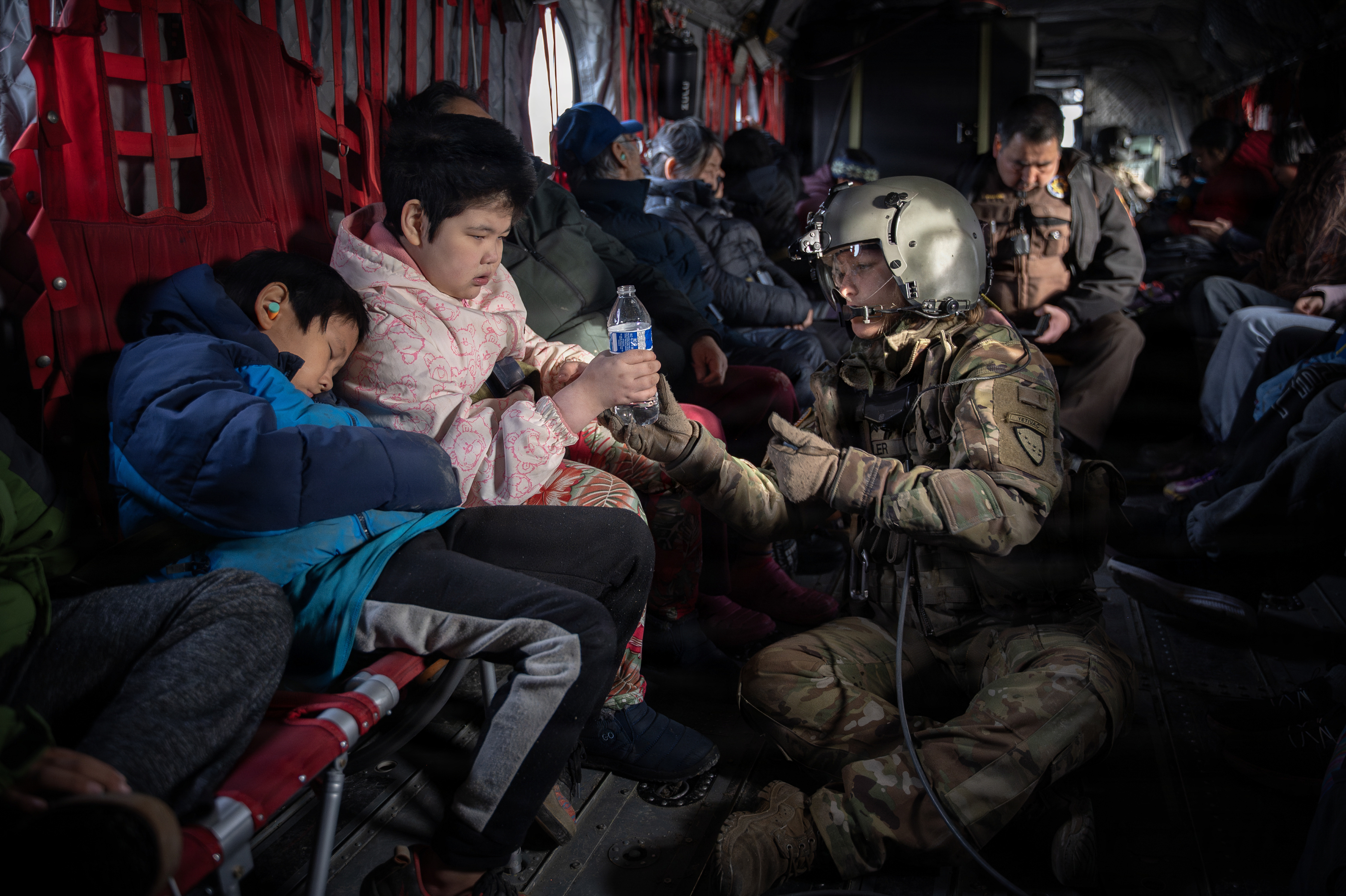
Alaska Army National Guard Sgt. Mary Miller, a CH-47 Chinook helicopter crew chief, passes a bottle of water to a child while evacuating displaced Alaskans from Kwigillingok, Alaska, during recovery operations Oct. 16, 2025. Alaska Army National Guard helicopter aircrews, with the 207th Aviation, pulled residents from hard-hit Alaskan communities and transported them to Bethel for follow-on travel to Joint Base Elmendorf-Richardson. — Credit: Sgt Joseph Moon, Alaska National Guard/Flickr
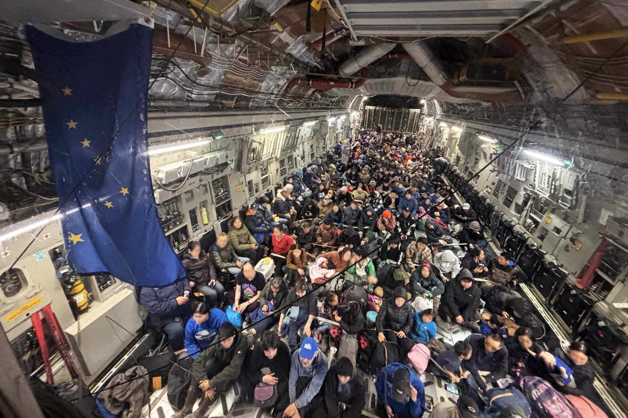
Alaska Air National Guard C-17 Globemaster III aircrew, assigned to the 176th Wing, evacuate approximately 300 displaced western Alaska residents from Bethel, Alaska, following Typhoon Halong, Oct. 15, 2025. — Credit: Sgt Joseph Moon, Alaska National Guard/Flickr
Amidst the tragedy, however, good also persisted. The Alaska Division of Homeland Security and Emergency Management worked with the Alaska Organized Militia, the US Coast Guard, and veterans to coordinate a group response to the disaster. The federal and state response impressed Fineup-Riordan. Within a week of the storm upheaving communities, children were back in school. The state tried to keep the children and their communities together. “They didn’t spread them out. They tried to keep them together as much as possible,” she added. The immediate response impressed Fineup-Riordan, but the probability that this would happen again is all too real for her.
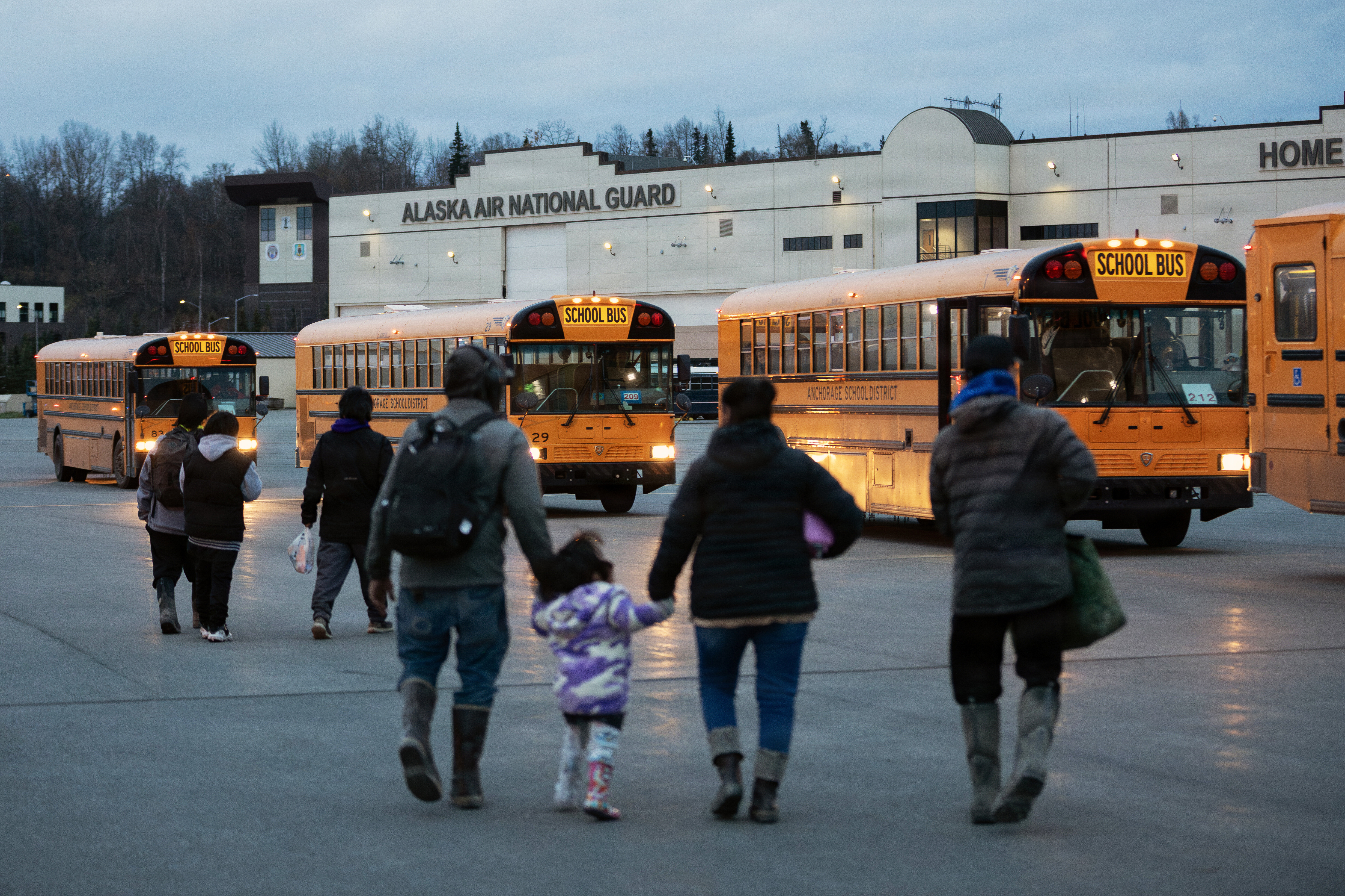
Western Alaskan communities board buses after arriving at Joint Base Elmendorf-Richardson (JBER), Alaska, Oct. 15, 2025. Alaska Air National Guard evacuated approximately 300 evacuated residents from western Alaska. The C-17 aircrew transported the displaced residents from Bethel to JBER during recover operations following Typhoon Halong. — Credit: Alejandro, Alaska National Guard/Flickr
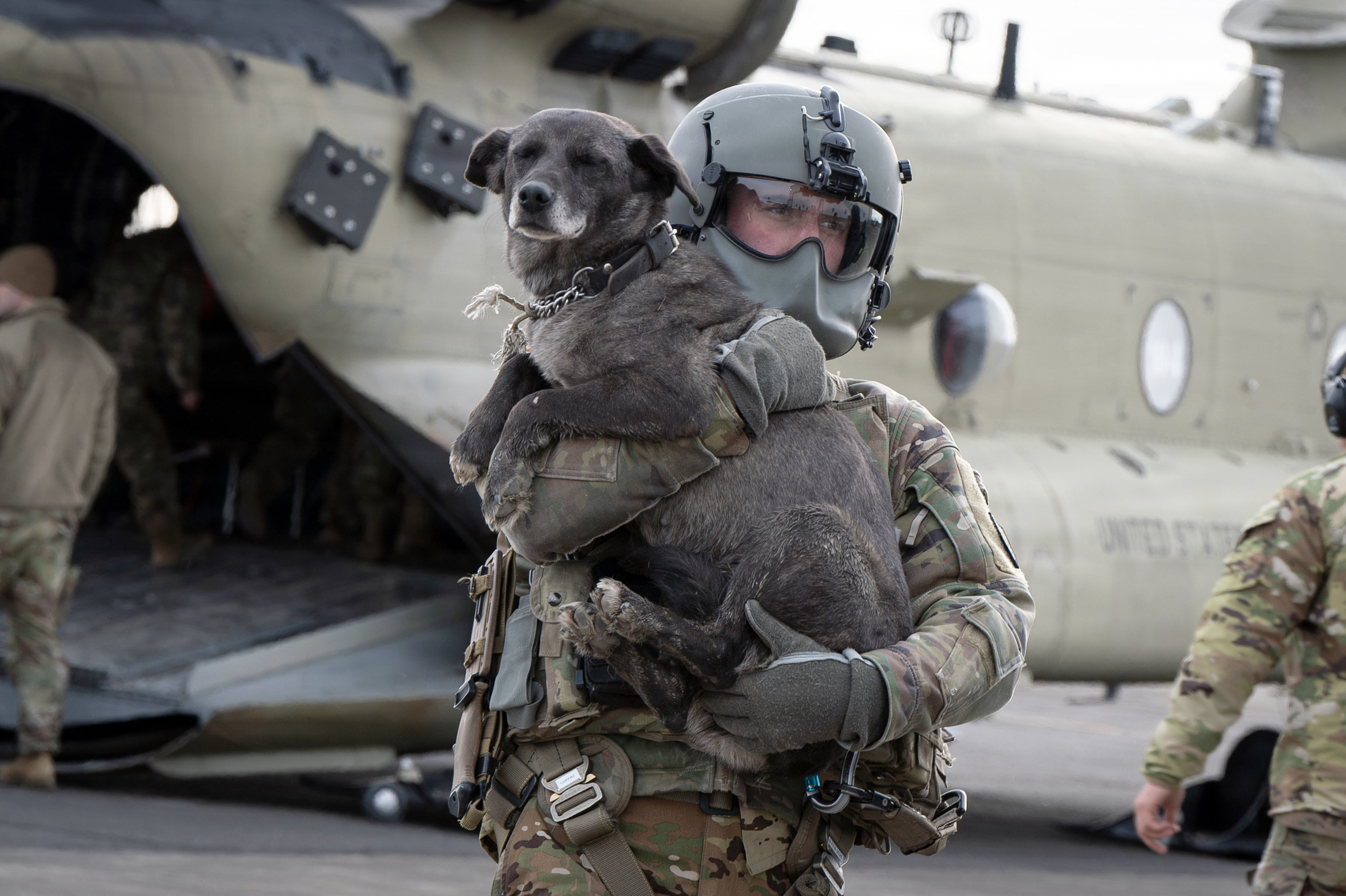
Alaska Army National Guard Sgt. Max Hardy carries a dog during recovery operations at Bethel, Alaska, Oct. 16, 2025. Alaska Army National Guard helicopter aircrews pulled residents from hard-hit Alaskan communities and transported them to Bethel for follow-on travel to Joint Base Elmendorf-Richardson. — Credit: Sgt Joseph Moon, Alaska National Guard/Flickr
Fineup-Riordan highlights a critical limitation within the Federal Emergency Management Agency (FEMA): its focus on rebuilding rather than relocation. “That is problematic,” she said, noting Alaska’s rapidly shifting climate. Fall storms are strengthening, permafrost is thawing, seasons are changing, and coastal sea ice freezes later. Ultimately, the landscape is changing, and while federal and state agencies excel at immediate disaster relief, they struggle to support long-term adaptation.
Grounded hope
As a glaciologist, Moon has a front row seat as to how quickly glacial systems are speeding up. “These systems are dynamic. There are so many mechanisms in place for the Greenland and Antarctic Ice Sheets to respond in very short time scales because of human-caused climate change,” she added. Better observations cannot prevent these changes, but they can help communities and policymakers make more informed decisions about them. New satellites and other observing systems can improve projections of where and how quickly ice loss, land motion, erosion, and water levels are changing. Those observations feed models that can help inform flood-risk maps, infrastructure planning, adaptation investments, and, where necessary, decisions about relocation.
Referring to Typhoon Halong, Fienup-Riordan said, “People are no longer saying if, but when, another storm like this will happen.” Where we go from here is dependent on funding and coordination between communities and government. “Communities want to go home, but how that can happen and if, are difficult to see clearly right now,” she added.
The reality is that the physical geography communities have built their lives around is transforming. Adaptation therefore has to account not only for physical constraints, but for financial and emotional realities as well. As Moon puts it, “What you commonly see is people hoping for a future that looks like the past, and that is not physically possible. We need to take some time for deep grief, sadness, anger, and loss. Then, serious reflection about what’s possible because when you look to the future, there is a range of what arrives. And we need to work and hope towards the best possible outcome, but that hope must be grounded in possible realities.”
Access data through the NASA NSIDC DAAC
NASA’s NSIDC DAAC manages, distributes, and supports a variety of cryospheric and climate-related datasets as one of the discipline-specific Earth Science Data and Information System (ESDIS) data centers within NASA’s Earth Science Data Systems (ESDS) Program. These observations help scientists understand changing conditions across the cryosphere, including sea ice and snow cover. User Resources include data documentation, help articles, data tools, training, and on-demand user support. Learn more about NSIDC DAAC services.
The Near-real-time Ice and Snow Extent (NISE) data set provides daily, global maps of sea ice concentrations and snow extent, offering a best estimate of current ice and snow conditions based on information and algorithms available at the time the data are acquired.
NOAA@NSIDC data highlighted in this article
The Sea Ice Index provides a quick look at Arctic- and Antarctic-wide changes in sea ice. It is a source for consistent, up-to-date sea ice extent and concentration images, in PNG format, and data values, in GeoTIFF and ASCII text files, from November 1978 to the present.
Permafrost Data
Circumpolar Active Layer Monitoring (CALM) Program Network
The CALM network includes 168 active sites in both hemispheres with 15 participating countries. This network represents the only coordinated and standardized program of observations using standard measurement protocols designed to observe and detect decadal changes in the dynamics of seasonal thawing and freezing in high-latitude soils.