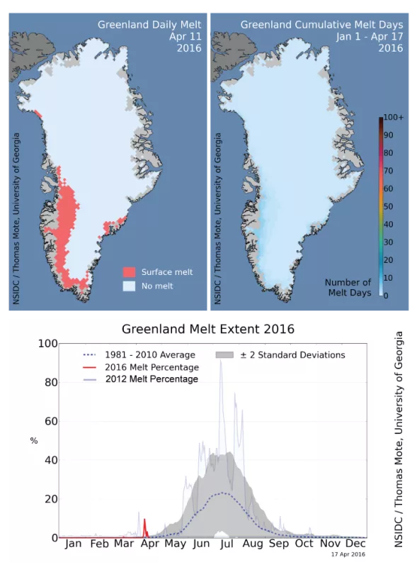
For six days in early April, unusual weather patterns produced an early season melt event on the Greenland Ice Sheet, covering up to 10 percent of its surface area. Such an event is unusual but not unprecedented; the record surface melt season of 2012 began in a similar manner. Local meteorological records were set in southwestern Greenland towns and at several ice sheet weather stations.
Overview of conditions
An early melt event occurred on April 10 through April 15, encompassing the central western and southeastern Greenland coastal areas. The event was a result of a large pulse of mid-Atlantic air moving northward, bringing record warm air to the entire ice sheet and rain along the western coast. Approximately 10 percent of the ice sheet surface melted on April 11, dropping to 5 percent on April 12 and less on later days. A melt event of similar magnitude occurred on April 6 to 9 of 2012, which became the current record surface melt and melt-runoff season for the satellite era (since 1978). (These values and dates are slightly different from those reported in other news releases, because they are based on different snowmelt mapping methods). Early melt events are important as they lower the surface albedo by increasing the snow grain size. A lower albedo allows for more absorption of the sun’s energy, fostering more ice melt.
Conditions in context
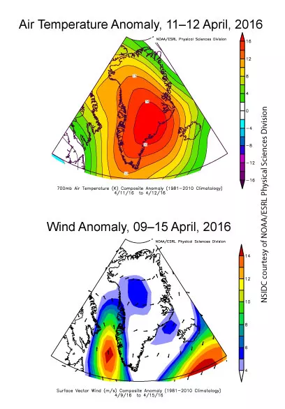
A surge of warm, moist air caused the early melt event. The air mass moved almost due north from the mid-Atlantic region along the western coast of Greenland, and then eastward across the ice sheet. On April 10, melting was confined to a narrow region of the southwestern coast, which spread on April 11 inland along the west side of the ice sheet and to the southeastern coast. During the last days of the melt event, melting was confined to the far southern coasts of the island. Conditions were warm throughout Greenland. Near-record April temperatures in Kangerlugssuaq reached 17.8 degrees Celsius (64 degrees Fahrenheit) and -6.6 degrees Celsius (20.1 degrees Fahrenheit) at the Summit research station. Data from NCEP/NCAR atmospheric reanalysis show that during the first three weeks of April near-surface air temperatures were 4 to 8 degrees Celsius (7 to 14 degrees Fahrenheit) above average over the entire ice sheet, with the largest departures over northwest Greenland. During the melt event, temperatures rose up to 16 degrees Celsius (29 degrees Fahrenheit) above average for this time of year.
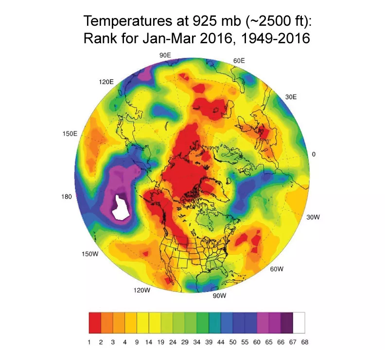
These warm April conditions follow on the warmest winter (January 1 to March 31, 2016) recorded for the Arctic. Large areas of the Arctic reported the warmest conditions in 67 years of weather model data, including the northern half of the Greenland Ice Sheet, much of the central Arctic, southern Alaska and the Canadian Rockies, and parts of central Siberia. The north-central Pacific and northern Atlantic saw temperatures among the lowest on record for that period.
How’s the snow this year in Greenland?
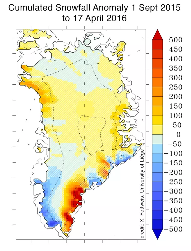
Fall, winter, and early spring snowfall in Greenland is near-average, except in South Greenland where anomalies are higher than the interannual variability. Above average snow totals occurred in the southeast while snowfall was below average along the southern western coast where the early melt event occurred. Last season’s snow can absorb much of this early meltwater. However, a lower than normal winter snowpack combined with this early melt event favor higher summer melt in this area because bare ice below the winter snow cover should appear sooner. Snowfall also plays an important role in the albedo of the ice sheet. New snow has an albedo between 0.85 and 0.90, absorbing only 10 to 15 percent of the incoming solar energy, but as warm conditions and surface melting continue, the surface darkens as the snow becomes coarse and wet.
Further reading
The 2016 Greenland Ice Sheet SMB simulated by MARv3.5.2 in real time
Polar Portal: Unusually Early Greenland Melt
Polar Portal: Monitoring ice and climate in the Arctic (GEUS, DMI, DTU) c/o Dr. Jason Box, Geological Survey of Denmark and Greenland (GEUS) Greenland Melting
PROMICE: Programme for Monitoring of the Greenland Ice Sheet


