Cryosphere glossary
from the point of view of the submariner, an ice canopy containing no large ice skylights or other features which permit a submarine to surface.
(1) water vapor content of the air. (2) some measure of the water-content of air; see also absolute humidity, relative humidity, specific humidity, dew point.
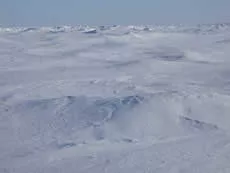
(1) [sea ice] a smooth hill of ice that forms on the sea ice surface from eroding ridges, particularly during the summer melt; the formation of hummocks is similar to young mountain peaks with steep slopes that erode into smooth, rolling hills. (2) [frozen ground] Small lumps of soil pushed up by frost action, often found in uniformly spaced in large groups. Hummocks can form in areas of permafrost or seasonally frozen ground, and are one of the most common surface features of the Arctic.
Image

Hummocks make the sea ice surface appear as rolling hills.
Ted Maksym, United States Naval Academy
a form of weathering that affects all rocks; water freezes in pores and cracks, which leads to an increase in specific volume (vol/unit mass) of the water, producing stress that is greater than the tensile strength of all common rocks; ultimately leads to shattering and fracturing of the rocks.
the volume of fluid passing through a unit cross section in unit time under the action of a unit hydraulic potential gradient.
the ratio of the hydraulic conductivity and the storage capacity of a groundwater aquifer.
artificial thawing (and removal) of frozen ground by the use of a stream or jet of water under high pressure.
a layer or body of cryotic (but unfrozen) ground in a permafrost area, maintained by moving mineralized groundwater.
hierarchical designation consisting of two additional digits for each level of specificity; established by the US Geological Survey to delineate portions of the United States based on surface features related to the distribution and movement of water. The HUC system divides the United States into 21 two-digit regions, 222 four-digit subregions, 370 six-digit basins, and smaller regions designated by additional digits.
any product of condensation or sublimation of atmospheric vapor, whether formed in free atmosphere or at the earth's surface; also any water particles blown by the wind from the earth's surface.
a layer or body of noncryotic unfrozen ground in a permafrost area, maintained by moving groundwater.
an instrument which measures the water vapor content in the atmosphere; there are several different means of transduction used in measuring this quantity and hence various types of hygrometers; these are: a) the psychrometer, which utilizes the thermodynamic method; b) the class of instruments which depends upon a change of physical dimension due to absorption of moisture (hair hygrometer, for example); c) those which depend upon condensation of moisture (dew point hygrometer); d) the class of instruments which depend upon the change of chemical or electrical properties due to absorption of moisture, and some others.