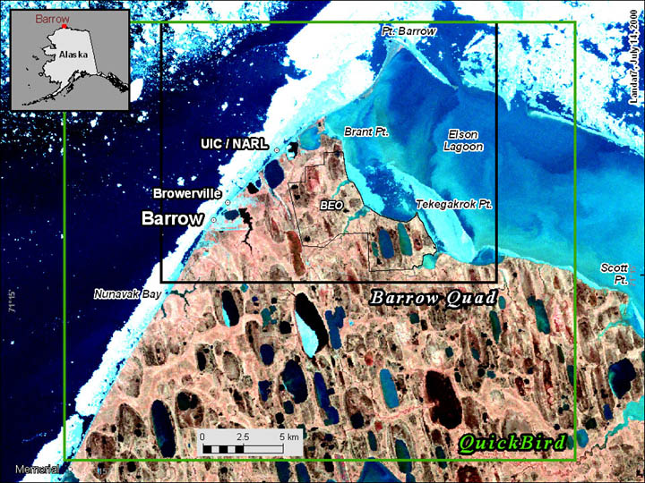
Spatial extent of the QuickBird image (green lines) and Barrow Quadrangle (black lines) data. Image courtesy of William Manley.