Service Interruption
High-Resolution Radar Imagery, Digital Elevation Models, and Related
GIS Layers for Barrow, Alaska: Coverage Map
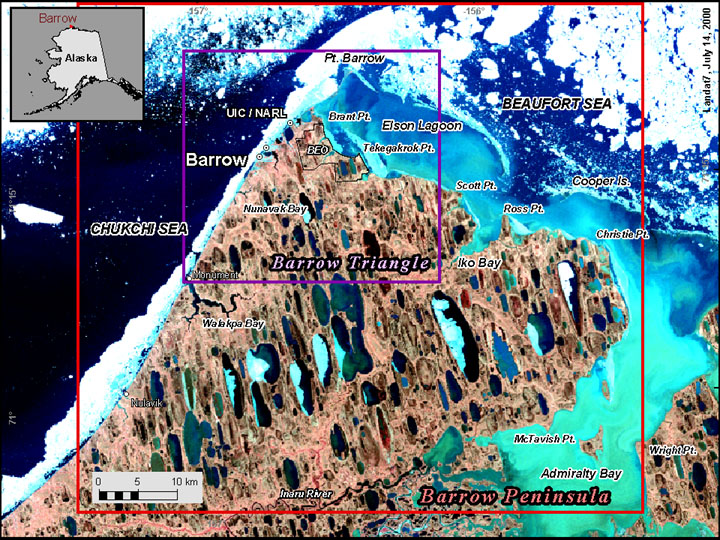
Spatial extent of the Barrow Peninsula (red lines) and Barrow Triangle (purple lines) data sets. Image courtesy of William Manley.