How do I order subsetted ICESat/GLAS HDF5 data in Earthdata Search?
NASA Earthdata Search is a map-based web interface for discovering and ordering data using spatial and temporal filters. This article explains how to search for ICESat/GLAS data based on spatial and temporal constraints. Additionally, you can subset files based on spatial bounding box, parameter, and temporal range, as well as reformat the data to ASCII.
Step 1: Search for the short name of the data you want
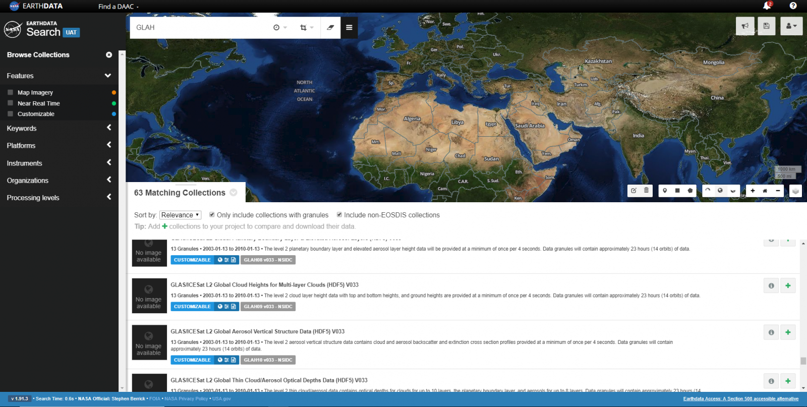
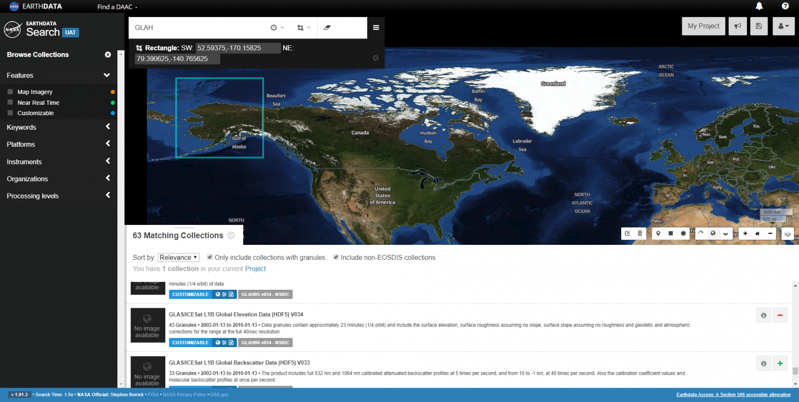
The ICESat/GLAS HDF5 data sets are listed on the NSIDC DAAC ICESat/GLAS data collection subsite. The short names are included in parentheses at the end of the data set title (for example, GLAH14). If you are interested in more than one data set, or if you'd like to browse all available GLAS HDF5 data sets, type "GLAH" into the search bar which will return all ICESat/GLAS HDF5 data sets.
Once you have the short name, go to the NASA Earthdata Search website and enter the data short name of interest into the search bar.
Step 2: Filter results by spatial or temporal constraints
If you are interested in filtering the data by a time period or region of interest, you can use the Temporal and Spatial filter options next to the search bar at the top of the page.
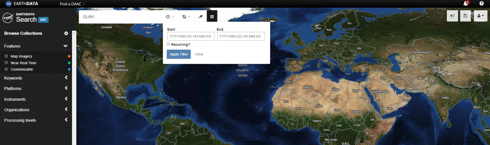
Clicking on the Start and End boxes allow you to drill down to the beginning and end dates of interest. GLAS data were collected from 20 February 2003 to 11 October 2009.
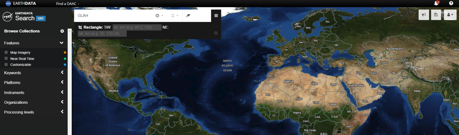
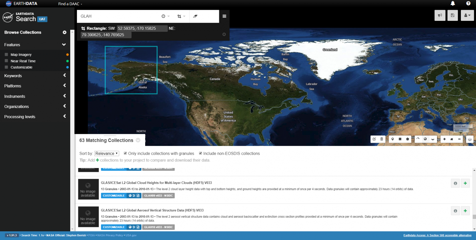
The Spatial filter includes several options for filtering, located next to the temporal filter. The rectangle option results in a map drawing tool, allowing you to draw a bounding box on the map. You can also write in the Southwest and Northeast points underneath the search box if you have specific coordinates of interest. For best results, enter a bounding box of at least 0.5° x 0.5°.
Step 3: Add the data sets (collections) of interest to your project
To add data sets (collections) of interest to your project click on the green '+' symbol on the far right side of the data set listing. Next, click on the gray "My Project" button at the top right on the page.
Step 4: Login to your Earthdata account
You will be directed to the Earthdata Login authentication page. Enter your Earthdata Login username and password, or register for a new account if needed. You will then land on the Data Access page, providing information on the data granules requested and data access methods. Under "Select Data Access Method" click on the "Customize Product" radio button, which will allow you to request data subsetting and reformatting services.
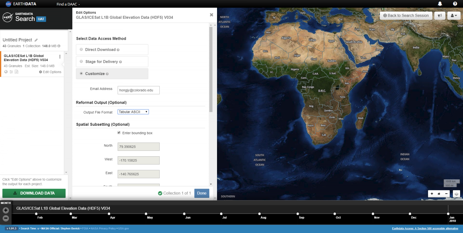
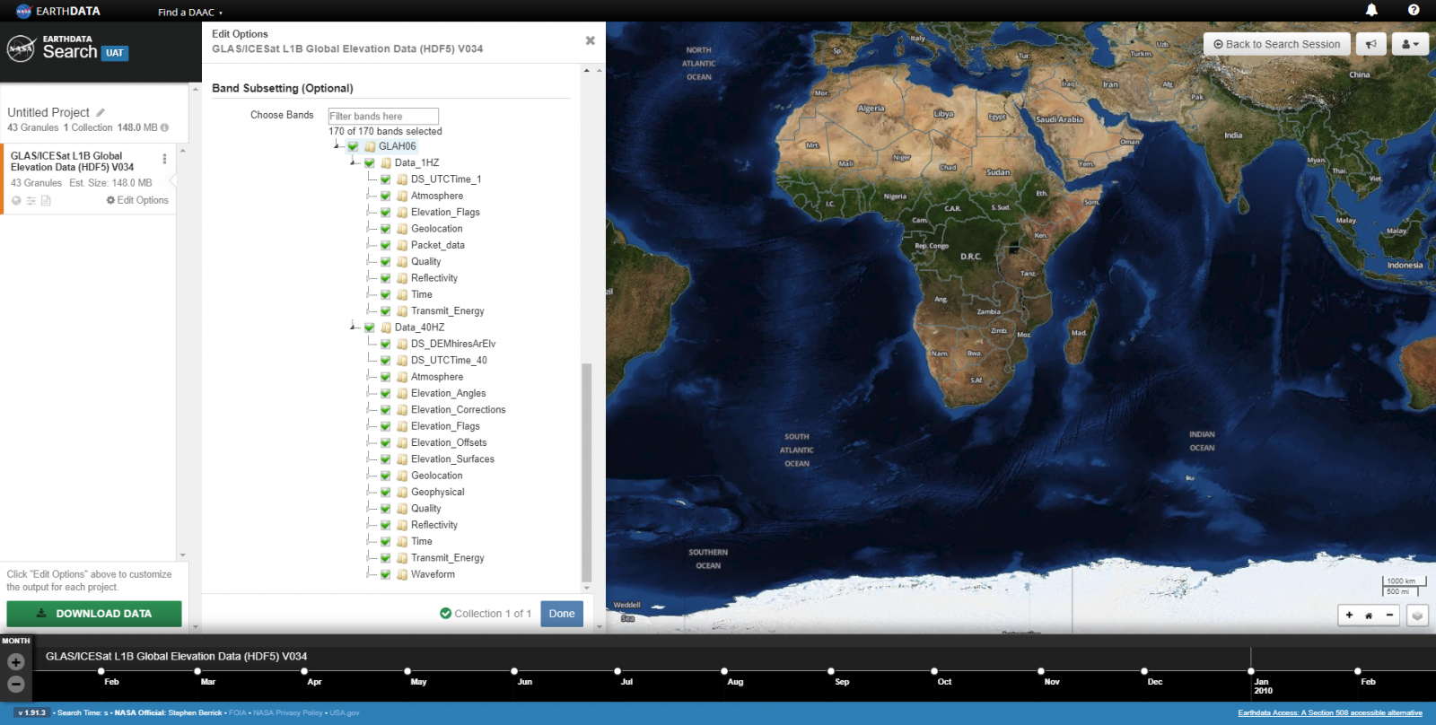
The last option on the form is Band Subsetting. All parameters contained within the HDF5 granules can be viewed by expanding the nodes. Click on the box next to each group or parameter to select or deselect. You can also search for parameters using the search bar next to Choose Bands.
Step 5: Submit your request
Click on the blue "Done" button at the bottom of the form. If you have more than one data set in your Project, repeat Step 4. Click on the green "Download Data" button once you are ready to submit your request. If your request exceeds 2000 granules, the order will be separated into 2000 granule chunks.
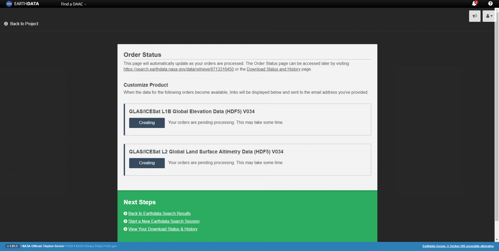
Step 6: Receive your request
Your request will begin to process. You will receive an email indicating that your request is pending, and you will receive an additional email with information on how to retrieve your files when the processing is complete. You can also download your order directly from Earthdata Search when complete.
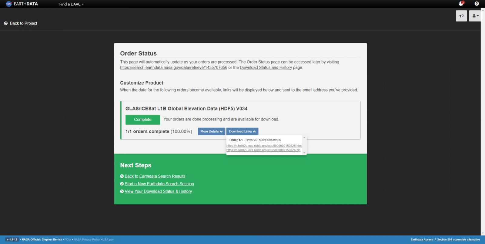
The first link contains additional information including the request summary, a list of input files, the zipped file containing all output files, and download links for each individual output file. The .zip link is also displayed below the .html link on this page for convenience. Stitching is an additional feature which produces a single file from the individual output files (only available for HDF5 format). This stitched file is returned in a separate email upon completion, and is also provided in the .html link when complete.
If you are interested in accessing these services programmatically using an API endpoint, please see the following guide:
Last Updated April 2019