GLIMS book authors: check Contents, authors, flags

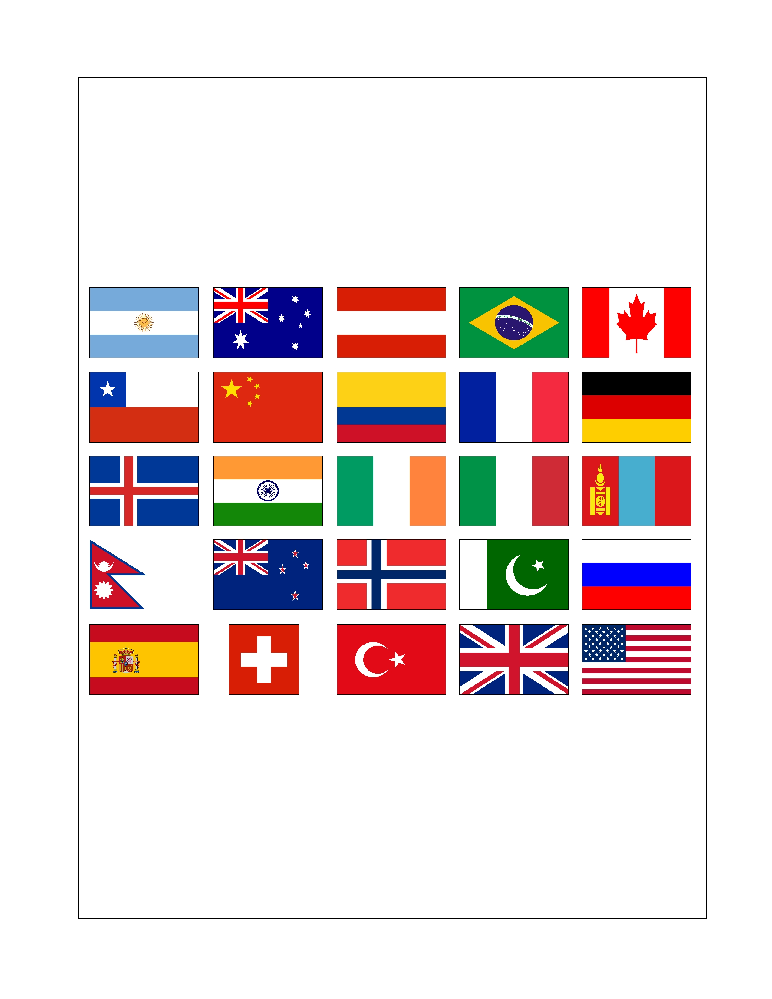
Dear GLIMS book authors:Please check the attachments, and: 1. Verify that the contents of your chapter are correct as listed (all sections, subsections, sub-subsections are listed correctly). There have been minor corrections since that last version was sent. 2. Verify that the author list is correct (and if you wish an expanded name, rather than initials, let us know). 3. Verify that the flags are accurate and are modern versions. Note that the flags are of the nations hosting the authors' institutions; if you wish your country of citizenship to be represented instead or in addition, let us know. (We will include the flags as a pictorial acknowledgement only if it is apparent that there are no strong objections from authors to include the flags, and that there are no incendiary statements implied by the depicted flags, i.e., these should be flags of U.N.-recognized states and the current, official flags recognized by each of the states. If anybody perceives a big problem, let me know, and we will delete plans for this pictorial acknowledgment. We will not imply that the book is an official product of the depicted nations, only that the book was written by a many-nation group of scientists. 4. If you wish for us to make an equivalent montage to depict funding agencies, please send the logo of that agency. We will not imply that this book was produced by those agencies, only that they provided support for some of the work contained in the book. If we get five or more agencies including NASA and ESA, we will include their logos (again, without implying any official link or approval, just that they funded some related research). Sincerely, Jeff Kargel Global Land Ice Measurements from Space Publisher: Springer-Praxis Books, Subseries: Geophysical Sciences ISBN: 978-3-540-79817-0 Editors: Jeffrey S. Kargel, Gregory J. Leonard, Michael P. Bishop, Andreas Kääb, and Bruce H. Raup CONTENTS Dedication Preface (Hugh H. Kieffer) Prologue (Jeffrey S. Kargel) Acknowledgements Part I Glacier Monitoring and Fundamentals of Glacier Remote Sensing (or Glacier Monitoring and Satellite Remote Sensing of Glaciers) 1 Introduction: Global Glacier Monitoring – a Long-Term Task Integrating In-Situ Observations and Remote Sensing (Michael Zemp, Richard Armstrong, Isabelle Gärtner-Roer, Wilfried Haeberli, Martin Hoelzle, Andreas Kääb, Jeffrey S. Kargel, Siri Jodha Singh Khalsa, Gregory J. Leonard, Frank Paul, Bruce H. Raup) 1.1 Why this Book? 1.2 Perennial Surface-Ice on Land 1.2.1 Definitions 1.2.2 Global Coverage 1.3 Glaciers and Climate 1.3.1 Formation of Glaciers and their Dynamical Controls 1.3.2 Glacier Reactions to Climate Change, and Response Times 1.3.3 Reporting Glacier Change Rates 1.4 International Glacier Monitoring 1.4.1 History of the International Glacier Monitoring in the 19th and 20th Century 1.4.2 The Global Terrestrial Network for Glaciers (GTN-G) 1.4.3 Available Data Sets 1.4.4 Challenges of the 21st Century 1.5 Glacier Observations from Space 1.5.1 Satellite Observations in GTN-G 1.5.2 Possible Applications 1.5.3 Challenges 1.6 Integrative Glacier Change Assessments 1.7 Synopsis and Organization of the Book 1.8 Conclusions Acknowledgements References 2 Theoretical Foundations of Remote Sensing for Glacier Assessment and Mapping (Michael P. Bishop, Andrew B.G. Bush, Roberto Furfaro, Alan R. Gillespie, Dorothy K. Hall, Umesh K. Haritashya, and John F. Shroder Jr.) 2.1 Introduction 2.2 Radiation-Transfer Cascade 2.2.1 Solar Irradiance 2.2.2 Surface Irradiance 2.2.2.1 Direct Solar Spectral Irradiance 2.2.2.2 Diffuse-Skylight Spectral Irradiance 2.2.2.3 Adjacent-Terrain Spectral Irradiance 2.2.3 Surface Reflectance 2.2.3.1 Bidirectional Reflectance Distribution Function and Albedo 2.2.4 Surface Emission 2.3 Surface-Energy Interactions 2.3.1 Snow 2.3.2 Glaciers 2.3.3 Water 2.4 Complications 2.5 Space-Based Information Extraction 2.5.1 Snow Cover 2.5.2 Ice Sheets 2.5.3 Alpine Glacier Mapping 2.5.4 Debris-Covered Glaciers 2.5.5 Snow Line and ELA 2.5.6 Ice-Flow Velocities 2.6 Numerical Modeling 2.6.1 Climate Modeling 2.6.2 Energy-Balance Modeling 2.6.2.1 Net Radiation 2.6.2.2 Turbulent Heat Fluxes 2.6.2.3 Ground Heat 2.6.3 Glacier Mass-Balance Modeling 2.7 Conclusions 2.8 Appendices 2.8.1 Notation Acknowledgements References 3 Radiative Transfer Modeling in the Cryosphere (R. Furfaro, A. Preveti, P. Picca, J. S. Kargel, and M. P. Bishop) 3.1 Introduction 3.2 Radiative Transfer Modeling of Glacier Surfaces and Lakes 3.2.1 RT Modeling Approach for Glacier Surfaces 3.2.2 Radiative Transfer Equation in Layered Mixtures of Snow, Ice, and Debris 3.2.3 Radiative-Transfer Equation in Glacier Lake Waters 3.3 Optical properties of snow, ice, debris, mixtures, and glacier lake water 3.3.1 Snow 3.3.2 Glacier ice 3.3.3 Rock Debris 3.3.4 Mixtures 3.3.5 Glacier Lake Water 3.4 Numerical Solution of the RTE 3.5 Glacier Radiative-Transfer Simulation Examples 3.6 Conclusions References 4 Glacier Mapping and Monitoring Using Multi-Spectral Data (Andreas Kääb, Tobias Bolch, Kimberly Casey, Torborg Heid, Jeffrey Kargel, Gregory Leonard, Frank Paul, Bruce Raup) 4.1 Introduction 4.2 Image Preprocessing 4.2.1 Radiometric Calibration 4.2.2 Geometric Preprocessing 4.3 Multi-Spectral Methods 4.3.1 Spectral Reflectance of Glacier Surfaces 4.3.1.1 Snow 4.3.1.2 Ice 4.3.1.3 Rock 4.3.1.4 Water 4.3.1.5 Vegetation 4.3.2 Image Classification Approaches 4.3.2.1 Hard and Soft Classification 4.3.2.2 Manual, Supervised and Unsupervised Classification 4.3.2.3 Parametric and Non-Parametric Classification 4.3.2.4 Spatial and Spectral Segmentation 4.3.2.5 Sub-Pixel Classification 4.3.2.6 Combinations and Others 4.3.3 Image Processing Techniques 4.3.3.1 Manual Delineation 4.3.3.2 False-Color Composites 4.3.3.3 Calculation of Reflectance 4.3.3.4 Spectral Transforms 4.3.3.5 Image Algebra and Segmentation 4.3.3.6 Unsupervised Classification 4.3.3.7 Supervised Classification 4.3.3.8 Artificial Neural Networks 4.3.3.9 Combinations 4.3.4 Post-Processing and GIS Workflow 4.4 Mapping Debris-Covered Ice 4.5 Thermal Imaging 4.6 Microwave/SAR Methods 4.7 Spectral Change Detection and Temporal Data Merging 4.7.1 Overview 4.7.2 Image Change Evaluation by Subtraction of Multispectral Anniversary Pairs (ICESMAP) 4.7.2.1 Generalized ICESMAP Processing Steps 4.8 Ice Flow 4.8.1 Image Choice and Preprocessing for Image Matching 4.8.2 Image Matching Techniques 4.8.3 Post-processing and Analysis 4.8.4 Accuracy 4.8.5 SAR Offset Tracking and Interferometry 4.9 Challenges, Conclusions and Perspectives Acknowledgements References 5 Digital Terrain Modeling and Glacier Topographic Characterization (Duncan J. Quincey, Michael P. Bishop, Andreas Kääb, Etienne Berthier, Boris Flach, Tobias Bolch, Manfred Buchroithner, Ulrich Kamp, Siri Jodha Singh Khalsa, Thierry Toutin, Umesh K. Haritashya, Adina Racoviteanu, John F. Shroder Jr., Bruce H. Raup) 5.1 Introduction 5.2 Background 5.3 Digital Elevation Model Generation 5.3.1 Source Data 5.3.2 Aerial and Satellite Image Stereoscopy 5.3.3 Ground Control Points 5.3.4 Software Packages 5.3.5 Post Processing (interpolation and smoothing) 5.3.6 Data Fusion 5.4 DEM Error and Uncertainty 5.4.1 Representation of DEM Error and Uncertainty 5.4.2 Type and Origin of Errors 5.5 Geomorphometry 5.5.1 Geomorphometric Land Surface Parameters 5.5.2 Scale-Dependent Analysis 5.5.3 Topographic Radiation Modeling 5.5.4 Altitude Functions 5.5.5 Glacier Elevation Changes and Mass-Balance Calculations 5.6 Glacier Mapping 5.6.1 Pattern Recognition 5.6.2 Artificial Intelligence Techniques 5.6.3 Object-Oriented Mapping 5.7 Discussion 5.8 Conclusions Acknowledgements References 6 ASTER datasets and derived products for global glacier monitoring (Bhaskar Ramachandran, John Dwyer, Bruce H. Raup, Jeffrey S. Kargel) 6.1 Introduction 6.2. ASTER Data Access and Use Policy 6.3. ASTER data 6.3.1. Performance of ASTER VNIR, SWIR, and TIR 6.3.1.1. Доверяй, но проверяй (doveryai, no proveryai; “Trust, but verify”) 6.3.1.2. Performance Overview 6.3.2.3. Radiometric Calibration 6.3.2.4. Geometric Corrections 6.3.2.5. Earth Rotation Angle Error 6.3.1.6. Nutation-related Longitudinal Error 6.3.2.7. Earth Ellipsoid-related Terrain Error 6.3.2.8. Loss of SWIR 6.4. ASTER Data Processing Stream 6.4.1. Standard Level-1A and Level-1B 6.4.2. ASTER Standard Higher-Level Products 6.4.2.1. Reflectance Suite 6.4.2.2. Temperature/Emissivity Suite 6.4.2.3. Detection Versus Full Resolution of Features in VNIR, SWIR, and TIR 6.4.2.4. Elevation Products 6.5. ASTER Data for GLIMS: STARs, DARs, Gain Settings, and Image Seasons Acknowledgments References 7 Quality in the GLIMS Glacier Database (B. H. Raup, S. J. S. Khalsa, R. Armstrong, W. A. Sneed, G. S. Hamilton, F. Paul, F. Cawkwell, M. J. Beedle, B. Menounos, R. Wheate, H. Rott, S. Liu, X. Li, D. Shangguan, G. Cheng, J. S. Kargel, C. F. Larsen, B. F. Molnia, J. L. Kincaid, A. Klein, V. Konovalov) 7.1 Introduction 7.2 Standard Methods and Tools 7.3 Accuracy and Precision in Glacier Mapping 7.4 The Glacier Analysis Comparison Experiments (GLACE) 7.4.1 GLACE 1 and GLACE 2 7.4.2 GLACE 2A and GLACE 3A (Manual Digitization) 7.5 GLACE Results 7.5.1 GLACE 1 and GLACE 2 7.5.2 GLACE 2A and GLACE 3A 7.5.3 Discussion 7.6 GLIMS Glacier Database and the Data Ingest Process 7.6.1 Ingest Quality Control Steps 7.6.2 Representation of Measurement Error 7.6.3 Derived Parameters in the Database 7.7 Conclusion Acknowledgements References Part II Regional Chapters 8 Mapping of Glaciers in Greenland (Leigh A. Stearns and Hester Jiskoot) 8.1 Greenland Glaciology 8.1.1 Ice Sheet Mass Changes 8.2 Case Study #1: Central East Greenland Margin Fluctuations and Climate Sensitivity from a GLIMS Glacier Inventory and ASTER DEM 8.2.1 Introduction 8.2.2 Methods 8.2.3 Results 8.3 Case Study #2: A Comparison of High-Rate GPS and ASTER-Derived Measurements on Helheim Glacier 8.3.1 Introduction 8.3.2 Data 8.3.3 Results 8.3.4 Discussion and Conclusions References 9 Remote Sensing of Recent Glacier Changes in the Canadian Arctic (Martin Sharp, David O. Burgess, Fiona Cawkwell, Luke Copland, James A. Davis, E. K. Dowdeswell, J. A. Dowdesewell, Alex S. Gardner, Douglas Mair, Libo Wang, Scott N. Williamson, Gabriel J. Wolken, Faye Wyatt) 9.1 Introduction 9.2 Regional Context 9.2.1 Geology and Physiography 9.2.2 Climate and Recent Climate Trends in the Canadian Arctic 9.2.3 Glacier Characteristics 9.3 Special Topics: Regional Glacier Mass Balance and Proxy Indicators 9.3.1 Surface Mass Balance and Mass Balance Changes 9.3.2 Summer Melt 9.3.3 Ice Flow and Iceberg Calving Fluxes 9.4 Case Studies 9.4.1 Surge-Type Glaciers 9.4.2 Northern Ellesmere Island Ice Shelves 9.5 Regional Synthesis: Recent Changes in Equilibrium Line Altitude and Glacier Extent 9.5.1 Methodology 9.5.2 Results 9.6 Key Issue 9.6.1 Changes in Glacier Surface Elevation, Volume and Mass; Sea Level Contributions 9.7 Summary and Conclusions References 10 A Digital Glacier Database for Svalbard (Max König, Christopher Nuth, Jack Kohler, Geir Moholdt, Rickard Pettersen) 10.1 Introduction 10.2 Regional Context 10.3 Database Structure 10.4 Data 10.4.1 The Original Topographic Map of Svalbard (S100) – 1936 / 1966 / 1971 10.4.2 The 1990 Photogrammetric Survey 10.4.3 The Satellite Dataset 10.5 Methodology 10.5.1 Creation of Glacier Outlines from Cartographic Data for the 1936/66/71 Dataset 10.5.2 Creation of Outlines from Cartographic Data for the 1990 Dataset 10.5.3 Creation of Outlines from Satellite Data for the 2001-2010 Dataset 10.5.4 Glacier and Snow Patches Smaller than 1 km2 10.6 Results 10.7 Conclusions and Future Perspectives Acknowledgements References 11 Glaciers of Kenai Fjords National Park and Katmai National Park and Preserve, Alaska (Bruce A. Giffen, Dorothy K. Hall, Janet Y. L. Chien) 11.1 Introduction 11.2 Regional Context 11.2.1 Geographic, Topographic, and Environmental Setting 11.2.2 Climate 11.2.3 Glacier Characteristics – Kenai Fjords National Park 11.2.4 Glacier Characteristics – Katmai National Park and Preserve 11.3 Procedures for Analysis of Glacier Changes 11.3.1 Imagery Classification 11.3.2 Complicating Issues 11.3.3 Manual Editing 11.4 Satellite Imagery Interpretation Accuracy 11.5 Areal Extent – Glacier Ice 11.5.1 Kenai Fjords National Park 11.5.2 Katmai National Park and Preserve 11.6 Terminus Position Measurements 11.6.1 Methodology 11.6.2 Kenai Fjords National Park 11.6.3 Katmai National Park and Preserve 11.7 Discussion and Conclusions References 12 Glacier Dammed Lakes, Alaska (David F. G. Wolfe, Jeffrey S. Kargel, Gregory J. Leonard) 12.1 Introduction 12.2 Regional Context 12.2.1. Geographic Setting 12.2.2. Climate 12.2.3. Previous Research 12.3. Methods 12.3.1. Horizontal attributes 12.3.2. Mean Glacier Altitude (MGA) 12.3.3. Glacier-Stream Order (complexity) 12.3.4. Glacier Surface Gradient 12.3.5. Damming Glacier Origin and Terminus Types, and Minimum-Maximum Altitudes 12.3.6. Aspect of the Icedam and of the Damming Glacier 12.4. Results 12.4.1. Changes Over Time: Lake-Damming Glaciers 12.4.1.1. Damming Glacier Origin Data 12.4.1.2. Damming Glacier Termini Data 12.4.1.3. Damming Glacier Complexity 12.4.1.4. Damming Glacier Gradient 12.4.2. Changes Over Time: Glacier Dammed Lake Population 12.4.2.1. Lake Location Along the Damming Glacier Margins: Absolute and Proportional Shifts 12.4.2.2. Lake Hypsography: Above Sealevel and Below Mean Glacier Altitude (MGA) 12.4.2.3. Aspect of Ice Dam Populations 12.4.2.4. Ice Dam and Lake Type Changes Through Time 12.4.2.5. Changes in Big Lakes and Some Notable Anecdotes 12.5 Case study: Iceberg Lake 12.5.1. Overview 12.5.2. Satellite Observations 12.5.3. Field Observations 12.5.4. Satellite-era Hydrology 12.5.5. Possible Causes of Iceberg Lake’s Dynamical Evolution 12.6. Discussion and Conclusions 12.7 Appendices 12.7.1. Study Area Lakes and Locations 12.7.2. Study Area Lake Attributes 12.7.3. Study Area Glacier Properties Acknowledgments References 13 Multispectral Image Analysis of Glaciers in the Chugach Mountains, Alaska (Jeffrey S. Kargel, Matthew J. Beedle, Andrew B.G. Bush, Francisco Carreño, Elena Castellanos, Umesh K. Haritashya, Gregory J. Leonard, Javier Lillo, Ivan Lopez, Mark Pleasants, Edward Pollack, and David Wolfe) 13.1 Introduction 13.2. Regional Context 13.2.1. Geological Context 13.2.2. Climatic Context: Descriptive Overview and Down-Scaled Model 13.2.3. Regional Significance of Glaciers in the Chugach/St. Elias Mountains 13.3. Case Studies: Glacier Inventorying and Assessment of Glacier Dynamics 13.3.1. A preliminary Inventory of the Bering-Malaspina Glacier Complex 13.3.1.1. Towards a Comprehensive Inventory in a Region of Superlatives 13.3.1.2. Data, Methods, and Errors 13.3.1.3. Results 13.3.1.4. Implications/Discussion 13.3.2. Glaciers of College Fiord: Harvard and Yale Glaciers 13.3.2.1. College Fiord Overview and Data Availability 13.3.2.2. Retreating Yale Glacier and Advancing Harvard Glacier 13.3.2.3. DEM Generation and Analysis 13.3.3. Scott Glacier 13.3.4. Glaciers of the Copper River Corridor: Childs, Miles, and Allen Glaciers 13.3.4.1. Calving Glaciers and Near Damming of the Copper River. 13.3.4.2. Miles Glacier and Glacial Aneurysms, Not Surging, as a Cause of Crenulated Medial Moraines 13.3.4.3. Childs Glacier: Exemplifying How Difficult it is for a Glacier to Dam a Perennial River 13.3.4.4. Allen Glacier: A Century of Decay of a Mighty Piedmont Placier 13.4. Conclusions Acknowledgments References 14 Remote Sensing of Glaciers in the Canadian Cordillera, Western Canada (Roger D. Wheate, Etienne Berthier, Tobias Bolch, Brian P. Menounos, Joseph M. Shea, John J. Clague, Erik Schiefer) 14.1 Introduction 14.2 Regional Context 14.2.1 Topographic Setting 14.2.2 Climate 14.2.3 Glacier Distribution and Characteristics 14.3 Special Topics and Case Studies 14.3.1 Glacier Hazards 14.3.1.1 Outburst Flood from Queen Bess Lake, 1997 (51.3°N, 124.5°W) 14.2.1.2 Outburst Floods from Summit Lake (56.2°N, 130.0°W) 14.3.1.3 Tulsequah Glacier and its Lakes (58.8°N, 133.8°W) 14.3.1.4 Capricorn Creek Landslide, 2010 (50.6°N, 123.5°W) 14.3.2 Glacier Changes 14.3.2.1 Bridge Glacier, Southern Coast Mountains, British Columbia 14.3.2.2 Dusty and Lowell Glaciers, Yukon 14.4 Regional Glacier Inventories and Synthesis 14.4.1 British Columbia and Alberta 14.4.2 Yukon 14.5 Concluding Remarks Acknowledgements References 15 ASTER and DEM Change Assessment of Glaciers Near Hoodoo Mountain, British Columbia, Canada (Jeffrey S. Kargel, Gregory J. Leonard, Roger Wheate, Benjamin Edwards) 15.1 Introduction 15.2 Geologic and Climatic Context 15.3 Special Topics 15.3.1 ASTER Image Differencing 15.3.1.1 2002/2003 Image Pair: A Record of Annual Changes 15.3.1.2 2003/2010 Image Pair 15.3.2 Topographic Differencing of Hoodoo Mountain and Vicinity: Analysis of 4-Time Series of DEMs 15.3.3 Mass Balance of Glaciers in the Hoodoo Mountain Study Region 15.3.4 Ground and Air Photo Assessment of Glacier Changes on Hoodoo Mountain and Vicinity 15.3.4.1 Twin Glacier 15.3.4.2 Hoodoo Glacier 15.3.4.3 Hoodoo Mountain Ice Cap 15.3.5 Glacier and Climate Changes in the Vicinity of Hoodoo Mountain 15.3.5.1 Climate Records 15.3.5.2 Inferences for Glacier Response Times 15.3.5.3 Figure of Merit for Climate Change and Energy Requirements to Drive Glacier Thinning 15.4 Synthesis and Conclusions Acknowledgements References 16 Glaciers of the Ragged Range, Nahanni National Park Reserve, Northwest Territories, Canada (Michael N. Demuth, Philip Wilson, Dana Haggarty) 16.1 Introduction 16.2 Geographic, Social, and Climatic Context 16.3 Glacier Inventory and Morphometry 16.4 Regional Synthesis 16.5 Recommendations for Further Work Acknowledgements References 17 Glaciers and Perennial Snowfields of the U.S. Cordillera (Andrew G. Fountain, Hassan J. Basagic IV, Charles Cannon, Mark Devisser, Mathew J. Hoffman, Jeffrey S. Kargel, Gregory J. Leonard, Kristina Thorneycroft, Steve Wilson) 17.1 Introduction 17.2 Regional Context 17.2.1 Geologic Context 17.2.1.1 The Cascade Range 17.2.1.2 Olympic Mountains 17.2.1.3 Sierra Nevada 17.2.1.4 Rocky Mountains 17.2.2 Climatic Context 17.3 Methods 17.4 Results 17.4.1 California 17.4.2 Colorado 17.4.3 Idaho 17.4.4 Montana 17.4.5 Nevada 17.4.6 Oregon 17.4.7 Washington 17.4.8 Wyoming 17.4.9 Advancing Glaciers 17.5 Case Studies Using ASTER 17.5.1 Grinnell Glacier, Glacier National Park, Montana 17.5.2 Glacier Changes on Mount Rainier, Washington, Assessed with Use of ASTER and MASTER Multispectral and Thermal Imagery 17.5.2.1 Background 17.5.2.2 Methods 17.5.2.3 Historic Changes of Mount Rainier’s Glaciers 17.5.3 ASTER and Field Studies of Blue Glacier, Olympic Mountains, Washington, USA 17.6 Summary and Conclusions Acknowledgements References 18 Remote Sensing of Glaciers and Icecaps in Iceland (Oddur Sigurðsson, Richard S. Williams Jr., Sandro Martinis, Ulrich Münzer) 18.1 Introduction 18.1.1 History of Mapping Iceland’s Glaciers 18.1.2 Scientific Analysis of Iceland’s Glaciers 18.1.3 Air- and Space-borne Imaging and Remote Sensing Analysis of Iceland’s Glaciers 18.2 Regional Context 18.2.1 Geography and Geology 18.2.2 Climate and Climate Variability 18.3 Special Topics and Methodology 18.3.1 Types of Glaciers 18.3.2 History of Iceland’s Glacier Variations 18.3.3 Identifying the Outline, Transient Snowline, and Firn Line of Glaciers 18.3.4 Jökulhlaups 18.4 Three Case Studies 18.4.1 Transient Tephra Lines 18.4.2 Classification of Vatnajökull Ice Cap According to Three Different Outlines 18.4.3 The Impact of the 2004 Jökulhlaup on Glacier Dynamics of Skeiðarárjökull 18.5 Regional Summary References 19 Norway (Liss M. Andreassen, Frank Paul, Jon Endre Hausberg) 19.1 Introduction 19.2 Regional Context 19.2.1 Glacier Observations 19.2.2 Glacier Changes 19.2.3 Previous Glacier Inventories 19.2.4 Digital Glacier Outlines from Topographical Maps (N50) 19.3 Methodology (Derivation of Glacier Outlines from Landsat) 19.3.1 Selection of Landsat Scenes 19.3.2 Glacier Mapping Methods 19.4 Case Studies and Special Topics 19.4.1 Glacier Size Distribution 19.4.2 Assessing Area Changes in Jotunheimen and Svartisen 19.4.3 Uncertainties 19.5 Conclusions Acknowledgements References 20 European Alps (Frank Paul, Yves Arnaud, Roberto Ranzi, Helmut Rott) 20.1 Introduction/Overview 20.2 Regional Context 20.2.1 Geographic and Topographic Characteristics 20.2.2 Climatic Conditions 20.2.3 Glacier Characteristics 20.2.4 Glacier Observations 20.2.5 Satellite Data 20.3 Austria 20.3.1 Regional Context 20.3.2 Austrian Glacier Inventories 20.3.3 Satellite-based Study of Glaciers in the Stubaier Alpen 20.3.4 Conclusion 20.4 France 20.4.1 Introduction 20.4.2 Examples of Remote Sensing-based Studies in the French Alps 20.5 Italy 20.5.1 Introduction 20.5.2 Glacier Retreat: Sabbione, Pustertal and Dolomites Glaciers 20.5.3 The Belvedere and Miage Debris Covered Glaciers 20.5.4 Albedo and Energy-Balance of the Adamello-Mandrone Glacier 20.6 Switzerland 20.6.1 Methods for Glacier Inventory Creation 20.6.2 Results 20.6.3 Conclusions 20.7 Synthesis and Outlook Acknowledgements References 21 Satellite Inventory of Glaciers in Turkey (Mehmet Akif Sarikaya, Ahmet Emre Tekeli) 21.1 Introduction 21.2 Regional Context 21.2.1 Topography 21.2.2 Climate 21.3 Methods 21.4 Occurrences of Glaciers 21.4.1 Glaciers in the Southeastern Taurus Mountains 21.4.1.1 Buzul Mountains 21.4.1.2 İkiyaka Mountains 21.4.2 Glaciers in the Coastal Ranges of the Eastern Black Sea 21.4.3 Glaciers on Individual Mountains 21.4.3.1 Mount Ağrı (Ararat) 21.4.3.2 Mount Erciyes 21.4.3.3 Mount Süphan 21.4.3.4 Mercan Mountains 21.5 Occurrences of Rock Glaciers 21.5.1 Kavuşşahap Mountains 21.5.2 Soğanlı Mountains 21.5.3 Rize Mountains 21.5.4 Karaçal Mountains 21.5.5 Mount Erciyes 21.5.6 Mercan Mountains 21.5.7 Esence Mountains 21.6 Summary and Conclusions 21.7 Appendices 21.7.1 Specification of Turkish glaciers and rock glaciers Acknowledgements References 22 Recent Glacier Changes in the Mongolian Altai Mountains: Case Studies from Munkh Khairkhan and Tavan Bogd (Brandon S. Krumveide, Ulrich Kamp, Gregory J. Leonard, Avirmed Dashtseren, Michael Walther) 22.1 Introduction 22.2 Regional Background 22.2.1 Quaternary History of Glaciers in the Mongolian Altai 22.2.2 Recent History of Glaciers in the Mongolian Altai 22.3 Regional Context and Study Areas 22.3.1 Geography and Climate 22.3.2 Munkh Khaikhan Range 22.3.3 Tavan Bogd Range 22.4 Data and Methods 22.4.1 Topographic Maps 22.4.2 Satellite Imagery 22.4.3 GPS Data 22.4.4 Pan-sharpening 22.4.5 Glacier Mapping 22.4.6 Error Analysis (Area Accuracy and Precision of Change) 22.4.7 Digital Elevation Models 22.4.8 DEM-Derived Datasets 22.4.9 Geomorphometric Analysis 22.5 Results 22.5.1 Glacier Changes in the Munkh Khairkhan Range 22.5.2 Glacier Changes in the Tavan Bogd Range 22.6 Discussion 22.6.1 Munkh Khairkhan Range 22.6.2 Tavan Bogd Range 22.7 Conclusions Acknowledgements References 23 Remote Sensing of Glaciers in Afghanistan and Pakistan (Michael P. Bishop, John F. Shroder Jr., Ghazanfar Ali, Andrew B. G. Bush, Umesh K. Haritashya, Rakshan Roohi, Mehmet Akif Sarikaya, Brandon J. Weihs) 23.1 Introduction 23.2 Regional Context 23.2.1 Geology 23.2.2 Topography 23.2.3 Climate 23.2.4 Glaciers 23.2.4.1 Afghanistan 23.2.4.2 Pakistan 23.3 Methodology 23.4 Case Studies 23.4.1 Afghanistan 23.4.1.1 Mir Samir 23.4.1.2 Daste Wer 23.4.1.3 Balacomar 23.4.1.4 Bandaka 23.4.1.5 Badakshan 23.4.1.6 Wakhan Pamir 23.4.2 Pakistan 23.4.2.1 Hindu Raj 23.4.2.2 Central Karakoram 23.4.2.3 Nanga Parbat Himalaya 23.5 Regional Synthesis 23.5.1 Afghanistan 23.5.2 Pakistan Acknowledgements References 24 Himalayan Glaciers (India, Bhutan, Nepal) (A. Racoviteanu, Y. Arnaud, I.M. Baghuna, S. Bajracharya, E. Berthier, R. Bhambri, T. Bolch, M. Byrne, R.K Chaujar, A. Kääb, U. Kamp, J. Kargel, A. V. Kulkarni, G. Leonard, P. Mool, R. Frauenfelder, I. Sossna) 24.1 Overview 24.2 Regional Context 24.2.1 Geographic, Geologic and Topographic Setting 24.2.2 Climate Dynamics and Glacier Regimes 24.2.3 Previous Glacier Mapping and Observations 24.3 Case Studies and Specific Topics 24.3.1 Sikkim Himalaya: Glacier Area Changes, 1960 – 2000 24.3.1.1 Introduction 24.3.1.2 Methods 24.3.1.3 Results: Glacier Area Changes 24.3.1.4 Summary of Findings 24.3.2 Khumbu and Garhwal Himalaya: Glacier Area and Thickness Changes, 1960’s – 2000’s 24.3.2.1 Introduction 24.3.2.2 Methods 24.3.2.3 Results 24.3.2.4 Summary of Findings 24.3.3 Everest Region, Nepal: Geomorphologic and Surface Reflectance Changes, 2001 – 2005 24.3.3.1 Introduction 24.3.3.2 Methods 24.3.3.3 Results 24.3.3.4 Summary of Findings 24.3.4 Brahmaputra River basin: Glacier Area, Volume and Velocity Changes, 1970s ~ 2000 24.3.4.1 Introduction 24.3.4.2 Methods 24.3.4.3 Results: Glacier Area Changes 24.3.4.4 Results: Glacier Volume Changes 24.3.4.5 Results: Glacier Velocities 24.3.4.6 Summary of Findings 24.3.5 Ladakh, North-western Indian Himalaya: Glacier Length/Area Changes, 1975 – 2008 24.3.5.1 Introduction 24.3.5.2 Methods 24.3.5.3 Results 24.3.5.4 Summary of Findings 24.3.6 Himachal Pradesh and Uttarakhand, Western Indian Himalaya: Glacier Area , 1962 – 2004 24.3.6.1 Introduction and Methods 24.3.6.2 Results 24.3.6.3 Summary of Findings 24.3.7 Himachal Pradeshh, Western Himalaya: Geodetic Mass balance Estimates, 1999 – 2004 24.3.7.1 Introduction 24.3.7.2 Methods 24.3.7.3 Results 24.3.7.4 Summary of Findings 24.4 Summary and Outlook 24.5 Appendices 24.5.1 Image Differencing: Methodology, Limitations, and Errors Acknowledgements References 25 Glaciers in China and Their Variations (Liu Shiyin, Shangguan Donghui, Xu Junli, Wang Xin, Yao Xiaojun, Jiang Zongli, Guo Wanqin, Lu Anxin, Zhang Shiqiang, Ye Baisheng, Li Zhen, Wei Junfeng, Wu Lizong) 25.1 Introduction to Glaciers in China 25.2 Regional Context 25.3 Methods for Glacier Change Monitoring by Remote Sensing 25.4 Glacier Area Extent Changes 25.4.1 Glacier Changes Since the Maximum of the Little Ice Age 25.4.2 Glacier Changes During the Recent Decades 25.4.2.1 Qilian Shan 25.4.2.2 Tianshan 25.4.2.3 Eastern Pamir Plateau 25.4.2.4 Karakoram 25.4.2.5 Tibetan Plateau 25.4.2.6 Integration 25.5 Changes in Surface Elevations 25.5.1 Keqikar Baxi Glacier 25.5.2 Yanglong River 25.6 Surface Movement Derived by Satellite Remote Sensing 25.6.1 Justification 25.6.2 Glacier Velocity Derived by D-InSAR and SAR Feature-Tracking Methods 25.6.3 Glacier Velocity Derived by Optical Images 25.7 Special Topics: Applied Hydrological Aspects of Chinese Glacier Dynamics 25.7.1 Special Topic 1: Glacier Hazards in the Upper Yalung Zangbo River Basin, China 25.7.1.1 Pumqu Basin 25.7.1.2 Poiqu Basin 25.7.1.3 Palongzangbu River Basin 25.7.1.4 Niyang River Basin 25.7.1.5 Nianchu River Basin 25.7.2 Special Topic 2: Glacier Water Resources in Western China Provinces 25.7.2.1 The Influence of Glacier Changes on Water Resources 25.7.2.2 Volume Changes of Glaciers 25.7.2.3 Potential Influences of Glacier Changes in the Future 25.8 Summary and Future Prospects References 26 Remote Sensing of Rapidly Diminishing Tropical Glaciers in the Northern Andes (Todd Albert, Andrew Klein, Joni Kincaid, Christian Huggel, Adina Racoviteanu, Yves Arnaud, Walter Silverio, Jorge Luis Ceballos) 26.1 Introduction 26.2 Regional Context 26.3 Special Topics and Case Studies 26.3.1 Quelccaya, Peru 26.3.2 Cordillera Vilcanota, Peru 26.3.3 Nevado Coropuna, Peru 26.3.4 Cordillera Blanca, Peru 26.3.5 Columbia 26.3.6 Tres Cruces, Bolivia 26.3.7 Venezuela 26.4 Regional Synthesis 26.5 Discussion References 27 A New Glacier Inventory for the Southern Patagonia Icefield and Areal Changes 1986 – 2000 (Gina Casassa, José Luis Rodríguez, Thomas Loriaux) 27.1 Introduction 27.2 Regional Context 27.2.1 Geographic Setting 27.2.2 Climate 27.2.3 Glacier Characteristics and Changes 27.3 Data and Methods 27.3.1 Satellite Imagery 27.3.2 Glacier Delineation 27.3.3 Ice Divides 27.3.4 Equilibrium Line Altitudes (ELAs) 27.3.5 Glacier Area Errors 27.4 Results 27.4.1 Glacier Inventory 27.4.2 Glacier Variations 1986-2000 27.5 Discussion 27.6 Conclusions Acknowledgements References 28 First Glacier Inventory and Recent Glacier Variations of Isla Grande de Tierra del Fuego and Islands in Southern Chile (Francisca Bown, Andrés Rivera, Pablo Zenteno, Claudio Bravo and Fiona Cawkwell) 28.1 Introduction 28.2 Regional Context 28.3 Methods 28.3.1 Satellite Data Acquisition and Pre-Processing 28.3.2 Glacier Extent Classification and Ice Divide Digitization 28.3.3 Frontal Variations 28.3.4 Errors 28.4 Results 28.4.1 Glacier Inventory 28.4.2 Frontal Variations 28.5 Discussion 28.5.1 Some Possible Explanations 28.6 Conclusions Acknowledgements References 29 New Zealand’s Glaciers (Trevor J. Chinn, Jeffrey S. Kargel, Gregory J. Leonard, Umesh K. Haritashya, and Mark Pleasants) 29.1 Introduction 29.2 Regional Context 29.2.1 Geologic Setting 29.2.2 Climatic Context and Glacier Overview 29.3 New Zealand’s Historical Glacier Dynamics 29.3.1 Early Historical Observations 29.3.2 The Franz Josef Glacier’s Long Historical Record 29.3.3 Proxy Mass Balance from Snowlines Programme and Aerial Photography 29.3.4 Glacier Responses Since the End of the LIA 29.4 Remote Sensing Case Studies 29.4.1 ASTER Observations of Mount Ruapehu, North Island 29.4.2 ASTER Observations of Small Glaciers of the Southern Alps 29.4.2.1 Glaciers in the Mt Tutoko Area (the Fjordland’s Darrans Range) 29.4.2.2 Brewster Glacier 29.4.3 ASTER Observations of Mount Cook Glaciers 29.4.3.1 Overview 29.4.3.2 ASTER Time Series of Mt Cook Glacier Changes 29.4.3.3 Flow Vector Mapping of Tasman Glacier 29.4.3.4 Measured Lake Growth and Future Lake Growth Scenarios 29.4.3.4 Energy Constraints and Discussion of Tasman Lake’s Growth Rate 29.5 Special Topics 29.5.1 Debris Production and Debris Cover of New Zealand Glaciers 29.5.2 New Zealand’s Glacier and Climate Coupling 29.6 Conclusions Acknowledgements References 30 Monitoring Glacier Changes on the Antarctic Peninsula (Jorge Arigony-Neto, Pedro Skvarca, Sebastián Marinsek, Mattias Braun, Angelika Humbert, Cláudio Wilson Mendes Júnior, Ricardo Jaña) 30.1 Introduction 30.2 Regional Context 30.2.1 Geologic Context 30.2.2 Climate Context 30.2.3 Summary of Known Glacier Dynamics 30.3 Methodology 30.3.1 Evaluation of ASTER-Derived DEMs in the Antarctic Peninsula 30.3.1.1 DEM Generation 30.3.1.2 DEM Registration 30.3.1.3 Stacking and Filtering 30.4 Case Studies and Special Topics 30.4.1 Monitoring of Glacier Changes on the Northeastern Antarctic Peninsula 30.4.2 Vega and James Ross Islands Glaciers 30.4.2.1 Vega Island (VI) 30.4.2.2 James Ross Island (JRI) 30.4.3 Former Tributaries of Prince Gustav Channel (PGC) Ice Shelf 30.4.3.1 Boydell and Sjögren (B-S) Glaciers 30.4.4 Former Tributaries of Larsen A Ice Shelf 30.4.4.1 Dinsmoor-Bombardier-Edgeworth (D-B-E) Glaciers 30.4.4.2 Drygalski Glacier 30.4.5 Former Tributaries of Larsen B Ice Shelf 30.4.5.1 Hektoria-Green-Evans (H-G-E) 30.4.5.2 Jorum-Crane-Maple-Melville (J-C-M-M) 30.4.6 Monitoring Changes and Break-up Events of the Wilkins Ice Shelf 30.4.6.1 Areal Changes and Break-Ups between 1986 and 2009 30.4.6.2 A Three-Step Process Chain for Break-Up Events 30.4.7 Variation of the Radar Glacier Zone Boundaries on the Northeaastern Antarctic Peninsula 30.5 Regional Synthesis 30.6 Summary and Conclusions Acknowledgements References 31 Mapping Blue Ice Areas and Crevasses in West Antarctica Using ASTER Images, GPS and Radar Measurements (Andrés Rivera, Fiona Cawkwell, Anja Wendt, Rodrigo Zamora) 31.1 Introduction 31.2 Blue Ice Areas 31.2.1 Mapping BIA Extent in the Field and on Imagery 31.2.2 Inter-Annual Fluctuations in the Extent of the Patriot Hills BIA 31.2.3 Inter-Annual Fluctuations in the Extent of Other BIAs 31.3 Crevasse Detection on Satellite Imagery 31.4 Radio Echo Sounding and Ground Penetrating Radar Measurements 31.5 Discussion 31.6 Conclusions Acknowledgements References 32 Remote Sensing of Glaciers of the Subantarctic Islands (J. Graham Cogley, Etienne Berthier, S. Donoghue) 32.1 Introduction 32.2 The Regional Context 32.3 Case Studies 32.3.1 Heard Island 32.3.2 Kerguelen 32.3.3 Montagu Island 32.4 Cartographic Inventory of the Subantarctic 32.5 Summary and Conclusions References Part III Summary 33 Summary and the Global Context of Key Findings (Jeffrey S. Kargel, Andrew G. Bush, J. Graham Cogley, Gregory J. Leonard, Bruce H. Raup, Claudio Smiraglia, Massimo Pecci, and Roberto Ranzi) 33.1 Overview 33.2 Summary: The Foundations of Glacier Remote Sensing Science (Chapters 2-7) 33.3 Super-regional Narratives of Glacier Dynamics 33.3.1. Glacier Changes in the Arctic Super-region (Greenland and the Canadian High Arctic) 33.3.2. Glacier Changes in the North Atlantic Super-region (Iceland, Norway and Svalbard) 33.3.3. Glaciers in the North American Cordilleran Super-region (U.S. and Western Canada) 33.3.4. Glacier Changes in the Mediterranean Super-region 33.3.5. Glacier Changes in the South and Central Asia Super-region 33.3.6. Glacier Changes in the Northern Andes 33.3.7. Glacier Changes in the Southern Ocean Super-region 33.3.8. Seasonal Thaw in a Blue-ice Area of the Antarctic Interior 33.4. Summary Discussion: Causes of Glacier Fluctuations 33.4.1. Global Warming: First-order Cause of the Modern-day Retreat and Thinning of Glaciers 33.4.2. What Drives Variability in Glacier Responses to the Changing Global Environment? 33.4.3. Glacier Change is Heterogeneous and Multivariate 33.4.4. Variable Response Times as a Further Cause of Heterogeneous Glacier Responses 33.4.5. Other Causes of Glacier Variability of Response Dynamics 33.4.6. The Things We Don’t Know (but Will Affect Glaciers and Us) 33.4.6.1. Extreme Weather 33.4.6.2. Reduction of Sea Ice 33.4.6.3. Shifting Thermohaline Circulation 33.4.6.4. Release of Methane from Seafloor and Lowland Permafrost Methane Clathrate 33.4.6.5. Do Glaciers Show Evidence of Major Regime Shifts? 33.5. The Public’s Two Big Questions 33.6. Conclusions Acknowledgments References
participants (1)
-
 Jeffrey Kargel