Cryosphere glossary
a recess at the base of a river bank or coastal bluff, produced by thermal erosion of ice-bonded permafrost.
the thickness at which ice no longer grows because it is so thick that heat from the ocean can no longer be conducted through the ice; it may take several years of growth and melt for ice to reach an equilibrium thickness.
study of the links between heat and energy. First law of thermodynamics states that heat is energy and the amount of energy within a system cannot change.
the process by which characteristic landforms result from the thawing of ice-rich permafrost or the melting of massive ice.
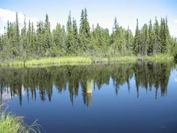
a lake occupying a closed depression formed by settlement of the ground following thawing of ice-rich permafrost or the melting of massive ice.
Image

Increased thawing of frozen ground could create more thermokarst features, like this lake.
Andrew Slater
a hummock remaining after melting of the ice wedges surrounding an ice-wedge polygon.
the often irregular topography resulting from the melting of excess ground ice and subsequent thaw settlement.
an instrument for measuring temperature; in meteorology, generally used to measure the temperature of the air or the soil.
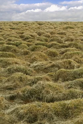
perennial hummocks formed in either the active layer in permafrost areas, or in the seasonally frozen ground in non-permafrost areas, during freezing of the ground.
Image

These big lumps in the ground are called thufur. Thufur can form when the ground freezes and thaws. These thufur are in Iceland.
Reinhold Richter
the fissure at the line of junction between an immovable icefoot or ice wall and fast ice, the latter being subject to the rise and fall of the tide.
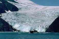
mountain glacier that terminates in the ocean.
Image

Holgate Glacier, Kenai Peninsula, Alaska
(1) in mountainous regions, the line above which climatic conditions do not allow the upright growth of trees (2) the poleward limit of tree growth, also known as the tree line.
a projection of the ice edge up to several km in length caused by wind and current; usually forms when a valley glacier moves very quickly into a lake or ocean.
the cumulative number of degree-days, calculated by adding all the negative mean daily air temperatures (degrees Celsius) for a specific station during a calendar year.
the cumulative number of degree-days, calculated by adding all the positive mean daily air temperatures (degrees Celsius) for a specific station during a calendar year.
the total amount of water (unfrozen water plus ice) contained in soil or rock.
a layer or body of unfrozen ground (in a permafrost area) that is gradually being eliminated by freezing.