Data Sets for Research
Scientific Data Search
Support for Researchers
Data for Everyone
Sponsored Programs
Looking for facts and information? See About the Cryosphere.
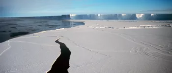
On Thin Ice: Expedition to a Crumbling Ice Shelf
Scientists blog from Antarctica and provide a glimpse of what it's like to do research in the field. Read their blog ...
For the Media
For Data Users
Current Conditions
NSIDC In the News
Events
NSIDC Highlights
Icelights: Answers to your burning questions about ice and climate
What's hot in the news around climate and sea ice and what are scientists talking about now? Read more...
About NSIDC
About the Cryosphere
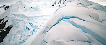
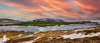
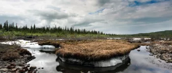
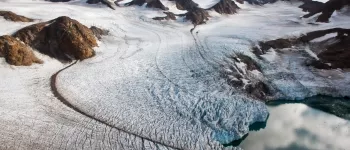
What is the Cryosphere?
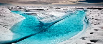
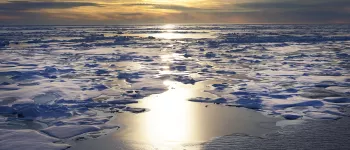
When scientists talk about the cryosphere, they mean the places on Earth where water is in its solid form, frozen into ice or snow. Read more ...
Getting ready for a long journey by dogsled, Shari Gearheard and Yvon Csonka don polar bear pants. Image courtesy Andy Mahoney. (View photo detail.)
NSIDC Scientist Biography (View photo detail.)
The Megadunes team, Ted Scambos, Mary Albert, Mark Fahenstock, Carolyn, and Chris Shuman, gathered for a quick photo before heading to McMurdo Station.Courtesy Ted Scambos and Rob Bauer, NSIDC Megadunes Web site (View photo detail.)
Ted Scambos stands at the edge of AMIGOSberg. In the background, the shape of AMIGOSberg sloping downhill from right to left, an example of iceberg flexing. Photo Credit: Courtesy Ted Scambos and Rob Bauer, NSIDC IceTrek Web site (View photo detail.)
Ronald Ross (left) and Pedro Skvarca (right) dragsthe sled across Chip, the test iceberg. Photo Credit: Courtesy Ted Scambos and Rob Bauer, NSIDC IceTrek Web site (View photo detail.)
Shari (right) and Lene (left) watch the dogs and sleds getting ready. Image courtesy Andy Mahoney. (View photo detail.)
Ted Scambos checks on the GPS/GPR surveying system during the 2002-03 Megadunes expedition. Image Credit: Courtesy Ted Scambos and Rob Bauer, NSIDC Megadunes Web site (View photo detail.)
The researchers stayed in tents while conducting some studies away from the traverse vehicles. Image Credit: Ted Scambos, NSIDC (View photo detail.)
Ted Scambos works in an office at McMurdo Station, Antarctica (View photo detail.)
Ted Scambos (View photo detail.)
Ted Scambos skies across Scar Inlet in Antarctica (View photo detail.)
Terry Haran wears a cold-water survival suit for a boat trip near the Antarctic Peninsula (View photo detail.)
Rob Bauer standing atop the tred of a PistenBully. Image Credit: Courtesy Ted Scambos and Rob Bauer, NSIDC Megadunes Web site (View photo detail.)
Ted Scambos (at the white board), leading the meeting at McMurdo Station. Image Credit: Courtesy Ted Scambos and Rob Bauer, NSIDC Megadunes Web site (View photo detail.)
The team right and ready for season two of Megadunes.From left, clockwise: Ted Scambos, Mac Cathles, Rob Bauer, Terry Haran, Makoto Suwa, Zoe Courville. Image Credit: Courtesy Ted Scambos and Rob Bauer, NSIDC Megadunes Web site (View photo detail.)
Ted Scambos poses with the GPS/GPR surveying system used during the Antarctic Megadunes expedition. Image Credit: Courtesy Ted Scambos and Rob Bauer, NSIDC Megadunes Web site (View photo detail.)
Ted Scambos wears goggles and a balaclava to protect his face from the harsh Antarctic weather. Image Credit: Courtesy Ted Scambos and Rob Bauer, NSIDC Megadunes Web site (View photo detail.)
Rob Bauer stands next to a sastrugi in the Megadunes area. Image Credit: Courtesy Ted Scambos and Rob Bauer, NSIDC Megadunes Web site (View photo detail.)
Ted Scambos on his snowmobile with Mt. Erebus in the background. Image Credit: Courtesy Ted Scambos and Rob Bauer, NSIDC Megadunes Web site (View photo detail.)
Ted Scambos checks on the GPR/GPS system. Image Credit: Courtesy Ted Scambos and Rob Bauer, NSIDC Megadunes Web site (View photo detail.)
The crew of the second season of Megadunes.From rear-left, clockwise: Jeff Severinghaus, Ted Scambos, Makoto Suwa, Mac Cathles, Terry Haran, Zoe Courville. Image Credit: Courtesy Ted Scambos and Rob Bauer, NSIDC Megadunes Web site (View photo detail.)
Rob Bauer stopping for a picture before taking another run down the slope. Image Credit: Courtesy Ted Scambos and Rob Bauer, NSIDC Megadunes Web site (View photo detail.)
Ted Scambos (left) and Terry Haran (right) stopping to enjoy the scenery of St. James Walkway. Image Credit: Courtesy Ted Scambos and Rob Bauer, NSIDC Megadunes Web site (View photo detail.)
Rob Bauer happily displaying the freshly duct-taped GPR system. Image Credit: NSIDC courtesy Ted Scambos and Rob Bauer. (View photo detail.)
Rob Bauer (left) and Terry Haran (right) working on the setup for the Automated Weather Station (AWS). Image Credit: NSIDC courtesy Ted Scambos and Rob Bauer. (View photo detail.)
Rob Bauer melting down snow for the team. Image Credit: NSIDC courtesy Ted Scambos and Rob Bauer. (View photo detail.)
Rob Bauer standing with the S3N Far Dune Flag, not to be misread as "S8N". Image Credit: NSIDC courtesy Ted Scambos and Rob Bauer. (View photo detail.)
Ted Scambos adjusting the GPR/GPS system. Image Credit: NSIDC courtesy Ted Scambos and Rob Bauer. (View photo detail.)
Ted Scambos, helping out by cleaning and drying off dishes, down in the galley. Photo Credit: Courtesy Ted Scambos, NSIDC (View photo detail.)
Terry Haran (center, middleground) drilling core samples with the team. Photo Credit: Courtesy Ted Scambos, NSIDC (View photo detail.)
Terry Haran drilling core samples with the team. Photo Credit: Courtesy Ted Scambos, NSIDC (View photo detail.)
Rob Bauer (left) & Ted Scambos (right) take a knee to remember their hike to the edge of AMIGOSberg. Photo Credit: Courtesy Ted Scambos and Rob Bauer, NSIDC IceTrek Web site (View photo detail.)
From left to right: Ronald Ross, Pedro Skvarca, John Evans, Ted Scambos, and Rob Bauer. Photo Credit: Courtesy Ted Scambos and Rob Bauer, NSIDC IceTrek Web site (View photo detail.)
From Left: Juan Carlos, Hernan, Rob Bauer, Ronald Ross, Ted Scambos, Jonathan Thom; below: Pedro Skvarca.The IceTrek Crew at Marambio Station. Photo Credit: Courtesy Ted Scambos and Rob Bauer, NSIDC IceTrek Web site (View photo detail.)
From Left: Jonathan Thom, Ted Scambos, Ronald Ross, and John Evans (facing away from the camera) discuss the particulars of the equipment to be brought on the IceTrek expedition. Photo Credit: Courtesy Ted Scambos and Rob Bauer, NSIDC IceTrek Web site (View photo detail.)
From Left: Ted Scambos and Thomas Nylen testthe GPS equipment prior to the IceTrek expedition. Photo Credit: Courtesy Ted Scambos and Rob Bauer, NSIDC IceTrek Web site (View photo detail.)
The IceTrek team drove up from Rio Gallegos to Parque Nacional los Glaciares. This is one in a series of photos from Parque Nacional los Glaciares. Photo Credit: Courtesy Ted Scambos and Rob Bauer, NSIDC IceTrek Web site (View photo detail.)
The IceTrek team drove up from Rio Gallegos to Parque Nacional los Glaciares. This is one in a series of photos from Parque Nacional los Glaciares.From Left: Ronald Ross, Jonathan Thom, Rob Bauer, Ted Scambos. Photo Credit: Courtesy Ted Scambos and Rob Bauer, NSIDC IceTrek Web site (View photo detail.)
From Left: Jonathan Thom, Rob Bauer, Ronald Ross, and Ted Scambos show off their survival gear for the IceTrek expedition. Photo Credit: Courtesy Ted Scambos and Rob Bauer, NSIDC IceTrek Web site (View photo detail.)
From Left (Clockwise): Ted Scambos, Pedro Skvarca, Jonathan Thom, and Ronald Ross discuss the specs of the weather station tripod to be deployed on AMIGOSberg. Photo Credit: Courtesy Ted Scambos and Rob Bauer, NSIDC IceTrek Web site (View photo detail.)
Ted Scambos tests out some of the camping gear for the IceTrek expedition. Photo Credit: Courtesy Ted Scambos and Rob Bauer, NSIDC IceTrek Web site (View photo detail.)
Rob Bauer (left) and Ronald Ross (right), were ready to come home at the end of the IceTrek expedition. Photo Credit: Courtesy Ted Scambos and Rob Bauer, NSIDC IceTrek Web site (View photo detail.)
Steve Ackley AIDJEX 1972 pilot study Image Credit: National Snow & Ice Data Center AIDJEX Web site (View photo detail.)
Ted Scambos smiles from the driver's seat of one of the traverse vehicles. Image Credit: Ted Scambos, NSIDC (View photo detail.)
Ted pretends to surf on a sastrugi, a snow formation caused by strong winds. Image Credit: Ted Scambos, NSIDC (View photo detail.)
Ted Scambos waits at the Antarctica terminal. Image Credit: Ted Scambos, NSIDC (View photo detail.)
Ted Scambos poses in front of the International Antarctic Center in New Zealand, waiting for his flight to Antarctica. Image Credit: Ted Scambos, NSIDC (View photo detail.)
Ted Scambos waits to board the plane that will take him to McMurdo Station in Antarctica. Image Credit: Ted Scambos, NSIDC (View photo detail.)
Ted prepares food for the traverse. Image Credit: Ted Scambos, NSIDC (View photo detail.)
Ted Scambos poses on a ridge above McMurdo Station, before the start of the U.S.-Norway Scientific Traverse of East Antarctica. Image Credit: Ted Scambos, NSIDC (View photo detail.)
Ted Scambos and the traverse team arrive at the South Pole, for the beginning of the U.S.-Norway Traverse of East Antarctica. Image Credit: Ted Scambos, NSIDC (View photo detail.)
The Norwegian-U.S. Traverse team disembarks from the LC-139 Hercules at the South Pole. Image Credit: Ted Scambos, NSIDC (View photo detail.)
The ceremonial South Pole is marked by flags and a pole. The real South Pole is a few hundred feet away. Image Credit: Ted Scambos, NSIDC (View photo detail.)
Ted Scambos poses in front of the geographic South Pole. Image Credit: Ted Scambos, NSIDC (View photo detail.)
Ted Scambos poses at the ceremonial South Pole, with South Pole station in the background. Image Credit: Ted Scambos, NSIDC (View photo detail.)
Ted Scambos takes measurements during the Norwegian-U.S. Scientific Traverse of East Antarctica. Image Credit: Ted Scambos, NSIDC (View photo detail.)
Ted Scambos takes measurements during the U.S.-Norway Scientific Traverse of East Antarctica. Image Credit: Ted Scambos, NSIDC (View photo detail.)
Ted Scambos snuggles in his sleeping bag, during a side trip of the Norwegian-U.S. Scientific Traverse of East Antarctica. Image Credit: Ted Scambos, NSIDC (View photo detail.)
Ted Scambos grew a beard during the Norwegian-U.S. Scientific Traverse of East Antarctica. Image Credit: Ted Scambos, NSIDC (View photo detail.)
Ted Scambos smiles, with the Antarctic sunset in the background. Image Credit: Ted Scambos, NSIDC (View photo detail.)
Ted Scambos poses in front of Troll station, the Norwegian Antarctic research station. Image Credit: Ted Scambos, NSIDC (View photo detail.)
Ted Scambos smiles after a successful field season in Antarctica. Image Credit: Ted Scambos, NSIDC (View photo detail.)
Terry Haran takes a break from setting up AMIGOS stations to pose for the camera. (View photo detail.)
Terry Haran enjoys the balmy weather on the Antarctic Peninsula (View photo detail.)
Rob Bauer (left) and Ted Scambos operate the radar sled during the 2009-2010 LARISSA expedition (View photo detail.)
Erin Pettit and Rob Bauer operate the radar sled during the 2009/2010 LARISSA expedition (View photo detail.)
Rob Bauer and Erin Pettit of UAF pose on a boat near Punta Arenas, Chile. (View photo detail.)
Ted Scambos (left) and Rob Bauer pose on the Antarctic Peninsula (View photo detail.)
Rob Bauer smiles in the cook tent during the 2009/2010 LARISSA expedition (View photo detail.)
Rob Bauer works with instruments prior to traveling out into the field. (View photo detail.)
Ted Scambos digs a snow pit in Antarctica. (View photo detail.)
Erin Pettit (left) and Rob Bauer (right) operate the radar sled during the 2009/2010 LARISSA expedition (View photo detail.)
Rob Bauer and Terry Haran pose in front of the test AMIGOS station on the NSIDC roof. (View photo detail.)
The team was stuck in the tent for 2 weeks while a storm prevented the airplane from landing. (View photo detail.)
NSIDC director poses at the sign marking the Arctic Circle along the Dalton Highway in Alaska, during the 2011 Arctic Observing Network project. (View photo detail.)
Mark Serreze (left) and Matthew Sturm collect data on snow cover during the 2011 Arctic Observing Network (Snownet) project. (View photo detail.)
Mark Serreze measures snow depth during the 2011 Arctic Observing Network (Snownet) project (View photo detail.)
Mark Serreze poses on the Arctic tundra, during the 2011 Arctic Observing Network (Snownet) project (View photo detail.)
NSIDC researcher Andrew Slater prepares to travel by snowmobile during the 2011 Arctic Observing Network (Snownet) project. (View photo detail.)
Researchers consult their notes during the 2011 Arctic Observing Network (Snownet) project in Alaska. (View photo detail.)
Mark Serreze consults plans during the 2011 Arctic Observing Network (Snownet) project in Alaska. (View photo detail.)
Mark Parsons sets up a weather station during the the 2011 Arctic Observing Network (Snownet) project in Alaska. (View photo detail.)
Researchers Matthew Sturm (left) and Mark Serreze examine layers in a snow pit during the 2011 Arctic Observing Network (Snownet) project in Alaska. (View photo detail.)
Mark Serreze measures snow depth during the 2011 Arctic Observing Network (Snownet) project in Alaska. (View photo detail.)
Andrew Slater poses with a snowmobile during the 2011 Arctic Observing Network (Snownet) project in Alaska. (View photo detail.)
Mark Serreze measures snow depthduring the 2011 Arctic Observing Network (Snownet) project in Alaska. (View photo detail.)
Scientist performing chemistry analysis of Arctic Ocean water by pouring it into a filtration assembly during SCICEX 98. Photo courtesy of ASL. (View photo detail.)
Jay Ardai (LDEO) launches a Seabird CTD which is suspended in the cage as an ADCP lays on the deck in preparation for deployment as a CTD/ADCP cast from the deck of the USS Hawkbill during SCICEX-98. Photo: Greg Kurras (Edwards and Coakley 2003). (View photo detail.)
Scientists and crew members setup a red tent on the bow of the USS Hawkbill used for holding science experiments while surfaced during SCICEX 98. Photo courtesy of ASL. (View photo detail.)
Elders Lhakpa Chinzum and Pasang Dorie (left and right center) of Phurpe village in Tsum Valley meet with Shari Gearheard (far left) and other visitors from Nunavut to talk about their life and changes in Tsum. Dhawa Lama, the group's new friend and guide, originally from Tsum himself, helps with translation. Credit: Henry Huntington (View photo detail.)
Inuit hunter Liemikie Palluq (left) and Shari Gearheard dressed in the traditional clothing of their Tsumba hosts, during an exchange to Nepal in 2012. Sharing culture, traditions, and ways of life were an important part of the exchange. Credit: Henry Huntington (View photo detail.)
Prayer flags flutter in the wind just outside the village of Burje, the home base of Gearheard and colleagues during their stay in Tsum Valley, Nepal. Credit: Shari Gearheard (View photo detail.)
National Snow and Ice Data Center (NSIDC) Director Mark Serreze at the Green Data Center open house on May 4, 2012. The Green Data Center design team was led by NSIDC Technical Services Manager David Gallaher, in collaboration with Serreze, and NASA NSIDC Distributed Active Archive Center Manager Ronald Weaver; Rick Osbaugh from RMH Group in Denver; Otto Van Geet from the National Renewable Energy Laboratory (NREL); and Lee Gillan from Coolerado Corporation. —Credit: Natasha Vizcarra/NSIDC (View photo detail.)
David Gallaher, National Snow and Ice Data Center (NSIDC) Technical Services Manager; Valeriy Maisotsenko, Chief Scientist and founder of Coolerado; and TJ Deora, director of the Colorado Governor's Energy Office at the Green Data Center open house on May 4, 2012 in Boulder, Colorado. Maisotsenko invented the data center's new cooling technology that uses 90 percent less energy than traditional air conditioning. The Green Data Center also uses an extensive rooftop solar array that results in a total energy savings of 70 percent. —Credit: Natasha Vizcarra/NSIDC (View photo detail.)
National Snow and Ice Data Center (NSIDC) Technical Services Manager David Gallaher at the Green Data Center open house on May 4, 2012. —Credit: Natasha Vizcarra/NSIDC (View photo detail.)
David Gallaher, National Snow and Ice Data Center (NSIDC) Technical Services Manager; Stein Sture, University of Colorado Vice Chancellor for Research; and William Lewis, Acting Director of the Cooperative Institute for Research in Environmental Sciences (CIRES) at the Green Data Center open house on May 4, 2012. —Credit: Natasha Vizcarra/NSIDC (View photo detail.)
Bob Muckle, mayor of Louisville, Colorado, and National Snow and Ice Data Center (NSIDC) Program Manager Ronald Weaver during the Green Data Center open house on May 4, 2012 in Boulder, Colorado. Weaver is co-investigator of the Green Data Center, which slashed energy consumption for data center cooling by more than 90 percent. Weaver also manages the NASA Snow and Ice Distributed Active Archive Center, NASA's single largest earth sciences data management program at the University of Colorado Boulder. —Credit: Natasha Vizcarra/NSIDC (View photo detail.)
University and community leaders celebrate the Green Data Center with NSIDC staff on May 4, 2012 in Boulder. Colorado. First row, left to right: Jeanne Behnke, Science Operations Manager at NASA's Earth Science Data and Information System; Emily Jasiak, Louisville City Council; Lesley Smith, outreach staff at the Cooperative Institute for Research in Environmental Sciences (CIRES); Deb Gardner, Boulder County Commissioner; Frances Draper, University of Colorado Vice Chancellor for Strategic Relations; Lisa Morzel, Boulder City Council; and U.S. Representative Jared Polis. —Credit: Natasha Vizcarra/NSIDC (View photo detail.)
National Snow and Ice Data Center (NSIDC) Program Manager Ronald Weaver, U.S. Representative Jared Polis, and NSIDC Technical Services Manager David Gallaher toast the Green Data Center on May 4, 2012 in Boulder, Colorado. —Credit: Natasha Vizcarra/NSIDC (View photo detail.)
U.S. Representative Jared Polis looks on as National Snow and Ice Data Center Technical Services Manager David Gallaher flips a ceremonial switch for the Green Data Center on May 4, 2012 in Boulder, Colorado. —Credit: Natasha Vizcarra/NSIDC (View photo detail.)
National Snow and Ice Data Center (NSIDC) Technical Services Manager David Gallaher explains to U.S. Representative Jared Polis (in yellow shirt) and other guests how the Green Data Center saves energy, on May 4, 2012 in Boulder, Colorado. —Credit: Natasha Vizcarra/NSIDC (View photo detail.)
A rooftop solar array reflects a sunny Colorado sky as guests, including U.S. Representative Jared Polis, tour the National Snow and Ice Data Center (NSIDC) during the Green Data Center open house on May 4, 2012. The Green Data Center project uses new cooling technology that uses 90 percent less energy than traditional air conditioning, and an extensive rooftop solar array that results in a total energy savings of 70 percent. —Credit: Natasha Vizcarra/NSIDC (View photo detail.)
National Snow and Ice Data Center (NSIDC) Technical Services Manager David Gallaher explains to U.S. Representative Jared Polis (in yellow shirt) and other guests how the Green Data Center saves energy, on May 4, 2012 in Boulder, Colorado. —Credit: Natasha Vizcarra/NSIDC —Credit: Natasha Vizcarra/NSIDC (View photo detail.)
National Snow and Ice Data Center (NSIDC) Director Mark Serreze and Coolerado founder and chief scientist Valeriy Maisotsenko at the Green Data Center open house on May 4, 2012 in Boulder, Colorado. Maisotsenko invented the data center's new cooling technology that uses 90 percent less energy than traditional air conditioning. —Credit: Natasha Vizcarra/NSIDC (View photo detail.)
National Snow and Ice Data Center (NSIDC) Program Manager Ron Weaver and NSIDC Director Mark Serreze at the Green Data Center open house on May 4, 2012 in Boulder, Colorado.—Credit: Natasha Vizcarra/NSIDC (View photo detail.)
National Snow and Ice Data Center (NSIDC) staff Rich Lutes examines an old data storage robot hand as fellow staff Jeff Groth looks on. The robot hand was decommissioned and the data tape library converted to smaller space-efficient storage to make way for the Green Data Center' s new, energy-saving cooling units. —Credit: Natasha Vizcarra/NSIDC (View photo detail.)
Ronald Weaver (fifth from left) accepts an award for the National Snow and Ice Data Center (NSIDC) with representatives of the RMH Group, an engineering consulting firm, on May 14, 2012 in Santa Clara, California. The Uptime Institute conferred the two organizations with the 2012 Green Enterprise IT (GEIT) Award for the Green Data Center project, an on-budget retrofit project which reduced the data center's energy use by 90 percent. Weaver is Principal Investigator and Manager of the NASA Distributed Active Archive Center (DAAC) at NSIDC. --Credit: Uptime Institute (View photo detail.)
NSIDC’s Mark Serreze on the tundra near the Brooks mountain range during the 2012 SnowNet expedition. --Credit: NSIDC, Mark Serreze (View photo detail.)
Matt Sturm of the U.S. Army Cold Regions Research and Engineering Laboratory (CRREL) and NSIDC’s Drew Slater discussing sampling strategy on the northern slope of Alaska during the 2012 SnowNet expedition. --Credit: NSIDC, Mark Serreze (View photo detail.)
NSIDC graduate student Allison Hurley sampling snow depth on the northern slope of Alaska during the 2012 SnowNet expedition. --Credit: NSIDC, Mark Serreze (View photo detail.)
Kelley Elder of the U.S. Forest Service examining depthoar crystals on the northern slope of Alaska during the 2012 SnowNet expedition. --Credit: NSIDC, Mark Serreze (View photo detail.)
NSIDC Drew Slater and team examining snow crystals on the northern slope of Alaska during the 2012 SnowNet expedition. --Credit: NSIDC, Mark Serreze (View photo detail.)
Kelley Elder of the U.S. Forest Service and Matt Sturm of the U.S. Army Cold Regions Research and Engineering Laboratory (CRREL) examining snow crystals in a snow pit on the northern slope of Alaska during the 2012 Snownet expedition. --Credit: NSIDC, Mark Serreze (View photo detail.)
National Snow and Ice Data Center (NSIDC) Director Mark Serreze (left) and Technical Services Manager David Gallaher survey the progress of solar array installation on the roof of NSIDC. —Credit: Ron Weaver/NSIDC (View photo detail.)
National Snow and Ice Data Center (NSIDC) Director Mark Serreze speaks at the Green Data Center open house on May 4, 2012. —Credit: Kristin Bjornsen/CIRES (View photo detail.)
National Snow and Ice Data Center (NSIDC) Technical Services Manager David Gallaher speaks at the Green Data Center open house on May 4, 2012. —Credit: Kristin Bjornsen/CIRES (View photo detail.)
National Snow and Ice Data Center (NSIDC) Program Manager Ronald Weaver leads a tour of the Green Data Center facilities at the Green Data Center open house on May 4, 2012 in Boulder, Colorado. —Credit: Kristin Bjornsen/CIRES (View photo detail.)
National Snow and Ice Data Center (NSIDC) Program Manager Ronald Weaver and Information Technology Security Coordinator Mike Stowe lead a tour of the Green Data Center facilities at the Green Data Center open house on May 4, 2012 in Boulder, Colorado. —Credit: Kristin Bjornsen/CIRES (View photo detail.)
National Snow and Ice Data Center (NSIDC) Program Manager Ronald Weaver shows guests air vents, which allow warm air from the data center to escape outdoors, at the Green Data Center open house on May 4, 2012 in Boulder, Colorado. —Credit: Kristin Bjornsen/CIRES (View photo detail.)
National Snow and Ice Data Center (NSIDC) Technical Services Manager David Gallaher displays cooling unit features during construction of the NSIDC Green Data Center. The evaporative units reduce cooling energy by more than 90 percent. (View photo detail.)
NSIDC Director Mark Serreze poses on the Arctic tundra, during the 2013 Arctic Observing Network (Snownet) project. (View photo detail.)
Researchers prepare their snowmobiles during the 2013 Arctic Observing Network (Snownet) field project in Alaska's North Slope. (View photo detail.)
NSIDC lead scientist Ted Scambos and Erin Pettit, glaciologist at University of Alaska, Fairbanks, pause for a picture in front of the peaks and glaciers ringing Beascochea Bay during the 2013 LARISSA Project. The Larsen Ice Shelf System, Antarctica (LARISSA) Project is a large, interdisciplinary, multi-institute study to explore every aspect of the deteriorating Larsen Ice Shelf region in Antarctica. Participating researchers set up instruments on the glaciers that feed into the remaining portion of the Larsen ice shelf. As changes occur on the ice, the stations will record it in data and pictures. (Credit: Ted Scambos, NSIDC) Read about the project on http://iceshelf.wordpress.com. (View photo detail.)
Ronald Ross, Rob Bauer, and NSIDC lead scientist Ted Scambos assemble Extreme Ice Survey cameras during the 2013 LARISSA Project. The Larsen Ice Shelf System, Antarctica (LARISSA) Project is a large, interdisciplinary, multi-institute study to explore every aspect of the deteriorating Larsen Ice Shelf region in Antarctica. Participating researchers set up instruments on the glaciers that feed into the remaining portion of the Larsen ice shelf. As changes occur on the ice, the stations will record it in data and pictures. (Credit: Ted Scambos, NSIDC) Read the expedition blog on http://iceshelf.wordpress.com. (View photo detail.)
Ronald Ross and Rob Bauer work on Extreme Ice Survey cameras during the 2013 LARISSA Project. The Larsen Ice Shelf System, Antarctica (LARISSA) Project is a large, interdisciplinary, multi-institute study to explore every aspect of the deteriorating Larsen Ice Shelf region in Antarctica. Participating researchers set up instruments on the glaciers that feed into the remaining portion of the Larsen ice shelf. As changes occur on the ice, the stations will record it in data and pictures. (Credit: Ted Scambos, NSIDC) Read the expedition blog on http://iceshelf.wordpress.com. (View photo detail.)
Kevin Schaefer uses a hammer to pound a soil sample tube into the ground near Barrow, Alaska on August 13, 2013. (Credit: Elchin Jafarov, NSIDC). (View photo detail.)
Kevin Schaefer pulls a ground penetrating radar unit through the tundra near Barrow, Alaska on August 14, 2013 to measure the active layer depth. The radar unit (in the box) emits a pulse which reflects off the permafrost to measure the active layer depth, which is recorded in the computer held by Andy Parsekian (Credit: Elchin Jafarov, NSIDC). (View photo detail.)
Lin Liu and Kevin Schaefer use a metal probe to measure the active layer depth along a survey line near Barrow, Alaska. (Credit: Andy Parsekian) (View photo detail.)
Andy Parsekian, Kevin Schaefer, and Lin Liu use a ground penetrating radar to measure the depth of an ice wedge on August 15, 2013. The survey line lies perpendicular to the ice wedge and similar ice wedges crisscross the tundra in the background (Credit: Elchin Jafarov, NSIDC). (View photo detail.)
Kevin Schaefer walks along the road to a next survey site near Barrow Alaska on August 11, 2013. Contrary to what the sign says, the effective speed limit was actually 5 mph (Credit: Elchin Jafarov, NSIDC). (View photo detail.)
Andy Persekian, Lin Liu, Elchin Jafarov, and Kevin Schaefer pose next to whale bones at the Welcome to Barrow, Alaska sign. (Credit: Elchin Jafarov, NSIDC) (View photo detail.)
Lin Liu and Andy Persekian check active layer depth measurements on a laptop as Elchin Jafarov looks on. (Credit: Kevin Schaefer, NSIDC) (View photo detail.)
Tundra bugs are always curious about permafrost researchers. (Kevin Schaefer, NSIDC) (View photo detail.)
Lin Liu, Andy Parsekian, and Elchin Jafarov pull a ground penetrating radar unit through the tundra near Barrow, Alaska on August 10, 2013. The radar unit is in the box and the computer records the active layer depth (Credit: Kevin Schaefer, NSIDC). (View photo detail.)
Kevin Schaefer drains his mud boots after a day of sloshing through wet tundra. (Kevin Schaefer, NSIDC) (View photo detail.)
Lin Liu and Andy Persekian take a dip during a break from data gathering. (Credit: Kevin Schaefer, NSIDC) (View photo detail.)
Lin Liu pulls a ground penetrating radar unit through the tundra in rainy weather as Andy Persekian and Elchin Jafarov follow behind. The survey near Barrow, Alaska measures active layer depth. The radar unit (in the box) emits a pulse which reflects off the permafrost to measure the active layer depth, which is recorded in the computer held by Andy Parsekian. (Credit: Kevin Schaefer, NSIDC) (View photo detail.)
Andy Parsekian sets up the ground penetrating radar equipment for a survey of active layer depth near Barrow, Alaska on August 13, 2013. (Credit: Lin Liu). (View photo detail.)
Lin Liu checks the day's data at basecamp. (Credit: Kevin Schaefer, NSIDC) (View photo detail.)
Lin Liu pulls a ground penetrating radar unit through the tundra in rainy weather. The survey near Barrow, Alaska measures active layer depth. The radar unit (in the box) emits a pulse which reflects off the permafrost to measure the active layer depth, which is recorded in the computer held by Andy Parsekian. (Credit: Kevin Schaefer, NSIDC) (View photo detail.)
In this photo taken on August 16, 2012, Tim Schaefer, Lin Liu, Alessio Gusmeroli, and Tingjun Zhang cook food and examine the day’s observations of active layer depth at camp just south of Deadhorse, Alaska. (Credit: Kevin Schaefer, NSIDC) (View photo detail.)
Tingjun Zhang, Alessio Gusmeroli, Lin Liu, and Tim Schaefer check gear before starting a new survey of active layer depth using ground penetrating radar on August 16, 2012. Zhang holds the radar controller while the yellow antenna rests at his feet next to a spool of survey line. (Credit: Kevin Schaefer, NSIDC) (View photo detail.)
Tim Schaefer slakes his thirst with ice chopped from an exposed ice layer at a thermokarst feature on August 19, 2012 near Toolik Lake, Alaska. (Credit: Kevin Schaefer, NSIDC) (View photo detail.)
Kevin Schaefer and Lin Liu photograph and wrap permafrost core samples on August 17, 2012 while Alessio Gusmeroli and Tim Schaefer drill more permafrost core samples. (Credit: Tingjun Zhang, NSIDC) (View photo detail.)
Tingjun Zhang drags the antenna for the ground penetrating radar while Alessio Gusmeroli records the active layer depth readings on August 16, 2012. (Credit: Tingjun Zhang, NSIDC). (View photo detail.)
Dawn finds Kevin Schaefer and Tim Schaefer still sleeping at camp near the Sagavanirktok River south of Deadhorse, Alaska on August 16, 2012. Mud makes the trucks appear brown, although their true colors are red and blue (Credit: Tingjun Zhang, NSIDC). (View photo detail.)
Research volunteer Tim Schaefer, Standford University scientist Lin Liu, and NSIDC senior research scientist Tingjun Zhang drill a permafrost sample south of Deadhorse, Alaska on July 10, 2009. The head nets protect the researchers from the clouds of mosquitoes that continually swarmed around them. (Credit: Kevin Schaefer, NSIDC) (View photo detail.)
Standford University scientist Lin Liu, NSIDC senior research scientist Tingjun Zhang, and research volunteer Tim Schaefer pull the auger bit containing a permafrost core out of a newly drilled hole near Deadhorse, Alaska on July 10, 2009. (Credit: Kevin Schaefer, NSIDC) (View photo detail.)