Data Sets for Research
Scientific Data Search
Support for Researchers
Data for Everyone
Sponsored Programs
Looking for facts and information? See About the Cryosphere.
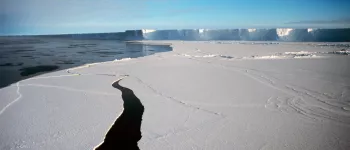
On Thin Ice: Expedition to a Crumbling Ice Shelf
Scientists blog from Antarctica and provide a glimpse of what it's like to do research in the field. Read their blog ...
For the Media
For Data Users
Current Conditions
NSIDC In the News
Events
NSIDC Highlights
Icelights: Answers to your burning questions about ice and climate
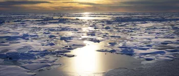
What's hot in the news around climate and sea ice and what are scientists talking about now? Read more...
About NSIDC
About the Cryosphere
What is the Cryosphere?
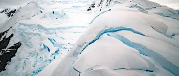
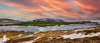
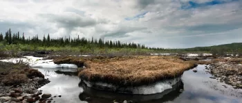
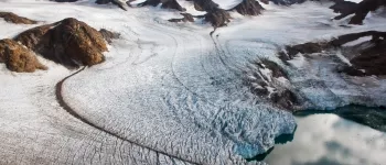
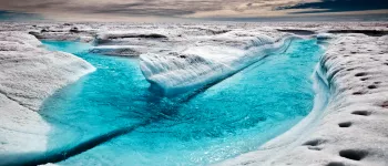
When scientists talk about the cryosphere, they mean the places on Earth where water is in its solid form, frozen into ice or snow. Read more ...
Researchers start to dig a snow pit. From left to right: Drew Slater,Matthew Sturm, and Steph Saari Image courtesy Mark Serreze, NSIDC. (View photo detail.)
Ravens are a common sight in Alaska. Image courtesy Mark Serreze, NSIDC. (View photo detail.)
Researchers discuss plans during the 2009 SnowNet project. From left to right: Matthew Sturm, Drew Slater, and Sveta Berezovskaya Image courtesy Mark Serreze, NSIDC. (View photo detail.)
The Brooks Range glows purple in the twilight. Image courtesy Mark Serreze, NSIDC. (View photo detail.)
Mark Serreze digs a deep snow pit. Image courtesy Mark Serreze, NSIDC. (View photo detail.)
Drew takes a turn in the pit. Image courtesy Mark Serreze, NSIDC. (View photo detail.)
The sun sets in Toolik, Alaska. Image courtesy Mark Serreze, NSIDC. (View photo detail.)
Matthew & Drew work the monster snow pit. Image courtesy Mark Serreze, NSIDC. (View photo detail.)
The snow pit looks deep when you're standing at the bottom. Image courtesy Mark Serreze, NSIDC. (View photo detail.)
MC Serreze stands atop Atigun Gorge. Image courtesy Mark Serreze, NSIDC. (View photo detail.)
Researchers head into the Brooks Range by snowmobile. Image courtesy Mark Serreze, NSIDC. (View photo detail.)
Snow Guru Matthew Sturm poses atop Atigun Gorge. Image courtesy Mark Serreze, NSIDC. (View photo detail.)
Drew Slater practices his lecturing skills. Image courtesy Mark Serreze, NSIDC. (View photo detail.)
Matthew & Drew work on the tundra, Brooks Range, AK. Image courtesy Mark Serreze, NSIDC. (View photo detail.)
Matthew Sturm carves snow blocks in Barrow. Image courtesy Mark Serreze, NSIDC. (View photo detail.)
Mark Serreze drills holes in the ice. Image courtesy Mark Serreze, NSIDC. (View photo detail.)
The SnowNet team found polar bear tracks. Image courtesy Mark Serreze, NSIDC. (View photo detail.)
Mark Serreze surveys the sea ice in Barrow, AK. Image courtesy Mark Serreze, NSIDC. (View photo detail.)
NSIDC director poses at the sign marking the Arctic Circle along the Dalton Highway in Alaska, during the 2011 Arctic Observing Network project. (View photo detail.)
Snowmobiles head north along the Dalton Highway towards the North Slope, for the 2011 Arctic Observing Network field season. (View photo detail.)
The sun sets over field camp during the 2011 Arctic Observing Network (Snownet) fieldwork. (View photo detail.)
The Alaska Pipeline transports oil 800 miles from the North Slope to Valdez, Alaska. (View photo detail.)
Mark Serreze (left) and Matthew Sturm collect data on snow cover during the 2011 Arctic Observing Network (Snownet) project. (View photo detail.)
Mark Serreze measures snow depth during the 2011 Arctic Observing Network (Snownet) project (View photo detail.)
Mark Serreze poses on the Arctic tundra, during the 2011 Arctic Observing Network (Snownet) project (View photo detail.)
NSIDC researcher Andrew Slater prepares to travel by snowmobile during the 2011 Arctic Observing Network (Snownet) project. (View photo detail.)
Researchers consult their notes during the 2011 Arctic Observing Network (Snownet) project in Alaska. (View photo detail.)
Mark Serreze consults plans during the 2011 Arctic Observing Network (Snownet) project in Alaska. (View photo detail.)
Mark Parsons sets up a weather station during the the 2011 Arctic Observing Network (Snownet) project in Alaska. (View photo detail.)
Researchers set up research equipment during the 2011 Arctic Observing Network (Snownet) project in Alaska. (View photo detail.)
Researchers Matthew Sturm (left) and Mark Serreze examine layers in a snow pit during the 2011 Arctic Observing Network (Snownet) project in Alaska. (View photo detail.)
Mark Parsons digs a snow pit to examine the properties of snow cover during the 2011 Arctic Observing Network (Snownet) project in Alaska. (View photo detail.)
Mark Parsons sets up research equipment during the 2011 Arctic Observing Network (Snownet) project in Alaska. (View photo detail.)
Mark Serreze measures snow depth during the 2011 Arctic Observing Network (Snownet) project in Alaska. (View photo detail.)
Andrew Slater poses with a snowmobile during the 2011 Arctic Observing Network (Snownet) project in Alaska. (View photo detail.)
An Arctic researcher and his snowmobile during the 2011 Arctic Observing Network (Snownet) project in Alaska. (View photo detail.)
Mark Serreze measures snow depthduring the 2011 Arctic Observing Network (Snownet) project in Alaska. (View photo detail.)
NSIDC’s Mark Serreze on the tundra near the Brooks mountain range during the 2012 SnowNet expedition. --Credit: NSIDC, Mark Serreze (View photo detail.)
A view of the Brooks mountain range on the northern slope of Alaska during the 2012 SnowNet expedition. --Credit: NSIDC, Mark Serreze (View photo detail.)
Matt Sturm of the U.S. Army Cold Regions Research and Engineering Laboratory (CRREL) and NSIDC’s Drew Slater discussing sampling strategy on the northern slope of Alaska during the 2012 SnowNet expedition. --Credit: NSIDC, Mark Serreze (View photo detail.)
A sled of equipment awaits the team outside the silver bullet shelter on the northern slope of Alaska during the 2012 SnowNet expedition. --Credit: NSIDC, Mark Serreze (View photo detail.)
NSIDC graduate student Allison Hurley sampling snow depth on the northern slope of Alaska during the 2012 SnowNet expedition. --Credit: NSIDC, Mark Serreze (View photo detail.)
Kelley Elder of the U.S. Forest Service takes snow samples on the tundra near the Brooks mountain range during the 2012 SnowNet expedition. --Credit: NSIDC, Mark Serreze (View photo detail.)
Kelley Elder of the U.S. Forest Service examining depthoar crystals on the northern slope of Alaska during the 2012 SnowNet expedition. --Credit: NSIDC, Mark Serreze (View photo detail.)
CRREL’s Matt Sturm and team examining snow crystals on the northern slope of Alaska during the 2012 SnowNet expedition. --Credit: NSIDC, Mark Serreze (View photo detail.)
Kelley Elder of the U.S. Forest Service with a fully loaded sled of equipment on the northern slope of Alaska during the 2012 SnowNet expedition. --Credit: NSIDC, Mark Serreze (View photo detail.)
Matt Sturm of the U.S. Army Cold Regions Research and Engineering Laboratory (CRREL) examining snowpack stratigraphy in a snow pit on the northern slope of Alaska during the 2012 Snownet expedition. --Credit: NSIDC, Mark Serreze (View photo detail.)
NSIDC Drew Slater and team examining snow crystals on the northern slope of Alaska during the 2012 SnowNet expedition. --Credit: NSIDC, Mark Serreze (View photo detail.)
Kelley Elder of the U.S. Forest Service and Matt Sturm of the U.S. Army Cold Regions Research and Engineering Laboratory (CRREL) examining snow crystals in a snow pit on the northern slope of Alaska during the 2012 Snownet expedition. --Credit: NSIDC, Mark Serreze (View photo detail.)
Researchers prepare to travel with their instruments using snowmobiles and sleds during the 2013 Arctic Observing Network (Snownet) project in Alaska. (View photo detail.)
Part of Brooks Range rises over the distance. (View photo detail.)
Researchers pose next to their snowmobiles during the 2013 Arctic Observing Network (Snownet) project in Alaska's North Slope. (View photo detail.)
Researchers check their gear during the 2013 Arctic Observing Network (Snownet) project in Alaska. (View photo detail.)
A propeller plane is on standby during the 2013 Arctic Observing Network (Snownet) fieldwork in Alaska. (View photo detail.)
Field camp crew check the research plane on standby during the 2013 Arctic Observing Network (Snownet) fieldwork in Alaska. (View photo detail.)
NSIDC Director Mark Serreze poses on the Arctic tundra, during the 2013 Arctic Observing Network (Snownet) project. (View photo detail.)
Researchers measure snow depth during the 2013 Arctic Observing Network (Snownet) project in Alaska. (View photo detail.)
Snowshoes are indispensable when setting up instruments to measure snow cover during the 2013 Arctic Observing Network (Snownet) fieldwork in Alaska. (View photo detail.)
A researcher measures snow depth during the 2013 Arctic Observing Network (Snownet) project in Alaska's North Slope. (View photo detail.)
Brooks Range provides a backdrop for instruments used in snow cover measurement during the 2013 Arctic Observing Network (Snownet) fieldwork in Alaska. (View photo detail.)
Researchers prepare their snowmobiles during the 2013 Arctic Observing Network (Snownet) field project in Alaska's North Slope. (View photo detail.)
Sastrugi, sharp irregular grooves or ridges formed on a snow surface by wind erosion, are seen here next to snowmobile tracks during the 2013 Arctic Observing Network (Snownet) project in the North Slope of Alaska. (View photo detail.)
Snowmobiles stand by at field camp during the 2013 Arctic Observing Network (Snownet) project in Alaska's North Slope. (View photo detail.)
A researcher's winter gloves provide a sense of scale to sastrugi, sharp irregular grooves or ridges formed on a snow surface by wind erosion, seen during the 2013 Arctic Observing Network (Snownet) project. (View photo detail.)