Data Sets for Research
Scientific Data Search
Support for Researchers
Data for Everyone
Sponsored Programs
Looking for facts and information? See About the Cryosphere.
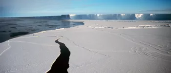
On Thin Ice: Expedition to a Crumbling Ice Shelf
Scientists blog from Antarctica and provide a glimpse of what it's like to do research in the field. Read their blog ...
For the Media
For Data Users
Current Conditions
NSIDC In the News
Events
NSIDC Highlights
Icelights: Answers to your burning questions about ice and climate
What's hot in the news around climate and sea ice and what are scientists talking about now? Read more...
About NSIDC
About the Cryosphere
What is the Cryosphere?
When scientists talk about the cryosphere, they mean the places on Earth where water is in its solid form, frozen into ice or snow. Read more ...
Tidewater glacier. College Fjord, AK. From ship. 05/27/07 Image Credit: Courtesy Lynn French, NSIDC (View photo detail.)
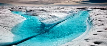
Glacial meltwater. Denali National Park, AK. From the air, small plane. 05/25/07 Image Credit: Courtesy Lynn French, NSIDC (View photo detail.)
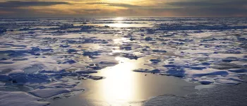
Ice floating in Glacier Bay. Glacier Bay National Park, AK. From ship. Image Credit: Courtesy Lynn French, NSIDC (View photo detail.)
“Small” ship in front of glacier in Glacier Bay. Glacier Bay National Park, AK. From ship. Image Credit: Courtesy Lynn French, NSIDC (View photo detail.)
Margerie Glacier, in Glacier Bay. Glacier Bay National Park, AK. From ship. Image Credit: Courtesy Lynn French, NSIDC (View photo detail.)
Bald eagle on some ice in Glacier Bay. Glacier Bay National Park, AK. From ship. Image Credit: Courtesy Lynn French, NSIDC (View photo detail.)
Margerie Glacier, in Glacier Bay. Calving photo #2. Glacier Bay National Park, AK. From ship. Image Credit: Courtesy Lynn French, NSIDC (View photo detail.)
Margerie Glacier, in Glacier Bay. Calving photo #1. Glacier Bay National Park, AK. From ship. Image Credit: Courtesy Lynn French, NSIDC (View photo detail.)
Margerie Glacier, in Glacier Bay. Calving photo #3. Glacier Bay National Park, AK. From ship. Image Credit: Courtesy Lynn French, NSIDC (View photo detail.)
Tidewater glacier in Glacier Bay. Calving photo #1. Glacier Bay National Park, AK. From ship. Image Credit: Courtesy Lynn French, NSIDC (View photo detail.)
Researchers start to dig a snow pit. From left to right: Drew Slater,Matthew Sturm, and Steph Saari Image courtesy Mark Serreze, NSIDC. (View photo detail.)
Ravens are a common sight in Alaska. Image courtesy Mark Serreze, NSIDC. (View photo detail.)
Researchers discuss plans during the 2009 SnowNet project. From left to right: Matthew Sturm, Drew Slater, and Sveta Berezovskaya Image courtesy Mark Serreze, NSIDC. (View photo detail.)
The Brooks Range glows purple in the twilight. Image courtesy Mark Serreze, NSIDC. (View photo detail.)
Mark Serreze digs a deep snow pit. Image courtesy Mark Serreze, NSIDC. (View photo detail.)
Drew takes a turn in the pit. Image courtesy Mark Serreze, NSIDC. (View photo detail.)
The sun sets in Toolik, Alaska. Image courtesy Mark Serreze, NSIDC. (View photo detail.)
Matthew & Drew work the monster snow pit. Image courtesy Mark Serreze, NSIDC. (View photo detail.)
The snow pit looks deep when you're standing at the bottom. Image courtesy Mark Serreze, NSIDC. (View photo detail.)
MC Serreze stands atop Atigun Gorge. Image courtesy Mark Serreze, NSIDC. (View photo detail.)
Researchers head into the Brooks Range by snowmobile. Image courtesy Mark Serreze, NSIDC. (View photo detail.)
Snow Guru Matthew Sturm poses atop Atigun Gorge. Image courtesy Mark Serreze, NSIDC. (View photo detail.)
Drew Slater practices his lecturing skills. Image courtesy Mark Serreze, NSIDC. (View photo detail.)
Matthew & Drew work on the tundra, Brooks Range, AK. Image courtesy Mark Serreze, NSIDC. (View photo detail.)
The SnowNet team found polar bear tracks. Image courtesy Mark Serreze, NSIDC. (View photo detail.)
Mark Serreze surveys the sea ice in Barrow, AK. Image courtesy Mark Serreze, NSIDC. (View photo detail.)
Matthew Sturm and Mark Serreze look at their equipment. Image courtesy Andrew Slater, NSIDC. (View photo detail.)
The Yukon River is marked by a road sign. Image courtesy Andrew Slater, NSIDC. (View photo detail.)
Scientists get out of their vehicles to check out Atigun Pass. Image courtesy Andrew Slater, NSIDC. (View photo detail.)
Dirt and grime has built up on a car wheel after driving on unpaved snowy roads. Image courtesy Andrew Slater, NSIDC. (View photo detail.)
This view shows the SnowNet project research area in 2009. Image courtesy Andrew Slater, NSIDC. (View photo detail.)
Mud-icicles can form while driving on unpaved snowy roads. Image courtesy Andrew Slater, NSIDC. (View photo detail.)
Matthew Sturm and another scientist set up gear for the 2009 SnowNet project. Image courtesy Andrew Slater, NSIDC. (View photo detail.)
The sun sets in Toolik during the 2009 SnowNet project. Image courtesy Andrew Slater, NSIDC. (View photo detail.)
Mark Serreze try to remove the road grime off the snowmobiles so they can be used. Image courtesy Andrew Slater, NSIDC. (View photo detail.)
Scientist speeds off to the research site on snowmobiles. Image courtesy Andrew Slater, NSIDC. (View photo detail.)
Drew Slater poses in his powder blue parka, during the 2009 SnowNet project. Image courtesy Andrew Slater, NSIDC. (View photo detail.)
Mark Serreze poses during the 2009 SnowNet project in Alaska. Image courtesy Andrew Slater, NSIDC. (View photo detail.)
Scientists take a much needed break during the 2009 SnowNet project. From left to right: Sveta Berezovskaya, Matthew Sturm, and Mark Serreze Image courtesy Andrew Slater, NSIDC. (View photo detail.)
Matthew Sturm and Steph Saari start digging at the SnowNet research site. Image courtesy Andrew Slater, NSIDC. (View photo detail.)
Matthew Sturm and Mark Serreze set up magna-probes to measure snow depth. Image courtesy Andrew Slater, NSIDC. (View photo detail.)
Steph Saari from CRREL snowshoes with equipment. Image courtesy Andrew Slater, NSIDC. (View photo detail.)
Mark Serreze and Sveta Berezovskaya set up magna-probes during the 2009 SnowNet project. Image courtesy Andrew Slater, NSIDC. (View photo detail.)
Ptarmigans leave distinctive tracks in the snow. Image courtesy Andrew Slater, NSIDC. (View photo detail.)
Mark Serreze digs a snow pit during the 2009 SnowNet project. Image courtesy Andrew Slater, NSIDC. (View photo detail.)
Mark Serreze works in the field during the 2009 SnowNet project. Image courtesy Andrew Slater, NSIDC. (View photo detail.)
Mark Serreze rests after finally reaching the bottom of a snow pit. Image courtesy Andrew Slater, NSIDC. (View photo detail.)
Matthew Sturm photographs snow layers in a snow pit during the 2009 SnowNet project. Image courtesy Andrew Slater, NSIDC. (View photo detail.)
Mark Serreze weighs snow during the 2009 SnowNet project. Image courtesy Andrew Slater, NSIDC. (View photo detail.)
Mark Serreze, Matthew Sturm, and another scientist look over some data. Image courtesy Andrew Slater, NSIDC. (View photo detail.)
Tom Douglas and Steph Saari work together to get a core sample. Image courtesy Andrew Slater, NSIDC. (View photo detail.)
Tom Douglas shows off the SIPRE corer, during the 2009 SnowNet project. Image courtesy Andrew Slater, NSIDC. (View photo detail.)
These fluffy dendritic snow crystals were photographed during SnowNet 2009. Image courtesy Andrew Slater, NSIDC. (View photo detail.)
Matthew Sturm examines a sample during the 2009 SnowNet project. Image courtesy Andrew Slater, NSIDC. (View photo detail.)
Tom Douglas remove a core sample. Image courtesy Andrew Slater, NSIDC. (View photo detail.)
Drew Slater shows the organic and frozen active layer in a permafrost core. Image courtesy Andrew Slater, NSIDC. (View photo detail.)
Equipment lined up in front of a long magna-probe line. Image courtesy Andrew Slater, NSIDC. (View photo detail.)
Scientists ride a snowmobile. Image courtesy Andrew Slater, NSIDC. (View photo detail.)
Scientists stand next to LIDAR rig. From left to right: Christopher Hiemstra, Matthew Sturm, and Art Gelvin Image courtesy Andrew Slater, NSIDC. (View photo detail.)
Matthew Sturm examines a sample. Image courtesy Andrew Slater, NSIDC. (View photo detail.)
Drew Slater poses in the powder blue parka that he was issued for the SnowNet project. Image courtesy Andrew Slater, NSIDC. (View photo detail.)
Matthew Sturm can dig, analyze and book a snow pit in record time. Image courtesy Andrew Slater, NSIDC. (View photo detail.)
Matthew Sturm scrapes to get a sample. Image courtesy Andrew Slater, NSIDC. (View photo detail.)
The snow pit kit. Image courtesy Andrew Slater, NSIDC. (View photo detail.)
Mark Serreze snowshoes en route to a personal best of 3001 probe points. Image courtesy Andrew Slater, NSIDC. (View photo detail.)
Drew Slater conducts a near-IR photography session. Image courtesy Andrew Slater, NSIDC. (View photo detail.)
Researchers pulled the LIDAR rig on this SnowStar Sled. Image courtesy Andrew Slater, NSIDC. (View photo detail.)
This LIDAR rig was used during the 2009 SnowNet project. Image courtesy Andrew Slater, NSIDC. (View photo detail.)
Art Gelvin works on equipment during the 2009 SnowNet project. Image courtesy Andrew Slater, NSIDC. (View photo detail.)
Toolik Field Station is marked by this brighly colored sign. Image courtesy Andrew Slater, NSIDC. (View photo detail.)
Scientists stayed in this dorm during the 2009 SnowNet project. Image courtesy Andrew Slater, NSIDC. (View photo detail.)
Mark Serreze cruises on a snowmobile. Image courtesy Andrew Slater, NSIDC. (View photo detail.)
Toolik Field Station. Image courtesy Andrew Slater, NSIDC. (View photo detail.)
Toolik Camp sign. Image courtesy Andrew Slater, NSIDC. (View photo detail.)
Chris Hiemstra prepares to take a GPS measurement. Image courtesy Andrew Slater, NSIDC. (View photo detail.)
Scientists stand ready to ride away on snowmobiles. Image courtesy Andrew Slater, NSIDC. (View photo detail.)
Matthew Sturm and Art Gelvin remove equipment from the SnowStar. Image courtesy Andrew Slater, NSIDC. (View photo detail.)
Matthew Sturm hangs out on a hillside in Atigun Gorge. Image courtesy Andrew Slater, NSIDC. (View photo detail.)
Snowmobiles wait at the bottom of a hill. Image courtesy Andrew Slater, NSIDC. (View photo detail.)
Christopher Hiemstra photographs some data. Image courtesy Andrew Slater, NSIDC. (View photo detail.)
Matthew Sturm poses on a frozen lake during the 2009 SnowNet project. Image courtesy Andrew Slater, NSIDC. (View photo detail.)
Scientists hike the side of the Atigun Gorge. Image courtesy Andrew Slater, NSIDC. (View photo detail.)
Matthew Sturm looks out over the Atigun Gorge. Image courtesy Andrew Slater, NSIDC. (View photo detail.)
Scientist rejoices at the top of Atigun Gorge. Image courtesy Andrew Slater, NSIDC. (View photo detail.)
Matthew Sturm rides a snowmobile. Image courtesy Andrew Slater, NSIDC. (View photo detail.)
Christopher Hiemstra hikes on Atigun Gorge. Image courtesy Andrew Slater, NSIDC. (View photo detail.)
Matthew Sturm rides off on a snowmobile. Image courtesy Andrew Slater, NSIDC. (View photo detail.)
Caribou pass by on frozen tundra. Image courtesy Andrew Slater, NSIDC. (View photo detail.)
A group of researchers take a hike during the 2009 SnowNet project, Alaska. Image courtesy Andrew Slater, NSIDC. (View photo detail.)
Matthew Sturm and Christopher Hiemstra pose during the 2009 SnowNet project. Image courtesy Andrew Slater, NSIDC. (View photo detail.)
Drew Slater hikes during the 2009 snownet project. Image courtesy Andrew Slater, NSIDC. (View photo detail.)
Christopher Hiemstra checks out a shed. Image courtesy Andrew Slater, NSIDC. (View photo detail.)
From left to rightArt Gelvin - CRRELMatthew Sturm - CRREL (Team Lead)Sveta Berezovskaya - WERC, Univ. Alaska @ Fairbanks (UAF)Christopher Hiemstra - CIRA, Colorado State Univ Image courtesy Andrew Slater, NSIDC. (View photo detail.)
From left to right: Christopher Hiemstra, Mark Serreze, Sveta Berezovskaya, and Art Gelvin Image courtesy Andrew Slater, NSIDC. (View photo detail.)
Matthew Sturm carefully examines the area and collects data. Image courtesy Andrew Slater, NSIDC. (View photo detail.)
Team Magna-Probe. From left to right: Art Gelvin - CRREL; Matthew Sturm - CRREL (Team Lead); Sveta Berezovskaya - WERC, Univ. Alaska @ Fairbanks (UAF); Christopher Hiemstra - CIRA, Colorado State Univ Image courtesy Andrew Slater, NSIDC. (View photo detail.)
From left to right: Matthew Sturm, Sveta Berezovskaya, Art Gelvin, and Christopher Hiemstra Image courtesy Andrew Slater, NSIDC. (View photo detail.)
Matthew and Sveta make a probe strategy. Image courtesy Andrew Slater, NSIDC. (View photo detail.)
Magna-probe equipment awaits use during the 2009 SnowNet project. Image courtesy Andrew Slater, NSIDC. (View photo detail.)
Matthew discusses sublimation & evaporation with Christopher. Image courtesy Andrew Slater, NSIDC. (View photo detail.)
Drew Slater gets ready to conduct magna-probe measurements. Image courtesy Andrew Slater, NSIDC. (View photo detail.)
Scientists pack up the gear for the night. From left to right: Art Gelvin, Matthew Sturm, Sveta Berezovskaya, and Christopher Hiemstra Image courtesy Andrew Slater, NSIDC. (View photo detail.)
Matthew Sturm watches Sveta Berezovskaya and Christopher Hiemstra pack up the gear (Names are in order from left to right) Image courtesy Andrew Slater, NSIDC. (View photo detail.)
Sveta Berezovskaya drives through the Arctic. Image courtesy Andrew Slater, NSIDC. (View photo detail.)
There are very few towns and service stations along the Dalton Highway in Alaska. Image courtesy Andrew Slater, NSIDC. (View photo detail.)
Much of northern Alaska is covered in boreal forest and tundra. Image courtesy Andrew Slater, NSIDC. (View photo detail.)
The Alaska pipeline transports crude oil from the North Slope of Alaska to Valdez. Image courtesy Andrew Slater, NSIDC. (View photo detail.)
Areas that contain much permafrost can look barren. But plants and animals prosper here in the summer days, when the top layer of frozen ground thaws. The caribou in this photograph, in the Noatak National Preserve, Alaska, are migrating in the early fall. (View photo detail.)
NSIDC director poses at the sign marking the Arctic Circle along the Dalton Highway in Alaska, during the 2011 Arctic Observing Network project. (View photo detail.)
Snowmobiles head north along the Dalton Highway towards the North Slope, for the 2011 Arctic Observing Network field season. (View photo detail.)
The sun sets over field camp during the 2011 Arctic Observing Network (Snownet) fieldwork. (View photo detail.)
The Alaska Pipeline transports oil 800 miles from the North Slope to Valdez, Alaska. (View photo detail.)
Mark Serreze (left) and Matthew Sturm collect data on snow cover during the 2011 Arctic Observing Network (Snownet) project. (View photo detail.)
Mark Serreze measures snow depth during the 2011 Arctic Observing Network (Snownet) project (View photo detail.)
Mark Serreze poses on the Arctic tundra, during the 2011 Arctic Observing Network (Snownet) project (View photo detail.)
NSIDC researcher Andrew Slater prepares to travel by snowmobile during the 2011 Arctic Observing Network (Snownet) project. (View photo detail.)
Researchers consult their notes during the 2011 Arctic Observing Network (Snownet) project in Alaska. (View photo detail.)
Mark Serreze consults plans during the 2011 Arctic Observing Network (Snownet) project in Alaska. (View photo detail.)
Mark Parsons sets up a weather station during the the 2011 Arctic Observing Network (Snownet) project in Alaska. (View photo detail.)
Researchers set up research equipment during the 2011 Arctic Observing Network (Snownet) project in Alaska. (View photo detail.)
Researchers Matthew Sturm (left) and Mark Serreze examine layers in a snow pit during the 2011 Arctic Observing Network (Snownet) project in Alaska. (View photo detail.)
Mark Parsons digs a snow pit to examine the properties of snow cover during the 2011 Arctic Observing Network (Snownet) project in Alaska. (View photo detail.)
Mark Parsons sets up research equipment during the 2011 Arctic Observing Network (Snownet) project in Alaska. (View photo detail.)
Mark Serreze measures snow depth during the 2011 Arctic Observing Network (Snownet) project in Alaska. (View photo detail.)
Andrew Slater poses with a snowmobile during the 2011 Arctic Observing Network (Snownet) project in Alaska. (View photo detail.)
An Arctic researcher and his snowmobile during the 2011 Arctic Observing Network (Snownet) project in Alaska. (View photo detail.)
Mark Serreze measures snow depthduring the 2011 Arctic Observing Network (Snownet) project in Alaska. (View photo detail.)
NSIDC’s Mark Serreze on the tundra near the Brooks mountain range during the 2012 SnowNet expedition. --Credit: NSIDC, Mark Serreze (View photo detail.)
A view of the Brooks mountain range on the northern slope of Alaska during the 2012 SnowNet expedition. --Credit: NSIDC, Mark Serreze (View photo detail.)
Matt Sturm of the U.S. Army Cold Regions Research and Engineering Laboratory (CRREL) and NSIDC’s Drew Slater discussing sampling strategy on the northern slope of Alaska during the 2012 SnowNet expedition. --Credit: NSIDC, Mark Serreze (View photo detail.)
A sled of equipment awaits the team outside the silver bullet shelter on the northern slope of Alaska during the 2012 SnowNet expedition. --Credit: NSIDC, Mark Serreze (View photo detail.)
NSIDC graduate student Allison Hurley sampling snow depth on the northern slope of Alaska during the 2012 SnowNet expedition. --Credit: NSIDC, Mark Serreze (View photo detail.)
Kelley Elder of the U.S. Forest Service takes snow samples on the tundra near the Brooks mountain range during the 2012 SnowNet expedition. --Credit: NSIDC, Mark Serreze (View photo detail.)
Kelley Elder of the U.S. Forest Service examining depthoar crystals on the northern slope of Alaska during the 2012 SnowNet expedition. --Credit: NSIDC, Mark Serreze (View photo detail.)
CRREL’s Matt Sturm and team examining snow crystals on the northern slope of Alaska during the 2012 SnowNet expedition. --Credit: NSIDC, Mark Serreze (View photo detail.)
Kelley Elder of the U.S. Forest Service with a fully loaded sled of equipment on the northern slope of Alaska during the 2012 SnowNet expedition. --Credit: NSIDC, Mark Serreze (View photo detail.)
Matt Sturm of the U.S. Army Cold Regions Research and Engineering Laboratory (CRREL) examining snowpack stratigraphy in a snow pit on the northern slope of Alaska during the 2012 Snownet expedition. --Credit: NSIDC, Mark Serreze (View photo detail.)
NSIDC Drew Slater and team examining snow crystals on the northern slope of Alaska during the 2012 SnowNet expedition. --Credit: NSIDC, Mark Serreze (View photo detail.)
Kelley Elder of the U.S. Forest Service and Matt Sturm of the U.S. Army Cold Regions Research and Engineering Laboratory (CRREL) examining snow crystals in a snow pit on the northern slope of Alaska during the 2012 Snownet expedition. --Credit: NSIDC, Mark Serreze (View photo detail.)
Researchers prepare to travel with their instruments using snowmobiles and sleds during the 2013 Arctic Observing Network (Snownet) project in Alaska. (View photo detail.)
Part of Brooks Range rises over the distance. (View photo detail.)
Researchers pose next to their snowmobiles during the 2013 Arctic Observing Network (Snownet) project in Alaska's North Slope. (View photo detail.)
Researchers check their gear during the 2013 Arctic Observing Network (Snownet) project in Alaska. (View photo detail.)
A propeller plane is on standby during the 2013 Arctic Observing Network (Snownet) fieldwork in Alaska. (View photo detail.)
Field camp crew check the research plane on standby during the 2013 Arctic Observing Network (Snownet) fieldwork in Alaska. (View photo detail.)
NSIDC Director Mark Serreze poses on the Arctic tundra, during the 2013 Arctic Observing Network (Snownet) project. (View photo detail.)
Researchers measure snow depth during the 2013 Arctic Observing Network (Snownet) project in Alaska. (View photo detail.)
Snowshoes are indispensable when setting up instruments to measure snow cover during the 2013 Arctic Observing Network (Snownet) fieldwork in Alaska. (View photo detail.)
A researcher measures snow depth during the 2013 Arctic Observing Network (Snownet) project in Alaska's North Slope. (View photo detail.)
Brooks Range provides a backdrop for instruments used in snow cover measurement during the 2013 Arctic Observing Network (Snownet) fieldwork in Alaska. (View photo detail.)
Researchers prepare their snowmobiles during the 2013 Arctic Observing Network (Snownet) field project in Alaska's North Slope. (View photo detail.)
Sastrugi, sharp irregular grooves or ridges formed on a snow surface by wind erosion, are seen here next to snowmobile tracks during the 2013 Arctic Observing Network (Snownet) project in the North Slope of Alaska. (View photo detail.)
Snowmobiles stand by at field camp during the 2013 Arctic Observing Network (Snownet) project in Alaska's North Slope. (View photo detail.)
A researcher's winter gloves provide a sense of scale to sastrugi, sharp irregular grooves or ridges formed on a snow surface by wind erosion, seen during the 2013 Arctic Observing Network (Snownet) project. (View photo detail.)
Kevin Schaefer uses a hammer to pound a soil sample tube into the ground near Barrow, Alaska on August 13, 2013. (Credit: Elchin Jafarov, NSIDC). (View photo detail.)
Kevin Schaefer pulls a ground penetrating radar unit through the tundra near Barrow, Alaska on August 14, 2013 to measure the active layer depth. The radar unit (in the box) emits a pulse which reflects off the permafrost to measure the active layer depth, which is recorded in the computer held by Andy Parsekian (Credit: Elchin Jafarov, NSIDC). (View photo detail.)
This plug of turf dug up near Barrow, Alaska shows a typical soil profile in tundra. The vegetation consists of moss and grass. A layer of dark brown organic matter extends down to a depth of 10 centimeters and beneath the organic layer is fine silt (Credit: Elchin Jafarov, NSIDC). (View photo detail.)
Lin Liu and Kevin Schaefer use a metal probe to measure the active layer depth along a survey line near Barrow, Alaska. (Credit: Andy Parsekian) (View photo detail.)
Andy Parsekian, Kevin Schaefer, and Lin Liu use a ground penetrating radar to measure the depth of an ice wedge on August 15, 2013. The survey line lies perpendicular to the ice wedge and similar ice wedges crisscross the tundra in the background (Credit: Elchin Jafarov, NSIDC). (View photo detail.)
Kevin Schaefer walks along the road to a next survey site near Barrow Alaska on August 11, 2013. Contrary to what the sign says, the effective speed limit was actually 5 mph (Credit: Elchin Jafarov, NSIDC). (View photo detail.)
Lin Liu pulls a ground penetrating radar unit through the tundra near Barrow, Alaska on to measure the active layer depth. The radar unit (in the box) emits a pulse which reflects off the permafrost to measure the active layer depth, which is recorded in the computer held by Andy Parsekian. (Credit: Kevin Schaefer, NSIDC) (View photo detail.)
Andy Persekian, Lin Liu, Elchin Jafarov, and Kevin Schaefer pose next to whale bones at the Welcome to Barrow, Alaska sign. (Credit: Elchin Jafarov, NSIDC) (View photo detail.)
Lin Liu and Andy Persekian check active layer depth measurements on a laptop as Elchin Jafarov looks on. (Credit: Kevin Schaefer, NSIDC) (View photo detail.)
Tundra bugs are always curious about permafrost researchers. (Kevin Schaefer, NSIDC) (View photo detail.)
Lin Liu, Andy Parsekian, and Elchin Jafarov pull a ground penetrating radar unit through the tundra near Barrow, Alaska on August 10, 2013. The radar unit is in the box and the computer records the active layer depth (Credit: Kevin Schaefer, NSIDC). (View photo detail.)
Kevin Schaefer drains his mud boots after a day of sloshing through wet tundra. (Kevin Schaefer, NSIDC) (View photo detail.)
Lin Liu and Andy Persekian take a dip during a break from data gathering. (Credit: Kevin Schaefer, NSIDC) (View photo detail.)
Lin Liu pulls a ground penetrating radar unit through the tundra in rainy weather as Andy Persekian and Elchin Jafarov follow behind. The survey near Barrow, Alaska measures active layer depth. The radar unit (in the box) emits a pulse which reflects off the permafrost to measure the active layer depth, which is recorded in the computer held by Andy Parsekian. (Credit: Kevin Schaefer, NSIDC) (View photo detail.)
Andy Parsekian sets up the ground penetrating radar equipment for a survey of active layer depth near Barrow, Alaska on August 13, 2013. (Credit: Lin Liu). (View photo detail.)
Lin Liu checks the day's data at basecamp. (Credit: Kevin Schaefer, NSIDC) (View photo detail.)
Lin Liu pulls a ground penetrating radar unit through the tundra in rainy weather. The survey near Barrow, Alaska measures active layer depth. The radar unit (in the box) emits a pulse which reflects off the permafrost to measure the active layer depth, which is recorded in the computer held by Andy Parsekian. (Credit: Kevin Schaefer, NSIDC) (View photo detail.)
In this photo taken on August 16, 2012, Tim Schaefer, Lin Liu, Alessio Gusmeroli, and Tingjun Zhang cook food and examine the day’s observations of active layer depth at camp just south of Deadhorse, Alaska. (Credit: Kevin Schaefer, NSIDC) (View photo detail.)
Tingjun Zhang, Alessio Gusmeroli, Lin Liu, and Tim Schaefer check gear before starting a new survey of active layer depth using ground penetrating radar on August 16, 2012. Zhang holds the radar controller while the yellow antenna rests at his feet next to a spool of survey line. (Credit: Kevin Schaefer, NSIDC) (View photo detail.)
Tim Schaefer slakes his thirst with ice chopped from an exposed ice layer at a thermokarst feature on August 19, 2012 near Toolik Lake, Alaska. (Credit: Kevin Schaefer, NSIDC) (View photo detail.)
Small ices lenses are common in permafrost, as seen in this typical permafrost core drilled near Deadhorse, Alaska on August 17, 2012. (Credit: Kevin Schaefer, NSIDC) (View photo detail.)
The Alaska pipeline follows the Dalton Highway in the Brooks Range in this photo taken on August 15, 2012. The pipeline connects the oil fields at Prudhoe Bay with the tanker facilities in Valdez, a distance of over 800 miles. (Credit: Kevin Schaefer, NSIDC) (View photo detail.)
Driving the Dalton Highway on August 15, 2012 becomes difficult as visibility drops to zero on Atigun Pass in the Brooks Range, Alaska. (Credit: Kevin Schaefer, NSIDC) (View photo detail.)
The equipment required to drill permafrost cores consists of shovels and a tarp, a motor to power the drill, a cooler to keep the samples frozen, a toolbox, a steel pry bar, and an augur drill bit. (Credit: Kevin Schaefer, NSIDC) (View photo detail.)
This permafrost core extracted from a depth of 1.5 meters on August 20, 2012 near Toolik Lake, Alaska has been frozen for thousands of years, yet green moss is visible at the 9 centimeter mark. (Credit: Kevin Schaefer, NSIDC) (View photo detail.)
Kevin Schaefer and Lin Liu photograph and wrap permafrost core samples on August 17, 2012 while Alessio Gusmeroli and Tim Schaefer drill more permafrost core samples. (Credit: Tingjun Zhang, NSIDC) (View photo detail.)
Alessio Gusmeroli models his new turf top hat after drilling a permafrost core near Deadhorse, Alaska on August 17, 2012). (Credit: Tingjun Zhang, NSIDC) (View photo detail.)
Tingjun Zhang drags the antenna for the ground penetrating radar while Alessio Gusmeroli records the active layer depth readings on August 16, 2012. (Credit: Tingjun Zhang, NSIDC). (View photo detail.)
Dawn finds Kevin Schaefer and Tim Schaefer still sleeping at camp near the Sagavanirktok River south of Deadhorse, Alaska on August 16, 2012. Mud makes the trucks appear brown, although their true colors are red and blue (Credit: Tingjun Zhang, NSIDC). (View photo detail.)
Lin Liu and Alessio Gusmeroli dig into a small pingo south of Deadhorse, Alaska on August 17, 2012. (Credit: Tingjun Zhang, NSIDC) (View photo detail.)
This picture taken on July 13, 2009 shows a typical borehole after collecting a permafrost core sample. The ice and soil shavings that result from the auger bit used to drill the core sample have a look and consistency of wet concrete (Credit: Kevin Schaefer, NSIDC). (View photo detail.)
Research volunteer Tim Schaefer, Standford University scientist Lin Liu, and NSIDC senior research scientist Tingjun Zhang drill a permafrost sample south of Deadhorse, Alaska on July 10, 2009. The head nets protect the researchers from the clouds of mosquitoes that continually swarmed around them. (Credit: Kevin Schaefer, NSIDC) (View photo detail.)
Standford University scientist Lin Liu, NSIDC senior research scientist Tingjun Zhang, and research volunteer Tim Schaefer pull the auger bit containing a permafrost core out of a newly drilled hole near Deadhorse, Alaska on July 10, 2009. (Credit: Kevin Schaefer, NSIDC) (View photo detail.)
On the 2009 trip to drill permafrost samples, the researchers’ truck was so loaded with equipment that retrieving anything required a headlong dive into the back. Here, Standford University scientist Lin Liu dives into the truck to retrieve his toothbrush in the morning. (Credit: Kevin Schaefer, NSIDC) (View photo detail.)
Standford University scientist Lin Liu and research volunteer Tim Schaefer are attempting to remove a drill bit that accidently froze into the permafrost at a site just south of Deadhorse, Alaska on July 11, 2009. The researchers spent eight hours chipping the drill bit out of the permafrost using a crowbar, pry bar, and a hammer (Credit: Kevin Schaefer, NSIDC) (View photo detail.)
A herd of several thousand caribou stalled our progress as they crossed the Dalton highway near Deadhorse, Alaska on July 12, 2009. (Credit: Tingjun Zhang, NSIDC) (View photo detail.)