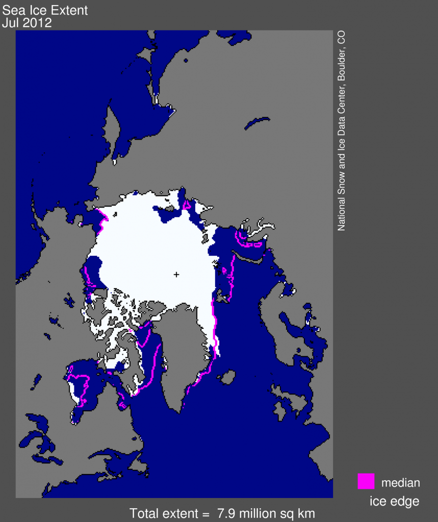
Figure 1. Arctic sea ice extent for July 2012 was 7.94 million square kilometers (3.07 million square miles). The orange line shows the 1979 to 2000 median extent for that month. The black cross indicates the geographic North Pole. {a href=”http://nsidc.org/data/seaice_index”} Sea Ice Index{/a} data. {a href=”http://nsidc.org/arcticseaicenews/about-the-data/”}About the data{/a}||Credit: National Snow and Ice Data Center|{a href=”http://nsidc.org/arcticseaicenews/?attachment_id=2083″}High-resolution image{/a}

