Frozen Ground & Permafrost
Overview
What is frozen ground?
When water turns into ice in soil, it becomes frozen ground. This frozen soil has a temperature at or below 0 °C (32 °F). More than half of all the land in the Northern Hemisphere freezes and thaws every year.
Seasonally frozen ground is near-surface soil that freezes for more than 15 days per year. Intermittently frozen ground is near-surface soil that freezes from one to 15 days per year. One-fourth of the land in the Northern Hemisphere has an underground layer that stays frozen all year long. Permafrost is ground that is frozen for at least two years. In many cases, permafrost has existed for many thousands of years and can be thousands of feet deep. Most of Earth’s permafrost lies in the Arctic, but some is in the Antarctic and in high mountains.
What is permafrost?
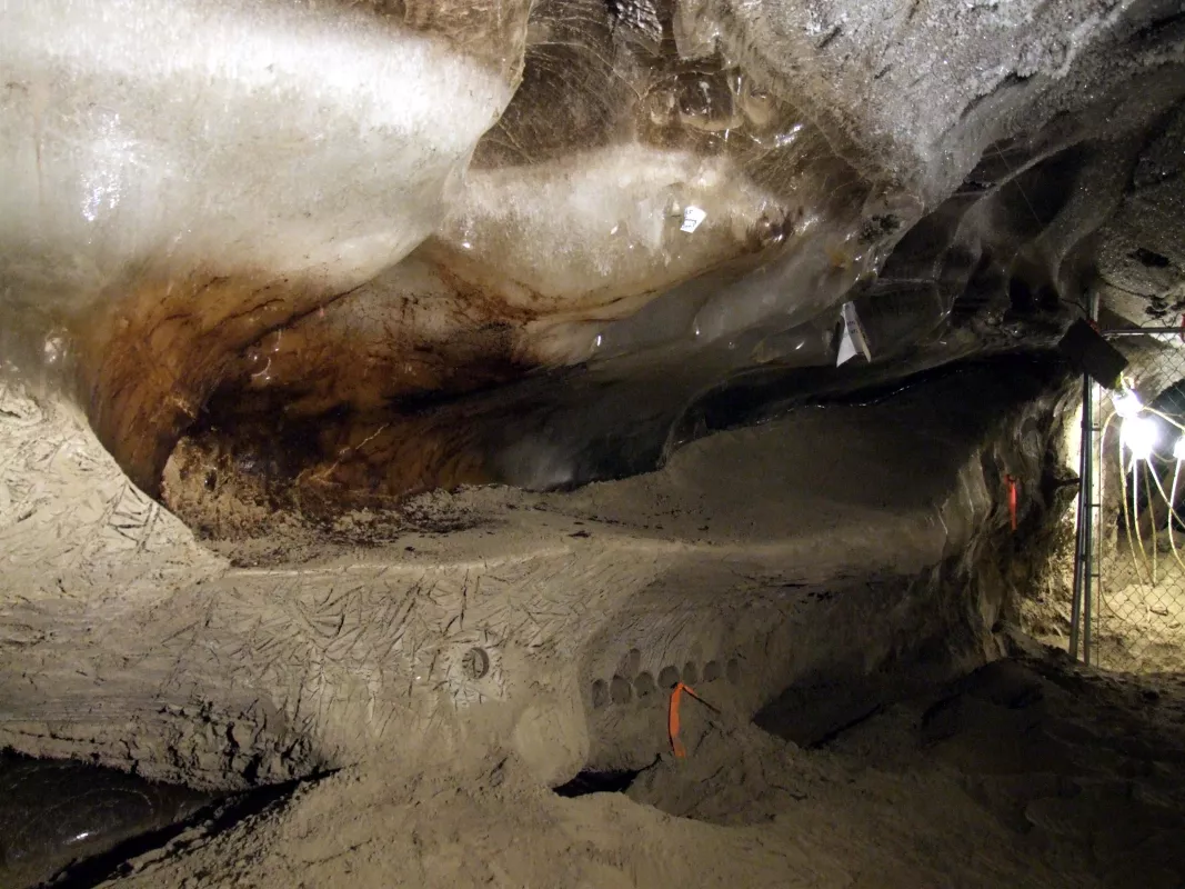
Permafrost is soil, sand, sediment, or rock that remains at or below 0 °C (32 °F) for at least two years. While most is on land, there is also some subsea permafrost beneath offshore Arctic continental shelves. Permafrost ranges in thickness from less than 1 meter (3.3 feet) to greater than 1,500 meters (4,900 feet).
Permafrost is not defined by soil moisture content, overlying snow cover, or location; it is defined solely by temperature. Any soil, sand, sediment, or rock remaining at or below 0 °C (32 °F) for two or more years is permafrost. However, some permafrost can contain over 30 percent ice in lenses and layers. The top part of the permafrost thaws and freezes on an annual basis. The maximum seasonal thaw depth in permafrost is called the active layer.
Where is frozen ground located?
Approximately 50 percent of the Northern Hemisphere's land surface is covered by seasonally frozen ground, which can last for a few weeks in the middle and lower latitudes to several months at high latitudes and high elevations.
Where is permafrost located?
Determining the location and extent of permafrost is often difficult. The historical approach has been to assume that ground temperature equals the average overlying air temperature, but ground and air temperatures usually differ. Even in areas where the average annual air temperature is below freezing, permafrost may not exist. Land under glaciers, ice sheets, rivers, and streams is often free of permafrost, despite freezing average air temperatures at the surface.
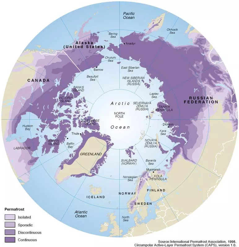
Scientists have mapped permafrost since the mid-twentieth century. In 1990, the International Permafrost Association (IPA) recognized the need for a single, unified map of the distribution and properties of permafrost in the Northern Hemisphere. The IPA map shows the distribution of continuous, discontinuous, sporadic, and subsea permafrost, along with isolated patches.
In total, permafrost occupies approximately 23 million square kilometers (9 million square miles) or about 25 percent of the exposed land surface in the Northern Hemisphere, with approximately 65 percent in Eurasia and the other 35 percent in North America and Greenland. Exposed land is land that is not covered by glacial ice. Permafrost occurs as far north as 84°N in northern Greenland, and as far south as 26°N in the high elevations of the Himalaya. However, most permafrost in the Northern Hemisphere occurs poleward of 60°N in Russia, Canada, and northern Alaska. Though it can also be found in northern Mongolia, northeastern China, the Qinghai-Xizang (Tibet) Plateau, and surrounding mountains.
Far less permafrost has been identified in the Southern Hemisphere, but some has been studied in Antarctica. The continent’s remote location, punishing environment, and minimal human presence have limited studies, but permafrost has been found in parts of the Antarctic Peninsula, Transantarctic Mountains, McMurdo Dry Valleys, and other locations.
Proximity to large water bodies tends to reduce temperature extremes, which affects the distribution of permafrost. Scandinavia and Iceland, for instance, have relatively little permafrost. Snow cover can play a varying role in the formation or survival of permafrost. In areas of continuous permafrost, seasonal snow cover can lead to warmer ground temperatures, while in areas of discontinuous or sporadic permafrost, the absence of snow cover can contribute to permafrost formation.


