Glaciers
Overview
What is a glacier?
A glacier is an accumulation of ice and snow that slowly flows over land. At higher elevations, more snow typically falls than melts, adding to its mass. Eventually, the surplus of built-up ice begins to flow downhill. At lower elevations, there is usually a higher rate of melt or icebergs break off that removes ice mass.
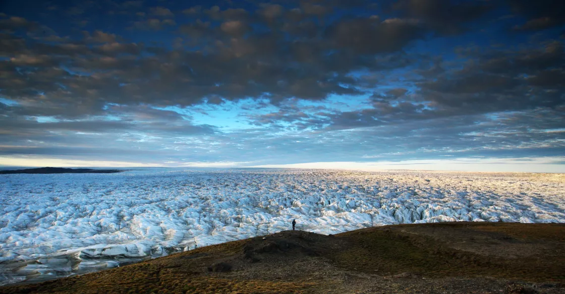
Alpine glaciers are frozen rivers of ice, slowly flowing under their own weight down mountainsides and into valleys. Glaciers also exist on the fringes of ice sheets. Ice sheets cover entire continents. During the Last Glacial Maximum, roughly 20,000 years ago, the Laurentide Ice Sheet covered much of North America, and its weight created basins that now hold the Great Lakes. Currently, there are only two ice sheets on Earth: the Antarctic and Greenland Ice Sheets.
What is an ice sheet?
An ice sheet is a mass of glacial ice that sits on land and extends more than 50,000 square kilometers (19,300 square miles). Ice sheets once covered much of the Northern Hemisphere during a series of Pleistocene Ice Ages. Now, Earth has just two ice sheets, one covers most of Greenland, the largest island in the world, and the other spans across the Antarctic continent. Ice sheets are constantly in motion, spreading out from broad domes.
Together, the Antarctic and Greenland Ice Sheets contain more than 99 percent of the freshwater ice on Earth. The amount of fresh water stored in both the Antarctic and Greenland Ice Sheets total over 68 percent of the fresh water on Earth.
The Antarctic Ice Sheet extends almost 14 million square kilometers (5.4 million square miles), roughly the area of the contiguous United States and Mexico combined. The Greenland Ice Sheet extends about 1.7 million square kilometers (656,000 square miles), covering 80 percent of the world’s largest island, and is equivalent to about three times the size of Texas.
Both ice sheets measure on average about 2 kilometers (1 mile) thick. If the entire Antarctic Ice Sheet melted, sea level would rise about 60 meters (197 feet). If the entire Greenland Ice Sheet melted, sea level would rise about 7.4 meters (24.3 feet).
What are ice caps and icefields?
An ice cap is a dome-shaped glacier with an area less than 50,000 square kilometers (19,300 square miles) that flows in all directions and covers much of the underlying topography. Ice caps form in high-latitude polar and subpolar mountain regions. Northern Europe is home to many ice caps; for example, the Vatnajökull ice cap in Iceland and the Austfonna ice cap in the Svalbard archipelago of Norway, which is the largest (in area) in Scandinavia. The largest ice cap in the world is the Severny Island ice cap, part of the Novaya Zemlya archipelago in the Russian Arctic.
An icefield is a mass of glacier ice, somewhat similar to an ice cap, but usually smaller and lacking a dome-like shape. Compared to an ice cap, an icefield is more strongly influenced by underlying terrain. Ice caps are also found in mountain ranges like the Himalaya, Rockies, Andes, and the Southern Alps of New Zealand.
What is an iceberg?
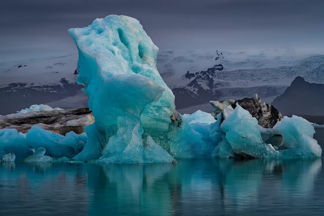
Icebergs are large floating chunks of ice, detached from a glacier, such as an alpine glacier or ice sheet, and carried out to a lake or the ocean. The word iceberg literally means ice mountain, berg borrowed from German.
Icebergs come in all shapes and sizes, from ice-cube-sized chunks to ice islands the size of a small country. The term “iceberg” refers to chunks of ice larger than 5 meters (16 feet) across. Smaller icebergs, known as bergy bits and growlers, can be especially dangerous for ships because they are harder to spot. The North Atlantic and the cold waters surrounding Antarctica are home to most of the icebergs on Earth. Antarctic ice shelves may calve icebergs that are over 80 kilometers (50 miles) long.
How do glaciers form?
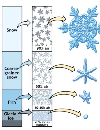
Glaciers begin to form when snow remains in the same area year round, where enough snow accumulates to transform into ice. Each year, new layers of snow bury and compress the previous layers. This compression forces the snow to recrystallize, initially forming grains similar to the size and shape of sugar grains.
Gradually, the grains grow larger and the air pockets between the grains get smaller, causing the snow to slowly compact and increase in density. After about a year, the snow turns into firn—an intermediate state between snow and glacier ice. At this point, it is about two-thirds as dense as water. Over time, larger ice crystals become so compressed that any air pockets between them are very tiny. In very old glacier ice, crystals can reach the size of an adult fist. For most glaciers, this process takes more than a hundred years.
Where are glaciers?
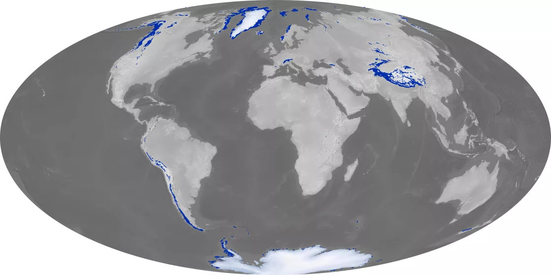
The world's glaciers have an estimated total area of about 700,000 square kilometers (270,000 square miles). Most of the world’s glaciers are in Antarctica. Glaciers are mainly found near the poles, but glaciers exist on all the world’s continents except Australia. Although Australia has no glaciers, it is considered part of Oceania, where glaciers can be found in New Zealand and the large islands of Indonesia and Papua New Guinea.
Most glaciers are found in regions of high snowfall in winter and low temperatures in summer. These conditions ensure that the snow that accumulates in the winter is not lost during the summer. Examples of such regions are Alaska, Patagonia, and the Himalayas. The Arctic islands of Canada get much less snowfall, but it is cold enough through the year that glaciers can form. In short, glaciers form at high latitudes or high elevations. Closer to the equator, higher elevations are required for needed snowfall and lower temperatures.


